Category:1960s maps of France
Countries of Europe: Albania · Armenia‡ · Austria · Belarus · Belgium · Bulgaria · Cyprus‡ · Denmark · Estonia · Finland · France‡ · Germany · Greece · Hungary · Iceland · Republic of Ireland · Italy · Netherlands‡ · Norway · Poland · Portugal‡ · Romania · Russia‡ · Spain‡ · Sweden · Switzerland · Turkey‡ · Ukraine · United Kingdom
‡: partly located in Europe
‡: partly located in Europe
Subcategories
This category has the following 9 subcategories, out of 9 total.
- 1960 maps of France (9 F)
- 1961 maps of France (1 F)
- 1962 maps of France (1 F)
- 1963 maps of France (1 F)
- 1964 maps of France (2 F)
- 1965 maps of France (1 F)
- 1968 maps of France (1 F)
'
- 1960s maps of Paris (2 F)
T
Media in category "1960s maps of France"
The following 6 files are in this category, out of 6 total.
-
 1967 data of France.jpg 5,847 × 2,877; 4.48 MB
-
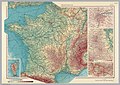 France, 1967.jpg 4,068 × 2,892; 2.97 MB
-
 France-Italy border 2.jpg 2,130 × 2,867; 1.35 MB
-
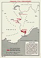 France-Italy border.jpg 1,967 × 2,789; 523 KB
-
 Selected areas of the Mediterranean, 1967.jpg 5,836 × 2,896; 3.18 MB
-
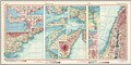
 Selected cities of France, 1967.jpg 1,997 × 2,883; 2.59 MB


