Category:20th-century maps of France
Countries of Europe: Albania · Armenia‡ · Austria · Azerbaijan‡ · Belarus · Belgium · Bosnia and Herzegovina · Bulgaria · Croatia · Cyprus‡ · Czech Republic · Denmark · Estonia · Finland · France‡ · Georgia‡ · Germany · Greece · Hungary · Iceland · Republic of Ireland · Italy · Kazakhstan‡ · Latvia · Lithuania · Luxembourg · Moldova · Montenegro · Netherlands‡ · North Macedonia · Norway · Poland · Portugal‡ · Romania · Russia‡ · Serbia · Slovakia · Slovenia · Spain‡ · Sweden · Switzerland · Turkey‡ · Ukraine · United Kingdom
Specific status: Isle of Man – Limited recognition: Abkhazia‡
‡: partly located in Europe
Specific status: Isle of Man – Limited recognition: Abkhazia‡
‡: partly located in Europe
Subcategories
This category has the following 32 subcategories, out of 32 total.
#
A
- 20th-century maps of Aisne (12 F)
- 20th-century maps of Autun (3 F)
B
C
- 20th-century maps of Corsica (10 F)
G
- 20th-century maps of Grenoble (18 F)
H
I
L
- 20th-century maps of Lyon (6 F)
M
N
O
- 20th-century maps of Oise (2 F)
P
S
Media in category "20th-century maps of France"
The following 10 files are in this category, out of 10 total.
-
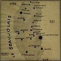
 Adolphe Valette - Scènes beaujolaises vues par un artiste - 01.jpg 1,575 × 1,554; 308 KB
-
 Adolphe Valette - Scènes beaujolaises vues par un artiste - 02.jpg 1,689 × 1,708; 527 KB
-

-

-
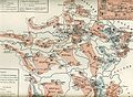 La Patrie.jpg 1,744 × 1,275; 740 KB
-
 Mappe der Schlacht in Frankreich-Juni 1940.jpg 2,476 × 2,284; 1.49 MB
-
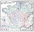
 Organisation militaire françaises 1907.png 1,247 × 1,169; 3.73 MB
-
 Roell-1912 Karte der Französischen Eisenbahnen.jpg 5,055 × 4,748; 3.27 MB
-

-
 Vidal de la Blache (1).jpg 1,196 × 1,054; 509 KB


.jpg)
.jpg)


_(14595495868).jpg)
.jpg)