Category:19th-century maps of the Dominican Republic
Countries of North America: Antigua and Barbuda · The Bahamas · Barbados · Belize · Canada · Costa Rica · Cuba · Dominican Republic · Guatemala · Haiti · Honduras · Jamaica · Mexico · Nicaragua · Panama · Saint Kitts and Nevis · Saint Vincent and the Grenadines · Trinidad and Tobago‡ · United States of America‡
Other territories: Bermuda · Greenland · Guadeloupe · Martinique · Puerto Rico
‡: partly located in North America
Other territories: Bermuda · Greenland · Guadeloupe · Martinique · Puerto Rico
‡: partly located in North America
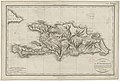
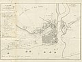
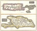
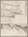
Media in category "19th-century maps of the Dominican Republic"
The following 18 files are in this category, out of 18 total.
-

-
-

-

-

-
-
-

-
 Old maps of Hispaniola - 1820 - 001.jpg 15,875 × 10,298; 21.94 MB
-
 Mapa de la isla de Santo Domingo.jpg 5,299 × 3,498; 5.41 MB
-
-

-

-
 EB9 Hayti.jpg 2,624 × 1,791; 752 KB
-
 Ernest gruening haiti.PNG 717 × 552; 317 KB
-
 Karte der Insel Haiti.png 2,395 × 980; 4.51 MB
-
 Port Napoléon dans la Baye de Samana.jpg 2,094 × 1,636; 508 KB
-
 Santo Domingo Map 1873 Mod.jpg 597 × 600; 229 KB
.jpg)

._Grav%C3%A9_par_Tardieu_l%27a%C3%AEn%C3%A9_-_btv1b84916109.jpg)
._Grav%C3%A9_par_Tardieu_l%27a%C3%AEn%C3%A9_-_btv1b8492183s.jpg)
._Grav%C3%A9_par_Tardieu_l%27a%C3%AEn%C3%A9_-_btv1b84921846.jpg)
.jpg)

._Grav%C3%A9_par_Tardieu_a%C3%AEn%C3%A9_-_btv1b8492204h.jpg)


_West_Indies_San_Domingo_Island_Samana_Bay_Surveyed_by_Commander_W_R_Bridgman_-_USS_Despatch_1882_RMG_S0479-001.jpg)


