Category:19th-century maps of Mexico
Countries of North America: Antigua and Barbuda · The Bahamas · Barbados · Belize · Canada · Costa Rica · Cuba · Dominican Republic · Guatemala · Haiti · Honduras · Jamaica · Mexico · Nicaragua · Panama · Saint Kitts and Nevis · Saint Vincent and the Grenadines · Trinidad and Tobago‡ · United States of America‡
Other territories: Bermuda · Greenland · Guadeloupe · Martinique · Puerto Rico
‡: partly located in North America
Other territories: Bermuda · Greenland · Guadeloupe · Martinique · Puerto Rico
‡: partly located in North America
Subcategories
This category has the following 14 subcategories, out of 14 total.
- 1800s maps of Mexico (16 F)
- 1870s maps of Mexico (10 F)
M
- 19th-century maps of Mexico City (26 F)
S
- 19th-century maps of Sinaloa (6 F)
Y
- 19th-century maps of Yucatán (28 F)
Media in category "19th-century maps of Mexico"
The following 45 files are in this category, out of 45 total.
-
 Carta general de la República Mexicana (Debray, 1867).jpg 13,929 × 9,437; 21.82 MB
-
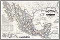
 Map of the United States of Mexico (Tanner, 1846).jpg 8,802 × 7,016; 12.62 MB
-
 129 of 'Michoacán. Paisajes, tradiciones y leyendas. 2 ser' (11209356726).jpg 1,482 × 2,419; 1.33 MB
-
 66 of 'Michoacán. Paisajes, tradiciones y leyendas. 2 ser' (11209216673).jpg 1,524 × 2,419; 748 KB
-
 67 of 'Michoacán. Paisajes, tradiciones y leyendas. 2 ser' (11210223784).jpg 1,524 × 2,408; 591 KB
-
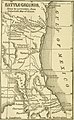
 204 of 'The War with Mexico' (11029980134).jpg 1,530 × 2,578; 1.02 MB
-
-

-

-
 282 of 'Reisen in den Vereinigten Staaten, Canada und Mexico' (11066756025).jpg 2,336 × 1,449; 257 KB
-
 310 of 'Reisen in den Vereinigten Staaten, Canada und Mexico' (11066451045).jpg 2,016 × 1,449; 464 KB
-
 405 of 'Le Mexique tel qu'il est aujourd'hui ... Deuxième édition' (11210323483).jpg 4,307 × 3,467; 2.72 MB
-

-

-

-

-
 503 of 'Curso elemental de geografia universal' (11090685546).jpg 6,527 × 4,744; 5.69 MB
-
 Admiralty Chart No 1936 Islands in the North Pacific Ocean, Published 1849.jpg 5,837 × 7,887; 22.21 MB
-

-

-
 HHBHM V1 D518 Mexican volcanoes.jpg 1,558 × 854; 109 KB
-
-
 Lake Chalco 1847.PNG 447 × 517; 600 KB
-
 Lienzo de Metlatoyuca (BM Am2006,Ptg.30088 1).jpg 2,500 × 1,903; 956 KB
-
 Lienzo de Metlatoyuca (BM Am2006,Ptg.30088 2).jpg 2,500 × 1,951; 924 KB
-
 Lienzo de Metlatoyuca (BM Am2006,Ptg.30088 3).jpg 2,500 × 1,875; 892 KB
-
 Lienzo de Metlatoyuca (BM Am2006,Ptg.30088 4).jpg 1,511 × 2,500; 586 KB
-
 Lienzo de Metlatoyuca (BM Am2006,Ptg.30088).jpg 1,490 × 2,500; 536 KB
-

-

-

-
 Map of the Republic of Texas and the Adjacent Territories, 1841.jpg 1,437 × 1,212; 458 KB
-
-

-

-
-
 Operations of Genl. Scott's Army on 8th, 12th & 13th Sep. 1847 - (Mexico City) LOC 2001620537.tif 7,042 × 8,482; 170.89 MB
-
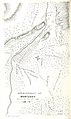
 Plan of Genl. Wool's camp at Buena-Vista, August 1847. LOC 2001622532.jpg 5,846 × 4,844; 3.93 MB
-
 Plan of Genl. Wool's camp at Buena-Vista, August 1847. LOC 2001622532.tif 5,846 × 4,844; 81.02 MB
-

-

-

-

-

-

.jpg)
.jpg)
.jpg)
.jpg)
.jpg)
.jpg)
.jpg)
.jpg)
%27_(11220791105).jpg)
.jpg)
.jpg)
.jpg)
.jpg)
.jpg)
.jpg)
.jpg)

_(14577370190).jpg)


_(14743832566).jpg)

.jpg)
.jpg)
.jpg)
.jpg)
.jpg)

_LOC_2001622589.jpg)

_(14760035076).jpg)
_(14778983714).jpg)
_(14781294485).jpg)
_LOC_2001620537.jpg)


_(14576056538).jpg)
.jpg)
_(14595068029).jpg)