Category:2010s maps of Australia
Countries of Oceania: Australia · Fiji · Kiribati · New Zealand · Papua New Guinea
Other areas: Hawaii – Partly: Indonesia
Other areas: Hawaii – Partly: Indonesia

Subcategories
This category has the following 6 subcategories, out of 6 total.
- 2010 maps of Australia (5 F)
- 2012 maps of Australia (1 F)
- 2013 maps of Australia (2 F)
- 2014 maps of Australia (8 F)
- 2015 maps of Australia (7 F)
- 2016 maps of Australia (16 F)
Media in category "2010s maps of Australia"
The following 3 files are in this category, out of 3 total.
-
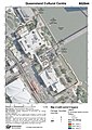 602844 - Queensland Cultural Centre - Map 2 (2017).jpg 707 × 1,000; 158 KB
-
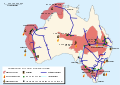 Australian oil and gas facilities map-en.svg 1,146 × 808; 224 KB
-
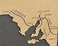 Goyder's Line map on cairn near Redhill, South Australia.jpg 273 × 216; 11 KB
.jpg)

