Category:2020s maps of the United States

States of the United States: Alabama · Alaska · Arizona · California · Colorado · Delaware · Georgia · Hawaii · Idaho · Iowa · Kentucky · Louisiana · Maryland · Massachusetts · Michigan · Nebraska · New Jersey · New York · North Carolina · Ohio · Pennsylvania · Tennessee · Texas · Utah · Wyoming – Washington, D.C.
Subcategories
This category has the following 32 subcategories, out of 32 total.
*
A
- 2020s maps of Alaska (5 F)
C
D
G
- 2020s maps of Georgia (U.S. state) (empty)
H
I
K
- 2020s maps of Kentucky (1 F)
L
M
N
- 2020s maps of Nebraska (empty)
O
P
T
- 2020s maps of Tennessee (4 F)
U
W
Media in category "2020s maps of the United States"
The following 7 files are in this category, out of 7 total.
-
 Asian Americans 2020 County.png 7,750 × 4,650; 8.71 MB
-
 Hispanic Americans 2020 County.png 9,470 × 5,635; 13.36 MB
-
 Housing prices inflation.webp 2,828 × 1,776; 975 KB
-
 Non-Hispanic White Americans 2020 County.png 15,610 × 8,900; 17.86 MB
-
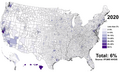
 Non-Whites (Hispanic and Non-Hispanic) in the US in 2020.svg 1,852 × 971; 4.26 MB
-
 US White Alone in 2020.svg 1,200 × 650; 1.51 MB
-
 White Americans 2020 County.png 15,610 × 8,900; 11.46 MB


_in_the_US_in_2020.svg)

