Category:Acton Trussell and Bednall
English: Acton Trussell and Bednall is a civil parish in the South Staffordshire district of Staffordshire, England. As the name indicates, it contains the two villages Acton Trussell and Bednall.
civil parish in England | |||||
| Upload media | |||||
| Instance of | |||||
|---|---|---|---|---|---|
| Named after | |||||
| Location | South Staffordshire, Staffordshire, West Midlands, England | ||||
 | |||||
Subcategories
This category has the following 2 subcategories, out of 2 total.
A
B
Media in category "Acton Trussell and Bednall"
The following 200 files are in this category, out of 292 total.
(previous page) (next page)-
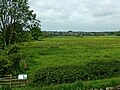
 A field near Acton Trussell - geograph.org.uk - 4932976.jpg 683 × 1,024; 185 KB
-
 A field of stubble - geograph.org.uk - 2805804.jpg 3,872 × 2,592; 5.7 MB
-
 A winter sowing - geograph.org.uk - 2805960.jpg 3,872 × 2,592; 5.3 MB
-
 A34 Looking Towards Newtown - geograph.org.uk - 2432269.jpg 640 × 428; 70 KB
-
-
 Acton Bridge No 93 - geograph.org.uk - 5199784.jpg 800 × 599; 170 KB
-
 Acton Bridge No 93 - geograph.org.uk - 5199792.jpg 800 × 580; 173 KB
-
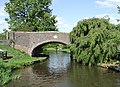
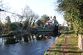
 Acton Bridge, Staffs ^ Worcs Canal - geograph.org.uk - 3019576.jpg 1,280 × 856; 276 KB
-
 Acton Hill Farm - geograph.org.uk - 2432258.jpg 640 × 428; 82 KB
-
 Acton Hill Farm - geograph.org.uk - 2446772.jpg 640 × 428; 66 KB
-
 Acton Hill Farm. - geograph.org.uk - 2446823.jpg 640 × 428; 88 KB
-

-
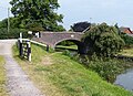
 Acton Moat Bridge No 92 - geograph.org.uk - 5199806.jpg 800 × 491; 103 KB
-
 Acton Moat Bridge, Staffs ^ Worcs Canal - geograph.org.uk - 3019575.jpg 1,280 × 856; 344 KB
-
 Acton Trussell - geograph.org.uk - 4933000.jpg 1,024 × 683; 305 KB
-

-
 Acton Trussell From Mill Lane. - geograph.org.uk - 2446842.jpg 640 × 428; 81 KB
-
 Acton Trussell trig - geograph.org.uk - 3095180.jpg 857 × 1,142; 587 KB
-
 Acton Trussell trig and a cropped field - geograph.org.uk - 3095176.jpg 1,142 × 857; 612 KB
-
 Acton Trussell, The Church of St James - geograph.org.uk - 6052241.jpg 800 × 533; 668 KB
-
 Acton Trussell, The Moat and Moat House - geograph.org.uk - 6052188.jpg 1,024 × 767; 1.2 MB
-
 Actonmill Farm - geograph.org.uk - 6237916.jpg 800 × 600; 101 KB
-
 All Saints CE (A) Primary School - geograph.org.uk - 3095165.jpg 1,142 × 857; 642 KB
-
 And .........LIFT-OFF^^ - geograph.org.uk - 4177570.jpg 1,024 × 1,024; 614 KB
-
 Approaching Deptmore Lock - geograph.org.uk - 4601183.jpg 640 × 427; 89 KB
-

-

-

-

-

-

-

-
 Barn End Road, Acton Trussell - geograph.org.uk - 4932994.jpg 1,024 × 683; 343 KB
-
 Beet field, Acton Trussell - geograph.org.uk - 3124588.jpg 640 × 459; 101 KB
-

-
 Bridge Over Stream, Acton Hill Road - geograph.org.uk - 3521296.jpg 1,475 × 1,073; 265 KB
-
 Canada geese with goslings near Stafford - geograph.org.uk - 6163227.jpg 1,600 × 900; 1.52 MB
-

-
 Canal and farmland south-east of Stafford - geograph.org.uk - 2593569.jpg 1,024 × 768; 421 KB
-
 Canal and farmland south-east of Stafford - geograph.org.uk - 2593612.jpg 1,024 × 587; 376 KB
-
 Canal and marina near Wildwood, Stafford - geograph.org.uk - 5693912.jpg 1,440 × 930; 1.53 MB
-
 Canal and Radford Meadows near Stafford - geograph.org.uk - 6018721.jpg 1,600 × 900; 1.59 MB
-

-
 Canal and Staffordshire farmland near Acton Trussell - geograph.org.uk - 5352386.jpg 1,280 × 850; 1.07 MB
-
 Canal approaching Acton Moat Bridge - geograph.org.uk - 2670795.jpg 1,024 × 768; 595 KB
-
 Canal at Deptmore Lock south of Stafford - geograph.org.uk - 6275786.jpg 960 × 1,280; 1.4 MB
-
 Canal Marina south-east of Stafford - geograph.org.uk - 2445970.jpg 800 × 600; 364 KB
-
 Canal moorings near Wildwood in Stafford - geograph.org.uk - 5609409.jpg 960 × 1,280; 1.48 MB
-
 Canal near Wildwood, Stafford - geograph.org.uk - 4194669.jpg 1,025 × 1,025; 488 KB
-
 Canal north of Acton Trussell in Staffordshire - geograph.org.uk - 5352368.jpg 1,280 × 837; 1.11 MB
-
 Canal north of Acton Trussell in Staffordshire - geograph.org.uk - 5352378.jpg 1,280 × 860; 913 KB
-
 Canal north of Acton Trussell in Staffordshire - geograph.org.uk - 6231089.jpg 1,280 × 1,280; 1.37 MB
-
-
 Canal north of Acton Trussell, Staffordshire - geograph.org.uk - 5049359.jpg 1,280 × 905; 720 KB
-
 Canal south of Acton Trussell in Staffordshire - geograph.org.uk - 5365255.jpg 1,280 × 960; 996 KB
-
 Canal south of Acton Trussell in Staffordshire - geograph.org.uk - 6163243.jpg 1,440 × 960; 1.34 MB
-
 Canal south of Acton Trussell, Staffordshire - geograph.org.uk - 5143658.jpg 1,280 × 824; 872 KB
-
 Canal south of Stafford - geograph.org.uk - 6231082.jpg 1,440 × 960; 1.15 MB
-
 Canal south-east of Stafford - geograph.org.uk - 4194555.jpg 1,024 × 768; 410 KB
-
 Canal south-east of Stafford - geograph.org.uk - 5353165.jpg 1,280 × 890; 1.29 MB
-
 Canal south-east of Stafford - geograph.org.uk - 5364154.jpg 1,280 × 960; 1.08 MB
-
 Canal south-east of Stafford - geograph.org.uk - 5693903.jpg 960 × 1,280; 1.3 MB
-
 Canal south-east of Stafford - geograph.org.uk - 6017981.jpg 960 × 1,280; 1.37 MB
-
 Canal west of Acton Trussell in Staffordshire - geograph.org.uk - 5352015.jpg 1,280 × 852; 1.17 MB
-
 Canal west of Acton Trussell in Staffordshire - geograph.org.uk - 5352066.jpg 1,280 × 932; 1.36 MB
-
 Canal west of Acton Trussell in Staffordshire - geograph.org.uk - 5352104.jpg 1,280 × 960; 1.19 MB
-
 Canalside cottage by Acton Trussell, Staffordshire - geograph.org.uk - 2662423.jpg 1,440 × 1,006; 1.34 MB
-
 Canalside cottage by Acton Trussell, Staffordshire - geograph.org.uk - 2662425.jpg 1,080 × 1,440; 1.45 MB
-

-

-

-

-

-
 Canalside hotel near Acton Trussell in Staffordshire - geograph.org.uk - 5370229.jpg 1,280 × 910; 1.01 MB
-
 Canalside hotel near Acton Trussell in Staffordshire - geograph.org.uk - 5370236.jpg 1,280 × 873; 1.14 MB
-

-
-
 Cattle near Acton Hill - geograph.org.uk - 4932983.jpg 1,024 × 683; 259 KB
-
 Causeway over boggy wood near Penkridge - geograph.org.uk - 3446360.jpg 1,200 × 1,600; 922 KB
-

-
 Church of St James, Acton Trussell - geograph.org.uk - 2654729.jpg 640 × 430; 35 KB
-
 Cock Lane running south - geograph.org.uk - 5401659.jpg 1,469 × 1,102; 434 KB
-
 Cock Lane towards Teddesley Home Farm - geograph.org.uk - 5401664.jpg 1,469 × 1,102; 585 KB
-
 Common Lane at Bednall Head - geograph.org.uk - 5401658.jpg 1,469 × 1,102; 570 KB
-
 Cook's Bank, Acton Trussell - geograph.org.uk - 4932980.jpg 1,024 × 683; 282 KB
-
 Cottage at Deptmore Lock - geograph.org.uk - 5199765.jpg 800 × 607; 121 KB
-
 Cottage On The Outskirts Of Bednall - geograph.org.uk - 2432193.jpg 640 × 428; 88 KB
-
 Cows feeding near Acton Trussell - geograph.org.uk - 2803016.jpg 3,872 × 2,592; 4.91 MB
-
 Crossroads on the road to Penkridge - geograph.org.uk - 2805929.jpg 3,872 × 2,592; 4.52 MB
-
 Dead End Road near M6 - geograph.org.uk - 2479894.jpg 640 × 428; 71 KB
-
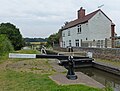
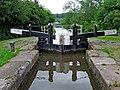
 Deptmore Lock - geograph.org.uk - 2801719.jpg 3,872 × 2,592; 5.1 MB
-
 Deptmore Lock and cottage near Stafford - geograph.org.uk - 4194314.jpg 1,200 × 887; 562 KB
-
 Deptmore Lock Cottage near Wildwood, Stafford - geograph.org.uk - 6018742.jpg 1,280 × 960; 1.52 MB
-
 Deptmore Lock near Wildwood, Stafford - geograph.org.uk - 2611477.jpg 1,024 × 605; 414 KB
-
 Deptmore Lock south-east of Stafford - geograph.org.uk - 6017984.jpg 1,280 × 960; 1.56 MB
-
 Deptmore Lock south-west of Wildwood, Stafford - geograph.org.uk - 6018741.jpg 1,280 × 853; 1.42 MB
-
 Discarded furniture by a country lane - geograph.org.uk - 2805943.jpg 3,872 × 2,592; 6.94 MB
-
 Donkey And Farmhouse - geograph.org.uk - 2432284.jpg 640 × 428; 99 KB
-
 Drain near the River Penk - geograph.org.uk - 6237814.jpg 800 × 600; 154 KB
-
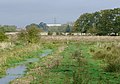
 Drainage channel on Radford Meadows - geograph.org.uk - 2801641.jpg 3,872 × 2,592; 5.24 MB
-

-
-

-
 Family of mute swans on the towpath - geograph.org.uk - 5199813.jpg 800 × 500; 158 KB
-
 Farmland - geograph.org.uk - 3736939.jpg 1,600 × 1,200; 515 KB
-

-
 Farmland by the church car park - geograph.org.uk - 4991073.jpg 1,600 × 1,064; 522 KB
-
 Farmland next to Teddesley Road - geograph.org.uk - 5197456.jpg 800 × 570; 173 KB
-
 Field below Plashes Farm - geograph.org.uk - 2804631.jpg 3,872 × 2,592; 4.11 MB
-
 Field off Teddesley Road - geograph.org.uk - 4933003.jpg 1,024 × 683; 246 KB
-
 Fishing by Shutthill Bridge - geograph.org.uk - 2803090.jpg 3,872 × 2,592; 4.95 MB
-
-
 Footbridge by the canal near Wildwood, Stafford - geograph.org.uk - 6018730.jpg 960 × 1,280; 1.21 MB
-
 Footbridge near Wildwood in Staffordshire - geograph.org.uk - 6018717.jpg 960 × 1,280; 1.8 MB
-
 Footpath off Mill Lane - geograph.org.uk - 6237923.jpg 800 × 600; 128 KB
-
 Former Burrows GM Ltd showroom and workshops - geograph.org.uk - 4983791.jpg 1,600 × 1,200; 465 KB
-

-
 Frozen canal near Ivy House Farm - geograph.org.uk - 2802965.jpg 3,872 × 2,592; 3.85 MB
-
 Gas Governor, Acton Trussell - geograph.org.uk - 3224711.jpg 480 × 640; 116 KB
-
 Grazing beside the River Penk - geograph.org.uk - 6237918.jpg 800 × 600; 97 KB
-
 Grazing near the River Penk - geograph.org.uk - 6237808.jpg 640 × 480; 65 KB
-

-
 Harvested field and willows near Roseford Farm - geograph.org.uk - 2801791.jpg 3,872 × 2,592; 6.3 MB
-
 Harvested field, Roseford Lane - geograph.org.uk - 3124618.jpg 640 × 436; 70 KB
-

-
 Hazelstrine Bridge No 96 - geograph.org.uk - 5199747.jpg 800 × 589; 182 KB
-
 Holiday Inn Express Stafford - geograph.org.uk - 6237806.jpg 800 × 600; 103 KB
-

-
 House and flowers beside the towpath - geograph.org.uk - 4601172.jpg 640 × 427; 112 KB
-
 House at Acton Hill Farm - geograph.org.uk - 2807142.jpg 3,872 × 2,592; 4.63 MB
-
 House On Common Lane - geograph.org.uk - 2432146.jpg 640 × 428; 71 KB
-

-
 Joggers by the Staffordshire and Worcestershire Canal - geograph.org.uk - 2802980.jpg 3,872 × 2,592; 4.24 MB
-
 Junction of Meadow Lane - geograph.org.uk - 4983824.jpg 1,600 × 1,200; 404 KB
-
 Junction on Acton Hill road - geograph.org.uk - 4932984.jpg 1,024 × 683; 269 KB
-
 Landscaped grounds at Stafford Boat Club - geograph.org.uk - 2445986.jpg 800 × 562; 356 KB
-
 Late 2nd C. Apsidal wing of Roman Villa - geograph.org.uk - 3242311.jpg 640 × 427; 117 KB
-
 Long Meadow. - geograph.org.uk - 2432248.jpg 640 × 428; 108 KB
-

-
 Looking towards Radford Meadows, Stafford - geograph.org.uk - 2183054.jpg 1,024 × 540; 265 KB
-
 M6 Motorway approaching junction 13 - geograph.org.uk - 2244491.jpg 640 × 480; 40 KB
-
 M6 motorway at junction 13, southbound - geograph.org.uk - 1917787.jpg 640 × 480; 132 KB
-
-
 M6 near Dunston - geograph.org.uk - 3690147.jpg 3,561 × 2,000; 1.36 MB
-
 M6 southbound at A449 exit slip - geograph.org.uk - 2824861.jpg 640 × 481; 34 KB
-
 M6 southbound near Acton Trussell - geograph.org.uk - 2824877.jpg 640 × 481; 33 KB
-
 Meadow Lane - geograph.org.uk - 4991060.jpg 1,600 × 1,064; 489 KB
-
 Meadow Lane-Teddesley Road Junction - geograph.org.uk - 6052194.jpg 800 × 600; 584 KB
-
 Meadow near Acton Trussell Bridge - geograph.org.uk - 3124500.jpg 640 × 480; 67 KB
-
 Mill Lane towards Acton Trussell - geograph.org.uk - 6237809.jpg 800 × 600; 94 KB
-
 Mill Lane towards Acton Trussell - geograph.org.uk - 6237915.jpg 800 × 600; 94 KB
-
 Mill Lane, Acton Gate - geograph.org.uk - 6237927.jpg 640 × 480; 82 KB
-
 Mixed farmland near Brocton - geograph.org.uk - 5959670.jpg 6,000 × 4,000; 7.53 MB
-
 Moored narrowboat by Stafford Boat Club - geograph.org.uk - 5694055.jpg 1,600 × 905; 1.45 MB
-
-
 Moored narrowboats by Stafford Boat Club - geograph.org.uk - 5694048.jpg 1,280 × 960; 1.42 MB
-
 Moored narrowboats near Wildwood, Stafford - geograph.org.uk - 5609288.jpg 1,280 × 824; 837 KB
-
 Moored narrowboats south-east of Stafford - geograph.org.uk - 5353187.jpg 931 × 1,280; 1.33 MB
-
 Moorings at Stafford Boat Club near Wildwood - geograph.org.uk - 6163203.jpg 1,440 × 960; 1.48 MB
-
 Moorings near Acton Trussell in Staffordshire - geograph.org.uk - 5370496.jpg 960 × 1,280; 1.13 MB
-
 Moorings near Wildwood, Stafford - geograph.org.uk - 5609301.jpg 1,024 × 1,024; 1.02 MB
-
 Moors Covert Farm - geograph.org.uk - 2432201.jpg 640 × 428; 83 KB
-

-

-

-
 Narrowboats near Roseford Bridge No 94 - geograph.org.uk - 5199774.jpg 800 × 581; 108 KB
-
 Narrowboats queuing for a lock near Stafford - geograph.org.uk - 5353197.jpg 1,280 × 960; 1.07 MB
-
 Near Bedroll - geograph.org.uk - 4933010.jpg 1,024 × 683; 321 KB
-
 Newtown from the 7 stars - geograph.org.uk - 2446806.jpg 640 × 428; 76 KB
-
 Old Barn With House Attached. - geograph.org.uk - 2432300.jpg 640 × 428; 97 KB
-
 Old road, Aston Gate - geograph.org.uk - 4932422.jpg 1,024 × 683; 342 KB
-
 Oldcroft, Acton Trussell (geograph 6857835).jpg 1,024 × 768; 179 KB
-
 On Camp Road near Springslade Lodge - geograph.org.uk - 3565196.jpg 3,481 × 2,487; 1.89 MB
-
 Ordnance Survey bench-mark on Mill Lane - geograph.org.uk - 3543483.jpg 2,560 × 1,920; 1.04 MB
-
 Pasture north of Acton Trussell in Staffordshire - geograph.org.uk - 5370252.jpg 1,280 × 873; 821 KB
-
 Pasture north of Acton Trussell in Staffordshire - geograph.org.uk - 5370315.jpg 1,280 × 848; 956 KB
-

-

-

-
 Path to Brocton - geograph.org.uk - 2804711.jpg 3,872 × 2,592; 4.6 MB
-
 Path to Dunston - geograph.org.uk - 2803057.jpg 3,872 × 2,592; 5.01 MB
-
 Ploughed field on Acton Hill - geograph.org.uk - 2807131.jpg 3,872 × 2,592; 4.78 MB
-
 Pond in a field above Acton Trussell - geograph.org.uk - 3095171.jpg 1,142 × 857; 609 KB
-
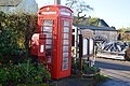 Post and telephone boxes - geograph.org.uk - 3736928.jpg 1,600 × 1,064; 488 KB
-
-
 Radford Meadows near Hazlestrine - geograph.org.uk - 2801693.jpg 3,872 × 2,592; 4.32 MB
-
 Radford Meadows near Stafford - geograph.org.uk - 5364136.jpg 1,280 × 832; 1,002 KB
-
 Radford Meadows near Stafford - geograph.org.uk - 5364145.jpg 1,280 × 828; 1,012 KB
-
 Radford Meadows near Stafford - geograph.org.uk - 6018725.jpg 1,440 × 960; 1.24 MB
-
 Radford Meadows near Stafford - geograph.org.uk - 6276648.jpg 1,600 × 900; 1.63 MB
-
 Radford Meadows west of Wildwood, Stafford - geograph.org.uk - 6018713.jpg 1,280 × 960; 1.62 MB
-
 Reflections on the underside of Shutthill Bridge - geograph.org.uk - 2803100.jpg 3,872 × 2,592; 3.19 MB
-
 River Penk - geograph.org.uk - 3124564.jpg 640 × 480; 133 KB
-
 River Penk - geograph.org.uk - 3124740.jpg 640 × 517; 104 KB
-
 River Penk at Acton Trussell - geograph.org.uk - 6052190.jpg 800 × 600; 571 KB
-

-

-

-
 Roseford Bridge, Staffs ^ Worcs Canal - geograph.org.uk - 3019577.jpg 1,280 × 856; 259 KB
-
 Roseford Farm - geograph.org.uk - 2801802.jpg 3,872 × 2,592; 5.82 MB


_Primary_School_-_geograph.org.uk_-_3095165.jpg)


.jpg)


