Category:Aerial photographs of Haut-Rhin
Departments of Metropolitan France: Ain [01] · Aisne [02] · Allier [03] · Alpes-de-Haute-Provence [04] · Hautes-Alpes [05] · Alpes-Maritimes [06] · Ardèche [07] · Ardennes [08] · Ariège [09] · Aube [10] · Aude [11] · Aveyron [12] · Bouches-du-Rhône [13] · Calvados [14] · Cantal [15] · Charente [16] · Charente-Maritime [17] · Cher [18] · Corrèze [19] · Corse-du-Sud [2A]† · Haute-Corse [2B]† · Côte-d’Or [21] · Côtes-d'Armor [22] · Creuse [23] · Dordogne [24] · Doubs [25] · Drôme [26] · Eure [27] · Eure-et-Loir [28] · Finistère [29] · Gard [30] · Haute-Garonne [31] · Gers [32] · Gironde [33] · Hérault [34] · Ille-et-Vilaine [35] · Indre [36] · Indre-et-Loire [37] · Isère [38] · Jura [39] · Landes [40] · Loir-et-Cher [41] · Loire [42] · Haute-Loire [43] · Loire-Atlantique [44] · Loiret [45] · Lot [46] · Lot-et-Garonne [47] · Lozère [48] · Maine-et-Loire [49] · Manche [50] · Marne [51] · Haute-Marne [52] · Mayenne [53] · Meurthe-et-Moselle [54] · Meuse [55] · Morbihan [56] · Moselle [57] · Nièvre [58] · Nord [59] · Oise [60] · Orne [61] · Pas-de-Calais [62] · Puy-de-Dôme [63] · Pyrénées-Atlantiques [64] · Hautes-Pyrénées [65] · Pyrénées-Orientales [66] · Bas-Rhin [67] · Haut-Rhin [68] · departmental district of the Rhône [69] · Haute-Saône [70] · Saône-et-Loire [71] · Sarthe [72] · Savoie [73] · Haute-Savoie [74] · Paris [75] · Seine-Maritime [76] · Seine-et-Marne [77] · Yvelines [78] · Deux-Sèvres [79] · Somme [80] · Tarn [81] · Tarn-et-Garonne [82] · Var [83] · Vaucluse [84] · Vendée [85] · Vienne [86] · Haute-Vienne [87] · Vosges [88] · Yonne [89] · Territoire de Belfort [90] · Essonne [91] · Hauts-de-Seine [92] · Seine-Saint-Denis [93] · Val-de-Marne [94] · Val-d'Oise [95]
Overseas departments and regions: Guadeloupe [971] · Martinique [972] · French Guiana [973] · Réunion [974] · Mayotte [976]
Overseas collectivities: Saint Pierre and Miquelon [975] · Saint Barthélemy [977] · Wallis and Futuna [986] · French Polynesia [987] · French Southern and Antarctic Lands [984]+
Sui generis territories: New Caledonia [988] · Clipperton Island [989]+
Subcategories
This category has the following 5 subcategories, out of 5 total.
B
Media in category "Aerial photographs of Haut-Rhin"
The following 64 files are in this category, out of 64 total.
-
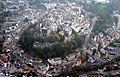
 01 Ulrichsburg, Ribeauville.JPG 3,943 × 2,533; 8.36 MB
-
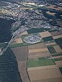
 2014-09-13 12-46-30 France Alsace Blotzheim Haberhaeuser.jpg 4,119 × 2,736; 6 MB
-
 2014-09-13 12-46-35 France Alsace Blotzheim Haberhaeuser.jpg 3,822 × 2,538; 5.55 MB
-
 2014-09-13 12-47-25 France Alsace Sierentz Sierentz.jpg 4,288 × 2,848; 8.48 MB
-
 2018-01 aerial Ill in flood 01.jpg 3,721 × 2,481; 7.09 MB
-
 2018-01 aerial Ill in flood 02.jpg 3,960 × 2,228; 5.65 MB
-
 2018-01 aerial Ill in flood 03.jpg 3,945 × 2,630; 6.91 MB
-
 2018-01 aerial Ill in flood 04.jpg 3,776 × 2,517; 6.41 MB
-
 2018-01 aerial Ill in flood 05.jpg 3,897 × 2,598; 6.32 MB
-
 2018-01 aerial Ill in flood 06.jpg 3,992 × 2,246; 6.66 MB
-
 2018-01 aerial Ill in flood 07.jpg 3,957 × 2,226; 4.51 MB
-
 2018-01 aerial Ill in flood 08.jpg 3,962 × 2,229; 5.29 MB
-
 2018-01 aerial Ill in flood 09.jpg 3,774 × 2,123; 5.1 MB
-
 2018-01 aerial Ill in flood 10.jpg 3,991 × 2,661; 7.7 MB
-
 2018-01 aerial Ill in flood 11.jpg 3,992 × 2,246; 7.21 MB
-
 2018-01 aerial Ill in flood 12.jpg 3,991 × 2,661; 7.53 MB
-
 2018-01 aerial Ill in flood 13.jpg 3,811 × 2,541; 6.52 MB
-
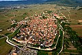
 Altkirch.jpg 800 × 515; 154 KB
-
 AnflugLFSB.jpg 3,024 × 4,032; 2.1 MB
-
 Atterrissage - Mulhouse.jpg 2,592 × 1,944; 253 KB
-
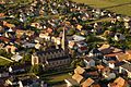
 Bergheim-aerien.jpg 690 × 460; 166 KB
-
 Centre wick.jpg 400 × 406; 45 KB
-
 Chateau a Heidwiller.jpg 800 × 502; 122 KB
-
 Chateau Saint-Ulrich 1- 4000x3000.JPG 4,000 × 3,000; 6.08 MB
-
 Chateau Saint-Ulrich 2- 4000x3000.JPG 4,000 × 3,000; 4.71 MB
-
 CMR AIRPORT COLMAR HOUSSEN FROM FLIGHT CDG-IST 777 TC-JJF (15428342056).jpg 2,503 × 1,668; 1.09 MB
-
 Couvent des dominicains vu du ciel (Guebwiller).jpg 1,661 × 1,034; 254 KB
-
 Dessenheim from the sky.jpg 1,600 × 1,065; 458 KB
-
 Eglise Sainte Barbe 2015-04-05 à 19.25.02.png 2,854 × 1,578; 5 MB
-
 Eglise Sainte Barbe 2015-04-05 à 19.25.50.png 2,874 × 1,588; 5.81 MB
-
 Eguisheim from the sky.jpg 1,600 × 1,065; 378 KB
-
 Haut-Ribeaupierre 2- 4000x3000.jpg 4,000 × 3,000; 4.73 MB
-
 Haut-Ribeaupierre 4000x3000.jpg 4,000 × 3,000; 5.13 MB
-
 HD.15.098 (11841650634).jpg 3,200 × 2,151; 660 KB
-
 Helfrantzkirch Vue aérienne.jpg 3,456 × 2,304; 3.04 MB
-
 L'eglise a Heidwiller.jpg 784 × 708; 149 KB
-
 L'Ill à travers le Haut-Rhin.jpg 3,056 × 4,592; 3.37 MB
-
 L'église a Obermorschwiller.jpg 1,070 × 1,060; 218 KB
-
 Mulhouse et la Tour de l'Europe.JPG 5,184 × 3,456; 7.64 MB
-
 Neuf-Brisach 006 850.jpg 850 × 637; 243 KB
-
 Neuf-Brisach 007 850.jpg 850 × 637; 205 KB
-
 Neuf-Brisach from the sky.jpg 1,600 × 899; 280 KB
-
 Neuf-Brisach vue01 2018-05-05.jpg 2,560 × 1,440; 2.23 MB
-
 NeufBrisach-002 (cropped).jpg 2,786 × 398; 497 KB
-
 NeufBrisach-002.jpg 2,786 × 1,592; 1.88 MB
-
 NeufBrisach-003.jpg 6,515 × 3,725; 8.53 MB
-
 Niederentzen - vue du ciel.jpg 500 × 334; 56 KB
-
 Niederentzen.jpg 1,600 × 1,065; 505 KB
-
 Niederhergheim.jpg 4,592 × 1,636; 1.37 MB
-
 Oberlarg vue du ciel.jpg 3,994 × 1,966; 1.54 MB
-
 Obermorschwiller.JPG 1,024 × 664; 491 KB
-
 Parc du Petit Prince, vue aérienne.jpg 3,000 × 2,008; 956 KB
-
 Quartier Sainte Barbe vu par drone.JPG 851 × 315; 79 KB
-
 Ribeauville-centre-aerien.jpg 690 × 460; 202 KB
-
 Ribeauvillé Wikivoyage Banner.JPG 4,000 × 575; 1.25 MB
-
 Rustenhart, aménagement du rond-point.jpg 4,030 × 1,963; 1.24 MB
-
 Rustenhart.jpg 1,600 × 1,065; 512 KB
-
 Skydiving France.jpg 5,184 × 3,456; 5.37 MB
-
 Soultz vue du ciel.jpg 886 × 591; 273 KB
-
 Statue of Liberty Colmar.jpg 5,184 × 3,456; 6.81 MB
-
 Turckheim vue du ciel.jpg 3,648 × 2,736; 3.31 MB
-
 Ungersheim Panorama.jpg 1,600 × 353; 204 KB
-
 Vue aerienne du monument Marin la Meslee de Dessenheim.jpg 1,112 × 1,004; 800 KB
-
 Zellenberg-aerien.jpg 690 × 460; 128 KB


.jpg)
.jpg)


.jpg)


.jpg)