Category:Aerial photographs of Loire-Atlantique
Departments of Metropolitan France: Ain [01] · Aisne [02] · Allier [03] · Alpes-de-Haute-Provence [04] · Hautes-Alpes [05] · Alpes-Maritimes [06] · Ardèche [07] · Ardennes [08] · Ariège [09] · Aube [10] · Aude [11] · Aveyron [12] · Bouches-du-Rhône [13] · Calvados [14] · Cantal [15] · Charente [16] · Charente-Maritime [17] · Cher [18] · Corrèze [19] · Corse-du-Sud [2A]† · Haute-Corse [2B]† · Côte-d’Or [21] · Côtes-d'Armor [22] · Creuse [23] · Dordogne [24] · Doubs [25] · Drôme [26] · Eure [27] · Eure-et-Loir [28] · Finistère [29] · Gard [30] · Haute-Garonne [31] · Gers [32] · Gironde [33] · Hérault [34] · Ille-et-Vilaine [35] · Indre [36] · Indre-et-Loire [37] · Isère [38] · Jura [39] · Landes [40] · Loir-et-Cher [41] · Loire [42] · Haute-Loire [43] · Loire-Atlantique [44] · Loiret [45] · Lot [46] · Lot-et-Garonne [47] · Lozère [48] · Maine-et-Loire [49] · Manche [50] · Marne [51] · Haute-Marne [52] · Mayenne [53] · Meurthe-et-Moselle [54] · Meuse [55] · Morbihan [56] · Moselle [57] · Nièvre [58] · Nord [59] · Oise [60] · Orne [61] · Pas-de-Calais [62] · Puy-de-Dôme [63] · Pyrénées-Atlantiques [64] · Hautes-Pyrénées [65] · Pyrénées-Orientales [66] · Bas-Rhin [67] · Haut-Rhin [68] · departmental district of the Rhône [69] · Haute-Saône [70] · Saône-et-Loire [71] · Sarthe [72] · Savoie [73] · Haute-Savoie [74] · Paris [75] · Seine-Maritime [76] · Seine-et-Marne [77] · Yvelines [78] · Deux-Sèvres [79] · Somme [80] · Tarn [81] · Tarn-et-Garonne [82] · Var [83] · Vaucluse [84] · Vendée [85] · Vienne [86] · Haute-Vienne [87] · Vosges [88] · Yonne [89] · Territoire de Belfort [90] · Essonne [91] · Hauts-de-Seine [92] · Seine-Saint-Denis [93] · Val-de-Marne [94] · Val-d'Oise [95]
Overseas departments and regions: Guadeloupe [971] · Martinique [972] · French Guiana [973] · Réunion [974] · Mayotte [976]
Overseas collectivities: Saint Pierre and Miquelon [975] · Saint Barthélemy [977] · Wallis and Futuna [986] · French Polynesia [987] · French Southern and Antarctic Lands [984]+
Sui generis territories: New Caledonia [988] · Clipperton Island [989]+
Media in category "Aerial photographs of Loire-Atlantique"
The following 53 files are in this category, out of 53 total.
-
 Airplane view - Savenay hospital center.jpg 450 × 316; 49 KB
-
 Baie du pouliguen.jpg 1,932 × 2,886; 4.1 MB
-
 Batz marais 1.png 654 × 797; 462 KB
-
 Batz marais 2.png 700 × 993; 606 KB
-
 Batz marais 3.png 714 × 962; 861 KB
-
 Batz Plage 4.png 677 × 1,057; 755 KB
-
 Batz plage Valentin.png 1,055 × 751; 651 KB
-
 Bourg Ancien de Saint-Viaud.jpg 846 × 582; 121 KB
-
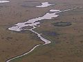 Briere near Assérac.jpg 640 × 480; 74 KB
-
 Briere near Guérande.jpg 1,280 × 960; 329 KB
-
 Briere near Saint-Joachim 2.jpg 2,560 × 1,920; 1.31 MB
-
 Briere near Saint-Joachim.jpg 1,280 × 960; 302 KB
-
 Campagne nantaise.jpg 4,000 × 3,000; 1.67 MB
-
 Carte postale ancienne de Chéméré 25.jpg 1,732 × 1,204; 783 KB
-
 Carte postale ancienne de Chéméré 31.jpg 1,748 × 1,204; 647 KB
-
 Carte postale ancienne de Chéméré 33.jpg 1,724 × 1,212; 599 KB
-
 Centre-ville et port de Nort-sur-Erdre.jpg 5,464 × 3,640; 6.29 MB
-
 Clisson vu du ciel.jpg 1,836 × 2,448; 4.03 MB
-
 Euronantes1.jpg 800 × 533; 313 KB
-
 Euronantes2.jpg 800 × 533; 311 KB
-
 Foret du gavre.jpg 837 × 472; 226 KB
-
 Fresque humaine contre l aeroport juin-2006.jpg 499 × 372; 63 KB
-
 Ile de Nantes.JPG 2,560 × 1,630; 4 MB
-
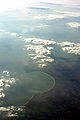
 Lac de Grand-Lieu.jpg 1,600 × 1,200; 668 KB
-
 Lac de Grand-Lieu2.jpg 1,362 × 680; 150 KB
-
 Marais salants vus du ciel.jpg 3,072 × 2,048; 4.18 MB
-
 Nantes 2.jpg 4,000 × 3,000; 2.2 MB
-
 Nantes aérien château2.JPG 954 × 626; 501 KB
-
 Nantes aérien château3.jpg 954 × 626; 499 KB
-
 Nantes aérien cours st pierre.JPG 1,304 × 691; 832 KB
-
 Nantes Pont de Cheviré.JPG 2,552 × 1,262; 2.66 MB
-
 Nantes à vol d'oiseau.png 2,057 × 1,420; 6.69 MB
-
 P1120625-Pornic-JMi.JPG 2,674 × 1,783; 3.8 MB
-
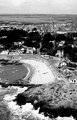
 Pen-Bron.jpg 999 × 582; 163 KB
-
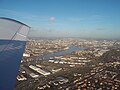
 Plane ride from Nantes to Lyon (7943500370).jpg 3,648 × 2,736; 4.5 MB
-
 Pointe-Saint-Gildas-44770.JPG 2,816 × 2,112; 3.2 MB
-
 Pont transbordeur Nantes.JPG 2,048 × 1,410; 981 KB
-
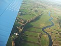
 Pont-Mindin.jpg 1,024 × 633; 221 KB
-
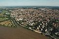
 Pornic vue aérienne.jpg 4,000 × 3,000; 1.64 MB
-
 Pornic Wikivoyage Banner.JPG 2,674 × 385; 949 KB
-
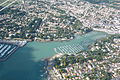
 Pornichet vue du ciel.jpg 3,600 × 2,400; 2.86 MB
-
 Port de Saint-Nazaire 2011.jpg 1,181 × 839; 280 KB
-
 Porte de Retz (7943500370) (cropped).jpg 1,770 × 881; 818 KB
-
 Saint-Nazaire le pont puis le chantier naval.JPG 4,608 × 2,592; 2.77 MB
-
 Saint-Sébastien-sur-Loire - vue aérienne - 2346.jpg 5,184 × 2,956; 3.05 MB
-
 Operation Chariot- the Raid on St Nazaire, 27-28 March 1942 C2351.jpg 2,479 × 1,772; 1.26 MB
-
 Operation Chariot- the Raid on St Nazaire, 27-28 March 1942 C2352.jpg 1,772 × 1,817; 1.14 MB
-
 Operation Chariot- the Raid on St Nazaire, 27-28 March 1942 C3317A.jpg 800 × 743; 136 KB
-
 St Nazaire 1942 aerial.jpg 750 × 500; 60 KB
-
 Thouaré-sur-Loire - vue d'avion - 2343.jpg 5,184 × 3,095; 2.87 MB
-
 Trescalan ancien.JPG 4,529 × 3,066; 2.92 MB
-
 Vue aérienne de La Chevroliere.jpg 1,493 × 762; 282 KB
-
 Vue aérienne de Saint-Sébastien-sur-Loire.jpg 1,600 × 1,065; 582 KB


.jpg)


_(cropped).jpg)


