Category:Aerial photographs of Kreis Euskirchen
Subcategories
This category has the following 8 subcategories, out of 8 total.
A
- Areal views of Urfttalsperre (7 F)
B
E
- Aerial photographs of Euskirchen (58 F)
K
- Aerial photographs of Kall (6 F)
M
- Aerial photographs of Mechernich (17 F)
W
Z
- Aerial photographs of Zülpich (51 F)
Media in category "Aerial photographs of Kreis Euskirchen"
The following 42 files are in this category, out of 42 total.
-
 2015-04-22 Luftbild freigestellt.jpg 2,303 × 1,890; 3.43 MB
-
 2019-03-13 Burg Dreiborn 360 Grad.jpg 8,192 × 4,096; 15.07 MB
-
 2019-03-31-Schloss Dreiborn-0040.jpg 4,393 × 2,927; 10.6 MB
-
 2019-03-31-Schloss Dreiborn-0041.jpg 4,290 × 2,858; 8.71 MB
-
 2019-03-31-Schloss Dreiborn-0051.jpg 3,310 × 2,205; 5.73 MB
-
 Aerial image of the Dahlemer Binz airfield.jpg 5,500 × 2,700; 6.38 MB
-
 Baasem.jpg 3,872 × 2,592; 7.86 MB
-
 Blankenheim (Ahr) 004x.jpg 4,032 × 2,268; 5.01 MB
-
 Blankenheim (Ahr) 025x.jpg 6,016 × 3,384; 8.31 MB
-
 Blankenheim (Ahr), St. Mariä Himmelfahrt.jpg 6,016 × 3,384; 8.14 MB
-
 Blankenheimerdorf 001.JPG 6,016 × 3,384; 8.8 MB
-
 Burg Blankenheim 002x.jpg 4,032 × 2,268; 5.12 MB
-
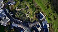
 Burg Dreiborn 003.jpg 5,472 × 3,078; 10.14 MB
-
 Burg Kronenburg 008x.jpg 6,016 × 3,384; 10.51 MB
-
 Burg Kronenburg 047x.jpg 6,016 × 3,384; 8.74 MB
-
 Burg Reifferscheid 002-.jpg 4,032 × 2,268; 5.34 MB
-
 Burg Wildenburg (Eifel) 003.JPG 4,512 × 2,538; 5.3 MB
-
 Dahlem (Nordeifel) 001x.jpg 6,016 × 3,384; 8.61 MB
-
 Dahlem.jpg 3,872 × 2,592; 7.86 MB
-
 Dreiborn (Schleiden), Burg Dreiborn 005.jpg 5,472 × 3,078; 9.93 MB
-
 Euskirchen - Wind Farm & Scenery - geo.hlipp.de - 26903.jpg 640 × 425; 75 KB
-
 Frauenkron.jpg 3,872 × 2,592; 5.76 MB
-
 Görresburg 006.JPG 4,823 × 2,713; 7.55 MB
-
 Hecken (Hellenthal) 001.JPG 6,016 × 3,384; 9.69 MB
-
 Kronenburg 030x.jpg 6,016 × 3,384; 9.3 MB
-
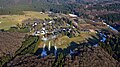
 Kronenburger See 001x.jpg 6,016 × 3,384; 6.86 MB
-
 Luftbild-Muelheim.jpg 1,024 × 683; 176 KB
-
 Marmagen 001.JPG 6,016 × 3,384; 9.16 MB
-
 Marmagen 002 Eifelhöhenklinik.JPG 6,016 × 3,385; 9.62 MB
-
 Mülheim 005, SO, Raketenstellung x.jpg 4,032 × 2,268; 5.02 MB
-
 Paulushof 001.JPG 6,016 × 3,384; 9.74 MB
-
 Rohr (Blankenheim) 001-.jpg 4,032 × 2,268; 5.2 MB
-
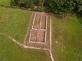 Roman farmhouse "villa rustica" Haupthaus Nettersheim Roderath.jpg 3,456 × 2,592; 3.31 MB
-
 Schleiden 001-.jpg 4,032 × 2,268; 5.66 MB
-
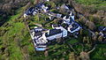
 Schloss Schleiden 005-.jpg 4,032 × 2,268; 5.38 MB
-
 Schloss Schleiden 008-.jpg 4,032 × 2,268; 5.43 MB
-
 Schloss Schmidtheim 009.JPG 6,016 × 3,384; 8.82 MB
-
 Schloss Schmidtheim.jpg 3,872 × 2,592; 5.39 MB
-
 Schmidtheim.jpg 3,872 × 2,592; 5.17 MB
-
 Steinbachtalsperre bei Kirchheim mit Waldschwimmbad. Luftaufnahme-0561.jpg 5,464 × 3,640; 15.64 MB
-
 Waldorf (Blankenheim) 001x.jpg 6,016 × 3,384; 8.02 MB
-
 Weitere Nebengebäude im Luftbild? der Villa rustica Roderath.jpg 1,022 × 764; 190 KB


_003.JPG)
_001x.jpg)

,_Burg_Dreiborn_005.jpg)


_001.JPG)


_004x.jpg)
_025x.jpg)
,_St._Mari%C3%A4_Himmelfahrt.jpg)
_001-.jpg)
_001x.jpg)