Category:Aerial photographs of Kreis Soest
Subcategories
This category has the following 12 subcategories, out of 12 total.
A
- Aerial photographs of Anröchte (38 F)
E
- Aerial photographs of Ense (62 F)
G
- Aerial photographs of Geseke (1 F)
L
M
- Aerial photographs of Möhnesee (203 F)
R
- Aerial photographs of Rüthen (137 F)
S
W
- Aerial photographs of Warstein (186 F)
Media in category "Aerial photographs of Kreis Soest"
The following 2 files are in this category, out of 2 total.
-
 Aerial image of Schloss Schwarzenraben (view from the south).jpg 3,800 × 3,500; 5.88 MB
-
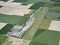 Aerial image of the Soest-Bad Sassendorf airfield.jpg 4,400 × 3,300; 3.71 MB
.jpg)
