Category:Airport diagrams of airports in Indiana
States of the United States: Alabama · Alaska · Arizona · Arkansas · California · Colorado · Connecticut · Delaware · Florida · Georgia · Hawaii · Idaho · Illinois · Indiana · Iowa · Kansas · Kentucky · Louisiana · Maine · Maryland · Massachusetts · Michigan · Minnesota · Mississippi · Missouri · Montana · Nebraska · Nevada · New Hampshire · New Jersey · New Mexico · New York · North Carolina · North Dakota · Ohio · Oklahoma · Oregon · Pennsylvania · Rhode Island · South Carolina · South Dakota · Tennessee · Texas · Utah · Vermont · Virginia · Washington · West Virginia · Wisconsin · Wyoming

Subcategories
This category has only the following subcategory.
Media in category "Airport diagrams of airports in Indiana"
The following 9 files are in this category, out of 9 total.
-
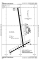
 BAK airport map.PNG 516 × 792; 50 KB
-
 BMG airport map.PNG 516 × 792; 56 KB
-
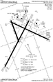
 EVV airport map.PNG 731 × 1,137; 96 KB
-
 FWA airport map.PNG 731 × 1,133; 101 KB
-
 GYY airport map.PNG 591 × 907; 68 KB
-
 HUF airport map.PNG 732 × 1,133; 100 KB
-
 KLAF Airport Diagram.svg 516 × 792; 534 KB
-
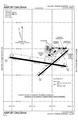 LAF airport map.PNG 516 × 792; 55 KB
-
 SBN airport map.PNG 731 × 1,133; 88 KB


