Category:Airport diagrams of airports in Minnesota
States of the United States: Alabama · Alaska · Arizona · Arkansas · California · Colorado · Connecticut · Delaware · Florida · Georgia · Hawaii · Idaho · Illinois · Indiana · Iowa · Kansas · Kentucky · Louisiana · Maine · Maryland · Massachusetts · Michigan · Minnesota · Mississippi · Missouri · Montana · Nebraska · Nevada · New Hampshire · New Jersey · New Mexico · New York · North Carolina · North Dakota · Ohio · Oklahoma · Oregon · Pennsylvania · Rhode Island · South Carolina · South Dakota · Tennessee · Texas · Utah · Vermont · Virginia · Washington · West Virginia · Wisconsin · Wyoming

Media in category "Airport diagrams of airports in Minnesota"
The following 9 files are in this category, out of 9 total.
-
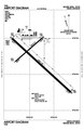
 FCM Airport Diagram.svg 378 × 548; 708 KB
-
 HIB Airport Diagram.pdf 806 × 1,237; 99 KB
-
 KMSP Airport Map.png 779 × 1,121; 141 KB
-
 KRST FAA Airport Diagram.svg 516 × 792; 477 KB
-
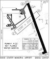 Ktobmap.PNG 358 × 420; 45 KB
-
 MSP Airport Diagram.svg 378 × 548; 1.11 MB
-
 Mspdiagram.gif 774 × 1,188; 97 KB
-
 RST airport map.PNG 1,076 × 1,651; 41 KB
-
 RstIntl.PNG 381 × 579; 36 KB


