Category:Alveley
Main Wikipedia article: Alveley.
village in Shropshire, United Kingdom  | |||||
| Upload media | |||||
| Instance of | |||||
|---|---|---|---|---|---|
| Location | Alveley, Shropshire, West Midlands, England | ||||
| official website | |||||
 | |||||
Subcategories
This category has the following 3 subcategories, out of 3 total.
M
- Alveley Methodist Church (5 F)
P
- Pool Hall, Shropshire (3 F)
Media in category "Alveley"
The following 200 files are in this category, out of 292 total.
(previous page) (next page)-

-
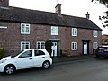
 16 and 17 Centre Place, Alveley.jpg 800 × 578; 96 KB
-
 16 Centre Place, Alveley - geograph.org.uk - 5621672.jpg 2,448 × 1,836; 1.45 MB
-
 17 Centre Place, Alveley - geograph.org.uk - 5621666.jpg 2,448 × 1,836; 1.26 MB
-
 19-21 Centre Place, Alveley.jpg 2,448 × 1,836; 1.46 MB
-
 7 Centre Place, Alveley.jpg 2,448 × 1,836; 1.43 MB
-
 A badly boggy bit - geograph.org.uk - 3065286.jpg 979 × 734; 469 KB
-

-
 A leafy path in the country park - geograph.org.uk - 5453037.jpg 857 × 1,142; 635 KB
-
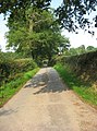
 A narrow lane beside Cherry Orchard Farm - geograph.org.uk - 3077047.jpg 1,142 × 857; 340 KB
-
 A sharp bend on the bridleway - geograph.org.uk - 3067022.jpg 979 × 734; 434 KB
-
 A small 'beach' on the east bank of the Severn - geograph.org.uk - 2554585.jpg 1,024 × 768; 191 KB
-
 A staggered crossroads near Tuckhill - geograph.org.uk - 3064931.jpg 979 × 734; 419 KB
-

-
-
 A442 at Blunder Bridge - geograph.org.uk - 3501710.jpg 640 × 480; 81 KB
-
 A442 at Cooks Cross - geograph.org.uk - 3501707.jpg 640 × 480; 57 KB
-
 A442 at Coton Lane junction - geograph.org.uk - 3501715.jpg 640 × 480; 57 KB
-

-
 A442 at Fenn Green - geograph.org.uk - 3501673.jpg 640 × 480; 52 KB
-
 A442 at Lowe Lane - geograph.org.uk - 3501672.jpg 640 × 480; 46 KB
-
 A442 at Mallards Close, Alveley - geograph.org.uk - 3501704.jpg 640 × 480; 66 KB
-
 A442 at Pool Hall - geograph.org.uk - 3501694.jpg 640 × 480; 76 KB
-
 A442 entering Alveley - geograph.org.uk - 3501699.jpg 640 × 480; 74 KB
-
 A442 near Alveley - geograph.org.uk - 3707019.jpg 1,600 × 958; 331 KB
-

-

-
 A442 southbound at Hooks Coppice - geograph.org.uk - 3553971.jpg 640 × 479; 56 KB
-
 A442 southbound near Fenn Green - geograph.org.uk - 3553963.jpg 640 × 481; 54 KB
-
 A442 southbound near Green House - geograph.org.uk - 3553625.jpg 640 × 480; 37 KB
-

-
 A458 at Broad Oak - geograph.org.uk - 2772984.jpg 640 × 480; 74 KB
-
 Access into Kingsnordley Farm - geograph.org.uk - 1036269.jpg 640 × 480; 58 KB
-
 Access road near The Butter Cross - geograph.org.uk - 1074410.jpg 640 × 480; 151 KB
-
 Access road to Kingsnordley Cottages - geograph.org.uk - 1036264.jpg 640 × 480; 83 KB
-
 Access to The Mill Hotel and Restaurant - geograph.org.uk - 1074417.jpg 640 × 480; 130 KB
-
 Across the river from Hampton Loade Station - geograph.org.uk - 5301136.jpg 1,600 × 1,067; 334 KB
-
 Across the River Severn near Alveley in Shropshire - geograph.org.uk - 6063378.jpg 1,440 × 1,080; 2.12 MB
-
 Across the River Severn near Highley, Shropshire - geograph.org.uk - 6064182.jpg 1,024 × 1,024; 1.54 MB
-
 Along the lane towards Moor House Farm - geograph.org.uk - 5624887.jpg 1,142 × 857; 455 KB
-
 Along the lane towards The Hadleys - geograph.org.uk - 5624886.jpg 857 × 1,142; 627 KB
-
 Alveley - Severn Valley Country Park - geograph.org.uk - 846977.jpg 480 × 640; 246 KB
-

-
 Alveley Cottage - geograph.org.uk - 1748672.jpg 800 × 600; 104 KB
-
 Alveley Industrial Estate - geograph.org.uk - 1748685.jpg 600 × 800; 153 KB
-
 Alveley Old Chapel - geograph.org.uk - 4789828.jpg 640 × 480; 66 KB
-
 Alveley Post Office, 60 Alveley - geograph.org.uk - 1813535.jpg 800 × 577; 114 KB
-
 Alveley Welcome - geograph.org.uk - 3602883.jpg 800 × 600; 166 KB
-
 Alveley, UK - panoramio (1).jpg 3,264 × 2,448; 4.37 MB
-
 Alveley, UK - panoramio (2).jpg 3,264 × 2,448; 2.31 MB
-
 Alveley, UK - panoramio (3).jpg 10,508 × 3,036; 9.9 MB
-
 Alveley, UK - panoramio (4).jpg 3,264 × 2,448; 2.69 MB
-
 Alveley, UK - panoramio (5).jpg 3,264 × 2,448; 1.8 MB
-
 Alveley, UK - panoramio (6).jpg 3,264 × 2,448; 2.48 MB
-
 Alveley, UK - panoramio (7).jpg 3,264 × 2,448; 1.96 MB
-
 Alveley, UK - panoramio.jpg 3,264 × 2,448; 1.42 MB
-
 Barn conversion just off Batfield Lane - geograph.org.uk - 3064950.jpg 979 × 734; 383 KB
-
 Barn conversions in progress - geograph.org.uk - 5621828.jpg 2,448 × 1,836; 1.35 MB
-
 Barrets - a couple of abandoned barns - geograph.org.uk - 3064856.jpg 979 × 734; 389 KB
-
-

-
 Birch woodland in the Severn Valley Country Park - geograph.org.uk - 6062261.jpg 1,440 × 960; 1.8 MB
-
 Bowhill stream and dingle - geograph.org.uk - 884201.jpg 640 × 480; 414 KB
-
 Bridleway in a hayfield - geograph.org.uk - 3065291.jpg 979 × 734; 414 KB
-
 Bridleway in Lyebatch - geograph.org.uk - 5627435.jpg 734 × 979; 479 KB
-
 Bridleway near Filletts, Shropshire - geograph.org.uk - 401429.jpg 640 × 457; 114 KB
-
 Bridleway to Hampton Loade - geograph.org.uk - 1812939.jpg 800 × 600; 149 KB
-
 Bridleway to No Man's Green - geograph.org.uk - 3065298.jpg 979 × 734; 404 KB
-

-
 Buttercross, Alveley - geograph.org.uk - 361339.jpg 640 × 480; 99 KB
-
 Buttercross, Alveley.jpg 578 × 800; 181 KB
-
 Butts Farm - geograph.org.uk - 504588.jpg 640 × 480; 81 KB
-
 Byway near Quatt, Shropshire - geograph.org.uk - 403867.jpg 480 × 640; 139 KB
-
 Byway running south towards Alveley - geograph.org.uk - 5627440.jpg 1,142 × 857; 487 KB
-
 Byway towards Lake House - geograph.org.uk - 5627449.jpg 1,142 × 857; 653 KB
-
 Canoe stack - geograph.org.uk - 776679.jpg 640 × 480; 141 KB
-
 Carpark near the visitor centre - geograph.org.uk - 5453036.jpg 1,306 × 979; 547 KB
-

-

-
 Church Cottages, Alveley - geograph.org.uk - 5623044.jpg 2,122 × 1,591; 1.21 MB
-
 Church Farm House, Alveley.jpg 2,122 × 1,591; 1.4 MB
-
 Church House - geograph.org.uk - 3602810.jpg 640 × 480; 105 KB
-
 Church House, Alveley - geograph.org.uk - 884176.jpg 640 × 480; 358 KB
-
 Cleaning Daft Dog up a bit - geograph.org.uk - 5627444.jpg 857 × 1,142; 618 KB
-

-
 Coton Lane near Birdsgreen - geograph.org.uk - 2497038.jpg 525 × 622; 185 KB
-
 Cottages at Broad Lanes - geograph.org.uk - 3077178.jpg 1,142 × 857; 396 KB
-

-

-

-

-
 Country Park south-west of Alveley, Shropshire - geograph.org.uk - 6062250.jpg 1,280 × 960; 2.1 MB
-
 Country Park south-west of Alveley, Shropshire - geograph.org.uk - 6062254.jpg 1,280 × 960; 1.42 MB
-
 Country Park south-west of Alveley, Shropshire - geograph.org.uk - 6062256.jpg 1,024 × 1,024; 1.62 MB
-
 Country Park visitor centre near Alveley in Shropshire - geograph.org.uk - 6064643.jpg 1,440 × 1,080; 1.76 MB
-
 Country road and farmland at Tuckhill - geograph.org.uk - 5502931.jpg 1,024 × 768; 310 KB
-
 Country road near Kingsnordley - geograph.org.uk - 2168153.jpg 483 × 640; 228 KB
-
 Crop Field and Oak Trees, near Birdsgreen, Shropshire - geograph.org.uk - 399568.jpg 1,280 × 933; 1.48 MB
-

-
 Elm Cottage, Alveley.jpg 2,122 × 1,591; 1.15 MB
-
 End of Walk - geograph.org.uk - 447242.jpg 640 × 480; 154 KB
-

-

-
 Ewes and Lambs, Birdsgreen, Shropshire - geograph.org.uk - 407027.jpg 640 × 480; 124 KB
-

-
 Farm access road off the NCR 45 - geograph.org.uk - 1074407.jpg 640 × 480; 92 KB
-
 Farm entrance, Turleygreen, Shropshire - geograph.org.uk - 3706991.jpg 1,600 × 1,147; 566 KB
-
 Farm Outhouse, Herons Gate Farm - geograph.org.uk - 401676.jpg 640 × 502; 99 KB
-
 Farm track in winter - geograph.org.uk - 3181783.jpg 640 × 480; 202 KB
-
 Farmland alongside the River Severn - geograph.org.uk - 2854944.jpg 3,029 × 2,119; 3.13 MB
-
 Farmland and River north of Highley, Shropshire - geograph.org.uk - 4709920.jpg 1,440 × 1,080; 2.23 MB
-

-
 Farmland near Birdsgreen - geograph.org.uk - 2168164.jpg 640 × 398; 248 KB
-
 Fields near Alveley, Shropshire - geograph.org.uk - 399735.jpg 640 × 417; 139 KB
-
 Fishing in the River Severn - geograph.org.uk - 2259477.jpg 1,024 × 683; 254 KB
-

-
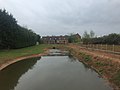
 Footbridge over the Severn - geograph.org.uk - 5578228.jpg 1,024 × 576; 192 KB
-
 Grazing, near Tuckhill, Shropshire - geograph.org.uk - 380850.jpg 640 × 442; 121 KB
-
 Hall Close Coppice - geograph.org.uk - 1748708.jpg 800 × 600; 214 KB
-

-
 He's Burnt the Cakes Again. Fungus - geograph.org.uk - 401440.jpg 640 × 480; 103 KB
-
 Hollow Ash Lane near Birdsgreen - geograph.org.uk - 2497046.jpg 487 × 640; 155 KB
-
 Holmes Orchard - geograph.org.uk - 5621561.jpg 1,469 × 1,102; 690 KB
-
 I certainly know how to pick 'em.... - geograph.org.uk - 3077183.jpg 816 × 612; 313 KB
-

-
 Ivy Place, Alveley.jpg 2,448 × 1,836; 1.26 MB
-
 Junction of lanes near Tuckhill - geograph.org.uk - 3064936.jpg 979 × 734; 437 KB
-

-
 Kissing Gate and stile - geograph.org.uk - 884230.jpg 640 × 480; 422 KB
-
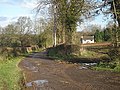
 Lake House, Alveley.jpg 979 × 734; 439 KB
-
 Lane junction at Heron's Gate - geograph.org.uk - 3065301.jpg 979 × 734; 388 KB
-
 Lanegreen Farm - geograph.org.uk - 3067301.jpg 979 × 734; 423 KB
-
 Large field south of Moor House Farm - geograph.org.uk - 5624889.jpg 1,142 × 857; 398 KB
-
 Lime near Birdsgreen - geograph.org.uk - 2168108.jpg 640 × 480; 236 KB
-
 Lodge Farm at Tuckhill - geograph.org.uk - 3067304.jpg 979 × 734; 430 KB
-
 Lodge to Quatford Castle - geograph.org.uk - 424164.jpg 600 × 450; 252 KB
-
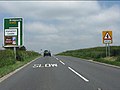
 Long straight on the A442 - geograph.org.uk - 3501669.jpg 640 × 480; 65 KB
-
 Looking north along the River Severn - geograph.org.uk - 2854923.jpg 3,264 × 2,448; 3.68 MB
-

-
 Lowe Lane, near Romsley, Shropshire - geograph.org.uk - 3619929.jpg 758 × 1,024; 277 KB
-
 Many shades of green along the Severn - geograph.org.uk - 2554608.jpg 1,024 × 768; 152 KB
-

-
 Mercian Way milepost near Highley in Shropshire - geograph.org.uk - 6063046.jpg 960 × 1,280; 1.74 MB
-
 Mill Gazebo - geograph.org.uk - 3610418.jpg 600 × 800; 203 KB
-
 Minor road to Moor House and Alveley - geograph.org.uk - 1812991.jpg 800 × 600; 139 KB
-
 Minor road to the Buttercross - geograph.org.uk - 1814884.jpg 800 × 600; 136 KB
-
 Modern barn and feed silos at Moor House Farm - geograph.org.uk - 5624893.jpg 1,142 × 857; 344 KB
-
 Moor House farmhouse - geograph.org.uk - 5624901.jpg 857 × 1,142; 409 KB
-
 Much spreading going on^ - geograph.org.uk - 6064608.jpg 1,440 × 960; 1.78 MB
-
 New Stabling, near Tuckhill, Shropshire - geograph.org.uk - 380847.jpg 640 × 480; 109 KB
-
 Old barn and new at Perry House farm - geograph.org.uk - 3067298.jpg 979 × 734; 463 KB
-

-

-
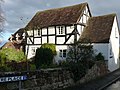
 Old house on corner of Centre Place - geograph.org.uk - 1814913.jpg 800 × 595; 145 KB
-
 Old OS benchmark - Alveley, The Three Horseshoes - geograph.org.uk - 5621581.jpg 857 × 1,142; 524 KB
-
 Older barn and Moor House Farm - geograph.org.uk - 5624898.jpg 1,142 × 857; 452 KB
-
 Onion Cottage - geograph.org.uk - 5627433.jpg 1,142 × 857; 494 KB
-
 OS benchmark - Alveley, wall on Vicarage Bank - geograph.org.uk - 5624878.jpg 857 × 1,142; 535 KB
-
 OS benchmark - Alveley, Yewtree Cottage - geograph.org.uk - 5625561.jpg 857 × 1,142; 451 KB
-
 Outbuilding, The Bell Inn.jpg 2,448 × 1,836; 1.46 MB
-

-
 Parkland near Birdsgreen - geograph.org.uk - 2168097.jpg 640 × 412; 182 KB
-
 Pasture and woodland east of Highley in Shropshire - geograph.org.uk - 6064610.jpg 1,440 × 960; 1.61 MB
-
 Pasture and woodland east of Highley in Shropshire - geograph.org.uk - 6064612.jpg 1,440 × 1,080; 2.06 MB
-

-

-
 Pasture and woodland west of Alveley in Shropshire - geograph.org.uk - 6063069.jpg 1,440 × 917; 1.62 MB
-

-
 Pasture west of Alveley in Shropshire - geograph.org.uk - 6063066.jpg 1,440 × 960; 1.65 MB
-
 Paths along the river - geograph.org.uk - 2854499.jpg 3,264 × 2,448; 3.94 MB
-
 Pathway in the Country Park near Alveley, Shropshire - geograph.org.uk - 6062487.jpg 1,440 × 1,080; 2.08 MB
-
 Pathway in the Country Park near Alveley, Shropshire - geograph.org.uk - 6062495.jpg 1,440 × 1,080; 2.54 MB
-

-
 Preserved colliery truck near Alveley in Shropshire - geograph.org.uk - 6066020.jpg 1,280 × 960; 1.43 MB
-

-
 Pub across the River Severn - geograph.org.uk - 682335.jpg 640 × 480; 92 KB
-
 Rape field beside A442 - geograph.org.uk - 1876986.jpg 640 × 439; 66 KB
-
 Red Lion Inn crossroads, A442 - geograph.org.uk - 3501666.jpg 640 × 480; 79 KB
-
 River and farmland by Hampton Loade, Shropshire - geograph.org.uk - 4707459.jpg 1,280 × 960; 875 KB
-
 River Severn at Hampton Loade - geograph.org.uk - 465574.jpg 640 × 480; 131 KB
-
 River Severn east of Highley in Shropshire - geograph.org.uk - 6064001.jpg 1,440 × 960; 1.6 MB
-
 River Severn near Highley in Shropshire - geograph.org.uk - 6063151.jpg 1,440 × 960; 1.28 MB
-
 River Severn north-east of Highley in Shropshire - geograph.org.uk - 6064638.jpg 1,440 × 1,080; 1.76 MB
-
 River Severn south of Hampton Loade - geograph.org.uk - 2854346.jpg 2,438 × 2,794; 2.35 MB
-
 Riverside pasture west of Alveley in Shropshire - geograph.org.uk - 6063063.jpg 1,280 × 1,280; 2 MB
-

-
 Road leading to the church - geograph.org.uk - 1813737.jpg 800 × 538; 116 KB
-
 Road outside St. Mary's Parish Church - geograph.org.uk - 1814785.jpg 800 × 595; 153 KB
-
 Road to St. Mary's Parish Church - geograph.org.uk - 1813762.jpg 800 × 569; 145 KB
-

-

-
 Roundhouse - geograph.org.uk - 1622403.jpg 640 × 426; 66 KB
-
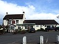 Royal Oak, Alveley - geograph.org.uk - 1859514.jpg 3,488 × 2,616; 2.58 MB
-
 Sandstone walls immediately to the south of the church - geograph.org.uk - 5623015.jpg 2,122 × 1,591; 1.62 MB
-
 Sandstone walls on the east side of the churchyard - geograph.org.uk - 5623013.jpg 2,122 × 1,591; 1.54 MB
-

-

-
 Severn Valley Country Park near Alveley, Shropshire - geograph.org.uk - 6062278.jpg 1,440 × 960; 1.74 MB
-
 Severn Valley Country Park on a wet day - geograph.org.uk - 5578223.jpg 1,024 × 576; 145 KB
-
 Severn Valley near Highley in Shropshire - geograph.org.uk - 6062264.jpg 1,440 × 960; 1.66 MB


.jpg)
.jpg)
.jpg)
.jpg)
.jpg)
.jpg)


,_Severn_Valley_Country_Park_-_geograph.org.uk_-_705032.jpg)


.jpg)