Category:Shropshire (district)
unitary authority (doesn't include Telford and Wrekin) | |||||
| Upload media | |||||
| Instance of |
| ||||
|---|---|---|---|---|---|
| Location | Shropshire, West Midlands, England | ||||
| Legislative body |
| ||||
| Population |
| ||||
| Area |
| ||||
| Replaces |
| ||||
| Different from | |||||
| official website | |||||
 | |||||
English: Shropshire is a district, in the county of Shropshire, England.
Subcategories
This category has the following 200 subcategories, out of 202 total.
(previous page) (next page)A
B
- Bayston Hill (149 F)
- Burwarton (84 F)
C
- Colebatch (114 F)
D
- Deuxhill (22 F)
E
F
G
H
I
K
L
M
N
O
P
Q
R
- Romsley, Shropshire (30 F)
- Rudge, Shropshire (128 F)
S
T
U
W
Pages in category "Shropshire (district)"
This category contains only the following page.
Media in category "Shropshire (district)"
The following 67 files are in this category, out of 67 total.
-
 A stubble turnip in Shropshire - geograph.org.uk - 4187698.jpg 1,024 × 768; 655 KB
-
 A458 Stourbridge Road near Lower Lodge Farm - geograph.org.uk - 4448266.jpg 1,142 × 857; 451 KB
-
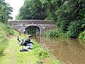 Angling on the Shroppie - geograph.org.uk - 2030187.jpg 640 × 480; 269 KB
-
 Apley Park - geograph.org.uk - 4299431.jpg 3,008 × 2,000; 2.9 MB
-
 B4176 at Greenfields Farm - geograph.org.uk - 4636979.jpg 1,024 × 576; 147 KB
-
 B4176, Crowgreaves - geograph.org.uk - 4332376.jpg 800 × 600; 359 KB
-
 Catstree - geograph.org.uk - 4333704.jpg 800 × 600; 388 KB
-
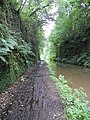 Cold ^ dank in Woodseaves cutting - geograph.org.uk - 2030169.jpg 480 × 640; 168 KB
-
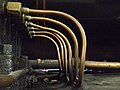 Copper Pipes (35973908220).jpg 3,648 × 2,736; 4.41 MB
-
 Country road near Yorton - geograph.org.uk - 2147029.jpg 499 × 640; 178 KB
-
 Cross-bedding in sandstone - geograph.org.uk - 4299391.jpg 3,008 × 2,000; 3.46 MB
-
 Crossroads near Pasford Cottages - geograph.org.uk - 4636975.jpg 1,024 × 576; 179 KB
-
 Entrance to Greenfields Farm - geograph.org.uk - 4636980.jpg 1,024 × 576; 184 KB
-
 Entrance to Hillview Nurseries - geograph.org.uk - 3724862.jpg 800 × 450; 221 KB
-
 Farm house at Catstree, Shropshire - geograph.org.uk - 4189930.jpg 1,024 × 761; 622 KB
-
 Farm track and lane - geograph.org.uk - 2108729.jpg 640 × 480; 412 KB
-
 Farmland east of Hartlebury, Shropshire - geograph.org.uk - 4188603.jpg 1,024 × 716; 416 KB
-
 Farmland near Hartlebury, Shropshire - geograph.org.uk - 4188575.jpg 1,280 × 688; 630 KB
-
 Farmland west of Catstree, Shropshire - geograph.org.uk - 4190024.jpg 1,024 × 768; 680 KB
-
 Farmland west of Catstree, Shropshire - geograph.org.uk - 4190029.jpg 768 × 1,024; 706 KB
-

-
 Field near Bridgnorth Plantation - geograph.org.uk - 4636974.jpg 1,024 × 576; 165 KB
-
 Field near Stableford - geograph.org.uk - 4333684.jpg 800 × 600; 401 KB
-
 Flat field, Stableford - geograph.org.uk - 4332380.jpg 800 × 600; 387 KB
-
 Flounders Folly, Callow Hill - geograph.org.uk - 3604681.jpg 640 × 469; 67 KB
-

-
 Free range pigs at Mose - geograph.org.uk - 4437628.jpg 1,142 × 857; 364 KB
-

-
 Hedge near Stableford - geograph.org.uk - 4332383.jpg 800 × 600; 426 KB
-
-
 Junction, B4176 - geograph.org.uk - 4332367.jpg 800 × 600; 414 KB
-
 Lodge near Market Drayton - geograph.org.uk - 2157908.jpg 640 × 450; 251 KB
-
 Old barn at Catstree, Shropshire - geograph.org.uk - 4189861.jpg 1,024 × 801; 430 KB
-
 Old barn at Catstree, Shropshire - geograph.org.uk - 4189886.jpg 1,280 × 777; 477 KB
-
 OS benchmark - barn on Apley estate - geograph.org.uk - 4191154.jpg 857 × 1,142; 369 KB
-
 Pasture and woodland near Littlegain, Shropshire - geograph.org.uk - 4716472.jpg 1,024 × 1,024; 853 KB
-
 Pasture near Littlegain, Shropshire - geograph.org.uk - 4716469.jpg 1,280 × 850; 761 KB
-
 Pasture south of Chesterton, Shropshire - geograph.org.uk - 4715887.jpg 1,280 × 853; 793 KB
-
 Pasture south of Chesterton, Shropshire - geograph.org.uk - 4715889.jpg 1,024 × 674; 371 KB
-
 Ploughed field at Catstree, Shropshire - geograph.org.uk - 4189733.jpg 1,024 × 681; 536 KB
-
 Potato field - geograph.org.uk - 4333697.jpg 800 × 600; 347 KB
-
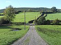
 Private lane south of Chesterton, Shropshire - geograph.org.uk - 4718327.jpg 1,024 × 768; 715 KB
-
 Public footpath north of Worfield, Shropshire - geograph.org.uk - 4187845.jpg 768 × 1,024; 591 KB
-
 Public footpath towards Hartlebury, Shropshire - geograph.org.uk - 4189853.jpg 768 × 1,024; 534 KB
-
 River Tern near Market Drayton - geograph.org.uk - 2157920.jpg 496 × 640; 263 KB
-
 Rooks near Market Drayton - geograph.org.uk - 2157887.jpg 640 × 370; 97 KB
-
 Shropshire Council composition.svg 360 × 185; 5 KB
-
 Stacked haylage and a pretty shonky shed - geograph.org.uk - 4448193.jpg 1,142 × 857; 404 KB
-
 The B4176 to Telford, Shropshire - geograph.org.uk - 4718341.jpg 1,280 × 891; 676 KB
-
 The Bog - geograph.org.uk - 4333686.jpg 800 × 600; 328 KB
-
 The bridleway towards Dallicott - geograph.org.uk - 4443567.jpg 857 × 1,142; 717 KB
-
 The Claverley road junction - geograph.org.uk - 4448264.jpg 1,110 × 787; 304 KB
-

-
 The lane at Catstree, Shropshire - geograph.org.uk - 4189938.jpg 1,024 × 716; 435 KB
-
 The lane at Catstree, Shropshire - geograph.org.uk - 4189965.jpg 1,280 × 815; 562 KB
-

-
 The lane through Catstree, Shropshire - geograph.org.uk - 4190485.jpg 1,024 × 668; 330 KB
-
 The lane to Stableford, Shropshire - geograph.org.uk - 4186301.jpg 1,024 × 724; 430 KB
-
 The lane to Stableford, Shropshire - geograph.org.uk - 4186342.jpg 1,024 × 1,024; 555 KB
-
 The lane to Stableford, Shropshire - geograph.org.uk - 4186451.jpg 1,024 × 629; 400 KB
-
 The Llynclys railway station, Cambrian Heritage Railways, Shropshire. View west.jpg 4,896 × 2,752; 2.5 MB
-
 The Rabbit Run - geograph.org.uk - 4332363.jpg 800 × 600; 415 KB
-
 Tree and former tree beside the bridleway - geograph.org.uk - 4443556.jpg 857 × 1,142; 530 KB
-
 Vegetation near Market Drayton - geograph.org.uk - 2157872.jpg 509 × 640; 348 KB
-
 Weather vane at Catstree, Shropshire - geograph.org.uk - 4189894.jpg 768 × 1,024; 470 KB
-
 Wheat, Crowgreaves - geograph.org.uk - 4332371.jpg 800 × 600; 384 KB
-
 WW2 pillbox on the Apley Estate - geograph.org.uk - 4183185.jpg 979 × 734; 393 KB


.jpg)


