Category:Boraston
village in the United Kingdom  | |||||
| Upload media | |||||
| Instance of | |||||
|---|---|---|---|---|---|
| Location | Shropshire, West Midlands, England | ||||
 | |||||
Subcategories
This category has the following 4 subcategories, out of 4 total.
Media in category "Boraston"
The following 71 files are in this category, out of 71 total.
-
 A rough field near Boraston - geograph.org.uk - 2744684.jpg 640 × 360; 209 KB
-
 A456 below Hammermill Hill - geograph.org.uk - 2742387.jpg 640 × 441; 64 KB
-
 A456 bend from Monks Bridge - geograph.org.uk - 3416419.jpg 640 × 424; 58 KB
-
 A456 south of Oldhill - geograph.org.uk - 3766286.jpg 3,519 × 2,467; 1.13 MB
-
 A456 westbound passing Peacock Inn - geograph.org.uk - 2744242.jpg 640 × 430; 57 KB
-
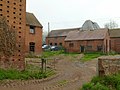
 Barn and cowhouse at Boraston Court - geograph.org.uk - 4936013.jpg 1,280 × 952; 309 KB
-
 Barn and hop kilns at Boraston Court.jpg 1,280 × 960; 360 KB
-
 Barn at Boraston Court - geograph.org.uk - 4936073.jpg 1,280 × 918; 313 KB
-
 Barn at Boraston Court.jpg 1,702 × 1,233; 2.26 MB
-
 Bench mark, Boraston Church - geograph.org.uk - 4936000.jpg 1,280 × 960; 454 KB
-
 Bora - geograph.org.uk - 455880.jpg 640 × 316; 168 KB
-
 Boraston Church - geograph.org.uk - 4683273.jpg 2,601 × 3,912; 2.22 MB
-
 Boraston Church - geograph.org.uk - 4685990.jpg 4,602 × 3,060; 2.76 MB
-
 Boraston Church - geograph.org.uk - 4685992.jpg 3,400 × 5,114; 3 MB
-
 Boraston Church - geograph.org.uk - 4685993.jpg 3,400 × 5,114; 4.99 MB
-
 Boraston Church - geograph.org.uk - 4693354.jpg 6,016 × 4,000; 2.92 MB
-
 Boraston Church - geograph.org.uk - 4693372.jpg 3,047 × 2,007; 5.1 MB
-
 Boraston Church - geograph.org.uk - 4702822.jpg 2,358 × 1,568; 3.88 MB
-
 Boraston Church - geograph.org.uk - 4935986.jpg 1,280 × 960; 518 KB
-
 Boraston Church - geograph.org.uk - 4935990.jpg 1,280 × 960; 277 KB
-
 Boraston Court - geograph.org.uk - 4936002.jpg 1,280 × 871; 281 KB
-
 Boraston Court - geograph.org.uk - 4936004.jpg 960 × 1,280; 392 KB
-
 Boraston Court.jpg 1,985 × 1,320; 1.47 MB
-
 Boraston Ford - geograph.org.uk - 4596316.jpg 1,084 × 725; 410 KB
-
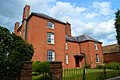
 Boraston House - geograph.org.uk - 4702785.jpg 1,550 × 1,418; 3.04 MB
-
 Boraston House - geograph.org.uk - 4936001.jpg 1,280 × 960; 460 KB
-
 Boraston House.jpg 1,458 × 970; 2.3 MB
-
 Bridleway to Nash Court Farm - geograph.org.uk - 2533420.jpg 680 × 1,024; 325 KB
-
 Categories of Employment in Boraston 2001.jpg 483 × 291; 16 KB
-
 Court Cottages, Boraston.jpg 1,280 × 800; 224 KB
-
 Ewe in the cowhouse, Boraston Court - geograph.org.uk - 4936009.jpg 1,280 × 960; 402 KB
-
 Farm buildings, Boraston Court - geograph.org.uk - 4702855.jpg 1,248 × 1,877; 1.34 MB
-
 Farm entrance at Boraston - geograph.org.uk - 2532974.jpg 680 × 1,024; 298 KB
-
 Ford at Tan House - geograph.org.uk - 4935980.jpg 1,280 × 960; 460 KB
-
 Green lane, Boraston - geograph.org.uk - 3158229.jpg 640 × 360; 159 KB
-
 Here comes the judge - geograph.org.uk - 216196.jpg 640 × 480; 85 KB
-
 Hop barn at Lower Farm, Boraston - geograph.org.uk - 4936043.jpg 1,280 × 867; 283 KB
-
 Hop barn at Myddle House farm - geograph.org.uk - 4936070.jpg 960 × 1,280; 429 KB
-
 Mytton's Cottage, Boraston.jpg 1,280 × 960; 449 KB
-
 National Hereford Show - geograph.org.uk - 216192.jpg 640 × 480; 84 KB
-
 National Hereford Show - geograph.org.uk - 216200.jpg 640 × 480; 67 KB
-
 Occupation Categories in Boraston 1881.jpg 482 × 291; 17 KB
-
 Old barn at Boraston - geograph.org.uk - 2532988.jpg 1,024 × 680; 147 KB
-
 Orchard, Oldhill - geograph.org.uk - 3158222.jpg 640 × 360; 208 KB
-
 Population Change Boraston.jpg 483 × 301; 23 KB
-
 Pump at Lower House Farmhouse - geograph.org.uk - 4936037.jpg 960 × 1,280; 399 KB
-
 Road above The Peacock - geograph.org.uk - 3158216.jpg 640 × 360; 214 KB
-
 Rose Cottage, Boraston.jpg 1,280 × 960; 364 KB
-
 Sheep and Pylon - geograph.org.uk - 454241.jpg 640 × 427; 179 KB
-
 Sheep, Boraston - geograph.org.uk - 3158660.jpg 640 × 360; 182 KB
-
 Tan House Farmhouse - geograph.org.uk - 4935983.jpg 960 × 1,280; 347 KB
-
 The Peacock Inn in the Teme Valley - geograph.org.uk - 3163458.jpg 640 × 480; 122 KB
-
 The Peacock inn near Boraston - geograph.org.uk - 3484109.jpg 1,024 × 768; 106 KB
-
 The Peacock Inn, Oldhill - geograph.org.uk - 227971.jpg 640 × 480; 82 KB
-
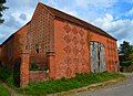
 Traditional red-brick farm buildings, Boraston - geograph.org.uk - 2532962.jpg 1,024 × 680; 217 KB
-
 Traditional red-brick farm buildings, Boraston - geograph.org.uk - 2532964.jpg 1,024 × 680; 218 KB
-
 Victorian letterbox - geograph.org.uk - 2532984.jpg 680 × 1,024; 220 KB
-
 Victorian woodwork, Boraston Church - geograph.org.uk - 4702653.jpg 1,715 × 2,408; 4.36 MB
-

-
 Cattle in a field at Boraston - geograph.org.uk - 462951.jpg 640 × 426; 102 KB
-
 Elm Cottage - geograph.org.uk - 454235.jpg 640 × 394; 178 KB
-
 Flood Plain Field - geograph.org.uk - 151276.jpg 640 × 480; 93 KB
-
 Foot of the Clee - geograph.org.uk - 147418.jpg 640 × 480; 84 KB
-
 Grassland near Aston Court - geograph.org.uk - 454248.jpg 640 × 427; 177 KB
-
 Hi-Tech Water - geograph.org.uk - 151279.jpg 640 × 480; 115 KB
-
 Mowing at Tilsop - geograph.org.uk - 462105.jpg 640 × 426; 128 KB
-
 Old oak tree at Whatmore - geograph.org.uk - 462942.jpg 426 × 640; 126 KB
-
 Old Track towards Spurtree - geograph.org.uk - 454490.jpg 640 × 427; 232 KB
-
 Teme Valley pastimes - geograph.org.uk - 227976.jpg 640 × 480; 103 KB
-
 Tenbury Show - geograph.org.uk - 221544.jpg 640 × 480; 65 KB
-
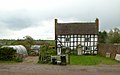
 Whatmore Court Farm - geograph.org.uk - 462945.jpg 640 × 426; 160 KB


