Category:Hopesay
village and civil parish in Shropshire, United Kingdom  | |||||
| Upload media | |||||
| Instance of | |||||
|---|---|---|---|---|---|
| Location | Shropshire, West Midlands, England | ||||
 | |||||
Subcategories
This category has the following 3 subcategories, out of 3 total.
Media in category "Hopesay"
The following 200 files are in this category, out of 222 total.
(previous page) (next page)-
 " Stanley Villas" Hopesay (1294439).jpg 1,000 × 707; 103 KB
-
 'The conservatory' 'Hesterworth' (1293729).jpg 1,000 × 709; 173 KB
-
 A gate on the Shropshire Way - geograph.org.uk - 2380372.jpg 640 × 480; 162 KB
-
 A road passes Wart Hill - geograph.org.uk - 4702327.jpg 1,024 × 768; 331 KB
-
 Another days work done - geograph.org.uk - 1232277.jpg 600 × 450; 270 KB
-
 Aston Rd. Hopesay (1294605).jpg 1,000 × 707; 97 KB
-
 At 'the corner' on Burrow hillfort - geograph.org.uk - 5882300.jpg 640 × 480; 86 KB
-
 Autumn colours below Burrow hillfort - geograph.org.uk - 3194818.jpg 640 × 480; 89 KB
-

-

-
 B4368 east passed Oaker Quarry - geograph.org.uk - 2702874.jpg 640 × 485; 70 KB
-
 B4369 at Medlicott - geograph.org.uk - 3798071.jpg 640 × 452; 55 KB
-
 Beautiful woodland - geograph.org.uk - 5068961.jpg 640 × 480; 144 KB
-
 Bend in the lane at Hammondsgreen - geograph.org.uk - 4751339.jpg 640 × 480; 92 KB
-
 Beside the railway, Broome - geograph.org.uk - 5639958.jpg 1,024 × 683; 387 KB
-
 Blackberries on Wart Hill - geograph.org.uk - 4753428.jpg 640 × 480; 154 KB
-
 Blackberry crop on Wart Hill - geograph.org.uk - 4753431.jpg 640 × 480; 159 KB
-
 Broome railway bridge - geograph.org.uk - 3798069.jpg 640 × 439; 104 KB
-
 Burrow - geograph.org.uk - 5642111.jpg 1,024 × 683; 310 KB
-
 Burrow hillfort - earthworks - geograph.org.uk - 837253.jpg 640 × 480; 85 KB
-
 Burrow Hillfort - geograph.org.uk - 3373576.jpg 1,840 × 1,232; 761 KB
-
 Burrow hillfort - rampart 2 and ditch - geograph.org.uk - 837243.jpg 640 × 480; 83 KB
-
 Burrow hillfort - rampart 3 - geograph.org.uk - 837245.jpg 640 × 480; 109 KB
-
 Cattle grid on the track - geograph.org.uk - 5758458.jpg 640 × 480; 72 KB
-
 Cattle loading area - geograph.org.uk - 5639961.jpg 1,024 × 683; 364 KB
-

-
 Cottages in Hopesay, Shropshire - geograph.org.uk - 3194673.jpg 640 × 480; 69 KB
-

-
 Cross-road at Longmeadow End - geograph.org.uk - 4904229.jpg 640 × 480; 50 KB
-
 Crowsmoor farm house - geograph.org.uk - 5267217.jpg 640 × 480; 101 KB
-
 Crowsmoor Farm near Craven Arms - geograph.org.uk - 2747110.jpg 640 × 418; 39 KB
-
 Deer on the path on Burrow hillfort - geograph.org.uk - 5882267.jpg 640 × 480; 139 KB
-
 Deserted house at Long Meadowend - geograph.org.uk - 5758437.jpg 640 × 480; 123 KB
-
 Direction Sign - Signpost at Round Oak - geograph.org.uk - 6102718.jpg 600 × 800; 110 KB
-
 Disused field barn in a wheatfield - geograph.org.uk - 837240.jpg 640 × 480; 85 KB
-
 Edge of a maize field - geograph.org.uk - 5881289.jpg 640 × 480; 98 KB
-
 Entering Burrow hillfort - geograph.org.uk - 5882254.jpg 640 × 480; 71 KB
-
 Entrance and drive 'Hesterworth' (1294824).jpg 1,000 × 1,409; 241 KB
-
 Fairmead, Hopesay (1294447).jpg 1,000 × 713; 91 KB
-
 Farm at Crowsmoor - geograph.org.uk - 2742197.jpg 640 × 473; 53 KB
-
 Farm track near Aston-on-Clun - geograph.org.uk - 2380366.jpg 640 × 480; 103 KB
-

-
 Field barn and sheds - geograph.org.uk - 3195015.jpg 640 × 480; 73 KB
-
 Field below the forestry plantation - geograph.org.uk - 3194994.jpg 640 × 480; 82 KB
-
 Field edge near Long Meadowend - geograph.org.uk - 5756945.jpg 640 × 480; 64 KB
-
 Field, Long Meadowend - geograph.org.uk - 3424409.jpg 640 × 480; 302 KB
-
 Field, Round Oak - geograph.org.uk - 4702708.jpg 1,024 × 684; 301 KB
-
 Field, Round Oak - geograph.org.uk - 4702711.jpg 1,024 × 684; 300 KB
-
 Fields below Burrow - geograph.org.uk - 3194747.jpg 640 × 480; 85 KB
-
 Flooded fields by B4367 - geograph.org.uk - 3288894.jpg 640 × 386; 74 KB
-

-
 Footbridge and ford on the Onny - geograph.org.uk - 3084065.jpg 640 × 480; 133 KB
-
 Footbridge and stile on a minor path - geograph.org.uk - 2380398.jpg 640 × 480; 154 KB
-
 Footpath off the lane at Upper Carwood - geograph.org.uk - 2380417.jpg 640 × 480; 124 KB
-
 Footpath, steps and stile - geograph.org.uk - 6011978.jpg 640 × 480; 140 KB
-
 Footpaths cross on Hopesay Hill - geograph.org.uk - 2380402.jpg 640 × 480; 96 KB
-

-
 Forestry track on Burrow - geograph.org.uk - 5882247.jpg 640 × 480; 109 KB
-

-
 Frosty field, Broome - geograph.org.uk - 5639960.jpg 1,024 × 683; 329 KB
-
 Fungus in the wood - geograph.org.uk - 3084000.jpg 640 × 480; 161 KB
-
 Garden display in Hopesay - geograph.org.uk - 3194700.jpg 640 × 480; 139 KB
-
 General view Hopesay (1293675).jpg 1,000 × 715; 49 KB
-
 Glenburrell Ford - geograph.org.uk - 4598137.jpg 1,084 × 725; 484 KB
-

-

-
 Harps Dingle - geograph.org.uk - 3084043.jpg 640 × 480; 83 KB
-
 Hedge, Broome - geograph.org.uk - 3424455.jpg 640 × 480; 301 KB
-
 Hedged field access path near Hopesay - geograph.org.uk - 3195009.jpg 640 × 480; 101 KB
-

-
 Hesterworth House, Hopesay (1293893).jpg 1,000 × 714; 63 KB
-
 Hesterworth on the way to Aston on Clun - geograph.org.uk - 2437441.jpg 800 × 600; 258 KB
-
 Hill grazing near Basford - geograph.org.uk - 1712382.jpg 640 × 480; 50 KB
-

-
 Hillside track on Aston Hill - geograph.org.uk - 1712344.jpg 640 × 480; 63 KB
-
 Hopesay (1293507).jpg 1,000 × 704; 78 KB
-
 Hopesay (1294301).jpg 1,000 × 711; 54 KB
-
 Hopesay and Burrow - geograph.org.uk - 4702351.jpg 1,024 × 684; 256 KB
-
 Hopesay church & rectory (1294443).jpg 890 × 534; 100 KB
-
 Hopesay Common - geograph.org.uk - 4702343.jpg 1,024 × 768; 309 KB
-
 Hopesay Common - geograph.org.uk - 4702346.jpg 1,024 × 684; 325 KB
-
 Hopesay Common - geograph.org.uk - 4712137.jpg 1,024 × 684; 326 KB
-
 Hopesay Common - geograph.org.uk - 4712155.jpg 1,024 × 684; 351 KB
-
 Hopesay Common - geograph.org.uk - 4712202.jpg 1,024 × 684; 380 KB
-
 Hopesay vicarage (1293581).jpg 1,000 × 715; 103 KB
-
 Hopesay Village - geograph.org.uk - 2054487.jpg 1,024 × 683; 194 KB
-
 House at Long Meadowend - geograph.org.uk - 4974826.jpg 4,340 × 2,747; 1.49 MB
-
 Junction at Long Meadowend - geograph.org.uk - 4974549.jpg 3,509 × 2,043; 953 KB
-
 Junction of tracks in forestry - geograph.org.uk - 3194967.jpg 640 × 480; 130 KB
-
 Junction, Round Oak - geograph.org.uk - 4702669.jpg 1,024 × 684; 456 KB
-
 Kaiserliche Marine flag - geograph.org.uk - 5639952.jpg 1,024 × 832; 628 KB
-
 Lane junction in Round Oak - geograph.org.uk - 3084019.jpg 640 × 480; 88 KB
-
 Lane through the wood - geograph.org.uk - 5068949.jpg 640 × 480; 149 KB
-
 Level crossing, Central Wales Line - geograph.org.uk - 3424447.jpg 640 × 480; 342 KB
-
 Little Brampton crossroads - geograph.org.uk - 4273576.jpg 1,024 × 683; 102 KB
-
 Little used footpath beside a wood - geograph.org.uk - 2380370.jpg 640 × 480; 48 KB
-
 Long Meadowend near Craven Arms - geograph.org.uk - 2437474.jpg 800 × 600; 305 KB
-

-
 Mill Street, Aston on Clun - geograph.org.uk - 5639953.jpg 1,024 × 683; 364 KB
-
 Moss on an oak tree on Burrow hillfort - geograph.org.uk - 5882337.jpg 640 × 480; 137 KB
-
 Near the top of Wart Hill - geograph.org.uk - 4753414.jpg 640 × 480; 112 KB
-
 New gate on part of the Shropshire Way - geograph.org.uk - 5881303.jpg 640 × 480; 141 KB
-
 Oak tree beside the Shropshire Way - geograph.org.uk - 5881273.jpg 640 × 480; 82 KB
-
 Oaker Wood - geograph.org.uk - 5642109.jpg 1,024 × 683; 346 KB
-
 Old sunken way near Aston-on-Clun - geograph.org.uk - 5882370.jpg 640 × 480; 153 KB
-
 On Burrow hillfort - geograph.org.uk - 3194925.jpg 640 × 480; 66 KB
-
 On Burrow hillfort rampart - geograph.org.uk - 5882260.jpg 640 × 480; 58 KB
-
 On Burrow hillfort ramparts - geograph.org.uk - 3194807.jpg 640 × 480; 86 KB
-

-

-

-
 On the edge of a field of maize - geograph.org.uk - 5881297.jpg 640 × 480; 99 KB
-

-
 On the lane - geograph.org.uk - 5068966.jpg 640 × 480; 119 KB
-
 On the main road at Long Meadowend - geograph.org.uk - 5758431.jpg 640 × 480; 68 KB
-

-
 On the Shropshire Way in Hopesay - geograph.org.uk - 5881238.jpg 640 × 480; 161 KB
-
 On the Shropshire Way near Hopesay - geograph.org.uk - 5881244.jpg 640 × 480; 103 KB
-
 On Wart Hill in summer - geograph.org.uk - 4753433.jpg 640 × 480; 117 KB
-
 Part of Hopesay village - geograph.org.uk - 3194665.jpg 640 × 480; 92 KB
-
 Part of Shropshire in autumn - geograph.org.uk - 3194788.jpg 640 × 480; 74 KB
-
 Part of the Onny Trail - geograph.org.uk - 3084059.jpg 640 × 480; 132 KB
-
 Part of Upper Carwood farm - geograph.org.uk - 5274627.jpg 640 × 480; 70 KB
-
 Pasture near the path - geograph.org.uk - 5756943.jpg 640 × 480; 63 KB
-

-
 Path and waymarker - geograph.org.uk - 5879022.jpg 640 × 480; 79 KB
-
 Path beside the stream - geograph.org.uk - 5882363.jpg 640 × 480; 96 KB
-

-
 Pheasant Nursery - geograph.org.uk - 2054500.jpg 1,024 × 683; 175 KB
-
 Pine clad hillock near Aston-on-Clun - geograph.org.uk - 5882240.jpg 640 × 480; 110 KB
-
 Pond at Long Meadowend - geograph.org.uk - 2747119.jpg 640 × 480; 89 KB
-
 Ponies on Hopesay Common - geograph.org.uk - 82409.jpg 640 × 423; 67 KB
-
 Pool in woodland - geograph.org.uk - 3083990.jpg 640 × 480; 103 KB
-
 Private drive near Hopesay - geograph.org.uk - 5881180.jpg 640 × 480; 89 KB
-
 Railway bridge at Broome, Shropshire - geograph.org.uk - 5266152.jpg 640 × 480; 57 KB
-
 Railway bridge at Broomemarsh - geograph.org.uk - 2720283.jpg 640 × 480; 82 KB
-
 Railway bridge at Broomemarsh - geograph.org.uk - 4974557.jpg 2,281 × 2,599; 1.15 MB
-
 Ramparts on Burrow - geograph.org.uk - 3604693.jpg 640 × 478; 76 KB
-
 Road junction at Low Meadowend - geograph.org.uk - 2742216.jpg 640 × 475; 68 KB
-
 Road junction at Round Oak - geograph.org.uk - 4751340.jpg 640 × 480; 83 KB
-
 Road sign at Round Oak - geograph.org.uk - 3084023.jpg 640 × 480; 55 KB
-
 Road to Round Oak from Hopesay - geograph.org.uk - 5881213.jpg 640 × 480; 84 KB
-

-
 Roundhouse in Aston-on-Clun - geograph.org.uk - 5878959.jpg 640 × 480; 119 KB
-
 Rowan tree on Burrow hillfort - geograph.org.uk - 5882344.jpg 640 × 480; 65 KB
-
 Running into Aston-on-Clun - geograph.org.uk - 2702877.jpg 640 × 440; 44 KB
-

-
 Scene in Hopesay - geograph.org.uk - 5881216.jpg 640 × 480; 107 KB
-
 Severn Trent's Laplow Quarry site - geograph.org.uk - 4753405.jpg 640 × 480; 91 KB
-
 Sheep grazing beside woodland in a secluded valley - geograph.org.uk - 4433681.jpg 2,346 × 3,128; 2.04 MB
-
 Sheep grazing peacefully beside the footpath - geograph.org.uk - 4433689.jpg 3,128 × 2,346; 1.73 MB
-
 Sheep grazing peacefully in a valley above Hopesay - geograph.org.uk - 4433692.jpg 3,128 × 2,346; 1.51 MB
-
 Sheep on Hopesay Hill - geograph.org.uk - 4712135.jpg 1,024 × 768; 325 KB
-
 Shropshire Way - geograph.org.uk - 2064866.jpg 1,024 × 683; 250 KB
-
 Shropshire Way at Wart Hill - geograph.org.uk - 2380411.jpg 640 × 480; 107 KB
-
 Signpost and stile on the Shropshire Way - geograph.org.uk - 4433700.jpg 2,346 × 3,128; 1.71 MB
-
 Signpost with a fish on it - geograph.org.uk - 4702665.jpg 684 × 1,024; 460 KB
-
 Slowly collapsing old bridge support - geograph.org.uk - 3285728.jpg 2,559 × 1,812; 3.03 MB
-
 Spring on Hopesay Hill - geograph.org.uk - 2054463.jpg 724 × 1,024; 247 KB
-
 Stile and gate in the field corner - geograph.org.uk - 3084039.jpg 640 × 480; 120 KB
-
 Stile on the Shropshire Way near Hopesay - geograph.org.uk - 5881187.jpg 640 × 480; 113 KB
-
 Stile with a view down to Smeathen - geograph.org.uk - 3084048.jpg 640 × 480; 112 KB
-
 Stone built house beside the road - geograph.org.uk - 5267239.jpg 640 × 480; 52 KB
-
 Summer in Shropshire - geograph.org.uk - 4753437.jpg 640 × 480; 102 KB
-
 Sunken lane from Hopeshay. - geograph.org.uk - 2064889.jpg 1,024 × 683; 295 KB
-
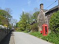 Telephone kiosk, Hopesay.jpg 640 × 480; 107 KB
-

-

-

-
 The Old Rectory in Hopesay - geograph.org.uk - 3194686.jpg 640 × 480; 71 KB
-
 The Old Rectory in Hopesay - geograph.org.uk - 5881204.jpg 640 × 480; 84 KB
-
 The Old Rectory, Hopesay - geograph.org.uk - 4161438.jpg 6,016 × 4,000; 3.35 MB
-
 The rail bridge at Broomemarsh - geograph.org.uk - 2437483.jpg 800 × 600; 312 KB
-
 The ramparts on Burrow hillfort - geograph.org.uk - 5882263.jpg 640 × 480; 75 KB
-

-
 The summit of Wart Hill, 324m - geograph.org.uk - 3284179.jpg 1,024 × 732; 302 KB
-
 The summit of Wart Hill, Shropshire - geograph.org.uk - 3084005.jpg 640 × 480; 123 KB
-
 The top end of Round Oak - geograph.org.uk - 4753410.jpg 640 × 480; 98 KB
-

-
 The village of Hopesay - geograph.org.uk - 2437428.jpg 800 × 600; 274 KB
-
 The way to Barlow Home Farm - geograph.org.uk - 2437425.jpg 800 × 600; 267 KB
-
 This way and that on Hopesay Hill - geograph.org.uk - 2380407.jpg 640 × 480; 49 KB
-
 Track at the edge of the woodland - geograph.org.uk - 5882190.jpg 640 × 480; 129 KB
-
 Track below Burrow hillfort summit - geograph.org.uk - 3194929.jpg 640 × 480; 128 KB
-
 Track in forestry plantation - geograph.org.uk - 3194986.jpg 640 × 480; 134 KB
-
 Track in the woods - geograph.org.uk - 837114.jpg 640 × 480; 110 KB
-
 Track in Warthill Plantation - geograph.org.uk - 3083994.jpg 640 × 480; 125 KB
-
 Track near Hopesay - geograph.org.uk - 4712583.jpg 1,024 × 684; 556 KB
-
 Track off the lane near Hopesay - geograph.org.uk - 5881196.jpg 640 × 480; 130 KB
-
 Two stiles and a dingle - geograph.org.uk - 2380383.jpg 480 × 640; 174 KB
-

-
 Under the bridge - geograph.org.uk - 2380395.jpg 640 × 480; 90 KB
-
 Union Jack in the rain - geograph.org.uk - 5267588.jpg 640 × 480; 34 KB
-
 Up onto Burrow Hill from Aston-on-Clun - geograph.org.uk - 837288.jpg 640 × 480; 123 KB
-

-
 Upper Carwood - geograph.org.uk - 4712201.jpg 1,024 × 684; 264 KB
-
 Victorian property beside the road - geograph.org.uk - 5267600.jpg 640 × 480; 43 KB
-

-

-
 View to Burrow hillfort - geograph.org.uk - 5881281.jpg 640 × 480; 84 KB
.jpg)
.jpg)


.jpg)


.jpg)
.jpg)


.jpg)


.jpg)


.jpg)
.jpg)

.jpg)


.jpg)


