Category:Pimhill
English: Pimhill is a geographically large civil parish in Shropshire, England, to the north of Shrewsbury. It is named after a hill, which rises to 163m, sometimes spelt Pim Hill. In recent times the parish is more well known as "Bomere Heath and District".

civil parish in Shropshire, UK | |||||
| Upload media | |||||
| Instance of | |||||
|---|---|---|---|---|---|
| Location | Shropshire, West Midlands, England | ||||
 | |||||
Subcategories
This category has the following 13 subcategories, out of 13 total.
A
- Albright Hussey (4 F)
B
- Bomere Heath (21 F)
C
- Crossgreen (2 F)
D
- Dunnsheath (2 F)
F
- Forton Heath (1 F)
G
- Grafton, Shropshire (5 F)
L
M
- Merrington, Shropshire (14 F)
- Mytton (6 F)
P
W
- Walford Heath (5 F)
Media in category "Pimhill"
The following 198 files are in this category, out of 198 total.
-
 158 829 Baschurch.jpg 3,445 × 2,461; 1.23 MB
-
 A528 at Broadoak - geograph.org.uk - 3933942.jpg 640 × 411; 75 KB
-

-
 A528 in Albrighton - geograph.org.uk - 4492240.jpg 1,600 × 1,200; 1.03 MB
-
 A528 towards Harmer Hill - geograph.org.uk - 6089391.jpg 640 × 456; 92 KB
-
 A528 towards Harmer Hill - geograph.org.uk - 6089395.jpg 800 × 600; 121 KB
-

-
 Albrighton village - geograph.org.uk - 3933939.jpg 640 × 419; 99 KB
-
 B5067 approaching Crossgreen - geograph.org.uk - 3933996.jpg 640 × 494; 45 KB
-
 B5067 approaching Leaton - geograph.org.uk - 3934021.jpg 640 × 438; 63 KB
-

-
 B5067 approaching Walford Heath - geograph.org.uk - 3934039.jpg 640 × 431; 69 KB
-
 B5067 at Berwick Lodge - geograph.org.uk - 3798115.jpg 640 × 455; 109 KB
-
 B5067 at Bomere Heath turn off - geograph.org.uk - 2521213.jpg 640 × 480; 77 KB
-
 B5067 at Rosehill - geograph.org.uk - 3798109.jpg 640 × 438; 66 KB
-
 B5067 roadworks just north of Leaton - geograph.org.uk - 2673143.jpg 640 × 496; 80 KB
-
 Bare trees north of Broadoak - geograph.org.uk - 4267174.jpg 1,600 × 1,200; 1.06 MB
-
 Barn on Shrewsbury Road, Albrighton - geograph.org.uk - 6089342.jpg 800 × 600; 86 KB
-
 Battlefield 1403 - geograph.org.uk - 5752301.jpg 640 × 480; 63 KB
-
 Battlefield 1403 - geograph.org.uk - 5752303.jpg 640 × 480; 59 KB
-
 Battlefield Farm - geograph.org.uk - 2513038.jpg 4,000 × 3,000; 5.97 MB
-
 Battlefield Farm 1403 - geograph.org.uk - 3688102.jpg 3,264 × 2,448; 4.77 MB
-
 Battlefield Farm shop and cafe - geograph.org.uk - 2521576.jpg 640 × 480; 71 KB
-
 Bend in the road - geograph.org.uk - 6272197.jpg 5,184 × 3,888; 4.69 MB
-
 Berwick Chapel - geograph.org.uk - 6122595.jpg 4,000 × 3,000; 2.49 MB
-
 Berwick House - geograph.org.uk - 135845.jpg 640 × 480; 184 KB
-
 Berwick Road near Shrewsbury - geograph.org.uk - 2138355.jpg 640 × 472; 250 KB
-
 Bomere Farm - geograph.org.uk - 4462815.jpg 640 × 426; 50 KB
-

-
 Bridge, Fitz Mill - geograph.org.uk - 3924248.jpg 640 × 480; 285 KB
-

-

-

-
 Car park entrance - geograph.org.uk - 6272193.jpg 5,184 × 3,888; 6.75 MB
-
 Cattle and Battlefield Church - geograph.org.uk - 2521571.jpg 640 × 480; 66 KB
-

-

-
 Cottage, Preston Gubbals - geograph.org.uk - 6089360.jpg 800 × 543; 139 KB
-
 Crossroads at Walford Heath - geograph.org.uk - 2521201.jpg 640 × 428; 92 KB
-
 Crossroads north of Shawell Cottages - geograph.org.uk - 3933206.jpg 640 × 457; 53 KB
-
 Crossroads, A528 and Preston Gubbals Road - geograph.org.uk - 4267378.jpg 1,024 × 615; 65 KB
-
 Dense woodland, Merrington Green - geograph.org.uk - 5567940.jpg 1,024 × 683; 586 KB
-

-
 Entering Walford Heath from Walford - geograph.org.uk - 2673121.jpg 640 × 445; 94 KB
-
 Entrance at North Lodge near Walford - geograph.org.uk - 2521198.jpg 640 × 480; 120 KB
-

-

-

-

-
 Farm buildings on Shrewsbury Road, Albrighton - geograph.org.uk - 6089344.jpg 2,848 × 2,136; 1.31 MB
-
 Farmland by the railway line - geograph.org.uk - 4462778.jpg 640 × 426; 53 KB
-
 Farmland near Merrington Plantation - geograph.org.uk - 4462927.jpg 640 × 426; 49 KB
-
 Farmland near Walford - geograph.org.uk - 4354260.jpg 800 × 600; 202 KB
-
 Farmland near Walford - geograph.org.uk - 4354263.jpg 800 × 600; 181 KB
-
 Field and The Rough - geograph.org.uk - 3924334.jpg 640 × 480; 257 KB
-

-

-

-
 Field entrance off the A528 - geograph.org.uk - 6089396.jpg 800 × 600; 111 KB
-
 Field near Bomere Heath - geograph.org.uk - 5567897.jpg 1,024 × 683; 424 KB
-
 Field off the A528 - geograph.org.uk - 6089387.jpg 800 × 600; 82 KB
-
 Field, Merrington Lane - geograph.org.uk - 5567950.jpg 1,024 × 683; 247 KB
-
 Fitz Village Hall - geograph.org.uk - 2384273.jpg 640 × 480; 76 KB
-

-
 Footpath over field, Albrighton - geograph.org.uk - 6089349.jpg 640 × 460; 45 KB
-
 Forage maize - geograph.org.uk - 5567901.jpg 1,024 × 683; 423 KB
-
 Forton Heath - geograph.org.uk - 3924237.jpg 640 × 480; 254 KB
-

-

-

-

-

-

-
 Grafton - geograph.org.uk - 3924259.jpg 640 × 480; 316 KB
-
 Grange Farm east of Bomere Heath - geograph.org.uk - 6089375.jpg 800 × 554; 102 KB
-
 Graves Plantation - geograph.org.uk - 4462771.jpg 640 × 290; 41 KB
-
 Grazing towards woodland - geograph.org.uk - 6089384.jpg 640 × 480; 49 KB
-

-
 Holy Trinity Church at Leaton - geograph.org.uk - 5232728.jpg 2,933 × 3,909; 1.4 MB
-
 Holy Trinity Church, Leaton - geograph.org.uk - 6122598.jpg 4,000 × 3,000; 2.42 MB
-
 House on Shrewsbury Road (A528) - geograph.org.uk - 6089353.jpg 800 × 539; 91 KB
-
 Houses by A524 in Albrighton - geograph.org.uk - 4267178.jpg 1,600 × 1,200; 1.33 MB
-
 Houses by A528 near Preston Gubbals - geograph.org.uk - 4267373.jpg 1,600 × 960; 850 KB
-

-
 Houses on the A528 - geograph.org.uk - 6089393.jpg 800 × 518; 142 KB
-
 Housing north of Dunnsheath - geograph.org.uk - 3934024.jpg 640 × 453; 96 KB
-
 Inscription at Merrington Well - geograph.org.uk - 1822997.jpg 640 × 480; 90 KB
-

-

-
 Lane at Forton Heath village boundary - geograph.org.uk - 5821206.jpg 1,024 × 732; 153 KB
-
 Lane at Grafton Farm - geograph.org.uk - 5821223.jpg 1,024 × 710; 95 KB
-
 Lane at Grafton village boundary - geograph.org.uk - 5821217.jpg 1,024 × 733; 206 KB
-
 Lane junction at Fitz Mill - geograph.org.uk - 5821211.jpg 1,024 × 704; 149 KB
-
 Lane towards Merrington - geograph.org.uk - 6089372.jpg 800 × 600; 94 KB
-
 Lane towards the A528 - geograph.org.uk - 6089385.jpg 640 × 480; 87 KB
-
 Lodge at entrance to Berwick House - geograph.org.uk - 3182895.jpg 640 × 480; 148 KB
-
 Lodge near Walford - geograph.org.uk - 2137551.jpg 640 × 410; 220 KB
-
 Lodges, Berwick Hall.jpg 640 × 354; 189 KB
-

-

-

-

-
 Merrington Green - geograph.org.uk - 5567934.jpg 1,024 × 683; 498 KB
-
 Merrington Green - geograph.org.uk - 5567936.jpg 1,024 × 683; 376 KB
-
 Merrington Lane - geograph.org.uk - 5567952.jpg 1,024 × 683; 232 KB
-
 Minor road towards Haston - geograph.org.uk - 6089389.jpg 640 × 480; 52 KB
-

-

-
 Never a train when you want one - geograph.org.uk - 2384320.jpg 640 × 480; 154 KB
-
 Newly cultivated field, Merrington - geograph.org.uk - 5567932.jpg 1,024 × 683; 428 KB
-
 Newly-erected farm buildings - geograph.org.uk - 6272186.jpg 5,184 × 3,888; 3.79 MB
-
 Newton Gorse - geograph.org.uk - 5567898.jpg 1,024 × 683; 462 KB
-
 Oilseed rape, Fitz - geograph.org.uk - 3924253.jpg 640 × 480; 286 KB
-

-

-

-

-

-

-

-

-
 Old Milestone by B5067, South of Leaton church (geograph 7479852).jpg 1,908 × 4,032; 3.15 MB
-
 Old station house at Leaton - geograph.org.uk - 2521590.jpg 640 × 480; 85 KB
-

-
 Ordnance Survey Flush Bracket S5844 - geograph.org.uk - 5232740.jpg 4,000 × 3,000; 3.41 MB
-
 Parkland near Forton Heath (geograph 2138029).jpg 640 × 396; 146 KB
-
 Path in Merrington Green nature reserve - geograph.org.uk - 2788433.jpg 640 × 480; 142 KB
-
 Path junction, Pim Hill - geograph.org.uk - 2241113.jpg 1,000 × 667; 522 KB
-
 Path junction, Pim Hill - geograph.org.uk - 2241126.jpg 1,000 × 667; 353 KB
-
 Path, Grafton - geograph.org.uk - 3924279.jpg 640 × 480; 264 KB
-
 Path, Merrington Green - geograph.org.uk - 5567941.jpg 1,024 × 683; 523 KB
-
 Path, Pim Hill - geograph.org.uk - 2241140.jpg 667 × 1,000; 484 KB
-
 Pim Hill North Top - geograph.org.uk - 38217.jpg 600 × 450; 93 KB
-
 Pim Hill summit - geograph.org.uk - 2241112.jpg 1,000 × 667; 400 KB
-

-
 Plex - geograph.org.uk - 3865077.jpg 640 × 480; 230 KB
-
 Plex Lane, Albrighton - geograph.org.uk - 6089347.jpg 640 × 480; 74 KB
-
 Pylon near Albionhayes - geograph.org.uk - 4462824.jpg 640 × 505; 69 KB
-
 Pylon near Bomere Heath - geograph.org.uk - 4462818.jpg 640 × 426; 47 KB
-
 Pylon near Great Wollascott - geograph.org.uk - 4462782.jpg 640 × 426; 45 KB
-
 Pylon, Merrington Plantation - geograph.org.uk - 4462930.jpg 426 × 640; 47 KB
-
 Quarry on Pim Hill - geograph.org.uk - 2271639.jpg 1,000 × 667; 626 KB
-
 Rails to Shrewsbury - geograph.org.uk - 2521600.jpg 640 × 480; 82 KB
-
 Railway bridge, Leaton - geograph.org.uk - 5567912.jpg 1,024 × 683; 368 KB
-
 Railway looking north at Leaton - geograph.org.uk - 2521595.jpg 640 × 480; 86 KB
-
 Railway Tavern, Old Woods - geograph.org.uk - 4354285.jpg 800 × 600; 140 KB
-

-
 River Perry - geograph.org.uk - 4093158.jpg 640 × 480; 324 KB
-

-
 Road junction, Dunnsheath - geograph.org.uk - 5567904.jpg 1,024 × 683; 442 KB
-
 Road near Newton Plantation - geograph.org.uk - 5232717.jpg 4,000 × 3,000; 3.85 MB
-

-
-

-
 Shrewsbury Road (A528) - geograph.org.uk - 6089355.jpg 640 × 480; 71 KB
-
 Shrewsbury Road, Albrighton - geograph.org.uk - 6089350.jpg 640 × 480; 86 KB
-
 Shrewsbury Road, Bomere Heath - geograph.org.uk - 5567926.jpg 1,024 × 683; 332 KB
-
 Signpost, Grafton - geograph.org.uk - 3924270.jpg 640 × 480; 274 KB
-
 Small woodland, Cross Green - geograph.org.uk - 5567902.jpg 1,024 × 683; 564 KB
-
 South end of Pim Hill - geograph.org.uk - 2241116.jpg 1,000 × 667; 371 KB
-
 Southern edge of Albrighton - geograph.org.uk - 4492279.jpg 1,600 × 1,200; 1.63 MB
-

-

-
 St John the Baptist Church, Albrighton - geograph.org.uk - 6089334.jpg 800 × 514; 114 KB
-
 St John the Baptist, Albrighton - geograph.org.uk - 3952634.jpg 4,320 × 3,240; 2.9 MB
-
 St Martin's Church, Preston Gubbals - geograph.org.uk - 6089362.jpg 640 × 480; 87 KB
-

-

-
 Station House Leaton - geograph.org.uk - 2521603.jpg 640 × 480; 89 KB
-
 Station Wood - geograph.org.uk - 4462785.jpg 640 × 426; 64 KB
-

-
 Sunken path from the A528 - geograph.org.uk - 2241114.jpg 1,000 × 667; 390 KB
-
 The church at Leaton, Shropshire - geograph.org.uk - 6006694.jpg 640 × 480; 80 KB
-
 The Church of St John the Baptist at Albrighton - geograph.org.uk - 5232745.jpg 4,000 × 3,000; 3.13 MB
-
 The Old Vicarage, Leaton - geograph.org.uk - 6122600.jpg 4,000 × 3,000; 2.32 MB
-
 The old village pump, Merrington - geograph.org.uk - 2788778.jpg 640 × 480; 103 KB
-
 The southern edge of Harmer Hill - geograph.org.uk - 4267381.jpg 1,024 × 683; 96 KB
-
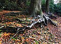 Tree roots near Pim Hill - geograph.org.uk - 2151990.jpg 1,600 × 1,168; 1.03 MB
-
 Twisty Lane towards Bomere Heath - geograph.org.uk - 6089369.jpg 640 × 480; 60 KB
-

-
 Village Well and Pump, Merrington - geograph.org.uk - 1822995.jpg 640 × 480; 89 KB
-
 Wale Memorial Room, Bomere Heath - geograph.org.uk - 5567925.jpg 1,024 × 683; 340 KB
-
 Walled structure near Fitz, Shropshire - geograph.org.uk - 2689196.jpg 640 × 480; 105 KB
-

-
 Woodland - Private, Keep Out - geograph.org.uk - 2384293.jpg 640 × 480; 177 KB
-

-

-

-

-

-

-

-

-

-

-
 Big puddle in heavy rain - geograph.org.uk - 655568.jpg 640 × 480; 85 KB
-
 Dairy cattle out in December - geograph.org.uk - 628741.jpg 640 × 480; 103 KB
-
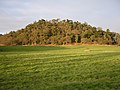 Pim Hill South Top - geograph.org.uk - 38216.jpg 600 × 450; 142 KB


,_Ellesmere_Road,_Shropshire_-_1_-_geograph.org.uk_-_3324343.jpg)
,_Ellesmere_Road,_Shropshire_-_2_-_geograph.org.uk_-_3324344.jpg)


,_Ellesmere_Road,_Shropshire_-_geograph.org.uk_-_3324332.jpg)
,_Ellesmere_Road,_Shropshire_-_geograph.org.uk_-_3324305.jpg)


,_Ellesmere_Road,_Shropshire_-_1_-_geograph.org.uk_-_3324312.jpg)
,_Ellesmere_Road,_Shropshire_-_2_-_geograph.org.uk_-_3324314.jpg)
,_Ellesmere_Road,_Shropshire_-_3_-_geograph.org.uk_-_3324320.jpg)


_-_geograph.org.uk_-_6089354.jpg)


,_Ellesmere_Road,_Shropshire_-_geograph.org.uk_-_3324342.jpg)


,_Ellesmere_Road,_Shropshire_-_geograph.org.uk_-_3324352.jpg)
,_Ellesmere_Road,_Shropshire_-_geograph.org.uk_-_3324328.jpg)
,_Ellesmere_Road,_Shropshire_-_geograph.org.uk_-_3324351.jpg)
,_Ellesmere_Road,_Shropshire_-_1_-_geograph.org.uk_-_3324345.jpg)
,_Ellesmere_Road,_Shropshire_-_2_-_geograph.org.uk_-_3324348.jpg)


_-_geograph.org.uk_-_6089353.jpg)


,_Ellesmere_Road,_Shropshire_-_1_-_geograph.org.uk_-_3324353.jpg)
,_Ellesmere_Road,_Shropshire_-_2_-_geograph.org.uk_-_3324354.jpg)


,_Ellesmere_Road,_Shropshire_-_1_-_geograph.org.uk_-_3324336.jpg)
,_Ellesmere_Road,_Shropshire_-_2_-_geograph.org.uk_-_3324337.jpg)


.jpg)


.jpg)


,_Ellesmere_Road,_Shropshire_-_1_-_geograph.org.uk_-_3324325.jpg)
,_Ellesmere_Road,_Shropshire_-_2_-_geograph.org.uk_-_3324326.jpg)
_-_geograph.org.uk_-_6089355.jpg)


,_Ellesmere_Road,_Shropshire_-_1_-_geograph.org.uk_-_3324321.jpg)
,_Ellesmere_Road,_Shropshire_-_2_-_geograph.org.uk_-_3324323.jpg)


,_Ellesmere_Road,_Shropshire_-_1_-_geograph.org.uk_-_3324330.jpg)
,_Ellesmere_Road,_Shropshire_-_2_-_geograph.org.uk_-_3324331.jpg)


_-_geograph.org.uk_-_6205307.jpg)
_-_geograph.org.uk_-_6205305.jpg)
_-_geograph.org.uk_-_6205287.jpg)
_-_geograph.org.uk_-_6205289.jpg)
_-_geograph.org.uk_-_6205294.jpg)
_-_geograph.org.uk_-_6205296.jpg)
_-_geograph.org.uk_-_6205297.jpg)
_-_geograph.org.uk_-_6205300.jpg)
_-_geograph.org.uk_-_6205301.jpg)
_-_geograph.org.uk_-_6205302.jpg)


