Category:Aston Eyre
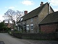
English: Aston Eyre is a village and civil parish in Shropshire, England, about four miles west of Bridgnorth. The parish had a population of 54 according to the 2001 census. The Manor House dates from the early 14th century.
Svenska: Aston Eyre är en by och civil parish i Shropshire i England. Byn ligger ca 6,5 km väster om Bridgnorth.
village in the United Kingdom  | |||||
| Upload media | |||||
| Instance of | |||||
|---|---|---|---|---|---|
| Location | Shropshire, West Midlands, England | ||||
 | |||||
Media in category "Aston Eyre"
The following 55 files are in this category, out of 55 total.
-
 A Mole's Progress^ Aston Eyre, Shropshire - geograph.org.uk - 489601.jpg 413 × 640; 172 KB
-
 A straight stretch of the B4368 - geograph.org.uk - 3778369.jpg 1,142 × 857; 314 KB
-
 A458 to Much Wenlock - geograph.org.uk - 775387.jpg 640 × 480; 85 KB
-
 Aston Eyre Church, (dedication unknown) - geograph.org.uk - 6140558.jpg 6,252 × 4,168; 6.54 MB
-

-

-

-

-

-

-

-
 Aston Eyre Church, (dedication unknown), Bell cote - geograph.org.uk - 6140597.jpg 7,049 × 4,699; 4.63 MB
-

-
 Aston Eyre Church, (dedication unknown), Chancel arch detail - geograph.org.uk - 6140569.jpg 7,083 × 4,722; 5.79 MB
-

-
 Aston Eyre Church, (dedication unknown), Southern aspect - geograph.org.uk - 6140560.jpg 6,705 × 4,470; 6.84 MB
-
 Aston Eyre Church, (dedication unknown), The altar - geograph.org.uk - 6140570.jpg 6,905 × 4,603; 5.25 MB
-
 Aston Eyre Church, (dedication unknown), The font - geograph.org.uk - 6140568.jpg 3,241 × 4,862; 2.85 MB
-

-

-
 Aston Eyre Church, (dedication unknown), The pulpit - geograph.org.uk - 6140573.jpg 5,961 × 3,974; 6.03 MB
-

-

-
 Aston Eyre Church, (dedication unknown), Western aspect - geograph.org.uk - 6140559.jpg 4,615 × 3,076; 3.6 MB
-

-
 Chestnut horses in Aston Eyre, Shropshire, England.jpg 640 × 267; 169 KB
-
 Farmland north-east of Monkhopton, Shropshire - geograph.org.uk - 4639473.jpg 1,280 × 869; 801 KB
-
 Footbridge over the Mor Brook - geograph.org.uk - 3778659.jpg 979 × 734; 539 KB
-
 Footpath alongside the Mor Brook - geograph.org.uk - 3778650.jpg 979 × 734; 367 KB
-

-
 Georgian postbox in Aston Eyre - geograph.org.uk - 3778648.jpg 857 × 1,142; 617 KB
-

-
 Grazing, Aston Eyre, Shropshire - geograph.org.uk - 489611.jpg 640 × 480; 197 KB
-
 Hillside fields and trees - geograph.org.uk - 4906458.jpg 2,048 × 1,536; 1.56 MB
-
 Horses Grazing, Aston Eyre, Shropshire - geograph.org.uk - 489624.jpg 640 × 480; 176 KB
-
 Kissing gate and an invisible footpath - geograph.org.uk - 2472102.jpg 480 × 640; 122 KB
-
 Leaving the church - geograph.org.uk - 767936.jpg 640 × 480; 93 KB
-
 Might be slippery when wet - geograph.org.uk - 3778651.jpg 734 × 979; 468 KB
-
 Old barn at Hall Farm - geograph.org.uk - 767931.jpg 640 × 480; 65 KB
-
 Orange Hawkbit - geograph.org.uk - 489770.jpg 435 × 640; 165 KB
-
 Orchard, Aston Eyre - geograph.org.uk - 3857253.jpg 640 × 480; 348 KB
-
 OS benchmark - Aston House farm building - geograph.org.uk - 3778664.jpg 734 × 979; 343 KB
-
 OS benchmark - Morville, Ash Bridge - geograph.org.uk - 3778358.jpg 1,142 × 857; 525 KB
-
 Population aston-eyre.JPG 385 × 232; 21 KB
-
 South of Aston Farm - geograph.org.uk - 3778652.jpg 1,142 × 857; 457 KB
-

-
 The B4368 in Aston Eyre, Shropshire - geograph.org.uk - 489596.jpg 640 × 480; 181 KB
-
 The Mor Brook near Muckley Cross - geograph.org.uk - 3778654.jpg 979 × 734; 470 KB
-
 The Mor Brook, north of the bridge - geograph.org.uk - 3778366.jpg 734 × 979; 469 KB
-
 The road to Ousley Farm - geograph.org.uk - 4906454.jpg 2,048 × 1,536; 1.57 MB
-
 West Farm - geograph.org.uk - 426190.jpg 640 × 480; 95 KB
-

-
 Cottage For Sale - geograph.org.uk - 775379.jpg 640 × 480; 73 KB
-
 Farmland - geograph.org.uk - 426222.jpg 640 × 480; 84 KB
-


_-_geograph.org.uk_-_6140558.jpg)
,_%27Christ%27s_Entry_into_Jerusalem%27_Norman_tympanum_(detail)_1_-_geograph.org.uk_-_6140580.jpg)
,_%27Christ%27s_Entry_into_Jerusalem%27_Norman_tympanum_(detail)_2_-_geograph.org.uk_-_6140581.jpg)
,_%27Christ%27s_Entry_into_Jerusalem%27_Norman_tympanum_(detail)_3_-_geograph.org.uk_-_6140582.jpg)
,_%27Christ%27s_Entry_into_Jerusalem%27_Norman_tympanum_(detail)_4_-_geograph.org.uk_-_6140587.jpg)
,_%27Christ%27s_Entry_into_Jerusalem%27_Norman_tympanum_(detail)_5_-_geograph.org.uk_-_6140592.jpg)
,_%27Christ%27s_Entry_into_Jerusalem%27_Norman_tympanum_(detail)_6_-_geograph.org.uk_-_6140594.jpg)
,_%27Christ%27s_Entry_into_Jerusalem%27_Norman_tympanum_-_geograph.org.uk_-_6140578.jpg)
,_Bell_cote_-_geograph.org.uk_-_6140597.jpg)
,_Chancel_arch_and_triple_lancet_east_window_-_geograph.org.uk_-_6140577.jpg)
,_Chancel_arch_detail_-_geograph.org.uk_-_6140569.jpg)
,_Norman_south_doorway_-_geograph.org.uk_-_6140563.jpg)
,_Southern_aspect_-_geograph.org.uk_-_6140560.jpg)
,_The_altar_-_geograph.org.uk_-_6140570.jpg)
,_The_font_-_geograph.org.uk_-_6140568.jpg)
,_The_pulpit_(detail)_1_-_geograph.org.uk_-_6140574.jpg)
,_The_pulpit_(detail)_2_-_geograph.org.uk_-_6140576.jpg)
,_The_pulpit_-_geograph.org.uk_-_6140573.jpg)
,_The_two_cell_Norman_layout_-_geograph.org.uk_-_6140567.jpg)
,_Triple_lancet_east_window_-_geograph.org.uk_-_6140572.jpg)
,_Western_aspect_-_geograph.org.uk_-_6140559.jpg)


