Category:Barrow-in-Furness
town and seaport in Westmorland and Furness, Cumbria, England, United Kingdom   | |||||
| Upload media | |||||
| Instance of | |||||
|---|---|---|---|---|---|
| Location | Barrow, Westmorland and Furness, Cumbria, North West England, England | ||||
| Area |
| ||||
| Different from | |||||
| official website | |||||
 | |||||
Subcategories
This category has the following 24 subcategories, out of 24 total.
B
- Barrow Raiders (13 F)
F
- Foulney Island (1 F)
- Furness Abbey Tunnel (1 F)
M
- Michaelson Road Bridge (1 F)
P
R
T
V
W
- Edward Wadham (1 F)
- Walney Bridge (9 F)
Pages in category "Barrow-in-Furness"
This category contains only the following page.
Media in category "Barrow-in-Furness"
The following 200 files are in this category, out of 399 total.
(previous page) (next page)-

-
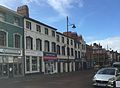 59-79 Duke Street, Barrow-in-Furness.jpg 2,873 × 2,113; 1.09 MB
-
 A lonely spot - geograph.org.uk - 4490421.jpg 640 × 480; 62 KB
-
 A5087 Roose Road - geograph.org.uk - 5685733.jpg 640 × 479; 51 KB
-
 A5087 Roose Road - geograph.org.uk - 5685738.jpg 640 × 479; 56 KB
-
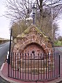 Abbey Rd Fountain.jpg 480 × 640; 138 KB
-
 Abbey Road Baptist Church, Barrow-in-Furness - geograph.org.uk - 4398448.jpg 2,048 × 1,536; 905 KB
-
 Abbey Road, Barrow-in-Furness - geograph.org.uk - 4386224.jpg 2,048 × 1,536; 1.68 MB
-
 Abbey Road, Barrow-in-Furness - geograph.org.uk - 4386250.jpg 2,048 × 1,536; 1.27 MB
-
 Abbey Road, Barrow-in-Furness.jpg 640 × 480; 116 KB
-
-
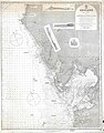
 Admiralty Chart No 2010 Morecambe Bay, Published 1873.jpg 12,195 × 8,415; 10.59 MB
-
 Admiralty Chart No 3164 Barrow Harbour, Published 1902.jpg 11,066 × 16,211; 69.06 MB
-
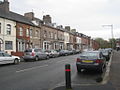 Ainslie Street, Barrow-in-Furness.jpg 1,024 × 768; 150 KB
-
 Anchor Line Cranes - geograph.org.uk - 279194.jpg 500 × 375; 53 KB
-

-
 Arms of Barrow in Furness.svg 1,581 × 2,001; 1.49 MB
-
 HMS B4.jpg 1,052 × 795; 72 KB
-
 BAE Central Yard Facility.jpg 640 × 480; 70 KB
-
 BAE in Barrow.jpg 1,600 × 1,200; 254 KB
-

-
 BAE Systems from Walney.jpg 3,072 × 2,304; 2.98 MB
-
 BAE-Port of Barrow.jpg 966 × 626; 76 KB
-

-
 Barrow - panoramio (3).jpg 2,816 × 2,112; 2.05 MB
-
 Barrow - panoramio (4).jpg 2,816 × 2,112; 2.62 MB
-
 Barrow - panoramio (5).jpg 2,709 × 2,079; 2.33 MB
-
 Barrow - panoramio (6).jpg 2,816 × 2,112; 2.41 MB
-
 Barrow - panoramio (7).jpg 2,263 × 1,445; 1.48 MB
-
 Barrow arms Thorncliffe.jpg 2,976 × 3,968; 1.93 MB
-
 Barrow cemetery gateway.jpg 2,560 × 1,456; 2.99 MB
-
 Barrow Crematorium - geograph.org.uk - 305012.jpg 640 × 480; 125 KB
-
 Barrow docks.jpg 909 × 665; 68 KB
-
 Barrow factory.jpg 1,596 × 665; 104 KB
-
 BARROW IN FURNESS CUMBRIA OCT 2013 (10107118396).jpg 4,653 × 2,833; 10.98 MB
-
 Barrow in Furness Town Arms.jpg 340 × 426; 42 KB
-
 Barrow Island, Barrow location map.jpg 371 × 599; 43 KB
-
 Barrow montage2.jpg 1,329 × 1,517; 832 KB
-
 Barrow Panorama 1 (June 17).jpg 16,382 × 2,080; 6.19 MB
-
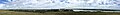
 Barrow panorama from slag bank.jpg 9,945 × 737; 1.84 MB
-
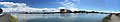 Barrow panorama from Walney July 2017.jpg 13,027 × 2,379; 5.33 MB
-
 Barrow Park Map.png 943 × 822; 289 KB
-
 Barrow Police Station Channelside.JPG 3,264 × 2,448; 2.63 MB
-
 Barrow Road - geograph.org.uk - 4350555.jpg 2,048 × 1,536; 1.48 MB
-
 Barrow skyline.jpg 800 × 600; 173 KB
-
 Barrow Steelworks.jpg 720 × 563; 108 KB
-
 Barrow-Blackpool-2019.jpeg 4,032 × 3,024; 4.02 MB
-
 Barrow-in-Furness aerial from the south.jpg 4,608 × 3,456; 2.75 MB
-
 Barrow-in-Furness aerial photo.jpg 1,024 × 768; 43 KB
-
 Barrow-in-furness map.jpg 917 × 672; 93 KB
-
 Barrow-in-Furness Map.png 1,058 × 926; 491 KB
-
 Barrow-in-Furness panorama across Walney Channel.jpg 7,057 × 1,241; 1.57 MB
-
 Barrow-in-Furness Park.jpg 1,024 × 768; 132 KB
-
 Barrow-in-Furness statue collage.jpg 500 × 583; 135 KB
-
 Barrow-In-Furness Town Hall - geograph.org.uk - 4363135.jpg 3,439 × 4,489; 3 MB
-
 Barrow-in-Furness UK local election 2015 map.svg 833 × 1,345; 368 KB
-
 Barrow-in-Furness UK local election 2019 map.svg 833 × 1,345; 368 KB
-
 Barrow-in-Furness Wikivoyage Banner.jpg 9,876 × 1,420; 2.25 MB
-
 BarrowSkyline.jpg 640 × 427; 62 KB
-
 Barrowterracota.png 1,345 × 1,026; 2.46 MB
-
 Basketball Court, Hindpool.JPG 3,264 × 2,448; 2.71 MB
-
 Bay Hide, South Walney Nature Reserve - geograph.org.uk - 4113630.jpg 640 × 427; 319 KB
-
 Beach and coastal defences near Rampside - geograph.org.uk - 4111708.jpg 640 × 427; 289 KB
-
 Beach track at Vickerstown - geograph.org.uk - 4518071.jpg 640 × 480; 59 KB
-
 Beacon Brow - geograph.org.uk - 4600034.jpg 2,560 × 1,753; 2.34 MB
-
 Bench with a view - geograph.org.uk - 4108930.jpg 640 × 427; 344 KB
-
 Biggar village - geograph.org.uk - 4481766.jpg 1,024 × 683; 790 KB
-
 BNFL Ship Terminal - geograph.org.uk - 72522.jpg 640 × 433; 58 KB
-
 Bowesfield Trig Point - geograph.org.uk - 4602217.jpg 2,552 × 1,773; 2.7 MB
-
 Brewers Fayre Restaurant - geograph.org.uk - 3864516.jpg 1,524 × 1,008; 1.12 MB
-
 Bridge Road - geograph.org.uk - 485018.jpg 640 × 480; 111 KB
-
 British Airships Q112310 (cropped).jpg 596 × 350; 104 KB
-
 Buccleuch Dock - Sunrise - geograph.org.uk - 485789.jpg 640 × 480; 41 KB
-
 Building, Port of Barrow - geograph.org.uk - 1564403.jpg 640 × 480; 47 KB
-

-
 Bus stop, Abbey Road, Barrow-in-Furness - geograph.org.uk - 4386212.jpg 2,048 × 1,536; 1.27 MB
-
 By Park House Farm looking towards disused iron ore mines - geograph.org.uk - 4365813.jpg 3,984 × 1,869; 3.64 MB
-

-
 Cattle grid, South End, Walney - geograph.org.uk - 4482764.jpg 1,024 × 683; 653 KB
-
 Cavendish Dock, Barrow - geograph.org.uk - 4367478.jpg 4,000 × 2,248; 4.58 MB
-

-
 Cavendish Street, Barrow-in-Furness - geograph.org.uk - 4398484.jpg 2,048 × 1,536; 1.12 MB
-
 Central Yard Complex, BAE Barrow.jpg 2,656 × 2,253; 1,019 KB
-
 Central Yard Facility Barrow July 17.jpg 750 × 733; 124 KB
-
 Central Yard Facility Barrow July 2017.jpg 1,190 × 533; 130 KB
-
 Co-operative funeral services building - geograph.org.uk - 4132901.jpg 1,500 × 1,000; 1.13 MB
-
 Coastguard Cottages at South Walney - geograph.org.uk - 4222393.jpg 640 × 480; 59 KB
-
 Concrete walkway - geograph.org.uk - 3769916.jpg 1,524 × 1,016; 1.06 MB
-
 Cornerhouse Park.jpg 1,024 × 768; 230 KB
-
 Corvus a chaff decoy launching system - geograph.org.uk - 3768114.jpg 1,528 × 1,012; 1.09 MB
-
 Coulton Street, Barrow-in-Furness - geograph.org.uk - 515301.jpg 640 × 480; 189 KB
-
 Dalton Road - geograph.org.uk - 484957.jpg 640 × 480; 89 KB
-
 Dalton Road, Barrow-in-Furness - geograph.org.uk - 4398488.jpg 2,048 × 1,536; 1.18 MB
-
 DDH Astute.jpg 439 × 127; 36 KB
-
 Derelict pylons - geograph.org.uk - 4106159.jpg 640 × 427; 305 KB
-

-
 Devonshire Dock Hall - panoramio (1).jpg 1,980 × 754; 1.08 MB
-
 Devonshire Dock Hall - panoramio.jpg 3,270 × 1,862; 4.33 MB
-

-
 Dock Basin, Barrow Docks - geograph.org.uk - 1564394.jpg 640 × 480; 38 KB
-
 HMS P47.jpg 752 × 505; 38 KB
-
 Driftwood on Walney Island - panoramio.jpg 1,219 × 873; 229 KB
-
 Duke Street, Barrow-in-Furness.jpg 640 × 470; 110 KB
-
 Elm Road, Barrow-in-Furness - geograph.org.uk - 1564871.jpg 640 × 480; 66 KB
-
 Entrance to Dock Basin, Barrow Docks - geograph.org.uk - 1564395.jpg 640 × 479; 62 KB
-
 Eroding shore, Hilpsford - geograph.org.uk - 4222410.jpg 800 × 600; 137 KB
-
 Farmland west of Newton - geograph.org.uk - 3826911.jpg 640 × 466; 37 KB
-
 Footpath in the Vale of Nightshade - geograph.org.uk - 4350556.jpg 2,048 × 1,536; 1.34 MB
-
 Footpath To Roosecote Moss - geograph.org.uk - 4694616.jpg 2,560 × 1,920; 3.25 MB
-
 Footpath under the railway - geograph.org.uk - 4350561.jpg 1,536 × 2,048; 1.14 MB
-
 Foreshore - geograph.org.uk - 1477455.jpg 640 × 457; 319 KB
-
 Foreshore - geograph.org.uk - 1477482.jpg 640 × 457; 266 KB
-
 Foreshore - geograph.org.uk - 1477499.jpg 640 × 457; 282 KB
-
 Foreshore - geograph.org.uk - 1477554.jpg 640 × 457; 290 KB
-
 Former Kwik Save, Barrow-in-Furness - geograph.org.uk - 4398465.jpg 2,048 × 1,536; 911 KB
-
 Former Parkview School buildings.jpg 2,351 × 381; 284 KB
-
 Fort Walney Tower - geograph.org.uk - 4600041.jpg 2,413 × 1,844; 2.03 MB
-
 Furness Abbey - geograph.org.uk - 4350581.jpg 2,048 × 1,536; 1.19 MB
-
 Furness Abbey Cottage.jpg 1,024 × 768; 230 KB
-
 Furness Abbey Tavern.jpg 2,048 × 1,536; 1,022 KB
-
 Furness Abbey visitor centre - geograph.org.uk - 4350576.jpg 2,048 × 1,152; 932 KB
-
 Furness Abbey, infirmary - geograph.org.uk - 4576527.jpg 640 × 497; 215 KB
-
 Furness Academy North Site.jpg 427 × 640; 77 KB
-

-
 Gateway to Abbey Approach, Abbey Road, Barrow.jpg 2,048 × 1,536; 1.76 MB
-
 Gateway to the Beach at Lowsy Point - geograph.org.uk - 205715.jpg 640 × 480; 74 KB
-

-
 Grazing and woodland - geograph.org.uk - 3826908.jpg 640 × 448; 58 KB
-
 Green Pastures - geograph.org.uk - 4493922.jpg 4,000 × 3,000; 3 MB
-
-

-
 Hare Hill Trig Point - geograph.org.uk - 4600063.jpg 2,560 × 1,727; 1.83 MB
-
 Hartington Street - geograph.org.uk - 485883.jpg 640 × 480; 115 KB
-
 Hartington Street, Hindpool, Barrow-in-Furness - geograph.org.uk - 4333845.jpg 1,024 × 768; 173 KB
-
 Hawcoat Hill - geograph.org.uk - 4600020.jpg 2,496 × 1,600; 1.84 MB
-
 Hawke Street, at the junction with Bath Street - geograph.org.uk - 4333834.jpg 1,024 × 768; 100 KB
-
 Haws Bed Marsh - geograph.org.uk - 4116663.jpg 640 × 427; 316 KB
-
 Hertfordshire tanker, Barrow Docks.jpg 640 × 480; 51 KB
-
 Hindpool Road Retail Park.jpg 600 × 800; 66 KB
-
 HMS Albion 2006.jpg 1,840 × 1,232; 451 KB
-
 HMS Vengeance (ca. 1899) (cropped).jpg 3,860 × 2,250; 2.23 MB
-
 HMS Vengeance (ca. 1899).jpg 4,169 × 3,266; 3.01 MB
-
 HMSM Tapir FL8657.jpg 800 × 575; 51 KB
-
 Holiday2005b 052.jpg 2,048 × 1,536; 680 KB
-
 Hollywood Park sign, Barrow.jpg 1,326 × 1,989; 641 KB
-
 House on The Promenade (1) - geograph.org.uk - 4478248.jpg 640 × 480; 49 KB
-
 House on The Promenade (2) - geograph.org.uk - 4478256.jpg 480 × 640; 93 KB
-
 Houses on Salthouse Road - geograph.org.uk - 3826903.jpg 640 × 401; 49 KB
-
 Houses on Yarlside Road - geograph.org.uk - 3826905.jpg 640 × 411; 49 KB
-

-

-

-

-

-

-

-
 Jetty - geograph.org.uk - 1564063.jpg 640 × 480; 60 KB
-
 Jetty, Barrow Docks - geograph.org.uk - 1564399.jpg 640 × 480; 48 KB
-
 Jubilee Bridge - geograph.org.uk - 4600052.jpg 2,555 × 1,436; 2 MB
-

-
 Keith Street, Barrow-in-Furness.JPG 2,434 × 1,786; 1.63 MB
-
 Kwik-Fit, Abbey Road, Barrow-in-Furness - geograph.org.uk - 4398437.jpg 2,048 × 1,536; 1.04 MB
-
 Lagoons of the South Walney Oyster Farm - geograph.org.uk - 839305.jpg 640 × 427; 145 KB
-
 Landing stage - geograph.org.uk - 1477379.jpg 640 × 457; 286 KB
-
 Landing stage - geograph.org.uk - 1477384.jpg 640 × 457; 253 KB
-
 Launch of H.M. Cruiser 'Powerful' - Taking the Water - 1896.jpg 1,201 × 783; 72 KB
-
 LeeceDuckPond.jpg 1,600 × 958; 152 KB
-
 Lime Street, Barrow-in-Furness - geograph.org.uk - 1564874.jpg 640 × 480; 60 KB
-
 HMS Liverpool (Bristol-class cruiser).jpg 330 × 246; 9 KB
-
 Lodge to Crosslands.jpg 2,432 × 1,806; 1.45 MB
-

-

-

-
 Looking westwards up Central Drive - geograph.org.uk - 4478249.jpg 640 × 480; 75 KB
-
 Lord Frederick Cavendish statue.jpg 800 × 1,200; 365 KB
-
 Manor Farm, Barrow-in-Furness - geograph.org.uk - 4386189.jpg 2,048 × 1,536; 1.04 MB
-
 Maple Street, Barrow-in-Furness - geograph.org.uk - 1564873.jpg 640 × 480; 59 KB
-
 Memorial to James 'Jimmy' Freel - panoramio.jpg 1,350 × 910; 975 KB
-
 Montage of several images of Barrow-in-Furness from Wikipedia Commons.jpg 1,630 × 1,822; 1.06 MB
-
 Mooring bollard - geograph.org.uk - 3770960.jpg 1,516 × 992; 1.14 MB
-
 Mylad's Barrow - Flickr - Ian Livesey.jpg 6,609 × 5,188; 23.24 MB
-
 Nelson Street, Hindpool - geograph.org.uk - 485866.jpg 640 × 480; 94 KB
-
 North Lodge Thorncliffe Creamatorium, Barrow-in-Furness.JPG 1,840 × 1,816; 605 KB
-
 North Lonsdale Hospital.jpg 1,325 × 753; 344 KB
-
 North shore of Walney Island - geograph.org.uk - 839330.jpg 640 × 407; 108 KB
-
 North Walney Reserve - geograph.org.uk - 900324.jpg 640 × 426; 33 KB
-
 North West Air Ambulance1.jpg 3,648 × 2,736; 2.02 MB
-
 Old fortifications, South Walney - geograph.org.uk - 4222966.jpg 640 × 480; 124 KB
-
 Old Tractor - geograph.org.uk - 1434618.jpg 640 × 480; 76 KB
-
 Ordnance Survey Cut Mark - geograph.org.uk - 5722889.jpg 640 × 520; 100 KB
-
 Ordnance Survey Cut Mark - geograph.org.uk - 5722897.jpg 640 × 390; 88 KB
-
 Ordnance Survey Cut Mark - geograph.org.uk - 5722898.jpg 640 × 499; 91 KB
-
 Ordnance Survey Cut Mark - geograph.org.uk - 5722899.jpg 640 × 460; 109 KB
-
 Ordnance Survey Cut Mark - geograph.org.uk - 5722900.jpg 640 × 495; 75 KB
-
 Ordnance Survey Cut Mark - geograph.org.uk - 5722908.jpg 640 × 461; 89 KB
-
 Ordnance Survey Cut Mark - geograph.org.uk - 5722920.jpg 511 × 640; 103 KB
-
 Ordnance Survey Cut Mark - geograph.org.uk - 5722923.jpg 640 × 444; 66 KB
-
 Ordnance Survey Cut Mark - geograph.org.uk - 5722926.jpg 640 × 329; 64 KB
-
 Ordnance Survey Cut Mark - geograph.org.uk - 5722931.jpg 527 × 640; 84 KB
-
 Ordnance Survey Cut Mark - geograph.org.uk - 5722935.jpg 640 × 320; 61 KB
%27_(11161672955).jpg)


.jpg)


.jpg)
.jpg)
.jpg)
.jpg)
.jpg)


.jpg)


.jpg)


,_South_Walney_-_geograph.org.uk_-_4224156.jpg)


_(cropped).jpg)
.jpg)


_-_geograph.org.uk_-_4478248.jpg)
_-_geograph.org.uk_-_4478256.jpg)


_-_geograph.org.uk_-_4478209.jpg)
_-_geograph.org.uk_-_4478210.jpg)
_-_geograph.org.uk_-_4478213.jpg)
_-_geograph.org.uk_-_4478215.jpg)
_-_geograph.org.uk_-_4478214.jpg)
_-_geograph.org.uk_-_4478216.jpg)
_-_geograph.org.uk_-_4478217.jpg)


.jpg)


.jpg)
.jpg)