Category:Benningholme
English: Benningholme is a hamlet in the East Riding of Yorkshire, England in an area known as Holderness. It is situated approximately 6 miles (9.7 km) north of Hull city centre and 1 mile (1.6 km) south west of the village of Skirlaugh.
village in United Kingdom  | |||||
| Upload media | |||||
| Instance of | |||||
|---|---|---|---|---|---|
| Location | Swine, East Riding of Yorkshire, Yorkshire and the Humber, England | ||||
 | |||||
Media in category "Benningholme"
The following 37 files are in this category, out of 37 total.
-
 Afternoon ride (geograph 3327979).jpg 1,024 × 768; 132 KB
-
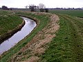
 Bend in Monkbridge Stream (geograph 3327975).jpg 1,024 × 768; 161 KB
-
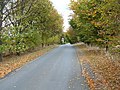
 Bend in the road - geograph.org.uk - 126123.jpg 640 × 480; 128 KB
-
 Benningholme Grange - geograph.org.uk - 1170208.jpg 640 × 426; 192 KB
-
 Benningholme Grange.jpg 640 × 480; 38 KB
-
 Benningholme Hall.jpg 800 × 600; 273 KB
-
 Bridge over Drewery's Sock Dike (geograph 4348443).jpg 640 × 480; 94 KB
-
 Bridge over Monkbridge Stream Drain - geograph.org.uk - 1527962.jpg 640 × 480; 65 KB
-
 Bulldike Bridge - geograph.org.uk - 551347.jpg 640 × 480; 91 KB
-
 Bulldike Drain (geograph 4352617).jpg 640 × 480; 113 KB
-
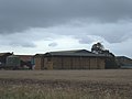
 Farm TA1238 - geograph.org.uk - 32574.jpg 640 × 480; 150 KB
-
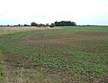
 Farmland - TA1139 - geograph.org.uk - 34896.jpg 640 × 480; 86 KB
-
 Farmland East of Benningholme Grange - geograph.org.uk - 1527980.jpg 640 × 480; 69 KB
-
-
 Farmland off Swine Road - geograph.org.uk - 1527985.jpg 640 × 480; 85 KB
-
 Farmland, Wawne Common - geograph.org.uk - 1527968.jpg 640 × 480; 92 KB
-

-
 Ings Lane towards Arnold - geograph.org.uk - 1527981.jpg 640 × 480; 76 KB
-
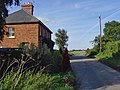 Ings Lane, Benningholme - geograph.org.uk - 962774.jpg 640 × 480; 197 KB
-
 Kidhill Lane (geograph 4353817).jpg 640 × 480; 61 KB
-
 Kidhill Lane, near Arnold - geograph.org.uk - 1170205.jpg 640 × 474; 189 KB
-
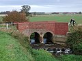 Lambwath Bridge, Benningholme - geograph.org.uk - 603309.jpg 640 × 475; 95 KB
-
 Lambwath Stream - geograph.org.uk - 1527983.jpg 640 × 480; 115 KB
-
 Minor Road Towards Skirlaugh - geograph.org.uk - 1527975.jpg 640 × 480; 50 KB
-
 Minor Road Towards Skirlaugh - geograph.org.uk - 1527978.jpg 640 × 480; 131 KB
-
 Monkbridge Stream (drain) (geograph 4351011).jpg 640 × 480; 60 KB
-
 Monkbridge Stream (drain) - geograph.org.uk - 126132.jpg 640 × 480; 104 KB
-
 Monkbridge Stream (geograph 6290165).jpg 1,024 × 768; 201 KB
-
 Monkbridge Stream Drain - geograph.org.uk - 1527971.jpg 640 × 480; 96 KB
-
 Ploughed field south of Kidhill Lane (geograph 4353818).jpg 640 × 480; 67 KB
-

-
 Roadside Drain near Benningholme - geograph.org.uk - 663933.jpg 640 × 480; 101 KB
-
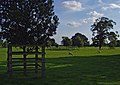 Sheep at Benningholme Hall - geograph.org.uk - 962792.jpg 640 × 452; 178 KB
-
 Skirlaugh, West - geograph.org.uk - 32581.jpg 640 × 480; 92 KB
-
 Swine Road - geograph.org.uk - 1527984.jpg 640 × 480; 50 KB
-
 The Lambwath Stream, Benningholme - geograph.org.uk - 962757.jpg 640 × 581; 193 KB
-
 Wheatfield near Skirlaugh - geograph.org.uk - 32562.jpg 640 × 480; 109 KB
.jpg)
.jpg)


.jpg)


.jpg)


.jpg)


_(geograph_4351011).jpg)
_-_geograph.org.uk_-_126132.jpg)
.jpg)

.jpg)


