Category:Swine, East Riding of Yorkshire
English: Swine is a village and civil parish in the East Riding of Yorkshire, England. It is situated approximately 5 miles (8 km) north east of Hull city centre and 2 miles (3.2 km) south of Skirlaugh to the west of the A165 road.
village in the United Kingdom  | |||||
| Upload media | |||||
| Instance of | |||||
|---|---|---|---|---|---|
| Location | East Riding of Yorkshire, Yorkshire and the Humber, England | ||||
 | |||||
Subcategories
This category has the following 14 subcategories, out of 14 total.
B
C
- Carr House, Swine (4 F)
E
- Engine House Bridge, Swine (1 F)
F
- Fairholme House Bridge (5 F)
G
- Gravel Hill Farm, Swine (3 F)
- Great Stanks, Swine (5 F)
H
- Hill Farm, Swine (4 F)
K
- Kelwell Farm, Swine (3 F)
M
- Main Street, Swine (3 F)
S
- Swine railway station (5 F)
- Swine War Memorial (1 F)
W
- Woodhouse Farm, Swine (6 F)
Media in category "Swine, East Riding of Yorkshire"
The following 200 files are in this category, out of 340 total.
(previous page) (next page)-
 A Big Clear Out - geograph.org.uk - 2649051.jpg 3,264 × 2,448; 2.04 MB
-
 A motorist's dilemma - geograph.org.uk - 4967865.jpg 4,548 × 3,376; 5.07 MB
-

-
 A public footpath towards Swine - geograph.org.uk - 2131724.jpg 800 × 600; 253 KB
-
 A road sign near Swine - geograph.org.uk - 2131755.jpg 800 × 600; 325 KB
-
 A unnamed house on Ings Lane, Skirlaugh - geograph.org.uk - 2151740.jpg 800 × 600; 215 KB
-

-
 Abbey Garth Farm Swine - geograph.org.uk - 2649073.jpg 3,264 × 2,448; 1.36 MB
-
 Abbey Garth Farm, Swine, Yorkshire - geograph.org.uk - 3285850.jpg 3,264 × 2,448; 4.27 MB
-
 Abbey Garths, Swine, Yorkshire - geograph.org.uk - 3284835.jpg 3,200 × 2,360; 3.63 MB
-
 Alongside Kelwell Drain - geograph.org.uk - 5688303.jpg 1,024 × 768; 242 KB
-
 Approaching a bend on Kidhill Lane - geograph.org.uk - 4353766.jpg 640 × 480; 55 KB
-
 Approaching Fairholme Farm (geograph 5449614).jpg 2,304 × 1,728; 1.55 MB
-
 Approaching Swine Station Trans Pennine Trail - geograph.org.uk - 4967891.jpg 4,608 × 3,456; 6.77 MB
-
 Avenue to Abbey Garth Farm - geograph.org.uk - 4695557.jpg 1,024 × 768; 309 KB
-
 Baling near Skirlaugh - geograph.org.uk - 963277.jpg 640 × 540; 189 KB
-
 Bank alongside Kelwell Drain - geograph.org.uk - 5688648.jpg 1,024 × 740; 152 KB
-
 Benningholme Hall across parkland - geograph.org.uk - 3837268.jpg 4,000 × 3,000; 2.53 MB
-
 Benningholme Hall, Skirlaugh - geograph.org.uk - 3387802.jpg 640 × 410; 185 KB
-
 Benningholme Large Bridge - geograph.org.uk - 6290161.jpg 1,024 × 768; 186 KB
-
 Bridge and houses on Kidhill Lane - geograph.org.uk - 1993086.jpg 800 × 600; 326 KB
-
 Bridleway alongside Monkbridge Stream (geograph 5677088).jpg 1,024 × 768; 191 KB
-
 Bridleway to Wawne - geograph.org.uk - 1528171.jpg 640 × 480; 70 KB
-
 Church of St Mary the Virgin, Swine - geograph.org.uk - 3252269.jpg 1,578 × 1,170; 379 KB
-
 Church of St Mary the Virgin, Swine - geograph.org.uk - 3252271.jpg 1,572 × 1,160; 417 KB
-
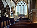 Church of St Mary the Virgin, Swine - geograph.org.uk - 3252281.jpg 2,798 × 2,088; 3.45 MB
-
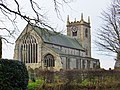 Church of St Mary the Virgin, Swine - geograph.org.uk - 3284843.jpg 3,256 × 2,438; 4.09 MB
-
 Church of St Mary the Virgin, Swine - geograph.org.uk - 3284859.jpg 3,210 × 2,374; 3.9 MB
-
 Common Lane and remains of a crop of sunflowers (geograph 5677095).jpg 1,024 × 768; 185 KB
-
 Coniston Lane, Swine - geograph.org.uk - 1192643.jpg 640 × 464; 117 KB
-
 Coniston Lane, Swine - geograph.org.uk - 2099209.jpg 800 × 600; 204 KB
-
 Coniston Lane, Swine - geograph.org.uk - 2131717.jpg 800 × 600; 302 KB
-
 Coniston Lane, Swine - geograph.org.uk - 6129027.jpg 1,600 × 1,065; 924 KB
-
 Coniston Lane, Swine - geograph.org.uk - 6129034.jpg 1,600 × 1,065; 783 KB
-
 Coniston Lane, Swine - geograph.org.uk - 652052.jpg 640 × 480; 79 KB
-
 Coniston Lane, Swine, Yorkshire - geograph.org.uk - 3284898.jpg 3,200 × 2,362; 3.96 MB
-
 Coniston Lane, Swine, Yorkshire - geograph.org.uk - 3333482.jpg 3,264 × 2,448; 4.06 MB
-
 Coniston Lane, Swine, Yorkshire - geograph.org.uk - 4036988.jpg 3,264 × 2,448; 3.42 MB
-
 Coniston Lane, Swine, Yorkshire - geograph.org.uk - 4038333.jpg 3,110 × 2,272; 2.71 MB
-
 Coniston Lane, Swine, Yorkshire - geograph.org.uk - 4038341.jpg 3,189 × 2,342; 3.43 MB
-
 Converted chapel Coniston Lane - geograph.org.uk - 4967901.jpg 4,608 × 3,456; 5.45 MB
-
 Cottages in Swine - geograph.org.uk - 652080.jpg 640 × 442; 83 KB
-

-
 Crop field off Kidhill Lane - geograph.org.uk - 4353763.jpg 640 × 480; 84 KB
-
 Crop field south of Kidhill Lane - geograph.org.uk - 4350968.jpg 640 × 480; 60 KB
-
 Crop field south of Kidhill Lane - geograph.org.uk - 4355243.jpg 640 × 480; 72 KB
-
-
 Crop field, Bennigholme Ings - geograph.org.uk - 4353715.jpg 640 × 480; 73 KB
-
 Crop field, Bennigholme Ings - geograph.org.uk - 4353747.jpg 640 × 480; 37 KB
-
 Crop field, Benningholme Grange - geograph.org.uk - 4348433.jpg 640 × 480; 101 KB
-
 Crop field, Kid Hill - geograph.org.uk - 4353771.jpg 640 × 480; 74 KB
-
 Cyclists on Ings Lane - geograph.org.uk - 4352549.jpg 640 × 428; 33 KB
-
-
 Dancing Lane into Swine - geograph.org.uk - 652223.jpg 640 × 480; 82 KB
-
 Dancing Lane to Kelwell Farm - geograph.org.uk - 652236.jpg 640 × 517; 78 KB
-
 Dancing Lane, Swine - geograph.org.uk - 1993095.jpg 800 × 600; 282 KB
-
 Dancing Lane, Swine - geograph.org.uk - 652217.jpg 640 × 392; 66 KB
-
 Dancing Lane, Swine, Yorkshire - geograph.org.uk - 3285098.jpg 3,252 × 2,430; 4.13 MB
-
 Dancing Lane, Swine, Yorkshire - geograph.org.uk - 4038321.jpg 3,107 × 2,299; 2.95 MB
-
 Dancing Lane, Swine, Yorkshire - geograph.org.uk - 5634229.jpg 2,592 × 1,944; 3.48 MB
-
 Dancing Lane, Swine, Yorkshire - geograph.org.uk - 5634260.jpg 2,588 × 1,940; 2.92 MB
-
-
 Drain and farmland - geograph.org.uk - 4353815.jpg 640 × 480; 69 KB
-
 Drain beside Kidhill Lane - geograph.org.uk - 4348437.jpg 640 × 480; 109 KB
-
 Drain beside Kidhill Lane - geograph.org.uk - 4352567.jpg 640 × 480; 117 KB
-
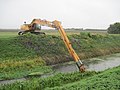 Drain Clearing Big Style - geograph.org.uk - 2649041.jpg 3,264 × 2,448; 2.27 MB
-
 Drain near Benningholme Grange - geograph.org.uk - 4348435.jpg 640 × 480; 103 KB
-
 Drain of Kidhill Lane - geograph.org.uk - 4350963.jpg 640 × 480; 78 KB
-
 Drain running sw from Swine Road - geograph.org.uk - 3837236.jpg 4,000 × 3,000; 3.25 MB
-
 Drain through Spring Nursery - geograph.org.uk - 3851460.jpg 4,000 × 3,000; 5.19 MB
-
 Entering Swine, East Yorkshire - geograph.org.uk - 2279232.jpg 800 × 600; 245 KB
-
 Fairholme Farm (geograph 5677135).jpg 1,024 × 768; 141 KB
-
 Farm bridge over New Cut Drain - geograph.org.uk - 4882053.jpg 1,200 × 799; 504 KB
-
 Farm bridge over New Cut Drain - geograph.org.uk - 4882061.jpg 1,200 × 799; 495 KB
-
 Farm building, Benningholme Grange - geograph.org.uk - 4348432.jpg 640 × 480; 67 KB
-
 Farm Building, near Woodhouse Farm - geograph.org.uk - 1528166.jpg 640 × 480; 73 KB
-
 Farm Track East of Kelwell Farm - geograph.org.uk - 1528116.jpg 640 × 480; 73 KB
-
 Farm track on the Carrs at Swine - geograph.org.uk - 4693219.jpg 1,024 × 768; 177 KB
-
 Farm Track to Swine - geograph.org.uk - 651957.jpg 640 × 480; 97 KB
-
 Farmbuildings at Woodhouse Farm - geograph.org.uk - 4693189.jpg 1,024 × 768; 179 KB
-
 Farmland near Benningholme Hall - geograph.org.uk - 4350987.jpg 640 × 480; 77 KB
-
 Farmland near Lane End Farm - geograph.org.uk - 1528120.jpg 640 × 480; 79 KB
-
 Farmland near Swine - geograph.org.uk - 1528146.jpg 640 × 480; 80 KB
-
 Farmland off Skirlaugh Road - geograph.org.uk - 1528053.jpg 640 × 480; 54 KB
-
 Farmland south of Kidhill Lane - geograph.org.uk - 4353811.jpg 640 × 480; 84 KB
-
 Field edge, Stackholmes - geograph.org.uk - 5688651.jpg 1,024 × 768; 206 KB
-
 Field entrance of Ings Lane - geograph.org.uk - 4352554.jpg 640 × 480; 96 KB
-
 Field Footpath toward Skirlaugh - geograph.org.uk - 3851495.jpg 4,000 × 3,000; 2.44 MB
-
 Field track near Swine - geograph.org.uk - 6249627.jpg 1,024 × 768; 160 KB
-
 Flat farmland off Kidhill Lane - geograph.org.uk - 4350989.jpg 640 × 480; 72 KB
-
 Footpath to Swine - geograph.org.uk - 5688642.jpg 1,024 × 768; 250 KB
-
 Footpath, Swine Village - geograph.org.uk - 1528122.jpg 640 × 480; 68 KB
-
 Former Holderness Drainage Notice - geograph.org.uk - 4986613.jpg 1,600 × 1,236; 725 KB
-
 Former School, Swine, Yorkshire - geograph.org.uk - 3285071.jpg 3,264 × 2,448; 3.56 MB
-
 Former station building, Coniston Lane, Swine, Yorkshire - geograph.org.uk - 3284912.jpg 3,250 × 2,428; 3.41 MB
-
 Former Village School - geograph.org.uk - 5482883.jpg 1,600 × 1,065; 625 KB
-
 Former Village School - geograph.org.uk - 5482935.jpg 1,600 × 1,065; 600 KB
-
 Gate House, Swine - geograph.org.uk - 775427.jpg 480 × 640; 118 KB
-
 Gateway to Benningholme Hall - geograph.org.uk - 3851485.jpg 4,000 × 3,000; 2.93 MB
-
 Giants Hill, Abbey Garths, Swine, Yorkshire - geograph.org.uk - 3284814.jpg 3,256 × 2,438; 3.48 MB
-
 Grange Cottages on Kidhill Lane - geograph.org.uk - 2565874.jpg 800 × 600; 363 KB
-
 Grass fields and Woodhouse Farm - geograph.org.uk - 4693218.jpg 1,024 × 768; 169 KB
-
 Gravel Hill Farm, Swine, Yorkshire - geograph.org.uk - 3285126.jpg 3,254 × 2,436; 4.37 MB
-
 Graveyard at St Mary the Virgin Church, Swine - geograph.org.uk - 5482944.jpg 1,600 × 1,065; 611 KB
-
 Graveyard at St Mary the Virgin Church, Swine - geograph.org.uk - 5482946.jpg 1,600 × 1,065; 632 KB
-
 Great Stanks beyond Kelwell Drain - geograph.org.uk - 5688640.jpg 1,024 × 768; 217 KB
-
 Great Stanks Farm - geograph.org.uk - 1993090.jpg 800 × 600; 240 KB
-
 Green Lane (track) over fields - geograph.org.uk - 3848628.jpg 4,000 × 3,000; 2.83 MB
-
 Green Lane - geograph.org.uk - 4673905.jpg 1,024 × 768; 183 KB
-
 Green Lane - geograph.org.uk - 652241.jpg 640 × 480; 80 KB
-
 Green Lane towards Swine - geograph.org.uk - 1528112.jpg 640 × 480; 60 KB
-
 Green Lane towards Swine - geograph.org.uk - 2099221.jpg 800 × 600; 271 KB
-
 Green Lane, Swine - geograph.org.uk - 775430.jpg 447 × 640; 106 KB
-
 Harrowing - geograph.org.uk - 2602311.jpg 640 × 480; 81 KB
-
 Harvesting near Benningholme Grange - geograph.org.uk - 2565828.jpg 800 × 600; 257 KB
-
 Harvesting near Benningholme Grange - geograph.org.uk - 2565831.jpg 800 × 600; 211 KB
-

-
 Hornsea Rail Trail - geograph.org.uk - 1528118.jpg 640 × 480; 141 KB
-
 Hornsea Rail Trail - geograph.org.uk - 2166227.jpg 640 × 427; 130 KB
-
 Hornsea Rail Trail - geograph.org.uk - 6249629.jpg 1,024 × 768; 188 KB
-
 Hornsea Rail Trail at Swine Station - geograph.org.uk - 4696224.jpg 1,024 × 768; 178 KB
-
 Hornsea Rail Trail near Swine - geograph.org.uk - 2099200.jpg 800 × 600; 312 KB
-
 Hornsea Rail Trail towards Swine - geograph.org.uk - 4882029.jpg 1,200 × 799; 279 KB
-
 Hornsea Rail Trail ^7 - geograph.org.uk - 5024169.jpg 640 × 480; 103 KB
-
 Hornsea Rail Trail ^8 - geograph.org.uk - 5024170.jpg 640 × 480; 103 KB
-
 Hornsea Rail Trail ^9 - geograph.org.uk - 5024171.jpg 640 × 480; 124 KB
-
 Houses on a minor road towards Hill Farm - geograph.org.uk - 2131746.jpg 800 × 600; 229 KB
-
 Houses on Kidhill Lane - geograph.org.uk - 4350958.jpg 640 × 480; 69 KB
-
 Ings Cottages - geograph.org.uk - 4351334.jpg 640 × 480; 81 KB
-
 Ings Lane - geograph.org.uk - 4352555.jpg 640 × 480; 81 KB
-
 Ings Lane - geograph.org.uk - 4353745.jpg 640 × 480; 80 KB
-
 Ings Lane - geograph.org.uk - 4353751.jpg 640 × 480; 68 KB
-
 Ings Lane - geograph.org.uk - 4355240.jpg 640 × 480; 90 KB
-
 Interesting village sign - geograph.org.uk - 5026873.jpg 640 × 480; 108 KB
-
 Kelwell Bridge on Skirlaugh Road - geograph.org.uk - 3835640.jpg 4,000 × 3,000; 3.87 MB
-
 Kelwell Bridge, near Swine - geograph.org.uk - 963289.jpg 640 × 599; 208 KB
-
 Kelwell Cottages, Swine - geograph.org.uk - 1192639.jpg 480 × 640; 113 KB
-
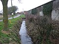
 Kelwell Drain (East) - geograph.org.uk - 652268.jpg 640 × 480; 131 KB
-
 Kelwell Drain (West) - geograph.org.uk - 652263.jpg 520 × 640; 111 KB
-
 Kelwell Drain - geograph.org.uk - 2602206.jpg 640 × 480; 105 KB
-
 Kelwell Drain - geograph.org.uk - 5688672.jpg 1,024 × 768; 273 KB
-
 Kelwell Drain - geograph.org.uk - 5688673.jpg 1,024 × 768; 312 KB
-
 Kelwell Drain - geograph.org.uk - 5688681.jpg 1,024 × 768; 156 KB
-
 Kelwell Drain - geograph.org.uk - 5688684.jpg 1,024 × 768; 184 KB
-
 Kelwell Drain and footpath from Swine - geograph.org.uk - 5688676.jpg 1,024 × 768; 264 KB
-
 Kelwell Drain east of Kelwell Bridge - geograph.org.uk - 3835650.jpg 4,000 × 3,000; 4.22 MB
-
 Kelwell Drain, Swine, Yorkshire - geograph.org.uk - 3375677.jpg 2,374 × 3,210; 3.92 MB
-
 Kelwell Drain, Swine, Yorkshire - geograph.org.uk - 3375680.jpg 3,224 × 2,392; 3.49 MB
-
 Kelwell Farm - geograph.org.uk - 6249616.jpg 1,024 × 768; 221 KB
-
 Kelwell Farm, Swine, Yorkshire - geograph.org.uk - 3375684.jpg 3,264 × 2,448; 3.67 MB
-
 Kid Hill - geograph.org.uk - 4693166.jpg 1,024 × 768; 179 KB
-
 Kidhill Lane - geograph.org.uk - 4348431.jpg 640 × 480; 51 KB
-
 Kidhill Lane - geograph.org.uk - 4348436.jpg 640 × 480; 60 KB
-
 Kidhill Lane - geograph.org.uk - 4348439.jpg 640 × 480; 61 KB
-
 Kidhill Lane - geograph.org.uk - 4350959.jpg 640 × 480; 103 KB
-
 Kidhill Lane - geograph.org.uk - 4350970.jpg 640 × 480; 120 KB
-
 Kidhill Lane - geograph.org.uk - 4350979.jpg 640 × 480; 58 KB
-
 Kidhill Lane - geograph.org.uk - 4352564.jpg 640 × 480; 94 KB
-
 Kidhill Lane - geograph.org.uk - 4353756.jpg 640 × 480; 65 KB
-
 Kidhill Lane - geograph.org.uk - 4353758.jpg 640 × 480; 72 KB
-
 Kidhill Lane - geograph.org.uk - 4353759.jpg 640 × 480; 76 KB
-
 Kidhill Lane - geograph.org.uk - 4353773.jpg 640 × 480; 51 KB
-
 Kidhill Lane - geograph.org.uk - 4353812.jpg 640 × 480; 59 KB
-
 Kidhill Lane - geograph.org.uk - 4355242.jpg 640 × 480; 51 KB
-
 Kidhill Lane - geograph.org.uk - 6290171.jpg 1,024 × 768; 137 KB
-
 Labwath Stream - geograph.org.uk - 4350983.jpg 640 × 508; 122 KB
-
 Lambwat Stream - geograph.org.uk - 4350978.jpg 640 × 480; 99 KB
-
 Lambwath Bridge and road junction - geograph.org.uk - 3844660.jpg 4,000 × 3,000; 2.71 MB
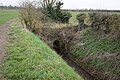
-
 Lambwath Stream (drain) - geograph.org.uk - 4352559.jpg 640 × 480; 78 KB
-
 Lambwath Stream (Drain) - geograph.org.uk - 4353755.jpg 640 × 480; 70 KB
-
 Lambwath Stream - geograph.org.uk - 4348429.jpg 640 × 480; 82 KB
-
 Lambwath Stream - geograph.org.uk - 4350974.jpg 640 × 480; 83 KB
-
 Lane End Farm, Coniston Lane, Swine, Yorkshire - geograph.org.uk - 3333479.jpg 3,194 × 2,352; 4.02 MB
-
 Lane near Swine - geograph.org.uk - 1163769.jpg 475 × 640; 220 KB
-
 Looking across Kelwell Drain towards Sand Hill - geograph.org.uk - 5688306.jpg 1,024 × 768; 227 KB
-
 Looking East along Coniston Lane - geograph.org.uk - 2099759.jpg 800 × 600; 187 KB
-
 Looking east from Swine Road - geograph.org.uk - 3851619.jpg 4,000 × 3,000; 3.23 MB
-
 Looking north along Swine Road - geograph.org.uk - 2278628.jpg 800 × 600; 240 KB
-
 Looking south from Hill Farm - geograph.org.uk - 2131436.jpg 800 × 600; 278 KB
-
 Low Grounds Farm, Swine - geograph.org.uk - 774273.jpg 452 × 640; 82 KB
-
 Main Street, Swine - geograph.org.uk - 2131730.jpg 800 × 600; 273 KB
-
 Main Street, Swine - geograph.org.uk - 5482892.jpg 1,600 × 1,065; 755 KB
-
 Main Street, Swine - geograph.org.uk - 5482940.jpg 1,600 × 1,065; 564 KB
-
 Main Street, Swine, Yorkshire - geograph.org.uk - 3285083.jpg 3,252 × 2,430; 4.02 MB
-
 Main Street, Swine, Yorkshire - geograph.org.uk - 3285106.jpg 3,260 × 2,442; 3.77 MB
-
 Main Street, Swine, Yorkshire - geograph.org.uk - 3285115.jpg 3,262 × 2,446; 4.27 MB
-
 Main Street, Swine, Yorkshire - geograph.org.uk - 4037000.jpg 2,798 × 2,086; 2.78 MB
-
 Main Street, Swine, Yorkshire - geograph.org.uk - 4038268.jpg 3,159 × 2,320; 2.78 MB
-
 Main Street, Swine, Yorkshire - geograph.org.uk - 4038291.jpg 3,242 × 2,420; 3.07 MB
-
 Main Street, Swine, Yorkshire - geograph.org.uk - 4038307.jpg 3,148 × 2,285; 3.24 MB
-
 Main Street, Swine, Yorkshire - geograph.org.uk - 4038362.jpg 3,252 × 2,430; 3.36 MB
-
 Main Street, Swine, Yorkshire - geograph.org.uk - 5634242.jpg 2,570 × 1,914; 2 MB
-
 Main Street, Swine, Yorkshire - geograph.org.uk - 5634264.jpg 2,592 × 1,944; 3.3 MB
-
 Main Street, Swine, Yorkshire - geograph.org.uk - 5634267.jpg 2,592 × 1,944; 3.56 MB
-
 Main Street, Swine, Yorkshire - geograph.org.uk - 5634271.jpg 2,592 × 1,944; 2.98 MB
-
 Main Street, Swine, Yorkshire - geograph.org.uk - 5634279.jpg 2,592 × 1,944; 2.32 MB
-
 Many pylons at Newlands (geograph 4967818).jpg 4,608 × 3,456; 3.48 MB
-
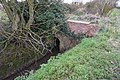
 Megson's Bridge - geograph.org.uk - 5688246.jpg 1,024 × 768; 261 KB
-
 Megson's Bridge - geograph.org.uk - 5688678.jpg 1,024 × 768; 261 KB
-
 Minor road to Woodhouse Farm - geograph.org.uk - 4967854.jpg 4,608 × 3,454; 5.2 MB


.jpg)


.jpg)


.jpg)


.jpg)


_over_fields_-_geograph.org.uk_-_3848628.jpg)


_-_geograph.org.uk_-_652268.jpg)
_-_geograph.org.uk_-_652263.jpg)


_-_geograph.org.uk_-_4352559.jpg)
_-_geograph.org.uk_-_4353755.jpg)


.jpg)


