Category:Bikeways in Lancashire
Ceremonial counties of England: Bedfordshire · Berkshire · Buckinghamshire · Cambridgeshire · Cheshire · Cornwall · Cumbria · Derbyshire · Devon · Dorset · Durham · East Riding of Yorkshire · East Sussex · Essex · Gloucestershire · Greater London · Greater Manchester · Hampshire · Herefordshire · Hertfordshire · Isle of Wight · Kent · Lancashire · Leicestershire · Lincolnshire · Merseyside · Norfolk · North Yorkshire · Northamptonshire · Northumberland · Nottinghamshire · Oxfordshire · Rutland · Shropshire · Somerset · South Yorkshire · Staffordshire · Suffolk · Surrey · Tyne and Wear · Warwickshire · West Midlands · West Sussex · West Yorkshire · Wiltshire · Worcestershire
City-counties: Bristol ·
Former historic counties:
Other former counties:
City-counties: Bristol ·
Former historic counties:
Other former counties:
Subcategories
This category has the following 4 subcategories, out of 4 total.
L
- Lancashire Coastal Way (18 F)
- Lancashire Cycleway (10 F)
N
Media in category "Bikeways in Lancashire"
The following 18 files are in this category, out of 18 total.
-
 A traffic restriction on the Cheshire Lines Path (geograph 5027752).jpg 4,412 × 2,808; 5.75 MB
-
 Aldcliffe Marsh Cutting, Lancaster - geograph.org.uk - 58178.jpg 640 × 480; 164 KB
-
 Cheshire Lines Cycle-way - geograph.org.uk - 114549.jpg 640 × 480; 107 KB
-
 Cheshire Lines Cycle-way - geograph.org.uk - 114554.jpg 640 × 480; 109 KB
-
 Converted railway route, Britannia - geograph.org.uk - 235858.jpg 640 × 435; 64 KB
-
 Cycle track beside the River Lune (geograph 2463987).jpg 1,600 × 1,200; 663 KB
-
 Cycleway - geograph.org.uk - 279641.jpg 640 × 480; 126 KB
-
 Cycleway near Conder Green - geograph.org.uk - 481457.jpg 480 × 640; 60 KB
-
 Footpath near Stodday - geograph.org.uk - 1070438.jpg 640 × 425; 94 KB
-
 Four Lane Ends - geograph.org.uk - 101623.jpg 640 × 427; 128 KB
-
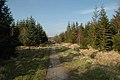 Gisburn Forest - geograph.org.uk - 21109.jpg 640 × 426; 129 KB
-
 Lancaster to Glasson Cycle track - geograph.org.uk - 1330687.jpg 640 × 480; 109 KB
-
 Lune cycleway going under the aqueduct - geograph.org.uk - 35061.jpg 429 × 640; 112 KB
-
 Ovangle Road overbridge B5273, Lancaster - geograph.org.uk - 47485.jpg 640 × 480; 193 KB
-

-
 The old main road to Skipton - geograph.org.uk - 58923.jpg 640 × 427; 203 KB
-
 The railway path, Caton - geograph.org.uk - 639681.jpg 471 × 640; 134 KB
-
 Railway Crossing Lane, Lancaster - geograph.org.uk - 57158.jpg 640 × 480; 166 KB
.jpg)


.jpg)


