Category:Bradfield, Berkshire
English: Images of the village and civil parish of Bradfield, Berkshire, England; including the villages of Bradfield Southend and Tutts Clump within the civil parish. For more details see Bradfield, Berkshire.
village and civil parish in Berkshire, England  | |||||
| Upload media | |||||
| Instance of | |||||
|---|---|---|---|---|---|
| Location | West Berkshire, Berkshire, South East England, England | ||||
| Population |
| ||||
| Area |
| ||||
| Said to be the same as | Bradfield (Wikimedia duplicated page, civil parish) | ||||
 | |||||
Subcategories
This category has the following 7 subcategories, out of 7 total.
Media in category "Bradfield, Berkshire"
The following 200 files are in this category, out of 290 total.
(previous page) (next page)-
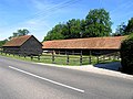 "Lone Barn" near Bradfield - geograph.org.uk - 21130.jpg 640 × 480; 146 KB
-
 250 miles per hour - geograph.org.uk - 914249.jpg 640 × 427; 113 KB
-
 A herd of prams - geograph.org.uk - 2328731.jpg 640 × 480; 72 KB
-
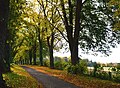
 A New-ish Avenue - geograph.org.uk - 3780056.jpg 1,024 × 802; 359 KB
-
 Ashampstead Road - geograph.org.uk - 1278294.jpg 640 × 480; 89 KB
-
 Ashampstead Road, Bradfield - geograph.org.uk - 503394.jpg 640 × 480; 157 KB
-
 Ashampsted Road crossroads northwest of Bradfield - geograph.org.uk - 2591603.jpg 3,648 × 2,736; 2.73 MB
-
 Ashampsted Road traffic calming entering Bradfield - geograph.org.uk - 2591623.jpg 3,648 × 2,736; 1.8 MB
-
 Avenue Clump has changed - geograph.org.uk - 5299827.jpg 5,059 × 3,140; 2.25 MB
-
 Back Lane plantation - geograph.org.uk - 1752462.jpg 1,024 × 768; 231 KB
-
 Back Lane Plantation - geograph.org.uk - 2328721.jpg 640 × 480; 102 KB
-
 Back of Bradfield - geograph.org.uk - 914203.jpg 427 × 640; 118 KB
-
 Bag in the Woods - geograph.org.uk - 4892350.jpg 3,535 × 3,000; 3.72 MB
-
 Bales at Maidenhatch Farm - geograph.org.uk - 911865.jpg 640 × 427; 130 KB
-
 Barley field - geograph.org.uk - 914216.jpg 640 × 427; 119 KB
-
 Barn at Bournefield Farm - geograph.org.uk - 5463272.jpg 1,024 × 770; 130 KB
-
 Barn conversion, Kimberhead Farm - geograph.org.uk - 5246063.jpg 3,264 × 2,448; 2.08 MB
-
 Barn Elms Farmhouse near Bradfield - geograph.org.uk - 21134.jpg 640 × 480; 301 KB
-
 BBQ area - Rushall Manor Farm - geograph.org.uk - 2325304.jpg 640 × 480; 97 KB
-
 BBQ from oil drums - geograph.org.uk - 2325318.jpg 640 × 480; 128 KB
-
 Beard's Hill - geograph.org.uk - 914254.jpg 640 × 427; 76 KB
-
 Bluebells in Pear Tree Copse - geograph.org.uk - 7353.jpg 640 × 480; 592 KB
-
 Bonfire in the wood - geograph.org.uk - 5239686.jpg 1,600 × 1,200; 598 KB
-
 Bottomhouse Farm entrance - geograph.org.uk - 2558986.jpg 3,648 × 2,736; 1.34 MB
-
 Letter box on Union Road - geograph.org.uk - 1331782.jpg 426 × 640; 231 KB
-
 Bradfield - Tree antenna - geograph.org.uk - 2067307.jpg 864 × 648; 132 KB
-
 Bradfield College cross roads - geograph.org.uk - 2865980.jpg 3,648 × 2,736; 2.26 MB
-
 Bradfield College Golf Course 3rd fairway - geograph.org.uk - 2501386.jpg 3,648 × 2,736; 3.04 MB
-
 Bradfield Golf Course 6th green - geograph.org.uk - 2500458.jpg 3,648 × 2,736; 3.46 MB
-
 Bradfield House and Farm - geograph.org.uk - 11676.jpg 640 × 480; 265 KB
-
 Bradfield telephone exchange - geograph.org.uk - 914197.jpg 640 × 419; 72 KB
-
 Bradfield Telephone Exchange, West Berkshire - geograph.org.uk - 6023389.jpg 2,592 × 1,944; 1.37 MB
-
 Bradfield Water Treatment Works - geograph.org.uk - 2591572.jpg 3,208 × 2,151; 1.18 MB
-
 Bradfield Water Treatment Works - geograph.org.uk - 2591588.jpg 3,648 × 2,736; 2.23 MB
-
 Bradfield - geograph.org.uk - 358413.jpg 640 × 477; 112 KB
-
 Bridge over The Bourne - geograph.org.uk - 3801444.jpg 1,024 × 738; 251 KB
-
 Bridge over the M4 - geograph.org.uk - 2296686.jpg 640 × 356; 32 KB
-
 Bridleway off Back Lane - geograph.org.uk - 1570906.jpg 640 × 480; 102 KB
-
 Bridleway to Greathouse Woods from Back Lane. - geograph.org.uk - 2347993.jpg 3,540 × 2,607; 1.96 MB
-
 Buckholdhill Farm - geograph.org.uk - 915284.jpg 427 × 640; 73 KB
-
 Buildings by the millstream at Bradfield - geograph.org.uk - 5463559.jpg 1,024 × 768; 203 KB
-

-
 Chieveley Services - M4-A34 - geograph.org.uk - 4937615.jpg 3,264 × 2,448; 4.34 MB
-
 Chimney at Bradfield College - geograph.org.uk - 5467592.jpg 838 × 1,024; 169 KB
-
 Choices, choices - geograph.org.uk - 914232.jpg 640 × 415; 140 KB
-
 Cock Lane, Bradfield, Berks - geograph.org.uk - 6223985.jpg 1,024 × 672; 174 KB
-
 Copyhold Farm - geograph.org.uk - 1331693.jpg 640 × 426; 185 KB
-
 Copyhold Farm Forge - geograph.org.uk - 5239637.jpg 4,000 × 3,000; 2.68 MB
-
 Corner by the telephone exchange - geograph.org.uk - 914194.jpg 640 × 427; 95 KB
-
 Cottage beside Blue Pool - geograph.org.uk - 2283804.jpg 3,648 × 2,736; 4 MB
-
 Country lane, Tutts Clump, Berkshire - geograph.org.uk - 4794031.jpg 3,773 × 4,629; 4.41 MB
-
 Cowshed - Rushall Farm - geograph.org.uk - 2328708.jpg 640 × 480; 97 KB
-
 Cowsheds - Rushall Farm - geograph.org.uk - 2328725.jpg 480 × 640; 88 KB
-
 Crossroads on Yattendon Lane, Upper Basildon - geograph.org.uk - 5101941.jpg 2,048 × 1,536; 921 KB
-
 Day visitors to Rushall Farm - geograph.org.uk - 2328717.jpg 640 × 480; 82 KB
-
 Duck Pond - geograph.org.uk - 2325314.jpg 640 × 480; 123 KB
-
 East towards Sannyfield Copse - geograph.org.uk - 914270.jpg 640 × 427; 102 KB
-
 Englefield and Bradfield from the air - geograph.org.uk - 2339383.jpg 480 × 640; 114 KB
-
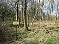
 Entrance off Back Lane - geograph.org.uk - 1570869.jpg 640 × 480; 79 KB
-
 Entrance to Herons Farm - geograph.org.uk - 915326.jpg 432 × 640; 58 KB
-
 Evening grazing at Malthouse Farm - geograph.org.uk - 1331793.jpg 640 × 425; 176 KB
-
 Exposed chalk face - geograph.org.uk - 1752473.jpg 1,024 × 768; 293 KB
-
 Family of Swans on River Pang.JPG 2,160 × 1,440; 1.17 MB
-
 Farm and Outbuildings - geograph.org.uk - 3851166.jpg 1,600 × 1,163; 357 KB
-
 Farm track ^ ditch - geograph.org.uk - 2325108.jpg 640 × 480; 92 KB
-
 Farming Antiques - geograph.org.uk - 3801518.jpg 1,430 × 1,600; 879 KB
-
 Farming debris - Rushall Farm - geograph.org.uk - 2325302.jpg 640 × 480; 116 KB
-
 Farming south of the M4 - geograph.org.uk - 911869.jpg 640 × 427; 99 KB
-
 Farmland and barn, Bradfield - geograph.org.uk - 6066518.jpg 1,024 × 768; 295 KB
-
 Farmland, Beenham - geograph.org.uk - 1776049.jpg 640 × 480; 150 KB
-
 Farmland, Bradfield - geograph.org.uk - 1596837.jpg 640 × 480; 167 KB
-
 Farmland, Bradfield - geograph.org.uk - 1808741.jpg 640 × 480; 131 KB
-
 Farmland, Bradfield - geograph.org.uk - 2321747.jpg 640 × 480; 145 KB
-
 Farmland, Bradfield - geograph.org.uk - 677769.jpg 640 × 480; 163 KB
-
 Farmland, Bradfield - geograph.org.uk - 677783.jpg 640 × 480; 155 KB
-
 Farmland, Bradfield - geograph.org.uk - 677804.jpg 640 × 480; 153 KB
-
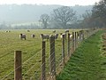
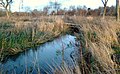
 Fence by Rushall Copse - geograph.org.uk - 2325307.jpg 640 × 480; 95 KB
-
 Field Barn on Back Lane - geograph.org.uk - 2591631.jpg 3,648 × 2,736; 1.97 MB
-
-
 Field boundary, Bradfield, Berkshire - geograph.org.uk - 4804244.jpg 2,323 × 2,307; 3.01 MB
-
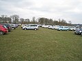
 Field car park - Rushall Farm - geograph.org.uk - 2328701.jpg 640 × 480; 93 KB
-
 Field for visitors - geograph.org.uk - 2328745.jpg 640 × 480; 72 KB
-
 Field north of Rushall Farm - geograph.org.uk - 2328640.jpg 640 × 480; 85 KB
-
 Fishing pond - geograph.org.uk - 911870.jpg 640 × 427; 118 KB
-
 Fishing pond - geograph.org.uk - 911872.jpg 640 × 427; 112 KB
-
 Fishing pond - geograph.org.uk - 911874.jpg 640 × 427; 105 KB
-
 Fishing pond - geograph.org.uk - 911877.jpg 640 × 427; 93 KB
-
 Flooding in Bradfield - geograph.org.uk - 503395.jpg 640 × 480; 148 KB
-
 Footbridge over the M4 - geograph.org.uk - 2296666.jpg 640 × 430; 47 KB
-
 Footbridge over the M4 - geograph.org.uk - 3649535.jpg 640 × 430; 42 KB
-
 Footbridge over the M4 - geograph.org.uk - 3649546.jpg 640 × 430; 29 KB
-
 Footbridge over the M4 - geograph.org.uk - 4815779.jpg 640 × 370; 44 KB
-
 Footbridge over the M4 - geograph.org.uk - 4815780.jpg 640 × 332; 37 KB
-
 Footpath Bridge, River Pang - geograph.org.uk - 3779031.jpg 1,600 × 1,344; 835 KB
-
 Footpath into The Larches - geograph.org.uk - 1278290.jpg 640 × 480; 90 KB
-
 Footpath off Scratchface Lane - geograph.org.uk - 4900194.jpg 4,000 × 3,000; 3.89 MB
-
 Footpath to Bradfield - geograph.org.uk - 1572993.jpg 640 × 480; 95 KB
-
 Footpath to Bradfield - geograph.org.uk - 1935800.jpg 800 × 600; 161 KB
-
 Footpath to Owlpit Copse - geograph.org.uk - 2325315.jpg 640 × 480; 134 KB
-
 Garden in autumn, Bradfield, Berkshire - geograph.org.uk - 4749520.jpg 4,000 × 4,902; 6.88 MB
-
 Greathouse Walk - geograph.org.uk - 914223.jpg 427 × 640; 111 KB
-
 Greathouse Walk - geograph.org.uk - 914235.jpg 640 × 427; 113 KB
-
 Hare Plantation - geograph.org.uk - 1278312.jpg 640 × 480; 70 KB
-
 Harvested Land near Ufton Wood - geograph.org.uk - 37131.jpg 640 × 480; 211 KB
-
 Heads or tails^ - geograph.org.uk - 909599.jpg 640 × 417; 52 KB
-
 Heron's Farm - geograph.org.uk - 5281366.jpg 3,822 × 2,186; 1.78 MB
-
 Hidden Herons Farm - geograph.org.uk - 4471037.jpg 2,448 × 3,264; 4.84 MB
-
 Hillside near Bottomhouse Farm - geograph.org.uk - 3780461.jpg 3,888 × 2,592; 2.13 MB
-
 Holy Trinity Church and graveyard - geograph.org.uk - 2558977.jpg 3,648 × 2,736; 1.77 MB
-

-
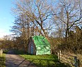
 House by the Millstream - geograph.org.uk - 3800041.jpg 1,024 × 768; 224 KB
-
 House near Bottomhouse Farm - geograph.org.uk - 5999331.jpg 4,160 × 3,120; 5.41 MB
-
 Houses in Heath Road - geograph.org.uk - 5045248.jpg 1,600 × 1,200; 519 KB
-
 Houses on Union Road - geograph.org.uk - 1331753.jpg 640 × 425; 215 KB
-

-

-

-
 Junction of Union Road and Common Hill - geograph.org.uk - 2865965.jpg 3,584 × 2,631; 1.44 MB
-
 Kids ^ Cows - Rushall Farm - geograph.org.uk - 2328750.jpg 480 × 640; 89 KB
-
 Lambing day - Rushall Farm - geograph.org.uk - 2325187.jpg 640 × 480; 60 KB
-
 Lane forms parish boundary on Clay Hill - geograph.org.uk - 2332157.jpg 640 × 427; 137 KB
-

-
-
 Lime avenue, Upper Basildon, Berkshire - geograph.org.uk - 4693678.jpg 640 × 467; 124 KB
-
 Lime avenue, Upper Basildon, Berkshire - geograph.org.uk - 4742165.jpg 4,605 × 3,390; 4.11 MB
-

-
 Long shadows - geograph.org.uk - 2328656.jpg 640 × 480; 79 KB
-
 Long Shadows - geograph.org.uk - 3858382.jpg 1,024 × 806; 179 KB
-
 Looking for dinosaurs - geograph.org.uk - 2325306.jpg 640 × 480; 132 KB
-
 Looking into the chalk pit - geograph.org.uk - 2328739.jpg 640 × 480; 139 KB
-
 Looking towards Rushall Copse - geograph.org.uk - 2325247.jpg 640 × 480; 112 KB
-
 Low Sun on Field Barn - geograph.org.uk - 3780023.jpg 1,600 × 949; 383 KB
-
 M4 farmbridge at Beards Hill - geograph.org.uk - 2599892.jpg 3,648 × 2,736; 2.78 MB
-
 M4 through Greathouse Wood - geograph.org.uk - 3627730.jpg 2,208 × 1,473; 1.59 MB
-
 M4 west of Theale - geograph.org.uk - 911848.jpg 640 × 427; 65 KB
-
 M4 westbound climbs uphill - geograph.org.uk - 3627691.jpg 2,435 × 1,503; 1.74 MB
-
 M4 westbound towards the top of a gradient - geograph.org.uk - 3627707.jpg 2,217 × 1,362; 1.57 MB
-
 M4 westbound, road bridge - geograph.org.uk - 3627766.jpg 2,286 × 1,479; 1.4 MB
-
 Maize near Slade Gate - geograph.org.uk - 914288.jpg 640 × 427; 110 KB
-
 Maize near Slade Gate - geograph.org.uk - 914296.jpg 427 × 640; 85 KB
-
 Mallard duck and beech reflections - geograph.org.uk - 4399329.jpg 800 × 511; 110 KB
-
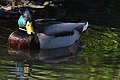 Mallard duck and ivy reflections - geograph.org.uk - 4404543.jpg 800 × 531; 97 KB
-
 Mallard duck and willow reflections - geograph.org.uk - 4404538.jpg 800 × 547; 105 KB
-
 Mallard duck making waves - geograph.org.uk - 4399346.jpg 800 × 735; 119 KB
-
 Malthouse Farm - geograph.org.uk - 1331800.jpg 640 × 427; 186 KB
-
 Malthouse Farm - geograph.org.uk - 4267601.jpg 1,600 × 1,200; 586 KB
-
 Mapletons - geograph.org.uk - 914276.jpg 640 × 417; 83 KB
-
 Miram's Copse - geograph.org.uk - 4900200.jpg 4,000 × 3,000; 6.5 MB
-
 Mist by The Bourne - geograph.org.uk - 5239546.jpg 1,600 × 1,200; 783 KB
-
 More Water Than They Want - geograph.org.uk - 3800073.jpg 1,024 × 838; 424 KB
-
 Mount's Hill - geograph.org.uk - 4471076.jpg 3,264 × 2,448; 3.78 MB
-
 New Way from the Cricket Ground - geograph.org.uk - 5045241.jpg 3,773 × 2,437; 1.93 MB
-

-
 Old style Granary - geograph.org.uk - 2325300.jpg 640 × 480; 88 KB
-
 One Way of Doing It - geograph.org.uk - 3784999.jpg 1,600 × 1,123; 615 KB
-
 Open day at Rushall Farm - geograph.org.uk - 1763054.jpg 640 × 480; 64 KB
-
 Open day at Rushall Farm - geograph.org.uk - 2325101.jpg 640 × 480; 76 KB
-
 Paddock near Slade Gate - geograph.org.uk - 914309.jpg 640 × 427; 91 KB
-
 Pasture and footpath, Stanford Dingley - geograph.org.uk - 2321720.jpg 640 × 480; 141 KB
-
 Pasture, Bradfield - geograph.org.uk - 2321732.jpg 640 × 427; 143 KB
-
 Pasture, Bradfield - geograph.org.uk - 677751.jpg 640 × 480; 184 KB
-
 Pasture, Bradfield Southend - geograph.org.uk - 1776037.jpg 640 × 427; 107 KB
-
 Path above chalk pit - geograph.org.uk - 2328697.jpg 640 × 480; 152 KB
-
 Path across Rushall Farm fields - geograph.org.uk - 2325229.jpg 640 × 480; 63 KB
-
 Path between Paddocks - geograph.org.uk - 5176264.jpg 1,600 × 1,200; 650 KB
-
 Path to Owlpit Copse - geograph.org.uk - 2328736.jpg 640 × 480; 140 KB
-
 Path to Rushall Manor Farm - geograph.org.uk - 3785067.jpg 1,600 × 1,200; 571 KB
-
 Paths meet at the gate - geograph.org.uk - 5239680.jpg 1,600 × 1,200; 681 KB
-
 Peatmoor Copse in Winter - geograph.org.uk - 3801394.jpg 1,024 × 768; 244 KB
-
 Phew, it's hot - geograph.org.uk - 914212.jpg 640 × 427; 95 KB
-
 Plantation at Bradfield Hall Farm - geograph.org.uk - 7349.jpg 640 × 480; 637 KB
-
 Ploughed field - geograph.org.uk - 1763057.jpg 640 × 480; 76 KB
-
 Ploughed fields - Rushall Farm - geograph.org.uk - 2325197.jpg 640 × 480; 75 KB
-
 Ploughing competition at Barn Elms Farm - geograph.org.uk - 2282220.jpg 3,648 × 2,736; 2.24 MB
-
 Ploughing competition at Barn Elms Farm - geograph.org.uk - 2282225.jpg 3,648 × 2,736; 3.39 MB
-
 Pond in Broomhill Copse - geograph.org.uk - 914238.jpg 427 × 640; 132 KB
-
 Poplar plantation near Folly Bridge - geograph.org.uk - 5246080.jpg 3,264 × 2,448; 2.82 MB
-
 Poplar plantation near Folly Bridge - geograph.org.uk - 5246088.jpg 3,264 × 2,448; 2.58 MB
-
 Poppies in a wheat field - geograph.org.uk - 1935792.jpg 1,024 × 720; 194 KB
-
 Poppy in the barley - geograph.org.uk - 914214.jpg 640 × 427; 135 KB
-
 Private woodland track - geograph.org.uk - 915281.jpg 427 × 640; 117 KB
-
 Pylon by the M4 - geograph.org.uk - 3351992.jpg 640 × 430; 60 KB
-
 Pylon next to the M4 - geograph.org.uk - 911855.jpg 427 × 640; 101 KB
-
 Ready for the next crop - geograph.org.uk - 2325265.jpg 639 × 416; 57 KB
-
 Red ^ Blue with Spikes - geograph.org.uk - 3801506.jpg 1,600 × 1,233; 794 KB
-
 Reflections in a Fish Pond - geograph.org.uk - 3801530.jpg 1,600 × 1,188; 539 KB
-
 Results of organic farming beside Back Lane - geograph.org.uk - 2302561.jpg 3,648 × 2,736; 1.76 MB
-
 River Pang in Bradfield - geograph.org.uk - 3800035.jpg 800 × 536; 184 KB
-
 River Pang in Bradfield, Berkshire.jpg 640 × 480; 93 KB
-
 River Pang in Peatmoor Copse - geograph.org.uk - 3801403.jpg 640 × 394; 93 KB
-
 River Pang near Bradfield - geograph.org.uk - 3392486.jpg 2,288 × 1,712; 1.26 MB
-
 River Pang near Bradfield College.JPG 2,160 × 1,440; 1.53 MB
-
 River Pang near Bradfield Hall - geograph.org.uk - 3780015.jpg 1,024 × 949; 440 KB
-
 River Pang upstream of Bradfield - geograph.org.uk - 3800067.jpg 1,024 × 757; 348 KB
-
 Road junction near Malthouse Farm - geograph.org.uk - 4257905.jpg 640 × 480; 136 KB
-
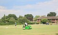 Rolling the Pitch - geograph.org.uk - 5047865.jpg 1,024 × 621; 153 KB
-
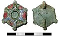 Roman, Enamelled plate brooch (FindID 573057).jpg 2,719 × 1,660; 2.3 MB
-
 Rough pasture south of Greathouse Cottage - geograph.org.uk - 2600874.jpg 3,648 × 2,736; 2.14 MB
-
 Rushall Copse - geograph.org.uk - 2325258.jpg 640 × 480; 84 KB
-
 Rushall Copse - geograph.org.uk - 2325305.jpg 640 × 480; 90 KB


_near_Ashampstead_and_Bradfield_-_geograph.org.uk_-_18548.jpg)


_feeding_at_buddleia_(1)_-_geograph.org.uk_-_5463557.jpg)
_feeding_at_buddleia_(2)_-_geograph.org.uk_-_5467394.jpg)


.jpg)


