Category:December 2009 in the East Riding of Yorkshire
Ceremonial counties of England: Bedfordshire · Berkshire · Buckinghamshire · Cambridgeshire · Cheshire · Cornwall · Cumbria · Derbyshire · Devon · Dorset · Durham · East Riding of Yorkshire · East Sussex · Essex · Gloucestershire · Greater London · Greater Manchester · Hampshire · Herefordshire · Hertfordshire · Isle of Wight · Kent · Lancashire · Leicestershire · Lincolnshire · Merseyside · Norfolk · North Yorkshire · Northamptonshire · Northumberland · Nottinghamshire · Oxfordshire · Rutland · Shropshire · Somerset · South Yorkshire · Staffordshire · Suffolk · Surrey · Tyne and Wear · Warwickshire · West Midlands · West Sussex · West Yorkshire · Wiltshire · Worcestershire
City-counties: Bristol ·
Former historic counties:
Other former counties:
City-counties: Bristol ·
Former historic counties:
Other former counties:
Deutsch: Bilder, die im Dezember 2009 in the East Riding of Yorkshire aufgenommen worden sind. Bitte beachten Sie, dass dies weder das Datum des Uploads noch das Datum des Scannens eines Fotos ist.
English: Images/pictures taken in the East Riding of Yorkshire during December 2009. Note this is not the date of the upload, nor the date a photo was scanned.
Español: Fotografías o imágenes tomadas en the East Riding of Yorkshire durante diciembre 2009. No es la fecha de subida ni escaneo, sino la fecha en que las fotografías o imágenes se crearon.
Esperanto: Bildoj faritaj en the East Riding of Yorkshire en decembro 2009. Tio ne estas la dato, kiam la bildoj estis alŝutitaj aŭ skanitaj.
Français : Photographies ou images prises en the East Riding of Yorkshire durant décembre 2009. Ce n'est pas la date du téléchargement ou du scan.
Galego: Fotografías ou imaxes tomadas en the East Riding of Yorkshire durante decembro 2009. Non é a data de subida nin escaneamento, senón a data na que se crearon as fotografías ou imaxes.
Italiano: Fotografie o immagini scattate a the East Riding of Yorkshire nel dicembre 2009. Nota bene: la data non si riferisce né a quella di upload né a quella in cui la foto è stata digitalizzata.
Norsk bokmål: Bilder tatt i the East Riding of Yorkshire i løpet av desember 2009. Merk at dette ikke er datoen for opplasting, eller når et bilde har blitt skannet.
Norsk nynorsk: Bilete teke i the East Riding of Yorkshire i løpet av desember 2009. Merk at dette ikkje er datoen for opplasting, eller når eit bilete har vorte skanna.
Русский: Изображения, сделанные в the East Riding of Yorkshire в течение декабрь 2009 (не дата загрузки изображения).
Українська: Зображення, зроблені в the East Riding of Yorkshire протягом грудень 2009. Зауважте, що це не дата завантаження чи дата сканування фотографії.
| December 2008 | ← | December 2009 | → | December 2010 | |||||||
| Jan | Feb | Mar | Apr | May | Jun | Jul | Aug | Sep | Oct | Nov | Dec |
| 148 | 203 | 903 | 767 | 930 | 718 | 783 | 588 | 336 | 712 | 202 | 287 |
|---|---|---|---|---|---|---|---|---|---|---|---|
Media in category "December 2009 in the East Riding of Yorkshire"
The following 200 files are in this category, out of 287 total.
(previous page) (next page)-
 10-11 Churchside - geograph.org.uk - 1635045.jpg 640 × 426; 84 KB
-
 2 Churchside - geograph.org.uk - 1635062.jpg 426 × 640; 52 KB
-
 Brough Road, South Cave (A1034) - geograph.org.uk - 1602181.jpg 640 × 480; 88 KB
-
 South Cave Town Hall - geograph.org.uk - 1601851.jpg 480 × 640; 70 KB
-
 Common Road - geograph.org.uk - 1603753.jpg 640 × 480; 44 KB
-
 Crabley Lane - geograph.org.uk - 1603274.jpg 640 × 480; 61 KB
-
 Mill Beck - geograph.org.uk - 1603261.jpg 640 × 480; 86 KB
-
 Pond and Greenhouses - geograph.org.uk - 1603260.jpg 640 × 480; 77 KB
-
 Pylons near Ings Lane - geograph.org.uk - 1603269.jpg 480 × 640; 38 KB
-
 South Cave looking north. - geograph.org.uk - 1640542.jpg 640 × 480; 61 KB
-
 A frozen village pond December 2009. Wetwang (geograph 6748781).jpg 4,000 × 3,000; 2.63 MB
-
 A1034 towards Sancton - geograph.org.uk - 1602124.jpg 640 × 480; 58 KB
-
 A1034 towards South Cave - geograph.org.uk - 1602099.jpg 640 × 480; 102 KB
-
 A1034 towards South Cave - geograph.org.uk - 1602164.jpg 640 × 480; 55 KB
-
 A614, Howden - geograph.org.uk - 1633182.jpg 640 × 480; 54 KB
-
 A63 towards Hull - geograph.org.uk - 1604689.jpg 640 × 480; 62 KB
-
 Aircraft Factory Brough.jpg 640 × 480; 47 KB
-
 All Saints Church - geograph.org.uk - 1601865.jpg 640 × 480; 91 KB
-
 All Saints Church Driffield 1.jpg 1,704 × 2,272; 816 KB
-
 All Saints Church Driffield 2.jpg 1,704 × 2,272; 1.17 MB
-
 Avenue of Trees near Ellerker - geograph.org.uk - 1603225.jpg 640 × 480; 88 KB
-
 B1230 towards Gilberdyke - geograph.org.uk - 1603722.jpg 640 × 480; 46 KB
-
 B1230 towards Howden - geograph.org.uk - 1603714.jpg 640 × 480; 58 KB
-
 B1230 towards North Cave - geograph.org.uk - 1603735.jpg 640 × 480; 91 KB
-
 Beckside Wilberfoss - geograph.org.uk - 1610408.jpg 640 × 480; 119 KB
-
 Beckside Wilberfoss - geograph.org.uk - 1610471.jpg 640 × 480; 73 KB
-
 Bennetland Lane.jpg 640 × 480; 102 KB
-
 Berthing Up - geograph.org.uk - 1637078.jpg 640 × 332; 35 KB
-
 Beverley Minster - panoramio.jpg 1,000 × 592; 322 KB
-
 Bishop's Manor - geograph.org.uk - 1635074.jpg 640 × 426; 82 KB
-
 Blacktoft Channel - geograph.org.uk - 1603486.jpg 640 × 480; 71 KB
-
 Blacktoft Channel - geograph.org.uk - 1603669.jpg 640 × 480; 47 KB
-
 Blacktoft Parish Church - geograph.org.uk - 1603661.jpg 640 × 480; 93 KB
-
 Blacktoft Warping Drain - geograph.org.uk - 1603666.jpg 640 × 480; 95 KB
-
 St. Mary's Church, Brandesburton - geograph.org.uk - 1637268.jpg 640 × 480; 69 KB
-
 Brandesburton - geograph.org.uk - 1637261.jpg 640 × 480; 85 KB
-
 Brandesburton in the snow - geograph.org.uk - 1637255.jpg 640 × 480; 91 KB
-
 Bridleway to Wholsea Grange - geograph.org.uk - 1601978.jpg 640 × 480; 81 KB
-
 Bridleway, Hotham Carrs - geograph.org.uk - 1601974.jpg 640 × 480; 127 KB
-
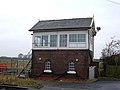
 Broomfleet Signal Box.jpg 640 × 480; 60 KB
-
 Broomfleet Station - geograph.org.uk - 1603316.jpg 640 × 480; 46 KB
-
 Brough Golf Club House - geograph.org.uk - 1604544.jpg 640 × 480; 72 KB
-
 Brough Golf Course - geograph.org.uk - 1604603.jpg 640 × 480; 61 KB
-
 Brough Railway Station - geograph.org.uk - 1604550.jpg 640 × 480; 53 KB
-
 Brough Roads, River Humber - geograph.org.uk - 1604557.jpg 640 × 480; 41 KB
-
 Burton Pidsea Primary School.JPG 2,272 × 1,704; 1.44 MB
-
 California Gardens, Howden - geograph.org.uk - 1633181.jpg 640 × 433; 46 KB
-
 Carr Dike - geograph.org.uk - 1601982.jpg 640 × 480; 120 KB
-
 Castle Drive, South Cave - geograph.org.uk - 1601859.jpg 640 × 480; 59 KB
-
 Cave Level Crossing - geograph.org.uk - 1603301.jpg 640 × 480; 37 KB
-
 Cave Road, Elloughton - geograph.org.uk - 1604538.jpg 640 × 480; 65 KB
-
 Chapter House - geograph.org.uk - 1635104.jpg 426 × 640; 62 KB
-
 Church Lane, Brandesburton - geograph.org.uk - 1637263.jpg 640 × 480; 67 KB
-
 Churchside - geograph.org.uk - 1635014.jpg 640 × 426; 80 KB
-
 Churchside - geograph.org.uk - 1635077.jpg 426 × 640; 60 KB
-
 Common Lane - geograph.org.uk - 1604563.jpg 640 × 480; 116 KB
-
 Cool Reflection - geograph.org.uk - 1605672.jpg 480 × 640; 81 KB
-
 Disused Farm Building, Ings Lane - geograph.org.uk - 1603282.jpg 640 × 480; 92 KB
-
 Dot Hill Farm - geograph.org.uk - 1602134.jpg 640 × 480; 53 KB
-
 Drain beside Greenoak Lane - geograph.org.uk - 1603702.jpg 640 × 480; 79 KB
-
 Drain beside Old Lane - geograph.org.uk - 1603678.jpg 640 × 480; 88 KB
-
 Driffield CofE VC Primary School 1.jpg 2,272 × 1,704; 880 KB
-
 Driffield CofE VC Primary School 2.jpg 2,272 × 1,704; 783 KB
-
 Driffield Methodist Church.jpg 2,272 × 1,704; 738 KB
-
 Dutch River at Low Tide - geograph.org.uk - 1638118.jpg 640 × 480; 57 KB
-
 Electricity Pylon - geograph.org.uk - 1604522.jpg 640 × 480; 32 KB
-
 Electricity Pylon, Tongue Lane - geograph.org.uk - 1603558.jpg 516 × 640; 46 KB
-
 Electricity Pylons - geograph.org.uk - 1603380.jpg 640 × 480; 36 KB
-
 Electricity Pylons - geograph.org.uk - 1603672.jpg 487 × 640; 38 KB
-
 Ellerker Beck - geograph.org.uk - 1603210.jpg 640 × 480; 113 KB
-
 Elloughton Hill Farm - geograph.org.uk - 1604629.jpg 640 × 480; 44 KB
-
 Elloughton Road - geograph.org.uk - 1604607.jpg 640 × 480; 80 KB
-
 Elloughton United Reformed Church - geograph.org.uk - 1604616.jpg 640 × 480; 76 KB
-
 Entrance to Everthorpe Prison.jpg 640 × 480; 63 KB
-
 Far Drain Scalby.jpg 640 × 480; 120 KB
-
 Farm Building, Carr Farm - geograph.org.uk - 1601987.jpg 640 × 480; 70 KB
-
 Farm Building, Newton - geograph.org.uk - 1603606.jpg 640 × 480; 78 KB
-
 Farm Building, South Farm - geograph.org.uk - 1602059.jpg 640 × 480; 65 KB
-
 Farm Track by Snake Hall Plantation - geograph.org.uk - 1601969.jpg 640 × 480; 96 KB
-
 Farm Track near Elloughton - geograph.org.uk - 1604533.jpg 640 × 480; 55 KB
-
 Farm Track near Hotham - geograph.org.uk - 1602082.jpg 640 × 480; 98 KB
-
 Farm Track South of Ellerker - geograph.org.uk - 1603245.jpg 640 × 480; 69 KB
-
 Farm Track, South Cliffe Common - geograph.org.uk - 1601997.jpg 640 × 480; 83 KB
-
 Farmland East of Staddlethorpe - geograph.org.uk - 1603540.jpg 640 × 480; 41 KB
-
 Farmland near Ellerker - geograph.org.uk - 1603220.jpg 640 × 480; 64 KB
-
 Farmland near Hotham - geograph.org.uk - 1602087.jpg 640 × 480; 78 KB
-
 Farmland off Cliffe Road - geograph.org.uk - 1602052.jpg 640 × 480; 59 KB
-
 Faxfleet Grange - geograph.org.uk - 1603409.jpg 640 × 480; 105 KB
-
 Field Drain - geograph.org.uk - 1603527.jpg 640 × 480; 95 KB
-
 Field Drain off Sands Lane - geograph.org.uk - 1603230.jpg 640 × 480; 62 KB
-
 Field Entrance off Cliffe Road - geograph.org.uk - 1602045.jpg 640 × 480; 110 KB
-
 Fishing in the Humber - geograph.org.uk - 1637069.jpg 530 × 640; 83 KB
-
 Footbridge (and Cycleway) over A63 - geograph.org.uk - 1604683.jpg 640 × 480; 73 KB
-
 Footbridge over the B1230 at Newport.jpg 640 × 480; 78 KB
-
 Footpath near Broomfleet - geograph.org.uk - 1603348.jpg 640 × 480; 84 KB
-
 Footpath near Providence Farm - geograph.org.uk - 1603288.jpg 640 × 480; 90 KB
-
 Frosty Pylon at Wilberfoss - geograph.org.uk - 1726216.jpg 1,744 × 1,308; 847 KB
-
 Frozen Field - geograph.org.uk - 1633450.jpg 640 × 396; 63 KB
-
 Futile Bricks - geograph.org.uk - 1635233.jpg 555 × 640; 131 KB
-
 Gated Farm Track, Elloughton Wold - geograph.org.uk - 1604634.jpg 640 × 480; 112 KB
-
 Gated Field Entrance, Carr Farm - geograph.org.uk - 1601989.jpg 640 × 480; 86 KB
-

-
 Gilberdyke Railway Junction - geograph.org.uk - 1603634.jpg 640 × 480; 86 KB
-
 Gilberdyke Railway Station.jpg 640 × 480; 55 KB
-
 Gilberdyke Railway Station2.jpg 640 × 480; 62 KB
-
 Golden Slumbers (4195434464).jpg 3,000 × 1,995; 3.85 MB
-
 Grange Farm near Broomfleet - geograph.org.uk - 1603327.jpg 640 × 480; 51 KB
-
 Green and serene, Little Driffield - geograph.org.uk - 1614841.jpg 640 × 427; 310 KB
-
 Greenoak Goit Drain - geograph.org.uk - 1603697.jpg 640 × 480; 78 KB
-
 Havenside in the Snow - geograph.org.uk - 1633478.jpg 640 × 480; 125 KB
-
 Havenside in the Snow - geograph.org.uk - 1633490.jpg 480 × 640; 112 KB
-
 Hedgerow and Field - geograph.org.uk - 1604518.jpg 640 × 480; 45 KB
-
 Hedon Church Windows - geograph.org.uk - 1627967.jpg 640 × 624; 175 KB
-
 Hedon Fish and Chip Shop - geograph.org.uk - 1611568.jpg 640 × 430; 52 KB
-
 High Road, Elloughton - geograph.org.uk - 1604624.jpg 640 × 480; 61 KB
-
 Holms Lane to Timber Top Farm - geograph.org.uk - 1602107.jpg 640 × 480; 91 KB
-
 Hotham Arms.jpg 640 × 517; 86 KB
-
 Houses in Danthorpe.JPG 2,272 × 1,704; 1.1 MB
-
 Houses on Humber Crescent - geograph.org.uk - 1604596.jpg 640 × 480; 64 KB
-
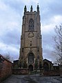
 Howden Minster - geograph.org.uk - 1623729.jpg 426 × 640; 75 KB
-
 Howden Minster - geograph.org.uk - 1618326.jpg 426 × 640; 75 KB
-
 Howden Minster - geograph.org.uk - 1623721.jpg 426 × 640; 83 KB
-
 Howden Minster choir - geograph.org.uk - 1635150.jpg 426 × 640; 94 KB
-
 Howden Minster nave - geograph.org.uk - 1623733.jpg 640 × 426; 75 KB
-
 Howden Minster nave - geograph.org.uk - 1623734.jpg 426 × 640; 70 KB
-
 Howden Minster pulpitum - geograph.org.uk - 1624978.jpg 640 × 426; 82 KB
-
 Hutt Farm - geograph.org.uk - 1601966.jpg 640 × 480; 78 KB
-
 Jack Russell - Eddi - panoramio (2).jpg 1,200 × 1,600; 384 KB
-
 Jarret Hill Lane - geograph.org.uk - 1603759.jpg 640 × 480; 72 KB
-
 Keeping Track - geograph.org.uk - 1633466.jpg 640 × 495; 152 KB
-
 Lake, South Cave - geograph.org.uk - 1601878.jpg 640 × 480; 81 KB
-
 Lane beside Market Weighton Canal - geograph.org.uk - 1603365.jpg 640 × 480; 95 KB
-
 Little Chef - geograph.org.uk - 1601835.jpg 640 × 480; 83 KB
-
 Lonely looking sky (4170660046).jpg 2,002 × 3,000; 3.49 MB
-
 Long Plantation - geograph.org.uk - 1604753.jpg 640 × 480; 65 KB
-
 Looking towards the William Wright Dock - geograph.org.uk - 1612744.jpg 609 × 640; 390 KB
-
 Low Field Farm - geograph.org.uk - 1602122.jpg 640 × 480; 68 KB
-
 Low Road to Everthorpe - geograph.org.uk - 1601906.jpg 640 × 480; 74 KB
-
 Low South Field - geograph.org.uk - 1602167.jpg 640 × 480; 69 KB
-
 Manor Road South Cliffe.jpg 640 × 480; 95 KB
-
 Melton Bridge, Brickyard Lane - geograph.org.uk - 1604774.jpg 640 × 480; 56 KB
-
 Melton Crossing Signal Box - geograph.org.uk - 1604697.jpg 640 × 480; 56 KB
-
 Melton Level Crossing - geograph.org.uk - 1604692.jpg 640 × 480; 75 KB
-
 Merryman Garth in Hedon - geograph.org.uk - 1633440.jpg 640 × 480; 121 KB
-
 Mill Farm, Yokefleet - geograph.org.uk - 1603685.jpg 640 × 480; 74 KB
-
 Minor Road near Everthorpe - geograph.org.uk - 1601911.jpg 640 × 480; 83 KB
-
 Minor Road to North Cave - geograph.org.uk - 1601917.jpg 640 × 480; 91 KB
-
 Minor Road towards Blacktoft - geograph.org.uk - 1603459.jpg 640 × 480; 59 KB
-
 Minor Road towards Gilberdyke - geograph.org.uk - 1603704.jpg 640 × 480; 68 KB
-
 Minor Road, Elloughton Wold - geograph.org.uk - 1604639.jpg 640 × 480; 71 KB
-
 Mirrored in the Mud - geograph.org.uk - 1602104.jpg 593 × 640; 161 KB
-
 Mobile Phone Mast, Hotham Road - geograph.org.uk - 1601928.jpg 480 × 640; 55 KB
-
 Mudflat, Redcliff Channel - geograph.org.uk - 1604730.jpg 640 × 480; 76 KB
-
 Navigation Beacon Faxfleet Ness.jpg 480 × 640; 46 KB
-
 Newbald Moor - geograph.org.uk - 1602112.jpg 640 × 480; 58 KB
-
 Newfield Lane - geograph.org.uk - 1601894.jpg 640 × 480; 75 KB
-
 North Cave Beck - geograph.org.uk - 1601922.jpg 640 × 480; 135 KB
-
 North Cave Wetlands Nature Reserve - geograph.org.uk - 1601946.jpg 640 × 480; 74 KB
-
 St Nicholas Church North Newbald.jpg 640 × 480; 101 KB
-
 Nursery Greenhouses - geograph.org.uk - 1603646.jpg 640 × 480; 111 KB
-
 Nursery Greenhouses, Ellerker - geograph.org.uk - 1603199.jpg 640 × 480; 47 KB
-
 Off to the Shops - geograph.org.uk - 1627970.jpg 480 × 640; 89 KB
-
 Ouse Bridge - geograph.org.uk - 1612731.jpg 640 × 426; 50 KB
-
 Oxmardyke Lane - geograph.org.uk - 1603583.jpg 640 × 480; 67 KB
-
 Oxmardyke Level Crossing - geograph.org.uk - 1603592.jpg 640 × 480; 45 KB
-
 Oxmardyke Signal Box - geograph.org.uk - 1603601.jpg 640 × 480; 76 KB
-
 Padcroft Lane near Hotham - geograph.org.uk - 1602092.jpg 640 × 480; 77 KB
-
 Path through North Cave Wetlands - geograph.org.uk - 1601942.jpg 640 × 480; 123 KB
-
 Pauper's coffin - geograph.org.uk - 1624985.jpg 640 × 426; 73 KB
-
 Pocklington - geograph.org.uk - 1613778.jpg 640 × 480; 87 KB
-
 Pocklington Fire Station.jpg 640 × 427; 198 KB
-
 Pool Beck - geograph.org.uk - 1604565.jpg 640 × 480; 98 KB
-
 Premier Inn, Junction 36, M62 - geograph.org.uk - 1633205.jpg 640 × 462; 58 KB
-
 Primitive Methodist Church Bewholme.jpg 2,272 × 1,704; 1.02 MB
-
 Primitive Methodist Church Elstronwick.JPG 2,272 × 1,704; 970 KB
-
 Railway Crossing Gate - geograph.org.uk - 1603341.jpg 640 × 480; 123 KB
-
 Railway Line towards Hull - geograph.org.uk - 1603334.jpg 640 × 480; 74 KB
-
 Railway Line towards Hull - geograph.org.uk - 1604780.jpg 640 × 480; 83 KB
-
 Railway towards Hull - geograph.org.uk - 1603306.jpg 640 × 480; 70 KB
-
 Red Cliff - geograph.org.uk - 1604745.jpg 640 × 480; 80 KB
-
 Redcliff Channel - geograph.org.uk - 1604721.jpg 640 × 480; 62 KB
-
 Redcliff Channel - geograph.org.uk - 1604737.jpg 640 × 479; 55 KB
-
 River Humber - geograph.org.uk - 1604709.jpg 640 × 480; 98 KB
-
 River Ouse Floodbank - geograph.org.uk - 1603480.jpg 640 × 480; 73 KB
-
 River Ouse South of Mill Farm - geograph.org.uk - 1603687.jpg 640 × 480; 38 KB
-
 Riverside Farm - geograph.org.uk - 1603442.jpg 640 × 480; 97 KB
-
 Road Junction, Near Welton - geograph.org.uk - 1604590.jpg 640 × 480; 56 KB
-
 Saltmarsh Grange - geograph.org.uk - 1603742.jpg 640 × 459; 65 KB
-
 Sands Drain - geograph.org.uk - 1603238.jpg 640 × 480; 69 KB
-
 Sands Drain - geograph.org.uk - 1603247.jpg 640 × 480; 62 KB
-
 Sands Lane, Ellerker - geograph.org.uk - 1603215.jpg 640 × 480; 79 KB
-
 Scalby Lane.jpg 640 × 480; 75 KB
-
 Service Station off the A63 - geograph.org.uk - 1603739.jpg 640 × 480; 63 KB
-
 Service Station, A63 Eastbound - geograph.org.uk - 1601838.jpg 640 × 480; 61 KB
-
 Service Station, A63 Westbound - geograph.org.uk - 1603767.jpg 640 × 461; 56 KB
-
 Service Station, Welton Road - geograph.org.uk - 1604598.jpg 640 × 480; 96 KB
-
 Sewerby Bridlington England East Yorkshire.jpg 1,995 × 3,000; 5.98 MB
-
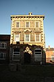
 Shire Hall - geograph.org.uk - 1635161.jpg 640 × 426; 56 KB
-
 Signal Box, Welton Crossing - geograph.org.uk - 1604585.jpg 640 × 480; 62 KB
-
 Sir John Metham - geograph.org.uk - 1624996.jpg 640 × 426; 81 KB


_-_geograph.org.uk_-_1602181.jpg)


.jpg)


_over_A63_-_geograph.org.uk_-_1604683.jpg)


.jpg)


.jpg)


.jpg)


