Category:Dover District
local government district in Kent, England, UK    | |||||
| Upload media | |||||
| Instance of | |||||
|---|---|---|---|---|---|
| Location | Kent, South East England, England | ||||
| Legislative body |
| ||||
| Inception |
| ||||
| Population |
| ||||
| Area |
| ||||
| Elevation above sea level |
| ||||
| Different from | |||||
| official website | |||||
 | |||||
Subcategories
This category has the following 40 subcategories, out of 40 total.
Media in category "Dover District"
The following 9 files are in this category, out of 9 total.
-
 Coat of arms of Dover District Council.svg 1,100 × 1,140; 588 KB
-
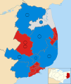 Dover UK ward map 2023.svg 1,066 × 1,266; 410 KB
-
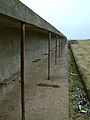 Range Butts - panoramio.jpg 1,536 × 2,048; 1.13 MB
-
 Rifle Range Butts (minus target frames) - panoramio.jpg 2,048 × 1,536; 1.23 MB
-
 Sigrún Þuríður.jpg 3,264 × 2,448; 2.03 MB
-
 Sr Margarets bay - panoramio.jpg 3,072 × 1,824; 1.58 MB
-
 St Margaret's at Cliffe - Kingsdown road - panoramio.jpg 570 × 760; 307 KB
-
 The red Lion, Wingham - panoramio.jpg 1,200 × 900; 374 KB
-
 UK Dover Council 2019.svg 360 × 185; 2 KB


_-_panoramio.jpg)


