Category:East Hampshire District
local government district in Hampshire, England  | |||||
| Upload media | |||||
| Instance of | |||||
|---|---|---|---|---|---|
| Location | Hampshire, South East England, England | ||||
| Capital | |||||
| Legislative body |
| ||||
| Population |
| ||||
| Area |
| ||||
| Different from | |||||
| official website | |||||
 | |||||
Subcategories
This category has the following 45 subcategories, out of 45 total.
A
B
C
E
F
G
H
K
M
N
O
P
R
S
W
Media in category "East Hampshire District"
The following 49 files are in this category, out of 49 total.
-
 A lovely place this - geograph.org.uk - 1370958.jpg 360 × 640; 69 KB
-
 Alton Rural District Council Notice - geograph.org.uk - 1576435.jpg 640 × 480; 167 KB
-

-
 Bentley Signal Box - geograph.org.uk - 669908.jpg 640 × 414; 70 KB
-
-

-
-

-
 East Hampshire Council Election 2023.svg 530 × 670; 153 KB
-

-
 East Hampshire District Council Composition 2023.svg 360 × 185; 4 KB
-
 East Meon - geograph.org.uk - 1234990.jpg 640 × 480; 43 KB
-
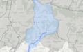 EMS water body.png 706 × 446; 280 KB
-

-
 Entrance to Inadown Riding School - panoramio.jpg 1,024 × 683; 602 KB
-
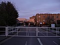 Entrance to Southdowns College - geograph.org.uk - 1245178.jpg 640 × 480; 69 KB
-
 Entrance to Southdowns College - geograph.org.uk - 1245182.jpg 640 × 480; 66 KB
-
 Frozen pond at East Tisted (geograph 5690384).jpg 640 × 427; 117 KB
-
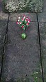 GeorgeIvesgraveBentworth.jpg 1,080 × 1,920; 740 KB
-

-

-

-
 Looking towards Petersfield - panoramio.jpg 1,024 × 768; 255 KB
-
 Main block at South Downs College - geograph.org.uk - 753220.jpg 640 × 480; 85 KB
-
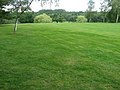 Meon Valley golf course - geograph.org.uk - 1358065.jpg 640 × 480; 131 KB
-
 Meon Valley Trail - geograph.org.uk - 830383.jpg 640 × 426; 101 KB
-
 Meon Valley Trail - geograph.org.uk - 830461.jpg 640 × 426; 136 KB
-
 Pastureland near College Road - geograph.org.uk - 753255.jpg 640 × 480; 35 KB
-
 Pond^ - geograph.org.uk - 514475.jpg 640 × 480; 141 KB
-
 Postbox in Castle Road - geograph.org.uk - 1114885.jpg 640 × 480; 96 KB
-
 Postbox in Finchdean Road - geograph.org.uk - 1230476.jpg 640 × 480; 118 KB
-
 Postbox in Hawkley Road - geograph.org.uk - 1321882.jpg 640 × 480; 67 KB
-
 Postbox, Lower Bordean - geograph.org.uk - 1624918.jpg 480 × 640; 191 KB
-
 River beside High Street, East Meon (geograph 5805272).jpg 1,024 × 683; 270 KB
-
 Sign Post at Newton Valence - panoramio.jpg 1,024 × 683; 998 KB
-
 Small car park in Vine Coppice - geograph.org.uk - 1609882.jpg 640 × 480; 55 KB
-
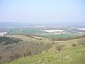
 South Downs - panoramio - Alistair Cunningham (1).jpg 1,024 × 768; 367 KB
-
 South Downs - panoramio - Alistair Cunningham.jpg 1,024 × 768; 403 KB
-
 South Downs - panoramio.jpg 1,024 × 768; 285 KB
-
 St John's Avenue - geograph.org.uk - 1551997.jpg 640 × 480; 47 KB
-
 Stables to Westbury House (geograph 3247818).jpg 3,648 × 2,432; 2.42 MB
-

-
 The Old Post - panoramio.jpg 1,536 × 2,048; 619 KB
-
 The Round House - panoramio.jpg 1,536 × 2,048; 837 KB
-
 There by the grace of God go I - panoramio.jpg 2,048 × 1,536; 712 KB
-
 UK East Hampshire Council 2019.svg 360 × 185; 3 KB
-
 View Down Brightstone Lane - Four Marks to Lower Farringdon - panoramio.jpg 1,024 × 683; 672 KB
-
 View over Inadown Riding School - panoramio.jpg 1,024 × 683; 587 KB
-
 View Over Ropley Field - panoramio.jpg 1,024 × 768; 574 KB


.jpg)


.jpg)


.jpg)


.jpg)


