Category:Headley, East Hampshire
village and civil parish in East Hampshire, UK  | |||||
| Upload media | |||||
| Instance of | |||||
|---|---|---|---|---|---|
| Location | East Hampshire, Hampshire, South East England, England | ||||
 | |||||
English: Headley is a village and civil parish in the East Hampshire district of Hampshire, England. It is 1.8 miles (2.9 km) east of Bordon on the B3002 road.
Subcategories
This category has the following 6 subcategories, out of 6 total.
Media in category "Headley, East Hampshire"
The following 179 files are in this category, out of 179 total.
-
 2016, a year on Geograph (Day 17) - geograph.org.uk - 4795795.jpg 640 × 480; 44 KB
-
 A gloomy bridleway - geograph.org.uk - 4808232.jpg 640 × 480; 154 KB
-
 A325 - Sleaford - geograph.org.uk - 2339056.jpg 800 × 534; 100 KB
-
 All Saints Church Clock in Headley, Hampshire - geograph.org.uk - 6260067.jpg 4,608 × 3,456; 2.9 MB
-
 All Saints Church Door in Headley, Hampshire - geograph.org.uk - 6260059.jpg 3,092 × 4,144; 2.33 MB
-
 All Saints Church in Headley, Hampshire - geograph.org.uk - 6259124.jpg 4,602 × 3,448; 2.68 MB
-
 All Saints Church in Headley, Hampshire - geograph.org.uk - 6259278.jpg 4,608 × 3,456; 2.17 MB
-
 All Saints Church in Headley, Hampshire - geograph.org.uk - 6260064.jpg 3,208 × 4,274; 2.36 MB
-

-
 All Saints Churchyard (10) - geograph.org.uk - 4796373.jpg 480 × 640; 74 KB
-
 All Saints Churchyard (10) - geograph.org.uk - 4796374.jpg 471 × 640; 86 KB
-
 All Saints Churchyard (6) - geograph.org.uk - 4796367.jpg 640 × 480; 76 KB
-
 All Saints Churchyard (7) - geograph.org.uk - 4796369.jpg 640 × 480; 71 KB
-
 All Saints Churchyard (8) - geograph.org.uk - 4796370.jpg 480 × 640; 128 KB
-
 All Saints Churchyard (9) - geograph.org.uk - 4796372.jpg 480 × 640; 66 KB
-
 All Saints, Headley, altar - geograph.org.uk - 4796361.jpg 465 × 640; 61 KB
-
 All Saints, Headley, banner - geograph.org.uk - 4796359.jpg 480 × 640; 57 KB
-

-
 All Saints, Headley, flags - geograph.org.uk - 4796356.jpg 640 × 480; 64 KB
-
 All Saints, Headley, font - geograph.org.uk - 4796358.jpg 640 × 472; 50 KB
-
 All Saints, Headley, memorial (i) - geograph.org.uk - 4796343.jpg 640 × 480; 71 KB
-
 All Saints, Headley, memorial (ii) - geograph.org.uk - 4796345.jpg 480 × 640; 55 KB
-
 All Saints, Headley, memorial (iii) - geograph.org.uk - 4796350.jpg 480 × 640; 58 KB
-
 All Saints, Headley, memorial (iv) - geograph.org.uk - 4796351.jpg 640 × 470; 32 KB
-
 All Saints, Headley, memorial (v) - geograph.org.uk - 4796352.jpg 640 × 480; 53 KB
-
 All Saints, Headley, memorial (vi) - geograph.org.uk - 4796354.jpg 480 × 640; 42 KB
-
 All Saints, Headley, memorial (vii) - geograph.org.uk - 4796355.jpg 640 × 480; 53 KB
-
 All Saints, Headley, prayer desk - geograph.org.uk - 4796357.jpg 640 × 480; 43 KB
-

-

-

-
 Appletree Cottage, Headley - geograph.org.uk - 3936475.jpg 1,518 × 1,135; 448 KB
-
 Arford Common, Berberis Julianae - geograph.org.uk - 4971311.jpg 3,678 × 2,456; 5 MB
-
 Arford Common, Clematis - geograph.org.uk - 4971300.jpg 3,679 × 2,456; 3.85 MB
-
 Arford Common, Filipendula - geograph.org.uk - 4971307.jpg 3,679 × 2,456; 5.82 MB
-
 Arford Common, Iris - geograph.org.uk - 4971303.jpg 3,679 × 2,456; 2.98 MB
-
 Arford Common, Rosa "Geoff Hamilton" - geograph.org.uk - 4971306.jpg 2,452 × 1,639; 1.9 MB
-
 Arford Common, Rosa "Rhapsody in Blue" - geograph.org.uk - 4971315.jpg 3,966 × 2,782; 5.45 MB
-
 Bacon Lane - geograph.org.uk - 4018489.jpg 640 × 480; 218 KB
-
 Barford Mill - geograph.org.uk - 2856678.jpg 4,288 × 3,216; 3.59 MB
-
 Barford, Hampshire - geograph.org.uk - 2856613.jpg 3,216 × 4,288; 3.65 MB
-
 Beech Hill Garage, Headley Down - geograph.org.uk - 4367470.jpg 639 × 467; 124 KB
-
 Bend on Standford Lane, Lindford - geograph.org.uk - 4367293.jpg 640 × 480; 233 KB
-

-
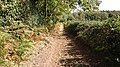
 Bridleway towards Picketts Hill - geograph.org.uk - 4807952.jpg 640 × 480; 176 KB
-
 Broxhead Cricket Pavilion - geograph.org.uk - 5931130.jpg 2,721 × 1,908; 2.31 MB
-
 Car park on Ludshott Common - geograph.org.uk - 4367513.jpg 640 × 480; 221 KB
-
 Cat outside the café at Headley - geograph.org.uk - 1709904.jpg 480 × 640; 80 KB
-
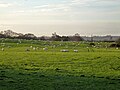
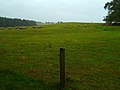
 Cattle in field near Headley Park - geograph.org.uk - 5371860.jpg 800 × 600; 192 KB
-
 Churchgate House, Headley - geograph.org.uk - 3799244.jpg 3,264 × 2,448; 1.62 MB
-
 Churt Meets Barford - geograph.org.uk - 2856596.jpg 4,288 × 3,216; 3.66 MB
-
 Churt Road - geograph.org.uk - 4809278.jpg 640 × 480; 204 KB
-
 Circular seat at Headley - geograph.org.uk - 1709861.jpg 640 × 480; 103 KB
-
 Coniferous woodland - geograph.org.uk - 4018423.jpg 640 × 480; 218 KB
-
 Crabtree Studios, Headley - geograph.org.uk - 3936443.jpg 2,374 × 1,744; 599 KB
-

-
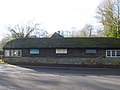
 Disused battery sheds for rearing chickens - geograph.org.uk - 5931117.jpg 2,769 × 1,952; 1.89 MB
-
 Entering Grayshott on Grayshott Road - geograph.org.uk - 4367512.jpg 640 × 480; 205 KB
-
 Entrance path onto Broxhead Common - geograph.org.uk - 5929257.jpg 3,376 × 2,160; 3.71 MB
-
 Entrance to Ludshott Common - geograph.org.uk - 4367514.jpg 640 × 480; 295 KB
-
 Exposed sand, Broxhead Common - geograph.org.uk - 4807910.jpg 640 × 480; 105 KB
-
 Farm road near Arford - geograph.org.uk - 1704813.jpg 800 × 600; 148 KB
-
 Fields east of Bacon Lane - geograph.org.uk - 4018510.jpg 640 × 480; 125 KB
-
 Flats on Grayshott Road, Headley Down - geograph.org.uk - 4367587.jpg 640 × 480; 279 KB
-
 Ford, Standford - geograph.org.uk - 4807834.jpg 640 × 480; 217 KB
-
 Former New Inn - geograph.org.uk - 3818525.jpg 2,797 × 1,975; 761 KB
-
 Frensham Lane, Hampshire - 180918 - geograph.org.uk - 5910269.jpg 4,608 × 3,456; 5.84 MB
-
 Fullers Vale pond 2023 (Tony Holkham).jpg 4,320 × 3,240; 4.64 MB
-
 Fullers Vale Wildlife Pond at Headley - geograph.org.uk - 1705025.jpg 800 × 684; 166 KB
-

-
 Gate into a sheep field - geograph.org.uk - 5928547.jpg 3,296 × 2,106; 3.58 MB
-
 Gate next to the path - geograph.org.uk - 5931087.jpg 3,109 × 2,121; 2.36 MB
-
 Gate on footpath - geograph.org.uk - 5931104.jpg 3,141 × 2,058; 3.16 MB
-
 Gate on the Shipwright's Way footpath - geograph.org.uk - 5928772.jpg 3,179 × 2,160; 3.73 MB
-
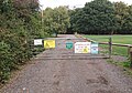
 Gate to Headley Nursery - geograph.org.uk - 5929250.jpg 3,840 × 2,160; 3.82 MB
-
 Gate to the Cricket Ground - geograph.org.uk - 5934526.jpg 2,776 × 1,934; 2.64 MB
-
 Gentles Lane - geograph.org.uk - 4807494.jpg 640 × 480; 201 KB
-
 Grayshott Road, Headley Down - geograph.org.uk - 4807506.jpg 640 × 480; 172 KB
-
 Grayshott Road, Headley Down - geograph.org.uk - 4807515.jpg 640 × 480; 197 KB
-
 Grazing sheep - geograph.org.uk - 4807926.jpg 640 × 480; 107 KB
-
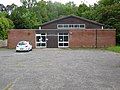
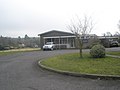 Headley Church Centre - geograph.org.uk - 1709906.jpg 640 × 480; 51 KB
-
 Headley Church Centre - geograph.org.uk - 3936429.jpg 3,264 × 2,448; 1.39 MB
-
 Headley Down Telephone Exchange (1) - geograph.org.uk - 4686704.jpg 3,648 × 2,736; 2.53 MB
-
 Headley Down Telephone Exchange (2) - geograph.org.uk - 4686717.jpg 3,648 × 2,736; 2.55 MB
-
 Headley Down, aerial 2017 - geograph.org.uk - 5444771.jpg 640 × 427; 68 KB
-
 Headley Fields - geograph.org.uk - 4807629.jpg 640 × 480; 202 KB
-
 Headley Fields - geograph.org.uk - 4807634.jpg 640 × 480; 147 KB
-
 Headley Grange - geograph.org.uk - 29789.jpg 640 × 428; 59 KB
-
 Headley K6 telephone kiosk.jpg 3,096 × 4,128; 5.48 MB
-
 Headley Mill - geograph.org.uk - 3807813.jpg 3,264 × 2,448; 2 MB
-
 Headley Mill - geograph.org.uk - 3807815.jpg 3,264 × 2,448; 3.04 MB
-
 Headley Mill - geograph.org.uk - 4807862.jpg 640 × 480; 155 KB
-
 Headley Mill Farm - geograph.org.uk - 3807818.jpg 2,733 × 1,700; 1.19 MB
-
 Headley Pharmacy and Badgerswood Surgery - geograph.org.uk - 3936472.jpg 1,575 × 1,181; 395 KB
-
 Headley Village Hall - geograph.org.uk - 1585305.jpg 640 × 360; 80 KB
-
 Hearn Vale at Headley - geograph.org.uk - 1705085.jpg 800 × 600; 169 KB
-
 Houses in Yeomans Place, Headley - geograph.org.uk - 3936448.jpg 3,264 × 2,448; 1.51 MB
-
 Junction of lanes near Headley Down - geograph.org.uk - 1705007.jpg 800 × 600; 140 KB
-
-
 Kay Crescent, Headley Down - geograph.org.uk - 2876949.jpg 800 × 600; 177 KB
-
 Kitts Lane - geograph.org.uk - 2856624.jpg 4,288 × 3,216; 3.51 MB
-
 Lane near Trottsford Farm - geograph.org.uk - 5371851.jpg 800 × 600; 190 KB
-

-
 Little Barn - geograph.org.uk - 3936470.jpg 3,264 × 2,448; 1.8 MB
-
 Looking along the Lindford Road - geograph.org.uk - 1709874.jpg 640 × 480; 83 KB
-
 Looking down Linden Road - geograph.org.uk - 4292813.jpg 640 × 427; 106 KB
-
 Many moles - geograph.org.uk - 4807922.jpg 640 × 480; 113 KB
-
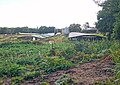
 Market Gardening at Headley - geograph.org.uk - 1411620.jpg 640 × 480; 240 KB
-
 Mill Dam, Whitmore Vale - geograph.org.uk - 2857813.jpg 4,288 × 3,216; 3.27 MB
-
 Mill Pond Dam, Barford - geograph.org.uk - 2857583.jpg 4,288 × 3,216; 3.45 MB
-
 Mill Pond, Barford - geograph.org.uk - 2857576.jpg 3,216 × 4,288; 3.86 MB
-
 New Inn Barn and Well Cottage - geograph.org.uk - 3793373.jpg 3,264 × 2,448; 1.68 MB
-
 Northern end of Carlton Road - geograph.org.uk - 2907613.jpg 640 × 482; 73 KB
-

-
 Notice by the lychgate of All Saints Church, Headley - geograph.org.uk - 5330855.jpg 2,592 × 1,944; 1.46 MB
-

-
 Old pit near Headley Park - geograph.org.uk - 4807959.jpg 640 × 480; 109 KB
-
 Old pit, Heath Hill - geograph.org.uk - 4018533.jpg 640 × 480; 279 KB
-
 Path between hedges - geograph.org.uk - 5928544.jpg 3,840 × 2,160; 5.06 MB
-
 Path into woodland at Headley Down - geograph.org.uk - 4292811.jpg 640 × 427; 139 KB
-
 Path onto Broxhead Common - geograph.org.uk - 5927919.jpg 3,278 × 2,146; 3.86 MB
-
 Path through Beech woodland - geograph.org.uk - 5933590.jpg 2,617 × 1,898; 2.65 MB
-
 Path towards Headley Down - geograph.org.uk - 2793232.jpg 640 × 427; 177 KB
-
 Phone box by the shops at Headley - geograph.org.uk - 1709870.jpg 640 × 480; 75 KB
-
 Plinth for sculpture - geograph.org.uk - 5931122.jpg 2,882 × 2,099; 3.64 MB
-
 Postbox at the junction - geograph.org.uk - 4018525.jpg 640 × 480; 144 KB
-
 Postbox on minor road, Sleaford, Hampshire - geograph.org.uk - 2715053.jpg 1,600 × 1,014; 478 KB
-
 Recreation ground, Headley - geograph.org.uk - 4807612.jpg 640 × 480; 137 KB
-
 River Wey - geograph.org.uk - 4807826.jpg 640 × 480; 186 KB
-
 River Wey aqueduct, Headley Park.jpg 4,128 × 3,096; 8.82 MB
-
 Road Junction on the A325, near Bordon, Hampshire - 180918 - geograph.org.uk - 5920274.jpg 4,377 × 2,942; 3.74 MB
-
 Roadside pond - geograph.org.uk - 4809290.jpg 640 × 480; 153 KB
-
 Rowan tree in All Saints Churchyard, Headley - geograph.org.uk - 4661234.jpg 3,648 × 2,736; 2.35 MB
-
 Seat on the green at Headley - geograph.org.uk - 1585298.jpg 640 × 360; 115 KB
-
 Seat outside Headley Church Centre - geograph.org.uk - 1709913.jpg 640 × 480; 50 KB
-

-
 Sheep on Picketts Hill - geograph.org.uk - 4809298.jpg 640 × 428; 98 KB
-
 Shipwrights Way near Sleaford - geograph.org.uk - 3822484.jpg 640 × 480; 58 KB
-
 Shipwrights' Way 20 - geograph.org.uk - 3695189.jpg 600 × 800; 184 KB
-
 Shipwrights' Way 22 - geograph.org.uk - 3695211.jpg 800 × 600; 125 KB
-
 Shipwrights' Way 23 - geograph.org.uk - 3695232.jpg 800 × 600; 171 KB
-
 Shipwrights' Way 24 - geograph.org.uk - 3695237.jpg 800 × 600; 96 KB
-
 Shipwrights' Way 25 - geograph.org.uk - 3695676.jpg 800 × 600; 160 KB
-
 Shipwrights' Way 26 - geograph.org.uk - 3695677.jpg 800 × 600; 107 KB
-
 Shipwrights' Way 27 - geograph.org.uk - 3695678.jpg 800 × 600; 204 KB
-
 Shipwrights' Way 28 - geograph.org.uk - 3695680.jpg 800 × 600; 175 KB
-
 Shipwrights' Way 29 - geograph.org.uk - 3695683.jpg 800 × 600; 145 KB
-
 Shipwrights' Way 30 - geograph.org.uk - 3695687.jpg 800 × 600; 139 KB
-
 Sir Harry Brittain Plaque in All Saints Churchyard, Headley - geograph.org.uk - 4661224.jpg 3,648 × 2,736; 2.44 MB
-
 Sleaford, near Bordon - geograph.org.uk - 3793366.jpg 3,264 × 2,448; 2.49 MB
-
 Smithfield Lane - geograph.org.uk - 4809286.jpg 640 × 480; 228 KB
-
 Spring at Barford - geograph.org.uk - 2856647.jpg 3,216 × 4,288; 3.72 MB
-
 Standford Ford - geograph.org.uk - 3743778.jpg 3,872 × 2,592; 4.82 MB
-
 Standford Mill on Standford Lane - geograph.org.uk - 4367281.jpg 2,304 × 1,728; 846 KB
-
 Stream at Barford - geograph.org.uk - 2856583.jpg 4,288 × 3,216; 3.77 MB
-
 Substation - geograph.org.uk - 29790.jpg 640 × 428; 28 KB
-
 The A325 at the junction of Forge Lane, Sleaford - geograph.org.uk - 3179027.jpg 2,043 × 1,503; 1.24 MB
-

-

-
 The Headley Trench- looking uphill towards Headley Village.png 750 × 1,334; 1.83 MB
-
 The Holly Bush, Headley - geograph.org.uk - 3799240.jpg 3,264 × 2,448; 2.58 MB
-
 The Old Ale House, Headley - geograph.org.uk - 3953751.jpg 1,367 × 1,024; 350 KB
-
 The Old Bank, Headley - geograph.org.uk - 1709868.jpg 640 × 471; 86 KB
-
 The Old Rectory, Headley - geograph.org.uk - 3936437.jpg 2,176 × 1,632; 970 KB
-
 Track away from the Shipwright's Way LDF. - geograph.org.uk - 5929254.jpg 3,840 × 2,160; 4.39 MB
-
 Track between fields on farmland - geograph.org.uk - 5928552.jpg 3,840 × 2,160; 5.17 MB
-
 Track on Heathland, Broxhead Common, Hampshire - geograph.org.uk - 5927346.jpg 3,840 × 2,160; 4.91 MB
-
 Track on Ludshott Common - geograph.org.uk - 2793235.jpg 640 × 428; 219 KB
-
 Track through the woods - geograph.org.uk - 5929240.jpg 3,840 × 2,160; 4.04 MB
-
 Undulating field, Picketts Hill - geograph.org.uk - 4807978.jpg 640 × 480; 97 KB
-
 Victorian Dreams - geograph.org.uk - 3936450.jpg 3,264 × 2,448; 1.42 MB
-

-
 Whiteley's Family Restaurant - geograph.org.uk - 3793608.jpg 3,264 × 2,448; 2.73 MB
-
 Whitmore Vale - geograph.org.uk - 2857866.jpg 4,288 × 3,216; 3.52 MB
-

-
 Wishanger Manor Gates, Frensham Lane, Hampshire - 180918 - geograph.org.uk - 5910261.jpg 4,608 × 3,456; 6.64 MB
-
 Woodland on Headley Wood estate - geograph.org.uk - 4807942.jpg 640 × 428; 175 KB
-
 Woodland path through a conifer forest - geograph.org.uk - 5928776.jpg 3,840 × 2,160; 3.52 MB
-
 Fullers Vale Pond - geograph.org.uk - 569890.jpg 640 × 480; 141 KB
_-_geograph.org.uk_-_4795795.jpg)


_-_geograph.org.uk_-_4796373.jpg)
_-_geograph.org.uk_-_4796374.jpg)
_-_geograph.org.uk_-_4796367.jpg)
_-_geograph.org.uk_-_4796369.jpg)
_-_geograph.org.uk_-_4796370.jpg)
_-_geograph.org.uk_-_4796372.jpg)


_-_geograph.org.uk_-_4796343.jpg)
_-_geograph.org.uk_-_4796345.jpg)
_-_geograph.org.uk_-_4796350.jpg)
_-_geograph.org.uk_-_4796351.jpg)
_-_geograph.org.uk_-_4796352.jpg)
_-_geograph.org.uk_-_4796354.jpg)
_-_geograph.org.uk_-_4796355.jpg)

_-_geograph.org.uk_-_4796363.jpg)
_-_geograph.org.uk_-_4796364.jpg)
_-_geograph.org.uk_-_4796365.jpg)


.jpg)


_-_geograph.org.uk_-_4686704.jpg)
_-_geograph.org.uk_-_4686717.jpg)


