Category:Geography of Kern County, California
Counties of California: Alameda · Alpine · Amador · Butte · Calaveras · Colusa · Contra Costa · Del Norte · El Dorado · Fresno · Glenn · Humboldt · Imperial · Inyo · Kern · Kings · Lake · Lassen · Los Angeles · Madera · Marin · Mariposa · Mendocino · Merced · Modoc · Mono · Monterey · Napa · Nevada · Orange · Placer · Plumas · Riverside · Sacramento · San Benito · San Bernardino · San Diego · San Joaquin · San Luis Obispo · San Mateo · Santa Barbara · Santa Clara · Santa Cruz · Shasta · Sierra · Siskiyou · Solano · Sonoma · Stanislaus ·Sutter · Tehama · Trinity · Tulare · Tuolumne · Ventura · Yolo · Yuba – Consolidated city-county: San Francisco
Wikimedia category | |||||
| Upload media | |||||
| Instance of | |||||
|---|---|---|---|---|---|
| Category combines topics | |||||
| Kern County | |||||
county in California, United States    | |||||
| Instance of | |||||
| Named after | |||||
| Location | California, Pacific States Region | ||||
| Capital | |||||
| Inception |
| ||||
| Population |
| ||||
| Area |
| ||||
| official website | |||||
 | |||||
Subcategories
This category has the following 22 subcategories, out of 22 total.
A
C
- Cuddy Valley (5 F)
D
- Delonegha Hot Springs (1 F)
J
K
L
M
O
P
- Mount Pinos (California) (22 F)
R
- Robbers Roost, California (7 F)
S
T
Media in category "Geography of Kern County, California"
The following 21 files are in this category, out of 21 total.
-

-
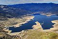 Aerial-LakeIsabella.jpg 550 × 375; 61 KB
-
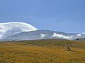
 Along Hwy 58 (143307785).jpeg 2,048 × 1,366; 1.3 MB
-
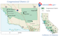 CA-22nd.png 651 × 400; 38 KB
-

-

-
 The Kern River Cañon - Pg-419.jpg 1,002 × 987; 467 KB
-
-
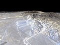 Garlock Fault.jpg 600 × 450; 31 KB
-
 Kern County - March 2022 - Sarah Stierch 01.jpg 4,032 × 3,024; 4.72 MB
-
 Kern County - March 2022 - Sarah Stierch 02.jpg 4,032 × 3,024; 1.04 MB
-
 Kern County - March 2022 - Sarah Stierch 03.jpg 4,032 × 3,024; 937 KB
-
 Kern River Oil Field aerial.jpg 3,648 × 2,736; 1.2 MB
-
 Kern-County-farms-and-california-aqueduct-Aerial-from-west-August-2014.jpg 3,123 × 1,840; 3.76 MB
-
 CuyamaValley.jpg 3,300 × 2,550; 1.03 MB
-
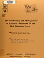 The Prehistory and management of cultural resources in the Red Mountain area (IA prehistorymanage00hall).pdf 845 × 1,122, 216 pages; 10.66 MB
-
 Railroad Junction2004 x.JPG 850 × 638; 302 KB
-

-
 Aerial-TehachapiAirport.jpg 550 × 369; 85 KB
-
 Water-pipeline in High Sierras, CA, USA (GN2D7363).jpg 4,500 × 3,000; 6.78 MB
-
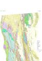 Of99-14 4a a.pdf 4,602 × 6,750; 8.72 MB
.jpg)

.jpeg)

_(cropped).jpg)
.jpg)


.jpg)