Category:Geography of Marin County, California
Counties of California: Alameda · Alpine · Amador · Butte · Calaveras · Colusa · Contra Costa · Del Norte · El Dorado · Fresno · Glenn · Humboldt · Imperial · Inyo · Kern · Kings · Lake · Lassen · Los Angeles · Madera · Marin · Mariposa · Mendocino · Merced · Modoc · Mono · Monterey · Napa · Nevada · Orange · Placer · Plumas · Riverside · Sacramento · San Benito · San Bernardino · San Diego · San Joaquin · San Luis Obispo · San Mateo · Santa Barbara · Santa Clara · Santa Cruz · Shasta · Sierra · Siskiyou · Solano · Sonoma · Stanislaus ·Sutter · Tehama · Trinity · Tulare · Tuolumne · Ventura · Yolo · Yuba – Consolidated city-county: San Francisco
Wikimedia category | |||||
| Upload media | |||||
| Instance of | |||||
|---|---|---|---|---|---|
| Category combines topics | |||||
| Marin County | |||||
county in California, United States   | |||||
| Instance of | |||||
| Part of |
| ||||
| Named after |
| ||||
| Location | California, Pacific States Region | ||||
| Located in or next to body of water | |||||
| Capital | |||||
| Inception |
| ||||
| Population |
| ||||
| Area |
| ||||
| official website | |||||
 | |||||
| geography | |||||
science that studies the terrestrial surface, the societies that inhabit it and the territories, landscapes, places or regions that form it when interacting with each other     | |||||
| Pronunciation audio | |||||
| Instance of |
| ||||
| Different from | |||||
| Partially coincident with | |||||
| |||||
Subcategories
This category has the following 30 subcategories, out of 30 total.
A
B
- Bolinas Lagoon (12 F)
- Bolinas Ridge (10 F)
- Bon Tempe Lake (12 F)
- Mount Burdell (15 F)
C
- Chimney Rock (California) (4 F)
- Coyote Creek (Marin County) (1 F)
D
- Drakes Estero (3 F)
F
L
M
- Marin Islands (2 F)
- Muir Beach Overlook (24 F)
N
- Nicasio Reservoir (4 F)
P
R
- Red Rock Island (3 F)
T
- Tennessee Beach California (5 F)
- Tomales Point (93 F)
W
- Whiteside Marsh (5 F)
Media in category "Geography of Marin County, California"
The following 54 files are in this category, out of 54 total.
-
 ACMlowerreachresarea.jpg 2,027 × 2,205; 819 KB
-
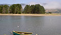
 Brock Schreiber Boathouse.jpg 2,380 × 1,657; 460 KB
-
 Tomalesbay01.jpg 2,256 × 1,010; 324 KB
-
 TomalesBayFromInverness.jpg 1,569 × 1,166; 1,016 KB
-
 Wpdms usgs photo point reyes large 2.jpg 300 × 280; 16 KB
-
 Belvedere Lagoon in July 2016.jpg 2,592 × 1,944; 1.38 MB
-
 Berkeley Hills, 1964.jpg 1,024 × 954; 616 KB
-
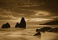
 BirdRock3339.jpg 1,849 × 807; 1.19 MB
-
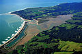 Bolinas California aerial view.jpg 1,500 × 1,000; 684 KB
-
 CA topo san quentin quadrangle.jpg 3,300 × 4,263; 7.11 MB
-
 California gaze (8483518870).jpg 4,000 × 3,000; 2.83 MB
-
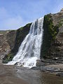
 Cascade Falls on Cascade Creek, tributary to Old Mill Creek, Mill Valley, California.jpg 2,448 × 3,264; 2.37 MB
-
-
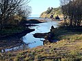
 EsteroDeSanAntonio3179.jpg 1,382 × 1,028; 1.01 MB
-
 AlamereFalls.JPG 2,736 × 3,648; 2.76 MB
-
 Top of Alamere Falls.jpg 1,440 × 1,800; 2.6 MB
-
 Fort Baker on San Francisco Bay.jpg 4,062 × 1,544; 4.24 MB
-
 Sunset-Golden Gate Park-San Francisco, California (3654968949).jpg 2,415 × 1,970; 472 KB
-
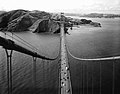 Golden Gate Bridge view from top, HAER CA-31-30.jpg 4,763 × 3,739; 2.41 MB
-
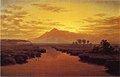
 San Anselmo Valley Near San Rafael by William Keith, 1869.jpg 482 × 319; 154 KB
-
 Kent Island 3420.jpg 1,909 × 1,098; 1.38 MB
-
 Lake Lagunitas (134303147).jpg 1,280 × 960; 473 KB
-
 Lake Lagunitas.jpg 2,592 × 1,944; 1.34 MB
-
 Lucas Valley, California.JPG 2,816 × 2,112; 1.36 MB
-
 Marin coastline.JPG 1,600 × 1,200; 1.06 MB
-
 Marin county.png 1,600 × 900; 2.42 MB
-
 Miller Creek 3563.jpg 1,704 × 1,536; 1.89 MB
-
 Morses Gulch 3431.JPG 2,048 × 1,536; 768 KB
-
 Mount Tamalpais from Napa Slough (William Marple).jpg 1,051 × 674; 76 KB
-
 Mt. Tam coastline.jpg 3,072 × 2,048; 605 KB
-
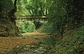
 Old Mill Creek with Old Mill, Mill Valley, CA Hugh Kuhn Winter 2011.jpg 1,851 × 2,478; 2.57 MB
-
 Point Reyes Marshall Trail 2.jpg 3,264 × 4,352; 8.02 MB
-
 Point San Pedro 07798.JPG 2,560 × 1,920; 1.84 MB
-
 Rat Rock 3655.jpg 889 × 260; 174 KB
-
 Redwood Creek at Muir Beach Hugh Kuhn WInter 2011.jpg 2,592 × 1,936; 2.42 MB
-
 Redwood Creek one mile downstream from Muir Woods Hugh Kuhn 2011.jpg 2,592 × 1,936; 3.24 MB
-
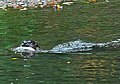
 River otter on bank, Park Ave San Anselmo Creek Charles Kennard cropped.jpg 1,054 × 709; 530 KB
-
-
 Rodeo Cove.jpg 3,264 × 2,247; 4.83 MB
-
 Sais footbridge over San Anselmo Creek dry 1997 Charles Kennard.jpg 900 × 587; 387 KB
-
 San Anselmo Creek alder roots 6.10 Charles Kennard.jpg 900 × 587; 387 KB
-
 Silva Island 2023-03-07.jpg 2,900 × 1,450; 940 KB
-
 Stinson Beach 3429.jpg 1,323 × 823; 688 KB
-
 Stinson beach.JPG 1,600 × 1,200; 987 KB
-
 Stinson Gulch 3430.jpg 1,969 × 1,011; 1.54 MB
-
 Summit of Mount Tamalpais, near Mill Valley, California.JPG 2,048 × 1,536; 605 KB
-
 The Sisters 3647.jpg 247 × 168; 44 KB
-
 View from Mount Tamalpais.JPG 800 × 600; 94 KB
-
 West Marin highlighted in Bay Area.jpg 769 × 798; 527 KB
-
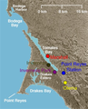 WestMarinTowns.png 300 × 370; 167 KB
-
 WestMarinTowns2.png 300 × 370; 178 KB
-
 Wilkins Gulch 3438.jpg 1,936 × 768; 1.27 MB
-
 CALIFORNIA-MARIN COUNTY - NARA - 543106.jpg 3,000 × 2,042; 857 KB
-
 Steelhead on Corte Madera Creek, Marin Gary Leo 2010.jpg 685 × 601; 554 KB


.jpg)


.jpg)


.jpg)


.jpg)


