Category:Geological maps of Kentucky
States of the United States: Alabama · Alaska · Arizona · Arkansas · California · Colorado · Connecticut · Delaware · Florida · Georgia · Hawaii · Idaho · Illinois · Indiana · Iowa · Kansas · Kentucky · Louisiana · Maine · Maryland · Massachusetts · Michigan · Minnesota · Mississippi · Missouri · Montana · Nebraska · Nevada · New Hampshire · New Jersey · New Mexico · New York · North Carolina · North Dakota · Ohio · Oklahoma · Oregon · Pennsylvania · Rhode Island · South Carolina · South Dakota · Tennessee · Texas · Utah · Vermont · Virginia · Washington · West Virginia · Wisconsin · Wyoming
Puerto Rico
Puerto Rico
Subcategories
This category has the following 3 subcategories, out of 3 total.
Media in category "Geological maps of Kentucky"
The following 7 files are in this category, out of 7 total.
-
 Extent of Bedford Shale and Berea Sandstone - Ohio and N Kentucky.jpg 9,750 × 13,550; 17.12 MB
-
 Generalized geologic map, Kentucky River Basin, Kentucky LOC 81692308.jpg 2,531 × 3,275; 872 KB
-
 Generalized geologic map, Kentucky River Basin, Kentucky LOC 81692308.tif 2,531 × 3,275; 23.72 MB
-
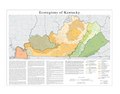 Kentucky Level IV ecoregions.pdf 4,800 × 3,750; 1.41 MB
-
 NPS cumberland-gap-geologic-map-east.jpg 2,183 × 1,512; 1.11 MB
-
 NPS cumberland-gap-geologic-map-west.jpg 2,188 × 1,511; 887 KB
-
 NPS mammoth-cave-geologic-map-east.jpg 1,648 × 2,270; 1.12 MB


