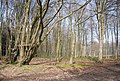
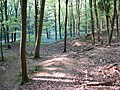
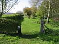
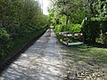
Category:Godmersham
English: Godmersham is a village and civil parish in the Ashford District of Kent, England. The village is located on the River Great Stour where it cuts through the North Downs. It is four miles (6.4km) north-west of Ashford on the A28 road midway between Ashford and Canterbury in an Area of Outstanding Natural Beauty with the North Downs Way and Pilgrims' Way traversing the parish.
village in United Kingdom  | |||||
| Upload media | |||||
| Instance of | |||||
|---|---|---|---|---|---|
| Location | Ashford, Kent, South East England, England | ||||
| Area |
| ||||
| Said to be the same as | Godmersham (Wikimedia duplicated page, civil parish) | ||||
 | |||||
Subcategories
This category has the following 4 subcategories, out of 4 total.
G
- Godmersham Park (12 F)
K
- King's Wood bowl barrow (8 F)
L
- St Lawrence's church, Godmersham (12 F)
O
- Oasts in Godmersham (6 F)
Media in category "Godmersham"
The following 200 files are in this category, out of 439 total.
(previous page) (next page)-
 A faint Stour Valley Walk - geograph.org.uk - 3033483.jpg 640 × 430; 66 KB
-
 A large field near Woodsdale Farm - geograph.org.uk - 3042062.jpg 640 × 430; 58 KB
-
 A28 near Buckwell Farm - geograph.org.uk - 3387857.jpg 1,024 × 642; 123 KB
-
 A28 road bridge over Great Stour - geograph.org.uk - 340845.jpg 640 × 426; 165 KB
-
 A28 towards Canterbury - geograph.org.uk - 3390504.jpg 1,024 × 661; 128 KB
-
 An ex-stubble strip - geograph.org.uk - 3034792.jpg 640 × 430; 94 KB
-
 Another track junction in King's Wood - geograph.org.uk - 1456147.jpg 640 × 480; 148 KB
-
 Arboreal seat - geograph.org.uk - 3473708.jpg 640 × 430; 146 KB
-
 Artwork in King's Wood - geograph.org.uk - 5455001.jpg 640 × 480; 190 KB
-
 Ashford Rd - geograph.org.uk - 5158402.jpg 640 × 426; 74 KB
-
 Barrier, North Downs Way - geograph.org.uk - 3483826.jpg 640 × 430; 130 KB
-
 Bilting - geograph.org.uk - 4840509.jpg 640 × 426; 56 KB
-
 Bilting - geograph.org.uk - 4840514.jpg 640 × 426; 68 KB
-
 Bilting - geograph.org.uk - 5158377.jpg 640 × 426; 59 KB
-
 Bilting - geograph.org.uk - 5825973.jpg 1,024 × 681; 141 KB
-
 Blossom and daffodils, Godmersham Park - geograph.org.uk - 5336529.jpg 640 × 480; 143 KB
-
-
 Bridleway AE4 - geograph.org.uk - 4272733.jpg 640 × 480; 211 KB
-
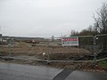 Building Site near Purr Wood - geograph.org.uk - 1765271.jpg 3,072 × 2,304; 1.54 MB
-
 Byway to Pope Street - geograph.org.uk - 2652267.jpg 480 × 640; 170 KB
-
 Byway west of Woodsdale Farm - geograph.org.uk - 3037793.jpg 640 × 430; 128 KB
-
 Canterbury Road (A28), Godmersham - geograph.org.uk - 2215688.jpg 4,320 × 3,240; 3.9 MB
-
 Canterbury Road (A28), Godmersham - geograph.org.uk - 2215690.jpg 4,320 × 3,240; 4.56 MB
-
 Canterbury Road - geograph.org.uk - 2535958.jpg 640 × 480; 144 KB
-

-

-

-
-
 Clearing at King's Wood - geograph.org.uk - 2537376.jpg 640 × 480; 208 KB
-
 Clearing in King's Wood - geograph.org.uk - 2536014.jpg 640 × 480; 226 KB
-
 Clearing in King's Wood - geograph.org.uk - 2536024.jpg 640 × 480; 135 KB
-
 Coneyearth Wood - geograph.org.uk - 3033466.jpg 640 × 430; 64 KB
-
 Coneyearth Wood - geograph.org.uk - 3033478.jpg 640 × 430; 63 KB
-
 Coneyearth Wood - geograph.org.uk - 3034786.jpg 640 × 430; 46 KB
-
 Conifer Copse on a slope - geograph.org.uk - 1558173.jpg 640 × 427; 70 KB
-

-
 Coppiced area in King's Wood - geograph.org.uk - 1456113.jpg 640 × 480; 93 KB
-
 Coppiced Area in King's Wood - geograph.org.uk - 1543537.jpg 640 × 427; 72 KB
-
 Coppiced Area in King's Wood - geograph.org.uk - 1543691.jpg 640 × 427; 95 KB
-
 Coppiced trees, King's Wood - geograph.org.uk - 3473589.jpg 640 × 430; 153 KB
-
 Coppicing in an old chalk pit - geograph.org.uk - 3473692.jpg 640 × 430; 152 KB
-
 Coppicing in King's Wood - geograph.org.uk - 1456097.jpg 640 × 480; 146 KB
-
 Coppicing, King's Wood - geograph.org.uk - 3469094.jpg 640 × 430; 150 KB
-
 Coppicing, King's Wood - geograph.org.uk - 3473567.jpg 640 × 430; 143 KB
-
 Coppicing, King's Wood - geograph.org.uk - 3473573.jpg 640 × 430; 146 KB
-
 Coppicing, King's Wood - geograph.org.uk - 3473586.jpg 640 × 430; 147 KB
-
 Coppicing, King's Wood - geograph.org.uk - 3473699.jpg 640 × 430; 107 KB
-
 Coppicing, King's Wood - geograph.org.uk - 3473710.jpg 640 × 430; 150 KB
-
 Cornfield in Godmersham Park - geograph.org.uk - 3631861.jpg 4,000 × 3,000; 4.21 MB
-
 Cornfield near the North Downs Way - geograph.org.uk - 3631875.jpg 4,000 × 3,000; 4.21 MB
-
 Cottage in the Woods - geograph.org.uk - 3033484.jpg 640 × 430; 90 KB
-
 Cottage near Woodsdale Farm - geograph.org.uk - 3635086.jpg 4,000 × 3,000; 4.07 MB
-
 Cottage, Bilting - geograph.org.uk - 5158356.jpg 640 × 360; 44 KB
-
 Cottage, Bilting - geograph.org.uk - 5158373.jpg 640 × 330; 52 KB
-
 Covered reservoir on Blue Downs - geograph.org.uk - 786088.jpg 640 × 480; 254 KB
-
 Crop Fields near Purr Wood - geograph.org.uk - 3048756.jpg 2,256 × 1,496; 932 KB
-
 Crops fields off Eggarton Lane - geograph.org.uk - 3048726.jpg 2,256 × 1,496; 895 KB
-
 Cutlers - geograph.org.uk - 5455011.jpg 640 × 428; 155 KB
-
 Daffodils by the Stour Valley Walk - geograph.org.uk - 3033453.jpg 640 × 430; 73 KB
-
 Daffodils, Stour Valley Walk - geograph.org.uk - 3033455.jpg 640 × 430; 68 KB
-
 Dead or alive^ - geograph.org.uk - 3473764.jpg 640 × 430; 115 KB
-
 Deer Lodge (2) - geograph.org.uk - 1490008.jpg 640 × 427; 80 KB
-
 Dense Vegetation, Stump Shave - geograph.org.uk - 3042049.jpg 640 × 430; 126 KB
-
 Dinosaur in Godmersham - geograph.org.uk - 3636472.jpg 4,000 × 3,000; 4.38 MB
-
 Distance Stone by the North Downs Way - geograph.org.uk - 3473717.jpg 640 × 430; 112 KB
-
 Disused chalk pit, King's Wood - geograph.org.uk - 3469141.jpg 640 × 430; 124 KB
-
 Downland farmland - geograph.org.uk - 3031529.jpg 640 × 430; 77 KB
-
 Downland farmland - geograph.org.uk - 3033482.jpg 640 × 430; 71 KB
-
 Downland north of Crundale - geograph.org.uk - 3031537.jpg 640 × 430; 65 KB
-
 Eggarton Cottages - geograph.org.uk - 3033465.jpg 640 × 430; 91 KB
-
 Eggarton Lane - geograph.org.uk - 2647625.jpg 640 × 305; 72 KB
-
 Eggarton Lane - geograph.org.uk - 3033469.jpg 640 × 430; 104 KB
-
 Eggarton Lane - geograph.org.uk - 3033472.jpg 640 × 430; 124 KB
-
 Eggarton Manor - geograph.org.uk - 3033441.jpg 640 × 430; 62 KB
-
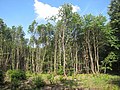
 Eggridge Wood - geograph.org.uk - 2648553.jpg 640 × 480; 172 KB
-
 Eggringe Wood - geograph.org.uk - 3042036.jpg 640 × 430; 59 KB
-
 Entrance to Eggarton Manor - geograph.org.uk - 3033458.jpg 640 × 430; 104 KB
-
 Expanding Woodland - geograph.org.uk - 403947.jpg 640 × 427; 68 KB
-
 Fallow farmland - geograph.org.uk - 3034789.jpg 640 × 430; 71 KB
-
-
 Farmland - geograph.org.uk - 3034797.jpg 640 × 430; 84 KB
-
 Farmland and woodland - geograph.org.uk - 3034811.jpg 640 × 431; 62 KB
-
 Farmland by King's Wood - geograph.org.uk - 3483721.jpg 640 × 430; 87 KB
-
 Farmland by King's Wood - geograph.org.uk - 3483816.jpg 640 × 430; 93 KB
-
 Farmland by Pope Street - geograph.org.uk - 2652284.jpg 640 × 480; 70 KB
-
 Farmland by the North Downs Way - geograph.org.uk - 3469025.jpg 640 × 430; 54 KB
-
 Farmland in the Stour Valley - geograph.org.uk - 4947861.jpg 640 × 426; 45 KB
-
 Farmland near Eggarton Manor - geograph.org.uk - 3031566.jpg 640 × 430; 57 KB
-
 Farmland near Purr Wood - geograph.org.uk - 3033449.jpg 640 × 430; 63 KB
-
 Farmland on the Downs - geograph.org.uk - 3031550.jpg 640 × 430; 87 KB
-
 Farmland on the downs - geograph.org.uk - 3033476.jpg 640 × 430; 66 KB
-
 Farmland on The Downs - geograph.org.uk - 3034805.jpg 640 × 430; 58 KB
-
 Farmland on the North Downs - geograph.org.uk - 3031544.jpg 640 × 430; 85 KB
-
 Farmland on the North Downs - geograph.org.uk - 3031569.jpg 640 × 430; 73 KB
-
 Farmland, Blue Downs - geograph.org.uk - 3034810.jpg 640 × 430; 73 KB
-
 Farmland, Blue Downs - geograph.org.uk - 3034819.jpg 640 × 430; 55 KB
-
 Farmland, Godmersham - geograph.org.uk - 4947863.jpg 640 × 426; 45 KB
-
 Farmland, Soakham Downs - geograph.org.uk - 3469035.jpg 640 × 430; 49 KB
-
 Fence in King's Wood - geograph.org.uk - 1543658.jpg 640 × 427; 118 KB
-
 Field on North Downs - geograph.org.uk - 2536004.jpg 640 × 480; 174 KB
-
 Fields off Pope Street - geograph.org.uk - 2648559.jpg 8,374 × 2,650; 7.96 MB
-
 Fields on the North Downs - geograph.org.uk - 2535984.jpg 640 × 480; 183 KB
-
 Footpath beside the railway near Godmersham - geograph.org.uk - 1773003.jpg 3,072 × 2,304; 2.53 MB
-
 Footpath in King's Wood - geograph.org.uk - 2308313.jpg 2,304 × 3,072; 3.29 MB
-
 Footpath junction, Soakham Downs - geograph.org.uk - 3469051.jpg 640 × 430; 142 KB
-
 Footpath off the North Downs Way - geograph.org.uk - 3483854.jpg 640 × 430; 99 KB
-
 Footpath this way - geograph.org.uk - 3037732.jpg 640 × 430; 154 KB
-
 Footpath through King's Wood - geograph.org.uk - 2536029.jpg 640 × 480; 214 KB
-
 Footpath to Godmersham - geograph.org.uk - 4563722.jpg 4,000 × 3,000; 4.2 MB
-
 Footpath to Godmersham - geograph.org.uk - 4563723.jpg 4,000 × 3,000; 4.04 MB
-
 Footpath to Purr Wood - geograph.org.uk - 1765289.jpg 3,072 × 2,304; 1.89 MB
-
 Footpath towards the railway - geograph.org.uk - 1773028.jpg 3,072 × 2,304; 1.92 MB
-
 Footprints in the soil - geograph.org.uk - 3034803.jpg 640 × 430; 65 KB
-
 Forest and Woodsdale Farm - geograph.org.uk - 3037802.jpg 640 × 430; 72 KB
-
 Forest clearance, King's Wood - geograph.org.uk - 3469232.jpg 640 × 430; 115 KB
-
 Forest Farm - geograph.org.uk - 3037795.jpg 640 × 430; 73 KB
-
 Forest Farmhouse - geograph.org.uk - 3037782.jpg 640 × 430; 86 KB
-
 Forest Farmhouse - geograph.org.uk - 786067.jpg 640 × 480; 217 KB
-
 Forest track, King's Wood - geograph.org.uk - 3473564.jpg 640 × 430; 72 KB
-
 Forestry machinery - geograph.org.uk - 5455020.jpg 640 × 480; 138 KB
-
 Four lambs - geograph.org.uk - 3037774.jpg 640 × 430; 88 KB
-
 Garwick Cottage and Eggringe Wood - geograph.org.uk - 786052.jpg 640 × 480; 199 KB
-
 Gate and field by Eggarton Lane - geograph.org.uk - 2647628.jpg 640 × 480; 130 KB
-
 Gate in Bilting Plantation - geograph.org.uk - 1543686.jpg 640 × 427; 117 KB
-
 Gate in King's Wood - geograph.org.uk - 1543698.jpg 640 × 427; 137 KB
-
 Godmersham and Crundale Village Hall - geograph.org.uk - 4935071.jpg 3,849 × 2,887; 2.59 MB
-
 Godmersham Park - geograph.org.uk - 5336481.jpg 640 × 480; 148 KB
-
 Godmersham Park - geograph.org.uk - 5336535.jpg 478 × 640; 85 KB
-
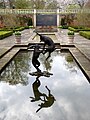
 Godmersham Park Gardens - geograph.org.uk - 5334353.jpg 640 × 480; 147 KB
-
 Godmersham Park Gardens - geograph.org.uk - 5334358.jpg 640 × 480; 138 KB
-
 Godmersham Park Gardens - geograph.org.uk - 5334362.jpg 640 × 482; 98 KB
-
 Godmersham Park Gardens - geograph.org.uk - 5334366.jpg 640 × 480; 144 KB
-
 Godmersham Park Gardens - geograph.org.uk - 5334370.jpg 464 × 640; 120 KB
-
 Godmersham Park Gardens - geograph.org.uk - 5334374.jpg 640 × 483; 107 KB
-
 Godmersham Park Gardens - geograph.org.uk - 5334376.jpg 640 × 476; 106 KB
-
 Godmersham Park House - geograph.org.uk - 5336490.jpg 640 × 520; 79 KB
-
 Godmersham Village Hall - geograph.org.uk - 1765255.jpg 3,072 × 2,304; 1.6 MB
-
 Great Stour and its water meadows at Godmersham - geograph.org.uk - 3631837.jpg 4,000 × 3,000; 4.16 MB
-
 Great Stour at Godmersham - geograph.org.uk - 3631825.jpg 4,000 × 3,000; 4.24 MB
-
 Great Stour at Godmersham - geograph.org.uk - 3631829.jpg 4,000 × 3,000; 4.03 MB
-
 Great Stour River near Godmersham - geograph.org.uk - 1773055.jpg 3,072 × 2,304; 1.87 MB
-
 Headland strip - geograph.org.uk - 3034800.jpg 640 × 430; 106 KB
-
 Heap of hay - geograph.org.uk - 5455004.jpg 640 × 480; 214 KB
-
 Hedge separating fields - geograph.org.uk - 3042065.jpg 640 × 430; 63 KB
-
 Hedgerow - geograph.org.uk - 3031554.jpg 640 × 430; 121 KB
-
 Home Farm House - geograph.org.uk - 4840508.jpg 640 × 426; 57 KB
-
 In King's Wood - geograph.org.uk - 4616518.jpg 1,600 × 1,067; 797 KB
-
 Isolated tree, Soakham Downs - geograph.org.uk - 3469044.jpg 640 × 430; 44 KB
-
 Junction on the North Downs Way - geograph.org.uk - 1456189.jpg 640 × 480; 133 KB
-
 King's Wood - geograph.org.uk - 2537378.jpg 640 × 480; 253 KB
-
 King's Wood - geograph.org.uk - 3469088.jpg 640 × 430; 148 KB
-
 King's Wood - geograph.org.uk - 3469134.jpg 640 × 430; 134 KB
-
 King's Wood - geograph.org.uk - 3469137.jpg 640 × 430; 135 KB
-
 King's Wood - geograph.org.uk - 3469226.jpg 640 × 430; 133 KB
-
 King's Wood - geograph.org.uk - 3469229.jpg 640 × 430; 135 KB
-
 King's Wood - geograph.org.uk - 3469231.jpg 640 × 430; 137 KB
-
 King's Wood - geograph.org.uk - 3469237.jpg 640 × 430; 135 KB
-
 King's Wood - geograph.org.uk - 3469241.jpg 640 × 430; 135 KB
-
 King's Wood - geograph.org.uk - 3469248.jpg 640 × 430; 120 KB
-
 King's Wood - geograph.org.uk - 3473571.jpg 640 × 430; 122 KB
-
 King's Wood - geograph.org.uk - 3473574.jpg 640 × 430; 116 KB
-
 King's Wood - geograph.org.uk - 3473576.jpg 640 × 430; 129 KB
-
 King's Wood - geograph.org.uk - 3473579.jpg 640 × 430; 134 KB
-
 King's Wood - geograph.org.uk - 3473618.jpg 640 × 430; 131 KB
-
 King's Wood - geograph.org.uk - 3473705.jpg 640 × 430; 132 KB
-
 King's Wood - geograph.org.uk - 3473719.jpg 640 × 430; 134 KB
-
 King's Wood - geograph.org.uk - 3473760.jpg 640 × 430; 133 KB
-
 King's Wood - geograph.org.uk - 3473762.jpg 640 × 430; 138 KB
-
 King's Wood - geograph.org.uk - 3473768.jpg 640 × 430; 131 KB
-
 King's Wood - geograph.org.uk - 3473769.jpg 640 × 430; 138 KB
-
 King's Wood - geograph.org.uk - 3483699.jpg 640 × 430; 135 KB
-
 King's Wood - geograph.org.uk - 3483705.jpg 640 × 430; 139 KB
-
 King's Wood - geograph.org.uk - 3483711.jpg 640 × 430; 127 KB
-
 King's Wood - geograph.org.uk - 3483730.jpg 640 × 430; 140 KB
-
 King's Wood - geograph.org.uk - 3483754.jpg 640 × 430; 131 KB
-
 King's Wood - geograph.org.uk - 3483774.jpg 640 × 430; 85 KB
-
 King's Wood - geograph.org.uk - 3483812.jpg 640 × 430; 136 KB
-
 King's Wood - geograph.org.uk - 3483820.jpg 640 × 430; 130 KB
-
 King's Wood - geograph.org.uk - 3483829.jpg 640 × 430; 142 KB
-
 King's Wood - geograph.org.uk - 4617081.jpg 1,600 × 1,067; 712 KB
-
 King's Wood, Hideaway den - geograph.org.uk - 2381071.jpg 3,264 × 2,448; 3.66 MB
-
 King's Wood, Loud speaker sculpture - geograph.org.uk - 2381136.jpg 3,264 × 2,448; 4.25 MB
-
 King's Wood, The Rosie Leventon Ring - geograph.org.uk - 2381088.jpg 3,264 × 2,448; 2.35 MB
-
 King's Wood, woodland view - geograph.org.uk - 2381095.jpg 3,264 × 2,448; 4.08 MB
-
 King's Wood, Woodland view - geograph.org.uk - 2381106.jpg 3,264 × 2,448; 3.39 MB
-
 Last years coppiced area in King's Wood - geograph.org.uk - 1456150.jpg 640 × 480; 101 KB
-
 Level Crossing looking East - geograph.org.uk - 1558182.jpg 640 × 427; 81 KB
-
 Lightly ploughed - geograph.org.uk - 3034794.jpg 640 × 430; 79 KB
-
 Line Cottage - geograph.org.uk - 1772997.jpg 3,072 × 2,304; 1.65 MB
-
 Log on track in King's Wood - geograph.org.uk - 1543649.jpg 640 × 427; 113 KB
-
 Log piles - geograph.org.uk - 3469235.jpg 640 × 430; 85 KB
-

-
 Looking NW along the Stour Valley Walk - geograph.org.uk - 788943.jpg 640 × 480; 270 KB
-
-

-
 Muddy Pond and bench in King's Wood - geograph.org.uk - 1456091.jpg 640 × 480; 103 KB
-
 Mushroom Colony in King's Wood - geograph.org.uk - 1543500.jpg 640 × 427; 102 KB
-
 National Trail on Soakham Down - geograph.org.uk - 4617086.jpg 1,600 × 1,067; 699 KB
-
 New plantings - geograph.org.uk - 3473697.jpg 640 × 430; 80 KB
-
 No traffic allowed - geograph.org.uk - 3483842.jpg 640 × 430; 133 KB


,_Godmersham_-_geograph.org.uk_-_2215688.jpg)
,_Godmersham_-_geograph.org.uk_-_2215690.jpg)


_-_geograph.org.uk_-_1490008.jpg)


