Category:St Lawrence's church, Godmersham
| Object location | | View all coordinates using: OpenStreetMap |
|---|
Grade I listed church in Godmersham, Kent, United Kingdom  | |||||
| Upload media | |||||
| Instance of | |||||
|---|---|---|---|---|---|
| Dedicated to | |||||
| Location | Godmersham, Ashford, Kent, South East England, England | ||||
| Diocese | |||||
| Heritage designation |
| ||||
| Inception |
| ||||
| Religion or worldview | |||||
 | |||||
Media in category "St Lawrence's church, Godmersham"
The following 12 files are in this category, out of 12 total.
-
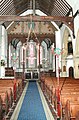
 Blocked west door, St Lawrence the Martyr church - geograph.org.uk - 2827371.jpg 1,496 × 2,256; 885 KB
-
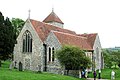
 Church of St Lawrence the Martyr, Godmersham - geograph.org.uk - 2827397.jpg 2,256 × 1,496; 943 KB
-
 Godmersham, St Lawrence's church memorial.jpg 1,406 × 1,890; 1.51 MB
-
 Godmersham, St Lawrence's church organ.jpg 1,496 × 2,256; 1.81 MB
-
 Godmersham, St Lawrence's church, Blocked West door.jpg 1,496 × 2,256; 887 KB
-
 Godmersham, St Lawrence's church.jpg 2,256 × 1,496; 885 KB
-
 St Lawrence Godmersham 1.jpg 5,705 × 3,837; 6.89 MB
-
 St Lawrence Godmersham 2.jpg 5,281 × 3,598; 7.14 MB
-
 St Lawrence, Godmersham, Kent - East end - geograph.org.uk - 324784.jpg 423 × 640; 156 KB
-
 St Lawrence, Godmersham, Kent - geograph.org.uk - 324782.jpg 640 × 426; 136 KB
-
 St Lawrence, Godmersham, Kent - geograph.org.uk - 324783.jpg 640 × 429; 115 KB
-
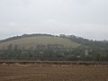 View of Godmersham Downs - geograph.org.uk - 1765294.jpg 3,072 × 2,304; 1.26 MB


