Category:Grade II listed bridges in South Yorkshire
Ceremonial counties of England: Bedfordshire · Berkshire · Buckinghamshire · Cambridgeshire · Cheshire · Cornwall · Cumbria · Derbyshire · Devon · Dorset · Durham · East Riding of Yorkshire · Essex · Gloucestershire · Greater London · Greater Manchester · Hampshire · Herefordshire · Hertfordshire · Kent · Lancashire · Leicestershire · Lincolnshire · Merseyside · Norfolk · North Yorkshire · Northamptonshire · Northumberland · Nottinghamshire · Oxfordshire · Rutland · Shropshire · Somerset · South Yorkshire · Staffordshire · Suffolk · Surrey · Tyne and Wear · Warwickshire · West Midlands · West Sussex · West Yorkshire · Wiltshire · Worcestershire
City-counties: Bristol ·
Former historic counties:
Other former counties:
City-counties: Bristol ·
Former historic counties:
Other former counties:
Subcategories
This category has the following 11 subcategories, out of 11 total.
B
- Ball Street Bridge, Sheffield (26 F)
- Bawtry Bridge (4 F)
G
P
- Penistone Viaduct (11 F)
R
- Rails packhorse bridge (3 F)
S
- Slippery Stones packhorse bridge (17 F)
T
- Tanpit Bridge (3 F)
W
- Wardsend Viaduct (6 F)
- Willow Bridge (2 F)
Media in category "Grade II listed bridges in South Yorkshire"
The following 38 files are in this category, out of 38 total.
-
 Adwick Bridge over the River Dearne - geograph.org.uk - 4006655.jpg 1,600 × 1,064; 565 KB
-
 Adwick Bridge.jpg 1,024 × 575; 186 KB
-
 Bardwell Road Railway Bridge.jpg 1,746 × 3,104; 2.22 MB
-
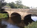
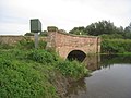
 Barugh Bridge and the River Dearne - geograph.org.uk - 654374.jpg 640 × 480; 108 KB
-
 Borough Bridge.JPG 2,560 × 1,920; 3.02 MB
-
 BoroughBridge.jpg 2,560 × 1,920; 1.97 MB
-
 Boulder Bridge, Penistone.jpg 4,320 × 3,240; 3.04 MB
-
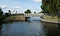 Bramwith Swing Bridge.jpg 1,024 × 614; 111 KB
-
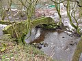
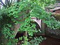
 Bridge in Menagerie Wood.jpg 800 × 533; 137 KB
-
 Bridge over Canal Killamarsh - geograph.org.uk - 2723060.jpg 1,168 × 800; 293 KB
-

-
 Bridge, Kiveton Bridge Station.jpg 1,024 × 768; 286 KB
-
 Bridge, Watermeadows Park.jpg 1,024 × 494; 195 KB
-
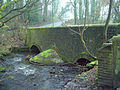
 Bridge, Worsbrough Mill.jpg 640 × 480; 191 KB
-
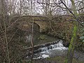
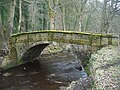
 Cascade Bridge - geograph.org.uk - 1148003.jpg 640 × 480; 104 KB
-
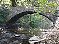
 Devil's Hole Bridge - geograph.org.uk - 2579449.jpg 640 × 480; 169 KB
-
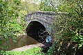
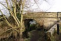
 Dog Kennel Bridge, Chesterfield Canal.jpg 1,024 × 768; 281 KB
-
 Footbridge,Cannon Hall Park.jpg 1,024 × 768; 220 KB
-
 Forge Bridge - geograph.org.uk - 2374859.jpg 3,296 × 2,472; 1.96 MB
-
 Overbridge on Storth Lane, Sheffield.jpg 3,648 × 2,736; 4.31 MB
-
 Oxspring Bridge.jpg 4,143 × 2,762; 2.39 MB
-
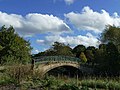
 Penistone - A628 road bridge over River Don - geograph.org.uk - 2632114.jpg 1,600 × 1,191; 652 KB
-
 Porter Bridge, Hangingwater Road.jpg 3,648 × 2,736; 4.08 MB
-
 Pudding Dike Bridge - geograph.org.uk - 2579460.jpg 640 × 480; 165 KB
-
 Roscoe Bridge, Rivelin, Sheffield.JPG 3,648 × 2,736; 3.97 MB
-
 Rowland's Bridge - geograph.org.uk - 1079936.jpg 640 × 427; 89 KB
-
 Serpentine Bridge, Stainborough Park.jpg 640 × 427; 98 KB
-
 Sharp Ford Bridge - geograph.org.uk - 2374889.jpg 3,296 × 2,472; 1.86 MB
-
 Packhorse Bridge, Croft House, Sheffield.JPG 3,648 × 2,736; 3.91 MB
-
 Smithy Bridge - geograph.org.uk - 1106037.jpg 640 × 427; 144 KB
-
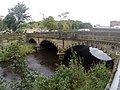
 Sprotbrough - bridge over River Don.jpg 2,272 × 1,704; 1.35 MB
-
 Thorpe Bridge - geograph.org.uk - 2578852.jpg 640 × 480; 146 KB
-
 Thurgoland Bridge.jpg 3,072 × 2,304; 1.46 MB
-
 Topham Ferry Bridge.jpg 1,024 × 768; 184 KB
-
 Unsliven Bridge, Underbank, Stocksbridge - geograph.org.uk - 1744444.jpg 2,124 × 1,417; 1.29 MB
-
 Upper Burbage - Bridge View - geograph.org.uk - 750398.jpg 640 × 480; 80 KB
-
 Upper Burbridge bridge - geograph.org.uk - 733517.jpg 480 × 640; 86 KB
-
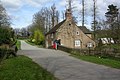 Wentworth Park - Cottage and Bridge. - geograph.org.uk - 390939.jpg 640 × 427; 121 KB


