Category:Gumley
Cebuano: Gumley maoy lungsod sa Hiniusang Gingharian. Ang Gumley nahimutang sa kondado sa Leicestershire ug apil sa nasod sa Inglatera, sa habagatang bahin sa nasod, ka molupyo. (→Gumley (lungsod))
English: Gumley is a village in Leicestershire, England, United Kingdom. The closest town is Market Harborough. The population of the civil parish (including Laughton, Leics) at the 2011 census was 209. (→Gumley)
Français : Gumley est un village et une paroisse civile du Leicestershire, en Angleterre. Il est situé à cinq kilomètres au nord-ouest de la ville de Market Harborough, dans le district de Harborough. Au moment du recensement de 2001, il comptait 106 habitants. (→Gumley)
Polski: Gumley – wieś w Anglii, w hrabstwie Leicestershire, w dystrykcie Harborough. Leży 18 km na południowy wschód od miasta Leicester i 126 km na północny zachód od Londynu. (→Gumley)
Svenska: Gumley är en ort i Storbritannien. Den ligger i grevskapet Leicestershire och riksdelen England, i den södra delen av landet. (→Gumley (ort))

village and civil parish in Leicestershire, UK  L'église paroissiale de Gumley est dédiée à sainte Hélène | |||||
| Upload media | |||||
| Instance of | |||||
|---|---|---|---|---|---|
| Location | Harborough, Leicestershire, East Midlands, England | ||||
| Population |
| ||||
| Area |
| ||||
| Said to be the same as | Gumley (Wikimedia duplicated page, civil parish) | ||||
 | |||||
Subcategories
This category has the following 2 subcategories, out of 2 total.
G
- Gumley War Memorial (8 F)
S
- St Helens church, Gumley (2 F)
Media in category "Gumley"
The following 200 files are in this category, out of 206 total.
(previous page) (next page)-
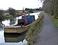
 'Anubis' on the Grand Union Canal - geograph.org.uk - 3795740.jpg 1,600 × 1,183; 450 KB
-
 'Blaby' moored along the Grand Union Canal - geograph.org.uk - 3795778.jpg 1,600 × 1,242; 576 KB
-
 'Early Victorian Village Weighbridge', Gumley - geograph.org.uk - 2558229.jpg 4,000 × 3,000; 2.88 MB
-
 16 Miles to Leicester - geograph.org.uk - 1431451.jpg 361 × 640; 200 KB
-
 17 miles from Leicester - geograph.org.uk - 6159609.jpg 1,703 × 1,277; 1,004 KB
-
 17 Miles to Leicester - geograph.org.uk - 1431454.jpg 480 × 640; 241 KB
-
 A life off the canal - geograph.org.uk - 617604.jpg 640 × 300; 98 KB
-
 At the top of Foxton Locks - geograph.org.uk - 417941.jpg 640 × 445; 93 KB
-
 Bridge 55 - geograph.org.uk - 545457.jpg 640 × 464; 131 KB
-

-

-
 Bridge No 63 west of Foxton, Leicestershire - geograph.org.uk - 3639827.jpg 1,024 × 682; 354 KB
-
 Bridge No. 63 near Foxton Junction - geograph.org.uk - 5104706.jpg 640 × 427; 106 KB
-

-
 Bridleway to Laughton Road - geograph.org.uk - 5008521.jpg 640 × 480; 93 KB
-
 Bridleway to Laughton Road - geograph.org.uk - 5008523.jpg 640 × 480; 70 KB
-
 Bridleway to Laughton Road - geograph.org.uk - 5008524.jpg 640 × 480; 64 KB
-
 Bridleway to Laughton Road - geograph.org.uk - 5008527.jpg 640 × 480; 62 KB
-
 Bridleway to Laughton Road - geograph.org.uk - 5008528.jpg 640 × 480; 58 KB
-
 Canal bank broken down by cattle drinking - geograph.org.uk - 5553736.jpg 1,024 × 768; 163 KB
-
 Canal footbridge near Foxton - geograph.org.uk - 1625077.jpg 640 × 428; 92 KB
-
 Canal footbridge near Foxton - geograph.org.uk - 1625079.jpg 428 × 640; 60 KB
-
 Canal footbridge near Foxton - geograph.org.uk - 1625098.jpg 428 × 640; 64 KB
-
 Church of St Helen, Gumley - geograph.org.uk - 2558185.jpg 4,000 × 3,000; 2.86 MB
-
 Country Lane south east of Gumley - geograph.org.uk - 2369295.jpg 640 × 480; 106 KB
-
 Countryside - geograph.org.uk - 2300643.jpg 800 × 531; 70 KB
-

-

-
 Cyclists on the lane to Gumley - geograph.org.uk - 5324979.jpg 800 × 653; 209 KB
-
 Debdale Lane and Debdale Wharf farmhouse - geograph.org.uk - 3387998.jpg 4,000 × 3,000; 3.48 MB
-
 Debdale Lane near Debdale Wharf - geograph.org.uk - 3387528.jpg 4,000 × 3,000; 3.43 MB
-
 Debdale Lane near Gumley, Leicestershire - geograph.org.uk - 417983.jpg 619 × 640; 172 KB
-

-
 Debdale Wharf Bridge, number 65, Grand Union Canal - geograph.org.uk - 4781306.jpg 2,000 × 1,347; 318 KB
-
 Farmland near Foxton Locks - geograph.org.uk - 2050360.jpg 640 × 480; 62 KB
-
 Farmland near Lubenham Lodge - geograph.org.uk - 5324977.jpg 800 × 600; 163 KB
-

-
 Farmland south of Debdale Wharf - geograph.org.uk - 5553732.jpg 1,024 × 768; 162 KB
-
 Farmland south of Debdale Wharf - geograph.org.uk - 6159615.jpg 1,946 × 1,460; 1.03 MB
-
 Farmland south-east of Debdale Grange - geograph.org.uk - 5553726.jpg 1,024 × 768; 159 KB
-

-
 Foxton Locks-Rainbow Bridge - geograph.org.uk - 2050353.jpg 640 × 480; 89 KB
-
 Foxton Road near Spinney Hill Farm - geograph.org.uk - 4669135.jpg 800 × 621; 203 KB
-
 Gate and lane near Holloway Spinney - geograph.org.uk - 2888739.jpg 640 × 480; 105 KB
-
 Gorse and pasture at Holloway Spinney - geograph.org.uk - 2888721.jpg 3,147 × 2,382; 3.33 MB
-
 Grand Union Canal - Barge - geograph.org.uk - 2300485.jpg 800 × 531; 77 KB
-
 Grand Union Canal - Bridge 63 - geograph.org.uk - 2300504.jpg 531 × 800; 148 KB
-
 Grand Union Canal - Bridge 63 - geograph.org.uk - 2300507.jpg 800 × 531; 158 KB
-
 Grand Union Canal - Debdale Wharf - geograph.org.uk - 2300482.jpg 800 × 531; 133 KB
-
 Grand Union Canal - Debdale Wharf Bridge - geograph.org.uk - 2300478.jpg 800 × 531; 174 KB
-
 Grand Union Canal - geograph.org.uk - 167582.jpg 640 × 480; 77 KB
-
 Grand Union Canal - geograph.org.uk - 5576389.jpg 1,600 × 900; 372 KB
-
 Grand Union Canal - Pat's Bridge - geograph.org.uk - 2300496.jpg 800 × 531; 170 KB
-
 Grand Union Canal - Straight - geograph.org.uk - 2300493.jpg 800 × 531; 62 KB
-
 Grand Union Canal - View from bridge 63 - geograph.org.uk - 2300499.jpg 800 × 531; 101 KB
-

-

-

-
 Grand Union Canal, near Foxton - geograph.org.uk - 1624794.jpg 640 × 428; 79 KB
-
 Grand Union Canal, near Lubenham - geograph.org.uk - 202670.jpg 640 × 480; 111 KB
-
 Grazing cattle near Gumley - geograph.org.uk - 2888802.jpg 3,036 × 2,302; 2.94 MB
-
 Grazing sheep near Gumley - geograph.org.uk - 4669110.jpg 800 × 600; 185 KB
-
 Gumley bridleway - geograph.org.uk - 5008519.jpg 640 × 480; 92 KB
-
 Gumley bridleway - geograph.org.uk - 5008520.jpg 640 × 480; 106 KB
-
 Gumley church - geograph.org.uk - 4593794.jpg 640 × 480; 24 KB
-
 Gumley Cricket Club 2007.jpg 3,369 × 2,290; 8.33 MB
-
 Gumley Cricket Ground - geograph.org.uk - 3591618.jpg 640 × 438; 31 KB
-
 Gumley footpath (geograph 4272044).jpg 1,760 × 1,168; 716 KB
-
 Gumley Hall Clock Tower - geograph.org.uk - 6298925.jpg 1,600 × 1,224; 557 KB
-
 Gumley Road, Leicestershire - geograph.org.uk - 545132.jpg 640 × 429; 98 KB
-
 Gumley village viewed from Foxton Locks - geograph.org.uk - 5324276.jpg 800 × 537; 122 KB
-
 Gumley Wood Triangulation Pillar - geograph.org.uk - 3591625.jpg 640 × 439; 41 KB
-
 Gumley woodland - geograph.org.uk - 4537699.jpg 640 × 480; 73 KB
-
 Gumley, Leicestershire - geograph.org.uk - 417978.jpg 638 × 640; 182 KB
-
 Gumley-Holloway Spinney - geograph.org.uk - 3927657.jpg 1,024 × 768; 193 KB
-

-
 Gumley-The Bell Inn - geograph.org.uk - 6298928.jpg 1,600 × 1,200; 365 KB
-
 Harvested field, south of Debdale Wharf - geograph.org.uk - 5553739.jpg 1,024 × 768; 173 KB
-
 Holloway Spinney from Narrow Lane - geograph.org.uk - 3293687.jpg 640 × 480; 23 KB
-
 House outside Gumley - geograph.org.uk - 4537698.jpg 480 × 640; 73 KB
-
 Keeper's Cottage at Gumley - geograph.org.uk - 2888749.jpg 2,053 × 1,318; 1.25 MB
-
-
-

-
-

-
 Leicestershire Round from Foxton to Gumley - geograph.org.uk - 5627665.jpg 4,000 × 3,000; 2.86 MB
-
 Lowland farm, south of Debdale Wharf - geograph.org.uk - 6159616.jpg 1,946 × 1,460; 931 KB
-

-
 Main street, Gumley, Leicestershire - geograph.org.uk - 875095.jpg 640 × 480; 84 KB
-
 Narrow lane descending through Holloway Spinney - geograph.org.uk - 2888730.jpg 3,264 × 2,448; 3.65 MB
-
 Narrow lane to Gumley - geograph.org.uk - 2888679.jpg 3,264 × 2,448; 3.57 MB
-
 Narrowboats moored along the Grand Union Canal - geograph.org.uk - 3795728.jpg 1,600 × 1,239; 661 KB
-

-
 Pasture west of Foxton in Leicestershire - geograph.org.uk - 5895676.jpg 1,440 × 905; 1.21 MB
-
 Pasture west of Foxton in Leicestershire - geograph.org.uk - 5895728.jpg 1,280 × 960; 1.21 MB
-
 Pat's Bridge on the Grand Union Canal - geograph.org.uk - 3795723.jpg 1,600 × 1,173; 560 KB
-
 Public bridleway near Gumley - geograph.org.uk - 5324980.jpg 800 × 543; 166 KB
-

-

-

-
 Road junction and grass triangle - geograph.org.uk - 5173999.jpg 800 × 600; 178 KB
-
 Rolling countryside at Gumley - geograph.org.uk - 4668124.jpg 800 × 551; 140 KB
-
 Rolling farmland near Gumley - geograph.org.uk - 2888793.jpg 3,264 × 2,448; 3.01 MB
-
 Smeeton Hill near Saddington Reservoir - geograph.org.uk - 2888691.jpg 3,264 × 2,448; 3.14 MB
-
 Stable block clock tower at Gumley Hall - geograph.org.uk - 2888768.jpg 2,448 × 3,264; 3.13 MB
-

-
 Steep lane at Holloway Spinney - geograph.org.uk - 2888714.jpg 2,358 × 2,991; 2.66 MB
-
 The Bell Inn, Main Street, Gumley - geograph.org.uk - 2558171.jpg 4,000 × 3,000; 2.89 MB
-
 Thornhill Farm near Gumley - geograph.org.uk - 2888784.jpg 3,264 × 2,448; 3.03 MB
-
 Towards Gumley - geograph.org.uk - 3591608.jpg 640 × 476; 69 KB
-
 Towards Gumley - geograph.org.uk - 3591627.jpg 640 × 473; 38 KB
-
 Towards Gumley - geograph.org.uk - 5008498.jpg 640 × 480; 76 KB
-
 Towards Gumley - geograph.org.uk - 5287698.jpg 480 × 640; 65 KB
-
 Towards Gumley Lodge - geograph.org.uk - 5008490.jpg 640 × 480; 74 KB
-
 Towards Gumley Lodge - geograph.org.uk - 5008491.jpg 640 × 480; 77 KB
-
 Towards Gumley Lodge - geograph.org.uk - 5008493.jpg 640 × 480; 86 KB
-
 Towards Gumley Lodge - geograph.org.uk - 5008494.jpg 640 × 480; 75 KB
-
 Towards Gumley Lodge - geograph.org.uk - 5008496.jpg 640 × 480; 68 KB
-
 Towards Gumley Lodge - geograph.org.uk - 5008513.jpg 640 × 480; 86 KB
-
 Towards Gumley Lodge - geograph.org.uk - 5008517.jpg 640 × 480; 85 KB
-
 Towards Saddington - geograph.org.uk - 3591628.jpg 640 × 481; 32 KB
-
 Towards Saddington Reservoir - geograph.org.uk - 5380343.jpg 640 × 640; 125 KB
-
 Towards the Gumley Road - geograph.org.uk - 5008515.jpg 640 × 480; 98 KB
-
 Tree lined towpath along the Grand Union Canal - geograph.org.uk - 3795784.jpg 1,600 × 1,133; 758 KB
-
 View to Thornhill Farm - geograph.org.uk - 2494136.jpg 640 × 287; 55 KB
-
 Where cattle come to drink, by Bridge 63 - geograph.org.uk - 5553714.jpg 1,024 × 768; 185 KB
-
 A busy day at Foxton Locks - geograph.org.uk - 417940.jpg 640 × 480; 118 KB
-
 Backwater of Saddington Reservoir - geograph.org.uk - 310692.jpg 640 × 480; 134 KB
-
-
 Barn - geograph.org.uk - 311051.jpg 640 × 480; 107 KB
-
 Bend in the Road, near Laughton - geograph.org.uk - 202795.jpg 480 × 640; 108 KB
-

-
 Bridleway near Gumley - geograph.org.uk - 202671.jpg 640 × 480; 145 KB
-
 Bunker's Hill Farm - geograph.org.uk - 545422.jpg 640 × 421; 108 KB
-
 Bunkers Hill, Leicestershire - geograph.org.uk - 580492.jpg 640 × 480; 96 KB
-
 Canal arm at Foxton - geograph.org.uk - 1514369.jpg 640 × 428; 94 KB
-
 Cattle Grid - geograph.org.uk - 545077.jpg 640 × 453; 121 KB
-
 Cattle Grid - geograph.org.uk - 545138.jpg 640 × 450; 121 KB
-
 Cattle next to Holloway Spinney - geograph.org.uk - 545084.jpg 640 × 487; 133 KB
-
 Corrugated iron barn - geograph.org.uk - 224726.jpg 640 × 480; 75 KB
-
 Country lane near Gumley, Leicestershire - geograph.org.uk - 545073.jpg 640 × 480; 132 KB
-
 Countryside near Gumley, Leicestershire - geograph.org.uk - 417973.jpg 480 × 640; 137 KB
-
 Countryside near Gumley, Leicestershire - geograph.org.uk - 417989.jpg 608 × 640; 136 KB
-

-
 Farmland near Laughton, Leicestershire - geograph.org.uk - 545142.jpg 640 × 469; 110 KB
-

-
 Feeding rack by a muddy gateway - geograph.org.uk - 317646.jpg 640 × 480; 147 KB
-
 Footpath to Gumley Covert - geograph.org.uk - 316599.jpg 640 × 480; 78 KB
-
 Foxton Locks - geograph.org.uk - 394630.jpg 640 × 480; 149 KB
-
 Foxton Locks basin. - geograph.org.uk - 372852.jpg 640 × 427; 60 KB
-
 Foxton Locks Canal Basin - geograph.org.uk - 579646.jpg 640 × 498; 123 KB
-
 Foxton Locks Inn - geograph.org.uk - 579637.jpg 640 × 349; 78 KB
-
 Foxton Locks, Grand Union Canal - geograph.org.uk - 478939.jpg 640 × 470; 82 KB
-
 Foxton Road near Gumley, Leicestershire - geograph.org.uk - 417968.jpg 605 × 640; 192 KB
-

-
 Grand Union Canal at Debdale Wharf - geograph.org.uk - 417927.jpg 640 × 582; 147 KB
-
 Grand Union Canal, Leicestershire - geograph.org.uk - 417893.jpg 640 × 453; 124 KB
-
 Grand Union Canal, Leicestershire - geograph.org.uk - 417906.jpg 640 × 626; 213 KB
-
 Grand Union Canal, Leicestershire - geograph.org.uk - 417916.jpg 640 × 480; 130 KB
-
 Grand Union Canal, Leicestershire - geograph.org.uk - 545424.jpg 640 × 473; 98 KB
-
 Grand Union Canal, Leicestershire - geograph.org.uk - 545431.jpg 640 × 444; 114 KB
-
 Grand Union Canal, Leicestershire - geograph.org.uk - 545447.jpg 640 × 483; 138 KB
-
 Grazing cattle - geograph.org.uk - 545126.jpg 640 × 480; 115 KB
-
 Gumley Road Bridge - geograph.org.uk - 417946.jpg 640 × 403; 104 KB
-
 Gumley, Leicestershire - geograph.org.uk - 417971.jpg 586 × 640; 150 KB
-
 Gumley, Leicestershire - geograph.org.uk - 417976.jpg 640 × 559; 155 KB
-

-
 Humpback bridge - geograph.org.uk - 545430.jpg 640 × 429; 109 KB
-
 Lane junction - geograph.org.uk - 545405.jpg 640 × 459; 114 KB
-
 Laughton Road canal bridge - geograph.org.uk - 545437.jpg 640 × 438; 127 KB
-
 Leicestershire countryside - geograph.org.uk - 545122.jpg 640 × 508; 105 KB
-
 Leicestershire farmland - geograph.org.uk - 580498.jpg 640 × 462; 119 KB
-
 Pat's Bridge - geograph.org.uk - 417937.jpg 640 × 434; 124 KB
-
 Please shut the gate. - geograph.org.uk - 316584.jpg 640 × 480; 120 KB
-
 Public bridleway to Gumley - geograph.org.uk - 545407.jpg 640 × 494; 108 KB
-
 Public footpath through Gumley Wood - geograph.org.uk - 417980.jpg 640 × 480; 166 KB
-
 Public footpath to Foxton Locks - geograph.org.uk - 417970.jpg 605 × 640; 136 KB
-
 Public footpath to Kibworth Beauchamp - geograph.org.uk - 417912.jpg 640 × 547; 142 KB
-
 Rainbow Bridge lower end of Foxton Locks. - geograph.org.uk - 372839.jpg 640 × 427; 103 KB
-
 Remains of last year's harvest - geograph.org.uk - 316614.jpg 640 × 480; 112 KB
-
 Road to Gumley, Leicestershire - geograph.org.uk - 547390.jpg 532 × 640; 135 KB
-
 Rookery - geograph.org.uk - 417949.jpg 543 × 640; 162 KB
-
 Rural scene in Leicestershire - geograph.org.uk - 417954.jpg 563 × 640; 132 KB
-
 Saddington reservoir - geograph.org.uk - 349143.jpg 640 × 480; 60 KB
-

-
 Scoborough Lodge Farm Sign - geograph.org.uk - 311055.jpg 640 × 480; 68 KB
-
 Scorborough Lodge Farm Entrance - geograph.org.uk - 296440.jpg 640 × 480; 99 KB
-
 Smeeton Gorse, Leicestershire - geograph.org.uk - 417992.jpg 480 × 640; 137 KB
-
 Straight on for Foxton - geograph.org.uk - 545415.jpg 640 × 404; 91 KB
-
 The Bell Inn, Gumley - geograph.org.uk - 417975.jpg 640 × 484; 97 KB
-
 The Grand Union Canal, Leicestershire - geograph.org.uk - 580511.jpg 640 × 480; 133 KB
-
 The road to Saddington - geograph.org.uk - 294228.jpg 640 × 480; 86 KB
-
 Time For a Rest - geograph.org.uk - 565635.jpg 480 × 640; 90 KB
-
 Top of the hill - geograph.org.uk - 167589.jpg 640 × 480; 124 KB
-
 Tow path on the Grand Union Canal - geograph.org.uk - 545450.jpg 640 × 480; 139 KB
-
 Triangulation Pillar - geograph.org.uk - 417987.jpg 640 × 523; 109 KB
-

-
 Useful storage area - geograph.org.uk - 311053.jpg 640 × 480; 117 KB
-
 View across to Covert on a frosty day - geograph.org.uk - 696356.jpg 640 × 480; 58 KB


_-_Main_Line_-_Farm_Footbridge_-_geograph.org.uk_-_3099966.jpg)
_-_Main_Line_-_Pats_Bridge_-_geograph.org.uk_-_3099986.jpg)


.jpg)


_-_geograph.org.uk_-_5962534.jpg)


