Category:Harborough District
local government district in Leicestershire, England, UK  | |||||
| Upload media | |||||
| Instance of | |||||
|---|---|---|---|---|---|
| Location | Leicestershire, East Midlands, England | ||||
| Capital | |||||
| Legislative body |
| ||||
| Inception |
| ||||
| Population |
| ||||
| Area |
| ||||
| official website | |||||
 | |||||
Subcategories
This category has the following 94 subcategories, out of 94 total.
A
B
C
- Claybrooke Magna (62 F)
- Cold Newton (53 F)
D
E
F
- Frisby, Leicestershire (38 F)
G
- Glooston (59 F)
H
I
K
L
M
N
O
P
R
S
- Smeeton Westerby (218 F)
T
- Thorpe Langton (98 F)
U
W
- West Langton (59 F)
Media in category "Harborough District"
The following 200 files are in this category, out of 569 total.
(previous page) (next page)-
 1914-1918 War Memorial, Market Harborough (geograph 6819239).jpg 768 × 1,024; 138 KB
-
 41, High Street, Market Harborough - geograph.org.uk - 6192906.jpg 1,024 × 768; 341 KB
-
-
 42 and 43, High Street, Market Harborough - geograph.org.uk - 6192886.jpg 1,024 × 768; 337 KB
-
 A new vets building. - geograph.org.uk - 4423092.jpg 640 × 480; 55 KB
-

-
 A4304 - geograph.org.uk - 4749849.jpg 640 × 426; 74 KB
-
 A508 Northampton Road in Market Harborough - geograph.org.uk - 3507937.jpg 3,590 × 2,384; 2.35 MB
-
 A6 avoiding Market Harborough - geograph.org.uk - 6192724.jpg 1,024 × 684; 287 KB
-
 A6 into Market Harborough - geograph.org.uk - 5253936.jpg 480 × 640; 43 KB
-
 A6 on outskirts of Market Harborough - geograph.org.uk - 6192716.jpg 1,024 × 684; 314 KB
-
 AA Brown Engineering - geograph.org.uk - 4541204.jpg 640 × 480; 65 KB
-
 Adam and Eve Street, Market Harborough - geograph.org.uk - 5862300.jpg 1,024 × 768; 204 KB
-
 Advanced preparation - geograph.org.uk - 6101145.jpg 1,024 × 768; 162 KB
-
 Airfield trackway - geograph.org.uk - 6101149.jpg 1,024 × 768; 190 KB
-
 Airfield trackway - geograph.org.uk - 6101151.jpg 1,024 × 768; 125 KB
-
 Albany House, Northampton Road - geograph.org.uk - 5025682.jpg 480 × 640; 84 KB
-
 Aldi supermarket, Market Harborough - geograph.org.uk - 4328119.jpg 640 × 480; 60 KB
-

-
 Alvington Way towards Burnmill Road - geograph.org.uk - 5023261.jpg 640 × 394; 73 KB
-
 Alvington Way towards Leicester Road - geograph.org.uk - 5023262.jpg 640 × 443; 80 KB
-
 Animal pen and field - geograph.org.uk - 5023268.jpg 640 × 498; 127 KB
-

-
 Approaching Bowden Hall Bridge - geograph.org.uk - 2557986.jpg 4,000 × 3,000; 2.9 MB
-
 B6047 Leicester Road - geograph.org.uk - 6192752.jpg 1,024 × 684; 305 KB
-
 B6047 Leicester Road - geograph.org.uk - 6192753.jpg 1,024 × 684; 327 KB
-
 Balancing Pond for new development - geograph.org.uk - 6186963.jpg 1,024 × 738; 473 KB
-
 Block of flats on Fairfield Road - geograph.org.uk - 4541206.jpg 480 × 640; 96 KB
-
 Blocked bridleway - geograph.org.uk - 6130645.jpg 1,024 × 768; 217 KB
-
 Bowden Ridge in Spring - geograph.org.uk - 1856068.jpg 640 × 480; 97 KB
-

-

-

-
-
 Brampton Valley Way crossing Scotland Road - geograph.org.uk - 3507924.jpg 4,000 × 3,000; 4.58 MB
-
 Brampton Valley Way leaving Market Harborough - geograph.org.uk - 5862329.jpg 1,024 × 768; 330 KB
-
 Braybrooke Road - geograph.org.uk - 5293413.jpg 480 × 640; 42 KB
-
 Braybrooke Road, Market Harborough - geograph.org.uk - 5862238.jpg 1,024 × 768; 217 KB
-
 Braybrooke Road, Market Harborough - geograph.org.uk - 5862240.jpg 1,024 × 768; 180 KB
-
 Braybrooke Road, near Market Harborough - geograph.org.uk - 5862233.jpg 1,024 × 768; 209 KB
-
 Brick art at Sainsbury's, Market Harborough - geograph.org.uk - 3064207.jpg 4,000 × 3,000; 3.41 MB
-
 Bridge No 14, from the south-east - geograph.org.uk - 5553224.jpg 1,024 × 768; 151 KB
-

-
 Bridleway alongside the Fardon Fields Farm Shop - geograph.org.uk - 6129853.jpg 1,024 × 768; 112 KB
-

-
-
 Bridleway through the new estate - geograph.org.uk - 6130641.jpg 1,024 × 768; 143 KB
-
 Bridleway through the new estate - geograph.org.uk - 6130642.jpg 1,024 × 768; 127 KB
-
 Bridleway through the new estate - geograph.org.uk - 6130643.jpg 1,024 × 768; 132 KB
-
 Britannia Walk, Market Harborough - geograph.org.uk - 5862319.jpg 1,024 × 768; 155 KB
-
 Building work from my back step - geograph.org.uk - 4628979.jpg 480 × 640; 113 KB
-
 Burnmill Road and fields - geograph.org.uk - 5023263.jpg 640 × 469; 85 KB
-
 Burnmill Road towards Great Bowden - geograph.org.uk - 4931834.jpg 640 × 492; 132 KB
-
 Burnmill Road towards Great Bowden - geograph.org.uk - 5023264.jpg 640 × 451; 123 KB
-
 Burnmill Road towards Market Harborough - geograph.org.uk - 4931835.jpg 640 × 461; 144 KB
-
 Burnmill Road towards Market Harborough - geograph.org.uk - 5023265.jpg 640 × 459; 138 KB
-
 Bus stop on Northampton Road, Market Harborough - geograph.org.uk - 6201022.jpg 2,034 × 1,526; 2 MB
-
 B^M Stores, Market Harborough - geograph.org.uk - 5061776.jpg 640 × 480; 74 KB
-
 Canalside house near Bowden Hall bridge (no 10) - geograph.org.uk - 6159850.jpg 1,837 × 1,379; 690 KB
-
 Car Park notice - geograph.org.uk - 4931831.jpg 634 × 640; 105 KB
-
 Catholic church, Market Harborough - geograph.org.uk - 5061787.jpg 480 × 640; 75 KB
-
 Catholic Social Club - geograph.org.uk - 5061789.jpg 640 × 480; 77 KB
-
 Caxton Street, Market Harborough - geograph.org.uk - 5025673.jpg 640 × 480; 59 KB
-
 Cemetery House - geograph.org.uk - 5025653.jpg 640 × 480; 74 KB
-
 Charlotte Francis Hairdressing - geograph.org.uk - 4562917.jpg 640 × 480; 72 KB
-

-
 Church and Old Grammar School, Market Harborough - geograph.org.uk - 6193065.jpg 1,024 × 768; 333 KB
-
 Church of St Dionysius Market Harborough - geograph.org.uk - 3067442.jpg 4,000 × 3,000; 3.67 MB
-
 Church Square - geograph.org.uk - 2492395.jpg 640 × 480; 98 KB
-
 Church Square - geograph.org.uk - 2542436.jpg 959 × 1,280; 328 KB
-
 Church Square - geograph.org.uk - 2542454.jpg 959 × 1,280; 271 KB
-
 Church Square, Market Harborough - geograph.org.uk - 5672536.jpg 2,000 × 1,347; 591 KB
-
 Church, Market Harborough - geograph.org.uk - 6193060.jpg 684 × 1,024; 258 KB
-
 Cinnamon Lounge Indian restaurant - geograph.org.uk - 5025675.jpg 640 × 480; 74 KB
-
 Clack Hill triangulation pillar - geograph.org.uk - 5023293.jpg 640 × 475; 77 KB
-
 Clack Hill triangulation pillar - geograph.org.uk - 5023295.jpg 640 × 463; 94 KB
-
 Clack Hill triangulation pillar - geograph.org.uk - 5023297.jpg 640 × 486; 82 KB
-
 Clack Hill triangulation pillar - geograph.org.uk - 5023298.jpg 640 × 534; 157 KB
-
 Clack Hill triangulation pillar - geograph.org.uk - 5023299.jpg 640 × 552; 110 KB
-
 Clack Hill Trig Point, Market Harborough - geograph.org.uk - 5243528.jpg 5,184 × 2,920; 1.98 MB
-
 Clips ton Street, Market Harborough - geograph.org.uk - 5025669.jpg 640 × 480; 54 KB
-
 Co-op petrol station - geograph.org.uk - 5061785.jpg 640 × 480; 64 KB
-
 Co-op, Market Harborough - geograph.org.uk - 5061782.jpg 640 × 480; 64 KB
-

-
 Commons Car Park meets Coventry Road - geograph.org.uk - 5061783.jpg 640 × 480; 69 KB
-
 Communication Mast on Clack Hill - geograph.org.uk - 5253933.jpg 480 × 640; 47 KB
-
 Concrete blocks - geograph.org.uk - 6101150.jpg 1,024 × 768; 242 KB
-
 Congregational Church, Market Harborough - geograph.org.uk - 6192755.jpg 1,024 × 768; 341 KB
-
 Corner of King's Head Place - geograph.org.uk - 2542390.jpg 1,280 × 959; 224 KB
-
 Cottage Hospital, Market Harborough - geograph.org.uk - 5061795.jpg 640 × 480; 70 KB
-
 Council Offices Market Harborough - geograph.org.uk - 3064116.jpg 4,000 × 3,000; 3.14 MB
-
 Court off Church Square, Market Harborough - geograph.org.uk - 6193573.jpg 768 × 1,024; 384 KB
-

-

-
 Daffodils next to the canal - geograph.org.uk - 5324666.jpg 800 × 576; 226 KB
-
 Dainite Factory remains - geograph.org.uk - 4786992.jpg 480 × 640; 65 KB
-
 Derelict block on St Mary's Road, Market Harborough - geograph.org.uk - 6200170.jpg 1,884 × 1,296; 1.37 MB
-
 Doddridge Road - geograph.org.uk - 4931832.jpg 640 × 477; 85 KB
-
 Doddridge Road car park - geograph.org.uk - 2492364.jpg 640 × 480; 83 KB
-
 Downstream River Welland - geograph.org.uk - 5061778.jpg 640 × 480; 86 KB
-
 Entering Leicestershire on Rockingham Road - geograph.org.uk - 6200993.jpg 3,264 × 2,448; 2.9 MB
-
 Entering Leicestershire on Rockingham Road - geograph.org.uk - 6200998.jpg 2,034 × 1,526; 1.57 MB
-
 Entering Northamptonshire - geograph.org.uk - 4134665.jpg 640 × 480; 69 KB
-
 Entrance to Doddridge Road car park - geograph.org.uk - 4931833.jpg 640 × 453; 72 KB
-
 Entrance to ex Metal Woods works - geograph.org.uk - 4562927.jpg 480 × 640; 65 KB
-
 Entrance to St Mary's Place, Market Harborough - geograph.org.uk - 5672541.jpg 2,000 × 1,408; 612 KB
-

-
 Entrance to the cemetery - geograph.org.uk - 5025655.jpg 640 × 480; 88 KB
-
 Entrance to Welland Park - geograph.org.uk - 4457137.jpg 480 × 640; 55 KB
-
 Ex Harborough Mail Offices - geograph.org.uk - 4562924.jpg 480 × 640; 75 KB
-
 Ex Metal Woods works - geograph.org.uk - 4562928.jpg 640 × 480; 61 KB
-
 Ex Metal Woods works - geograph.org.uk - 4562929.jpg 640 × 480; 35 KB
-
 Exit from Fox Yard - geograph.org.uk - 2542412.jpg 1,280 × 940; 380 KB
-
 F Tooms - Mould manufacturers - geograph.org.uk - 4562934.jpg 640 × 480; 59 KB
-
 Fairfield Road, Market Harborough - geograph.org.uk - 5144736.jpg 480 × 640; 57 KB
-
 Farmland, Clack Hill - geograph.org.uk - 4782698.jpg 640 × 426; 38 KB
-
 Farndon Fields Farm Shop - geograph.org.uk - 5389034.jpg 2,000 × 1,333; 1.94 MB
-
 Field edge and hedge - geograph.org.uk - 4931837.jpg 640 × 478; 108 KB
-
-
 Field north of Burnmill Road - geograph.org.uk - 4931836.jpg 640 × 486; 72 KB
-
-
 Fields by Leicester Lane - geograph.org.uk - 4931823.jpg 640 × 470; 90 KB
-
 Final banking - geograph.org.uk - 6101154.jpg 1,024 × 768; 175 KB
-
 First of the year (33922420611).jpg 6,000 × 4,000; 16.89 MB
-
 Flats, Factory Lane, Market Harborough - geograph.org.uk - 6193522.jpg 1,024 × 768; 301 KB
-

-

-

-
 Footpath across the fields - geograph.org.uk - 3508391.jpg 1,652 × 1,285; 542 KB
-
 Footpath from Great Bowden to Market Harborough - geograph.org.uk - 5810513.jpg 4,000 × 3,000; 3.06 MB
-
 Footpath to Gartree - geograph.org.uk - 6101153.jpg 1,024 × 768; 201 KB
-
 Footpath to Harborough - geograph.org.uk - 5333268.jpg 480 × 640; 91 KB
-

-
 Footpath towards the Brampton Valley Way - geograph.org.uk - 4573333.jpg 640 × 480; 114 KB
-
 Former builder's yard, Market Harborough - geograph.org.uk - 6193506.jpg 1,024 × 768; 363 KB
-
 Former fire station, Market Harborough - geograph.org.uk - 6192935.jpg 1,024 × 768; 341 KB
-
 Former Grammar School in Church Square Market Harborough - geograph.org.uk - 3064104.jpg 4,000 × 3,000; 3.47 MB
-
 Former Harborough Autos, Abbey Street - geograph.org.uk - 6192983.jpg 1,024 × 684; 260 KB
-
 Former industrial building - geograph.org.uk - 4328110.jpg 640 × 480; 94 KB
-

-
 Former Symingtons factory, Market Harborough - geograph.org.uk - 6193545.jpg 768 × 1,024; 366 KB
-
 Gallow Hill Works - geograph.org.uk - 4618383.jpg 1,280 × 851; 332 KB
-

-
 Garden of Remembrance, Market Harborough - geograph.org.uk - 6193161.jpg 1,024 × 768; 415 KB
-
 Gateway and cattle pen - geograph.org.uk - 5023271.jpg 640 × 458; 120 KB
-
 Gateway to Clack Hill - geograph.org.uk - 5023272.jpg 640 × 469; 95 KB
-
 Gladstone Street, Market Harborough - geograph.org.uk - 5025685.jpg 640 × 480; 59 KB
-
 Godfrey Payton Chartered Surveyors - geograph.org.uk - 1983474.jpg 640 × 480; 52 KB
-
 Gores Lane, Market Harborough - geograph.org.uk - 5130585.jpg 480 × 640; 81 KB
-
 Grand Union Canal - geograph.org.uk - 2487923.jpg 640 × 329; 80 KB
-
 Grand Union Canal - geograph.org.uk - 2487926.jpg 640 × 480; 128 KB
-
 Grand Union Canal, Market Harborough Arm - geograph.org.uk - 3474927.jpg 640 × 480; 121 KB
-

-
 Grand Union Canal, Market Harborough Arm - geograph.org.uk - 3475053.jpg 640 × 480; 102 KB
-

-

-

-

-

-
-

-

-

-
 Grand Union Canal, Market Harborough Branch - geograph.org.uk - 2557863.jpg 4,000 × 3,000; 2.83 MB
-
 Granville Street, Market Harborough - geograph.org.uk - 5025678.jpg 640 × 480; 58 KB
-
 Grazing off Rockingham Road - geograph.org.uk - 4134664.jpg 640 × 480; 76 KB
-
 Great Bowden, Gallow Hill Works (2) - geograph.org.uk - 3474952.jpg 640 × 480; 97 KB
-
 Great Bowden, Gallow Hill Works (3) - geograph.org.uk - 4200698.jpg 640 × 482; 68 KB
-
 Great Bowden, Great Bowden Hall - geograph.org.uk - 3474996.jpg 640 × 480; 75 KB
-
 H Monk ^ Sons - geograph.org.uk - 4562923.jpg 480 × 640; 52 KB
-
 Harborough District Council Offices (geograph 6818575).jpg 1,024 × 768; 160 KB
-
 Harborough Innovation Centre - geograph.org.uk - 5253913.jpg 640 × 480; 50 KB
-
 Harborough Market, Market Harborough - geograph.org.uk - 5862305.jpg 1,024 × 768; 174 KB
-
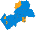 Harborough UK ward map 2019.svg 711 × 582; 398 KB
-
 Harborough UK ward map 2023.svg 711 × 582; 398 KB
-
 Hawthorn blossom along the Market Harborough arm - geograph.org.uk - 6159633.jpg 1,946 × 1,460; 1.14 MB
-

-
 Hedgerow - geograph.org.uk - 4772318.jpg 640 × 426; 38 KB
-
 Heygate Street - geograph.org.uk - 2494100.jpg 640 × 480; 96 KB
-
 High Street - closed to traffic - geograph.org.uk - 2542396.jpg 1,280 × 948; 347 KB
-
 High Street - closed to traffic - geograph.org.uk - 2542403.jpg 1,280 × 959; 343 KB
-
 High Street - geograph.org.uk - 2492385.jpg 640 × 480; 103 KB
-
 High Street - geograph.org.uk - 2492388.jpg 640 × 480; 98 KB
-
 High Street - geograph.org.uk - 2492413.jpg 640 × 480; 93 KB
-
 High Street - geograph.org.uk - 2492414.jpg 640 × 480; 93 KB
-

-
 High Street, Market Harborough - geograph.org.uk - 5104671.jpg 640 × 427; 80 KB
-
 High Street, Market Harborough, west side - geograph.org.uk - 6192926.jpg 1,024 × 768; 336 KB
-
 Homebase on Springfield Street, Market Harborough - geograph.org.uk - 6202038.jpg 2,034 × 1,526; 1.7 MB
-
 House and estate agents, Roman Way - geograph.org.uk - 6193564.jpg 1,024 × 768; 352 KB
-
 House on Leicester Road - geograph.org.uk - 2492269.jpg 640 × 480; 91 KB
-
 House on Northampton Road - geograph.org.uk - 5025684.jpg 480 × 640; 63 KB
-
 Houses on Fairfield Road, Market Harborough - geograph.org.uk - 6192944.jpg 1,024 × 768; 360 KB
-
 Houses on Northampton Road - geograph.org.uk - 5025666.jpg 640 × 480; 59 KB
-
 Houses on School Lane, Market Harborough - geograph.org.uk - 6192985.jpg 1,024 × 768; 310 KB
-
 Houses on St Mary's Road, Market Harborough - geograph.org.uk - 6201451.jpg 2,034 × 1,526; 1.85 MB
-

-

-
 I 2829 (9388507642).jpg 2,592 × 3,888; 6.63 MB
-
 I 2870 (9388489074).jpg 3,662 × 1,680; 4.56 MB
.jpg)


_-_geograph.org.uk_-_4328131.jpg)
_-_geograph.org.uk_-_4328132.jpg)
_-_geograph.org.uk_-_4328153.jpg)
_-_geograph.org.uk_-_4328156.jpg)


_-_geograph.org.uk_-_6159850.jpg)


.jpg)


_-_geograph.org.uk_-_3498560.jpg)
_-_geograph.org.uk_-_3498587.jpg)


_-_geograph.org.uk_-_3474952.jpg)
_-_geograph.org.uk_-_4200698.jpg)


.jpg)


.jpg)
.jpg)