Category:North Kilworth
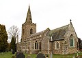
English: North Kilworth is a village in south Leicestershire, England, north of South Kilworth. Largely bypassed by the A4304 road, the village consists of a mix of old and new housing and includes a primary school and the parish church of St. Andrew's dating from the 13th century.
village and civil parish in Leicestershire, United Kingdom | |||||
| Upload media | |||||
| Instance of | |||||
|---|---|---|---|---|---|
| Location | Harborough, Leicestershire, East Midlands, England | ||||
| Population |
| ||||
| Area |
| ||||
 | |||||
Subcategories
This category has the following 6 subcategories, out of 6 total.
Media in category "North Kilworth"
The following 157 files are in this category, out of 157 total.
-
 15th. fairway at Kilworth Springs - geograph.org.uk - 446902.jpg 640 × 480; 67 KB
-
 A bend in Lutterworth Road (A4304) - geograph.org.uk - 3910323.jpg 640 × 480; 97 KB
-
-
 Albert's Archives - geograph.org.uk - 4643892.jpg 3,238 × 2,159; 3.09 MB
-
 Aspley House, North Kilworth - geograph.org.uk - 4706781.jpg 640 × 480; 73 KB
-
 Barn, Pincet Lodge - geograph.org.uk - 4340762.jpg 640 × 480; 84 KB
-
 Bosworth Road - geograph.org.uk - 4340760.jpg 640 × 480; 83 KB
-
 Bosworth Road - geograph.org.uk - 4340768.jpg 640 × 480; 78 KB
-
 Bosworth Road view - geograph.org.uk - 5549424.jpg 497 × 640; 44 KB
-
 Bridge 39 - geograph.org.uk - 592860.jpg 640 × 463; 133 KB
-

-
 Crop field off Bosworth Road - geograph.org.uk - 4340759.jpg 640 × 480; 83 KB
-
 Crop field off Bosworth Road - geograph.org.uk - 4340766.jpg 640 × 480; 92 KB
-

-
 Dismantled Railway near North Kilworth - geograph.org.uk - 1616922.jpg 480 × 640; 169 KB
-
 Dismantled Railway Track. - geograph.org.uk - 417680.jpg 640 × 480; 82 KB
-
 Dismantled Railway Track. - geograph.org.uk - 417695.jpg 640 × 480; 76 KB
-
 Diversification - geograph.org.uk - 4643895.jpg 3,238 × 2,159; 2.48 MB
-
 Elmwood Cottage, North Kilworth - geograph.org.uk - 5440949.jpg 640 × 428; 98 KB
-
 Entering North Kilworth - geograph.org.uk - 2804419.jpg 800 × 600; 123 KB
-
 Entering North Kilworth - geograph.org.uk - 3910305.jpg 640 × 480; 61 KB
-
 Farmland by North Kilworth Mill Farm - geograph.org.uk - 2947700.jpg 1,280 × 857; 392 KB
-
 Farmland east of Kilworth Road - geograph.org.uk - 3910313.jpg 640 × 480; 52 KB
-
 Farmland off Pincet Lane - geograph.org.uk - 4340763.jpg 640 × 480; 84 KB
-
 Farmland south of Lutterworth Road - geograph.org.uk - 3910318.jpg 640 × 480; 62 KB
-
 Frozen Grand Union Canal near Husbands Bosworth - geograph.org.uk - 2189895.jpg 1,024 × 768; 262 KB
-
 Grand Union Canal near Downton Farm - geograph.org.uk - 17862.jpg 640 × 480; 133 KB
-
 Grand Union Canal, Leicester Section - geograph.org.uk - 3470088.jpg 640 × 480; 111 KB
-
 Grand Union Canal, Leicester Section - geograph.org.uk - 3470181.jpg 640 × 480; 122 KB
-

-

-

-
 Grand Union Canal, near North Kilworth - geograph.org.uk - 202801.jpg 640 × 480; 111 KB
-
 Husbands Bosworth Tunnel in Leicestershire - geograph.org.uk - 5877618.jpg 1,280 × 903; 1.56 MB
-
 Husbands Bosworth Tunnel in Leicestershire - geograph.org.uk - 5877623.jpg 1,280 × 960; 1.36 MB
-
 Husbands Bosworth Tunnel Portal - geograph.org.uk - 2189903.jpg 1,024 × 768; 274 KB
-
 Husbands Bosworth Tunnel west portal, Leicestershire - geograph.org.uk - 5877629.jpg 1,280 × 942; 1.34 MB
-
 Husbands Bosworth Tunnel western portal - geograph.org.uk - 3115195.jpg 3,034 × 2,008; 1.54 MB
-
 I can remember when it was all fields round here - geograph.org.uk - 4643898.jpg 3,238 × 2,159; 2.39 MB
-
 Kilworth House Theatre Vicinity, N. Kilworth, Leics. - geograph.org.uk - 5642376.jpg 3,940 × 2,955; 4.89 MB
-
 Kilworth House Theatre, N. Kilworth, Leics. - geograph.org.uk - 5642304.jpg 3,473 × 2,074; 1.98 MB
-
 Kilworth House Theatre, N. Kilworth, Leics. - geograph.org.uk - 5642315.jpg 2,690 × 3,845; 3.61 MB
-
 Kilworth House Theatre, N. Kilworth, Leics. - geograph.org.uk - 5642325.jpg 3,866 × 2,716; 3.19 MB
-
 Kilworth House Theatre, N. Kilworth, Leics. - geograph.org.uk - 5642338.jpg 3,986 × 2,990; 4.88 MB
-
 Kilworth House Theatre, N. Kilworth, Leics. - geograph.org.uk - 5642371.jpg 3,927 × 2,945; 2.72 MB
-
 Kilworth House, N. Kilworth, Leics. - geograph.org.uk - 5642259.jpg 2,787 × 2,625; 2.14 MB
-
 Kilworth House, N. Kilworth, Leics. - geograph.org.uk - 5642265.jpg 2,355 × 3,394; 1.57 MB
-
 Kilworth House, N. Kilworth, Leics. - geograph.org.uk - 5642275.jpg 3,897 × 2,922; 2.85 MB
-
 Kilworth House, N. Kilworth, Leics. - geograph.org.uk - 5642285.jpg 3,595 × 2,239; 2.52 MB
-
 Kilworth Road - geograph.org.uk - 3910315.jpg 640 × 480; 81 KB
-
 Kilworth Road towards Walton - geograph.org.uk - 5549413.jpg 525 × 640; 57 KB
-
 Kilworth Springs Golf Course - geograph.org.uk - 2944476.jpg 1,280 × 856; 303 KB
-
 Kilworth Springs Golf Course - geograph.org.uk - 2946336.jpg 1,280 × 856; 299 KB
-
 Kilworth Wharf - geograph.org.uk - 164606.jpg 640 × 480; 110 KB
-
 Leicester 27 Miles - geograph.org.uk - 592873.jpg 550 × 640; 208 KB
-
 Leicester Section prior to Husbands Bosworth Tunnel - geograph.org.uk - 3115507.jpg 3,072 × 2,048; 1.81 MB
-
 Leicester Section south of Station Farm - geograph.org.uk - 3115186.jpg 3,072 × 2,048; 1.85 MB
-
 Living Milestone No 9 - geograph.org.uk - 592878.jpg 526 × 640; 188 KB
-
 Lutterworth Road (A4304) - geograph.org.uk - 3910320.jpg 640 × 480; 61 KB
-
 North Kilworth Bowls Club - geograph.org.uk - 3614545.jpg 1,024 × 817; 255 KB
-
 North Kilworth bridleway - geograph.org.uk - 5173330.jpg 640 × 480; 36 KB
-
 North Kilworth Kennels - geograph.org.uk - 1426732.jpg 640 × 480; 69 KB
-
 North Kilworth Mill Farm - geograph.org.uk - 2952781.jpg 1,280 × 856; 367 KB
-
 North Kilworth Nether Hall - geograph.org.uk - 3619979.jpg 1,024 × 768; 240 KB
-
 North Kilworth Parish Church - geograph.org.uk - 5173328.jpg 640 × 480; 49 KB
-
 North Kilworth Village Hall - geograph.org.uk - 3619971.jpg 1,024 × 768; 230 KB
-
 North Kilworth, Leics - St Andrew's Church - geograph.org.uk - 5243529.jpg 5,184 × 2,920; 4.74 MB
-
 Pincet Lane (B5414) - geograph.org.uk - 4340765.jpg 640 × 480; 75 KB
-
 Pincet Lane - geograph.org.uk - 5549425.jpg 480 × 640; 41 KB
-
 Private lane leading down to North Kilworth Mill Farm, Leics - geograph.org.uk - 5243530.jpg 5,184 × 2,920; 4.51 MB
-

-
 South Andrew's, North Kilworth - geograph.org.uk - 2804422.jpg 800 × 600; 161 KB
-
 South Kilworth Road - geograph.org.uk - 5440941.jpg 640 × 428; 164 KB
-
 South Kilworth Road - geograph.org.uk - 592888.jpg 640 × 456; 97 KB
-
 St Andrew, North Kilworth - Chancel - geograph.org.uk - 3423179.jpg 1,000 × 718; 252 KB
-
 St Andrew, North Kilworth - Churchyard - geograph.org.uk - 3423169.jpg 1,000 × 667; 366 KB
-
 St Andrew, North Kilworth - Churchyard - geograph.org.uk - 3423171.jpg 1,000 × 667; 342 KB
-
 St Andrew, North Kilworth - Churchyard - geograph.org.uk - 3423173.jpg 1,000 × 667; 234 KB
-
 St Andrew, North Kilworth - East end - geograph.org.uk - 3423175.jpg 1,000 × 667; 195 KB
-
 St Andrew, North Kilworth - Font - geograph.org.uk - 3423215.jpg 725 × 1,000; 170 KB
-
 St Andrew, North Kilworth - geograph.org.uk - 3423154.jpg 1,000 × 661; 165 KB
-
 St Andrew, North Kilworth - geograph.org.uk - 3423157.jpg 1,000 × 633; 182 KB
-
 St Andrew, North Kilworth - geograph.org.uk - 3423159.jpg 1,000 × 717; 205 KB
-
 St Andrew, North Kilworth - geograph.org.uk - 3423164.jpg 1,000 × 677; 211 KB
-
 St Andrew, North Kilworth - Sanctuary - geograph.org.uk - 3423185.jpg 1,000 × 698; 242 KB
-
 St Andrew, North Kilworth - Stained glass window - geograph.org.uk - 3423197.jpg 573 × 1,000; 265 KB
-
 St Andrew, North Kilworth - Stained glass window - geograph.org.uk - 3423200.jpg 338 × 1,000; 142 KB
-
 St Andrew, North Kilworth - Stained glass window - geograph.org.uk - 3423202.jpg 484 × 1,000; 230 KB
-
 St Andrew, North Kilworth - Stained glass window - geograph.org.uk - 3423208.jpg 629 × 1,000; 310 KB
-
 St Andrew, North Kilworth - Stained glass window - geograph.org.uk - 3423212.jpg 583 × 1,000; 259 KB
-
 St Andrew, North Kilworth - Wall monument - geograph.org.uk - 3423189.jpg 788 × 1,000; 195 KB
-
 St Andrew, North Kilworth - Wall monument - geograph.org.uk - 3423192.jpg 897 × 1,000; 181 KB
-
 St Andrew, North Kilworth - Wall monument - geograph.org.uk - 3423193.jpg 720 × 1,000; 149 KB
-
 St Andrew, North Kilworth - War Memorial - geograph.org.uk - 3423213.jpg 569 × 1,000; 157 KB
-
 St Andrew, North Kilworth - West end - geograph.org.uk - 3423187.jpg 1,000 × 667; 229 KB
-
 St. Andrew's - North Kilworth - geograph.org.uk - 5549409.jpg 640 × 480; 51 KB
-
 Station Road (A4304) - geograph.org.uk - 3910311.jpg 640 × 480; 84 KB
-
 Sybolds Spinney Bridge - geograph.org.uk - 592881.jpg 640 × 487; 161 KB
-
 The entrance to Kilworth Springs - geograph.org.uk - 2804414.jpg 800 × 600; 84 KB
-
 The Green, North Kilworth - geograph.org.uk - 1829827.jpg 640 × 480; 84 KB
-
 The Green, North Kilworth - geograph.org.uk - 4706790.jpg 640 × 480; 62 KB
-
 The Old Post House, North Kilworth - geograph.org.uk - 4706789.jpg 640 × 480; 65 KB
-
 The Staging Post, Kilworth House Hotel, N. Kilworth, Leics. - geograph.org.uk - 5642357.jpg 4,004 × 3,003; 4.32 MB
-
 The Staging Post, Kilworth House Hotel, N. Kilworth, Leics. - geograph.org.uk - 5642364.jpg 3,780 × 2,885; 3.51 MB
-
 The Washpit, North Kilworth - geograph.org.uk - 4706784.jpg 480 × 640; 124 KB
-
 The White Lion pub, North Kilworth - geograph.org.uk - 3910309.jpg 640 × 480; 57 KB
-
 Track to Mill Farm - geograph.org.uk - 1829816.jpg 640 × 480; 109 KB
-
 Union Chapel, North Kilworth - geograph.org.uk - 4706794.jpg 480 × 640; 71 KB
-
 Washpit Lane, North Kilworth - geograph.org.uk - 597557.jpg 640 × 440; 130 KB
-
 Welford Arm Junction, Grand Union Canal - geograph.org.uk - 202799.jpg 640 × 480; 106 KB
-
-
 White Lion in North Kilworth - geograph.org.uk - 597588.jpg 640 × 503; 82 KB
-
 Wind turbine east of Kilworth Road - geograph.org.uk - 5440968.jpg 640 × 480; 103 KB
-
 Abandoned Quarry. - geograph.org.uk - 419483.jpg 640 × 480; 146 KB
-
 Abattoir and Local Butcher. - geograph.org.uk - 417064.jpg 640 × 480; 95 KB
-
 Bosworth Mill Farm, Leicestershire - geograph.org.uk - 592057.jpg 640 × 449; 102 KB
-
 Bridge 40 -The Mill Bridge. - geograph.org.uk - 419469.jpg 640 × 480; 109 KB
-
 Bridge 45, Station Road - geograph.org.uk - 597605.jpg 640 × 480; 67 KB
-
 Bridge no 37, South Kilworth Road - geograph.org.uk - 592887.jpg 640 × 462; 124 KB
-
 Bridge to Bosworth Mill Farm. - geograph.org.uk - 368552.jpg 640 × 480; 112 KB
-
 Cattle in "Stoney". - geograph.org.uk - 431213.jpg 640 × 480; 105 KB
-
 Church Spinney - geograph.org.uk - 597380.jpg 640 × 409; 57 KB
-
 Derelict Grain Store and Mast. - geograph.org.uk - 394670.jpg 640 × 480; 103 KB
-
 Entering North Kilworth - geograph.org.uk - 597423.jpg 640 × 439; 111 KB
-
 Farmland near North Kilworth - geograph.org.uk - 202783.jpg 640 × 480; 79 KB
-
 Grand Union Canal and towpath - geograph.org.uk - 597606.jpg 640 × 455; 123 KB
-
 Isolated Wood. - geograph.org.uk - 402670.jpg 640 × 480; 109 KB
-
 Kibworth Springs Premier Golf Club - geograph.org.uk - 597390.jpg 640 × 589; 77 KB
-
 Kilworth House Hotel - geograph.org.uk - 597411.jpg 640 × 401; 74 KB
-
 Leicester 26 Miles - geograph.org.uk - 592848.jpg 476 × 640; 180 KB
-
 Lodge Farm, Welford, Northants - geograph.org.uk - 17221.jpg 640 × 480; 116 KB
-
 Looking towards the Grand Union Canal - geograph.org.uk - 17870.jpg 640 × 480; 93 KB
-
 Mill Bridge - geograph.org.uk - 592855.jpg 640 × 475; 155 KB
-
 Mill Farm - geograph.org.uk - 164626.jpg 640 × 480; 150 KB
-
 North Kilworth - geograph.org.uk - 167627.jpg 640 × 480; 173 KB
-
 North Kilworth - geograph.org.uk - 167629.jpg 640 × 480; 162 KB
-
 North Kilworth - geograph.org.uk - 244725.jpg 640 × 480; 100 KB
-
 North Kilworth - geograph.org.uk - 244883.jpg 640 × 480; 165 KB
-
 North Kilworth - geograph.org.uk - 245266.jpg 640 × 480; 106 KB
-
 North Kilworth - geograph.org.uk - 245269.jpg 640 × 480; 141 KB
-
 North Kilworth - geograph.org.uk - 597580.jpg 640 × 599; 92 KB
-
 North Kilworth information board - geograph.org.uk - 597566.jpg 640 × 470; 129 KB
-
 North Kilworth Mill Farm. - geograph.org.uk - 368622.jpg 640 × 480; 86 KB
-
 River under Railway. - geograph.org.uk - 368609.jpg 640 × 480; 133 KB
-
 Rugby Road towards South Kilworth - geograph.org.uk - 592903.jpg 640 × 509; 121 KB
-
 Sheep Pasture. - geograph.org.uk - 417768.jpg 640 × 480; 102 KB
-
 Sign at Welford Junction - geograph.org.uk - 592081.jpg 517 × 640; 190 KB
-
 South Kilworth Road - geograph.org.uk - 597395.jpg 640 × 388; 71 KB
-
 Sparford Bridge - geograph.org.uk - 592842.jpg 640 × 482; 136 KB
-
 Spring View. - geograph.org.uk - 413772.jpg 640 × 480; 92 KB
-
 Station Farm across the Rape Field. - geograph.org.uk - 402655.jpg 640 × 480; 98 KB
-
 Station Road, North Kilworth - geograph.org.uk - 597591.jpg 640 × 413; 59 KB
-
 The "Gallops". - geograph.org.uk - 417718.jpg 640 × 480; 94 KB
-

-

-

-
 Where Once a Bridge Stood. - geograph.org.uk - 419475.jpg 640 × 480; 143 KB

_-_geograph.org.uk_-_3910323.jpg)


_-_geograph.org.uk_-_3910320.jpg)


_-_geograph.org.uk_-_4340765.jpg)


_-_geograph.org.uk_-_3910311.jpg)


