Category:Ullesthorpe
Cymraeg: Pentref a chymuned yn Lloegr ydy Ullesthorpe.
English: Ullesthorpe is a small village in south Leicestershire, England. It has a population of 868.
Polski: Ullesthorpe – wieś w Anglii, w hrabstwie Leicestershire, w dystrykcie Harborough, ok 868 mieszkańców. Leży 19 km na południowy zachód od miasta Leicester i 134 km na północny zachód od Londynu. Przez Ullesthorpe przechodziła nieistniejąca już linia kolejowa z Leicester do Rugby, w latach 1840-1961 była tu czynna stacja kolejowa.
Main Wikipedia article: Ullesthorpe.

human settlement in United Kingdom | |||||
| Upload media | |||||
| Instance of | |||||
|---|---|---|---|---|---|
| Location | Harborough, Leicestershire, East Midlands, England | ||||
| Population |
| ||||
| Area |
| ||||
 | |||||
Subcategories
This category has only the following subcategory.
U
- Ullesthorpe railway station (2 F)
Media in category "Ullesthorpe"
The following 98 files are in this category, out of 98 total.
-

-
 An Ullesthorpe resident - geograph.org.uk - 626037.jpg 640 × 475; 129 KB
-
 Congregational Chapel, Ullesthorpe - geograph.org.uk - 5697069.jpg 640 × 640; 82 KB
-
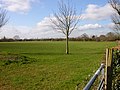
 Fairway Meadows, Ullesthorpe - geograph.org.uk - 1621262.jpg 640 × 480; 51 KB
-
-

-
 Gates along Lutterworth Road - geograph.org.uk - 3451252.jpg 3,444 × 2,465; 2.53 MB
-
 Hall Lane, Ullesthorpe - geograph.org.uk - 3570200.jpg 640 × 480; 111 KB
-
 Leaving Ullesthorpe - geograph.org.uk - 5685102.jpg 1,600 × 900; 268 KB
-
 Lodge Farm, Ullesthorpe - geograph.org.uk - 736434.jpg 640 × 421; 134 KB
-
 Lutterworth Road at Palmers Garden Centre - geograph.org.uk - 3451267.jpg 2,497 × 1,878; 1.47 MB
-
 Lutterworth Road towards Ullesthorpe - geograph.org.uk - 626016.jpg 640 × 477; 88 KB
-
 Main Street in Ullesthorpe - geograph.org.uk - 626041.jpg 640 × 399; 72 KB
-
 Main Street, Ullesthorpe - geograph.org.uk - 183991.jpg 640 × 480; 248 KB
-
 Manor Road, Ullesthorpe - geograph.org.uk - 4956190.jpg 1,280 × 853; 445 KB
-
 Mere Lane - geograph.org.uk - 4956173.jpg 1,280 × 853; 403 KB
-
 Mere Lane towards Ashby Parva - geograph.org.uk - 5410741.jpg 640 × 451; 140 KB
-
 Mere Lane towards Cross in Hand - geograph.org.uk - 5410742.jpg 640 × 447; 137 KB
-
 Mill Road, Ullesthorpe - geograph.org.uk - 1621218.jpg 640 × 480; 82 KB
-
 Mill Road, Ullesthorpe - geograph.org.uk - 3570197.jpg 640 × 480; 78 KB
-
 Ordnance Survey Map of Ullesthorpe and the surrounding area.PNG 478 × 312; 292 KB
-
 Ordnance survey map of Ullesthorpe.PNG 238 × 137; 69 KB
-
 Ordnance Survey map of Ullesthorpe.PNG 508 × 338; 337 KB
-
 Ordnance Survey Map of Ullesthorpe.PNG 484 × 306; 293 KB
-
 Outbuildings, Ullesthorpe windmill - geograph.org.uk - 4956189.jpg 1,280 × 853; 491 KB
-

-
 Pigsty at Ullesthorpe windmill - geograph.org.uk - 4956185.jpg 1,280 × 853; 623 KB
-
-
 Right of Way, Ullesthorpe - geograph.org.uk - 1621235.jpg 480 × 640; 69 KB
-

-

-
 Road bridge, Ullesthorpe - geograph.org.uk - 1621195.jpg 640 × 480; 139 KB
-
 Road narrows over bridge near Ullesthorpe - geograph.org.uk - 2134806.jpg 1,024 × 696; 171 KB
-
 Stable and cartshed, Ullesthorpe windmill - geograph.org.uk - 4956187.jpg 1,280 × 842; 487 KB
-
 The lonely tree - geograph.org.uk - 5684587.jpg 1,600 × 900; 231 KB
-
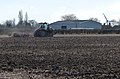 Tractor near Breach Barn - geograph.org.uk - 3451211.jpg 2,979 × 1,972; 1.71 MB
-
 Trees by a stream - geograph.org.uk - 736421.jpg 640 × 421; 133 KB
-
 Trees on a ridge - geograph.org.uk - 736378.jpg 640 × 315; 147 KB
-
 Ullesthorpe - geograph.org.uk - 146465.jpg 640 × 480; 130 KB
-
 Ullesthorpe - geograph.org.uk - 146470.jpg 640 × 480; 119 KB
-
 Ullesthorpe - geograph.org.uk - 156064.jpg 640 × 480; 112 KB
-
 Ullesthorpe - geograph.org.uk - 167655.jpg 640 × 480; 123 KB
-
 Ullesthorpe - geograph.org.uk - 3165907.jpg 640 × 417; 262 KB
-
 Ullesthorpe - geograph.org.uk - 5371178.jpg 4,128 × 2,322; 4.83 MB
-
 Ullesthorpe - geograph.org.uk - 60947.jpg 640 × 480; 131 KB
-
 Ullesthorpe Court Hotel - geograph.org.uk - 3567761.jpg 640 × 480; 73 KB
-
 Ullesthorpe Golf Course - geograph.org.uk - 1621244.jpg 640 × 480; 46 KB
-
 Ullesthorpe Mill - geograph.org.uk - 1621264.jpg 480 × 640; 91 KB
-
 Ullesthorpe Mill.jpg 639 × 460; 185 KB
-
 Ullesthorpe Sign 019.JPG 2,000 × 3,008; 2.62 MB
-
 Ullesthorpe station.jpg 1,192 × 904; 303 KB
-

-

-
-

-

-

-
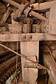
 Ullesthorpe Subscription Mill - stones - geograph.org.uk - 3165885.jpg 424 × 640; 241 KB
-
 Ullesthorpe Subscription Mill - stones - geograph.org.uk - 3165889.jpg 424 × 640; 256 KB
-
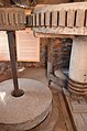
 Ullesthorpe Subscription Mill - stones - geograph.org.uk - 3165895.jpg 424 × 640; 253 KB
-
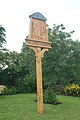
 Ullesthorpe village sign - geograph.org.uk - 626039.jpg 416 × 640; 96 KB
-
 Ullesthorpe, postbox No. LE17 88 - geograph.org.uk - 1290416.jpg 640 × 480; 82 KB
-
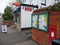
 Ullesthorpe, the store-post office - geograph.org.uk - 1290407.jpg 640 × 480; 68 KB
-
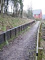
 Ullesthorpe-Dismantled Railway - geograph.org.uk - 1726645.jpg 640 × 480; 115 KB
-
 Ullesthorpe-Dismantled Railway - geograph.org.uk - 1726923.jpg 640 × 480; 126 KB
-
 Ullesthorpe-Dismantled Railway - geograph.org.uk - 1728173.jpg 640 × 480; 117 KB
-
 Ullesthorpe-Footpath to the A5 - geograph.org.uk - 1729828.jpg 640 × 480; 87 KB
-
 Ullesthorpe-Lutterworth Road - geograph.org.uk - 1726694.jpg 640 × 480; 79 KB
-
 Ullesthorpe-Main Street - geograph.org.uk - 1728150.jpg 640 × 480; 61 KB
-
 Ullesthorpe-Manor Road - geograph.org.uk - 1729835.jpg 640 × 480; 115 KB
-
 Ullesthorpe-Midland Counties Line - geograph.org.uk - 1628618.jpg 640 × 480; 100 KB
-
 Ullesthorpe-Mill Road - geograph.org.uk - 1726666.jpg 640 × 480; 77 KB
-
 Ullesthorpe-Mill Road - geograph.org.uk - 1726914.jpg 640 × 480; 58 KB
-

-
 Ullesthorpe-The Old Post Office - geograph.org.uk - 1728199.jpg 640 × 480; 68 KB
-
 Ullesthorpe-The Swan Inn - geograph.org.uk - 1728138.jpg 640 × 480; 55 KB
-
 View along Main Street, Ullesthorpe - geograph.org.uk - 626034.jpg 640 × 424; 61 KB
-
 View towards Magna Park - geograph.org.uk - 626758.jpg 640 × 448; 99 KB
-
-
 Approaching Ullesthorpe - geograph.org.uk - 626029.jpg 640 × 480; 93 KB
-
 Between Frolesworth and Ullesthorpe - geograph.org.uk - 183997.jpg 640 × 480; 192 KB
-
 Countryside south of Ullesthorpe - geograph.org.uk - 626720.jpg 640 × 469; 71 KB
-
 Lutterworth - geograph.org.uk - 98008.jpg 640 × 480; 103 KB
-
 Lutterworth Road junction - geograph.org.uk - 626010.jpg 640 × 420; 89 KB
-
 Lutterworth Road near Ullesthorpe - geograph.org.uk - 626027.jpg 640 × 479; 97 KB
-
 Main Street leaves Ullesthorpe - geograph.org.uk - 626723.jpg 640 × 453; 100 KB
-
 Milepost - geograph.org.uk - 626031.jpg 476 × 640; 121 KB
-
 North along Frolesworth Road - geograph.org.uk - 626043.jpg 640 × 404; 84 KB
-
 The Chequers Country Inne - geograph.org.uk - 626040.jpg 640 × 493; 71 KB
-
 The Swan Inn - geograph.org.uk - 626042.jpg 640 × 452; 67 KB
-
 Track south of Ullesthorpe - geograph.org.uk - 186199.jpg 640 × 480; 74 KB
-
 Ullesthorpe - geograph.org.uk - 134521.jpg 640 × 480; 181 KB
-
 Ullesthorpe - geograph.org.uk - 134524.jpg 640 × 480; 119 KB
-
 Ullesthorpe - geograph.org.uk - 146463.jpg 640 × 480; 133 KB
-
 Ullesthorpe - geograph.org.uk - 167329.jpg 640 × 480; 164 KB
-
 Ullesthorpe - geograph.org.uk - 170595.jpg 640 × 480; 141 KB
-
 Ullesthorpe signs - geograph.org.uk - 626033.jpg 640 × 501; 118 KB
-
 Ullesthorpe Village centre - geograph.org.uk - 354485.jpg 640 × 480; 131 KB


