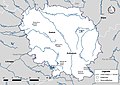
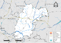
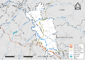
Category:Hydrographic maps of Creuse
Departments of Metropolitan France: Ain [01] · Aisne [02] · Alpes-de-Haute-Provence [04] · Hautes-Alpes [05] · Alpes-Maritimes [06] · Ardèche [07] · Ardennes [08] · Ariège [09] · Aube [10] · Aude [11] · Aveyron [12] · Bouches-du-Rhône [13] · Calvados [14] · Cantal [15] · Charente [16] · Charente-Maritime [17] · Cher [18] · Corrèze [19] · Corse-du-Sud [2A]† · Haute-Corse [2B]† · Côte-d’Or [21] · Côtes-d'Armor [22] · Creuse [23] · Dordogne [24] · Doubs [25] · Drôme [26] · Eure [27] · Eure-et-Loir [28] · Finistère [29] · Gard [30] · Haute-Garonne [31] · Gers [32] · Gironde [33] · Hérault [34] · Ille-et-Vilaine [35] · Indre [36] · Indre-et-Loire [37] · Isère [38] · Jura [39] · Landes [40] · Loir-et-Cher [41] · Loire [42] · Haute-Loire [43] · Loire-Atlantique [44] · Loiret [45] · Lot [46] · Lot-et-Garonne [47] · Lozère [48] · Maine-et-Loire [49] · Manche [50] · Marne [51] · Haute-Marne [52] · Mayenne [53] · Meurthe-et-Moselle [54] · Meuse [55] · Morbihan [56] · Moselle [57] · Nièvre [58] · Nord [59] · Oise [60] · Orne [61] · Pas-de-Calais [62] · Puy-de-Dôme [63] · Pyrénées-Atlantiques [64] · Hautes-Pyrénées [65] · Pyrénées-Orientales [66] · Bas-Rhin [67] · Haut-Rhin [68] · Haute-Saône [70] · Saône-et-Loire [71] · Sarthe [72] · Savoie [73] · Haute-Savoie [74] · Paris [75] · Seine-Maritime [76] · Seine-et-Marne [77] · Yvelines [78] · Deux-Sèvres [79] · Tarn [81] · Tarn-et-Garonne [82] · Var [83] · Vaucluse [84] · Vendée [85] · Vienne [86] · Haute-Vienne [87] · Vosges [88] · Yonne [89] · Territoire de Belfort [90] · Essonne [91] · Hauts-de-Seine [92] · Val-de-Marne [94] · Val-d'Oise [95]
Media in category "Hydrographic maps of Creuse"
The following 200 files are in this category, out of 270 total.
(previous page) (next page)-
 23-Cours eau 50km.jpg 3,507 × 2,480; 580 KB
-
 23-Cours eau.jpg 3,507 × 2,480; 1.62 MB
-
 23-Cours eau-relief.png 5,457 × 3,543; 7.97 MB
-
 23-Cours eau-relief2.png 5,457 × 3,543; 6.75 MB
-
 23-Cours eau-relief3.png 5,457 × 3,543; 6.92 MB
-
 23-Cours eau-relief4-80-masque.png 5,457 × 3,543; 6.9 MB
-
 23-UHR.jpg 3,507 × 2,480; 530 KB
-
 23-Cours eau-relief4-80.png 5,457 × 3,543; 6.95 MB
-
 23-SAGE.jpg 3,507 × 2,480; 843 KB
-
 23-Cours eau-relief4-90.png 5,457 × 3,543; 7 MB
-
 23-Bassins DCE.jpg 3,507 × 2,480; 1.07 MB
-
 23-Creuse-Sage.png 3,507 × 2,480; 1.31 MB
-
 23001-Ahun-Routes-Hydro.svg 1,056 × 744; 5.14 MB
-
 23002-Ajain-Routes-Hydro.svg 1,056 × 744; 4.15 MB
-
 23003-Alleyrat-Routes-Hydro.svg 1,056 × 744; 2.68 MB
-
 23004-Anzême-Routes-Hydro.svg 1,056 × 744; 4.03 MB
-
 23005-Arfeuille-Châtain-Routes-Hydro.svg 1,056 × 744; 3.59 MB
-
 23006-Arrènes-Routes-Hydro.svg 1,056 × 744; 4.4 MB
-
 23007-Ars-Routes-Hydro.svg 1,056 × 744; 4.42 MB
-
 23008-Aubusson-Routes-Hydro.svg 1,056 × 744; 4.3 MB
-
 23009-Auge-Routes-Hydro.svg 1,056 × 744; 2.62 MB
-
 23010-Augères-Routes-Hydro.svg 1,056 × 744; 3.59 MB
-
 23011-Aulon-Routes-Hydro.svg 1,056 × 744; 3.22 MB
-
 23012-Auriat-Routes-Hydro.svg 1,056 × 744; 3.52 MB
-
 23013-Auzances-Routes-Hydro.svg 1,056 × 744; 2.88 MB
-
 23014-Azat-Châtenet-Routes-Hydro.svg 1,056 × 744; 2.4 MB
-
 23015-Azerables-Routes-Hydro.svg 1,056 × 744; 4.51 MB
-
 23016-Banize-Routes-Hydro.svg 1,056 × 744; 3.27 MB
-
 23017-Basville-Routes-Hydro.svg 1,056 × 744; 3.51 MB
-
 23018-Bazelat-Routes-Hydro.svg 1,056 × 744; 4.08 MB
-
 23019-Beissat-Routes-Hydro.svg 1,056 × 744; 2.96 MB
-
 23020-Bellegarde-en-Marche-Routes-Hydro.svg 1,074 × 744; 1.9 MB
-
 23021-Bénévent-l'Abbaye-Routes-Hydro.svg 1,056 × 744; 3 MB
-
 23022-Bétête-Routes-Hydro.svg 1,056 × 744; 3.46 MB
-
 23023-Blaudeix-Routes-Hydro.svg 1,056 × 744; 2.46 MB
-
 23024-Blessac-Routes-Hydro.svg 1,056 × 744; 3.58 MB
-
 23025-Bonnat-Routes-Hydro.svg 1,056 × 744; 4.37 MB
-
 23026-Bord-Saint-Georges-Routes-Hydro.svg 1,056 × 744; 4.63 MB
-
 23027-Bosmoreau-les-Mines-Routes-Hydro.svg 1,056 × 744; 2.45 MB
-
 23028-Bosroger-Routes-Hydro.svg 1,056 × 744; 2.67 MB
-
 23029-Le Bourg-d'Hem-Routes-Hydro.svg 1,056 × 744; 3.16 MB
-
 23030-Bourganeuf-Routes-Hydro.svg 1,056 × 744; 3.83 MB
-
 23031-Boussac-Routes-Hydro.svg 1,363 × 744; 3.19 MB
-
 23032-Boussac-Bourg-Routes-Hydro.svg 1,056 × 744; 3.96 MB
-
 23033-La Brionne-Routes-Hydro.svg 1,056 × 744; 2.91 MB
-
 23034-Brousse-Routes-Hydro.svg 1,056 × 744; 2.32 MB
-
 23035-Budelière-Routes-Hydro.svg 1,056 × 744; 3.63 MB
-
 23036-Bussière-Dunoise-Routes-Hydro.svg 1,056 × 744; 3.82 MB
-
 23037-Bussière-Nouvelle-Routes-Hydro.svg 1,056 × 744; 2.59 MB
-
 23038-Bussière-Saint-Georges-Routes-Hydro.svg 1,056 × 744; 3.22 MB
-
 23039-La Celle-Dunoise-Routes-Hydro.svg 1,056 × 744; 4.68 MB
-
 23040-La Celle-sous-Gouzon-Routes-Hydro.svg 1,056 × 744; 2.64 MB
-
 23041-La Cellette-Routes-Hydro.svg 1,056 × 744; 3.63 MB
-
 23042-Ceyroux-Routes-Hydro.svg 1,056 × 744; 3.41 MB
-
 23043-Chamberaud-Routes-Hydro.svg 1,056 × 744; 2.32 MB
-
 23044-Chambon-Sainte-Croix-Routes-Hydro.svg 1,056 × 744; 2.19 MB
-
 23045-Chambon-sur-Voueize-Routes-Hydro.svg 1,056 × 744; 5.32 MB
-
 23046-Chambonchard-Routes-Hydro.svg 1,056 × 744; 2.59 MB
-
 23047-Chamborand-Routes-Hydro.svg 1,056 × 744; 3.5 MB
-
 23048-Champagnat-Routes-Hydro.svg 1,056 × 744; 3.5 MB
-
 23049-Champsanglard-Routes-Hydro.svg 1,056 × 744; 3.05 MB
-
 23050-La Chapelle-Baloue-Routes-Hydro.svg 1,056 × 744; 2.81 MB
-
 23051-La Chapelle-Saint-Martial-Routes-Hydro.svg 1,056 × 744; 2.58 MB
-
 23052-La Chapelle-Taillefert-Routes-Hydro.svg 1,056 × 744; 4.45 MB
-
 23053-Chard-Routes-Hydro.svg 1,056 × 744; 2.7 MB
-
 23054-Charron-Routes-Hydro.svg 1,056 × 744; 4.5 MB
-
 23055-Châtelard-Routes-Hydro.svg 1,056 × 744; 1.89 MB
-
 23056-Châtelus-le-Marcheix-Routes-Hydro.svg 1,056 × 744; 4.29 MB
-
 23057-Châtelus-Malvaleix-Routes-Hydro.svg 1,056 × 744; 2.97 MB
-
 23058-Le Chauchet-Routes-Hydro.svg 1,056 × 744; 2.43 MB
-
 23059-La Chaussade-Routes-Hydro.svg 1,056 × 744; 3.33 MB
-
 23060-Chavanat-Routes-Hydro.svg 1,056 × 744; 2.72 MB
-
 23061-Chénérailles-Routes-Hydro.svg 1,056 × 744; 2.84 MB
-
 23062-Chéniers-Routes-Hydro.svg 1,056 × 744; 4.33 MB
-
 23063-Clairavaux-Routes-Hydro.svg 1,056 × 744; 3.53 MB
-
 23064-Clugnat-Routes-Hydro.svg 1,056 × 744; 4.98 MB
-
 23065-Colondannes-Routes-Hydro.svg 1,056 × 744; 2.74 MB
-
 23066-Le Compas-Routes-Hydro.svg 1,056 × 744; 3.45 MB
-
 23067-La Courtine-Routes-Hydro.svg 1,056 × 744; 4.29 MB
-
 23068-Cressat-Routes-Hydro.svg 1,056 × 744; 4.67 MB
-
 23069-Crocq-Routes-Hydro.svg 1,056 × 744; 3.27 MB
-
 23070-Crozant-Routes-Hydro.svg 1,056 × 744; 4.28 MB
-
 23071-Croze-Routes-Hydro.svg 1,056 × 744; 3.95 MB
-
 23072-Domeyrot-Routes-Hydro.svg 1,056 × 744; 3.49 MB
-
 23073-Dontreix-Routes-Hydro.svg 1,056 × 744; 3.87 MB
-
 23074-Le Donzeil-Routes-Hydro.svg 1,056 × 744; 2.95 MB
-
 23075-Dun-le-Palestel-Routes-Hydro.svg 1,056 × 744; 3.98 MB
-
 23076-Évaux-les-Bains-Routes-Hydro.svg 1,056 × 744; 5.37 MB
-
 23077-Faux-la-Montagne-Routes-Hydro.svg 1,056 × 744; 4.6 MB
-
 23078-Faux-Mazuras-Routes-Hydro.svg 1,056 × 744; 3.37 MB
-
 23079-Felletin-Routes-Hydro.svg 1,056 × 744; 4.58 MB
-
 23080-Féniers-Routes-Hydro.svg 1,056 × 744; 2.47 MB
-
 23081-Flayat-Routes-Hydro.svg 1,056 × 744; 4.63 MB
-
 23082-Fleurat-Routes-Hydro.svg 1,056 × 744; 2.94 MB
-
 23083-Fontanières-Routes-Hydro.svg 1,056 × 744; 2.84 MB
-
 23084-La Forêt-du-Temple-Routes-Hydro.svg 1,056 × 744; 2.55 MB
-
 23086-Fransèches-Routes-Hydro.svg 1,056 × 744; 3.7 MB
-
 23087-Fresselines-Routes-Hydro.svg 1,056 × 744; 4.34 MB
-
 23088-Gartempe-Routes-Hydro.svg 1,056 × 744; 2.71 MB
-
 23089-Genouillac-Routes-Hydro.svg 1,056 × 744; 4.59 MB
-
 23090-Gentioux-Pigerolles-Routes-Hydro.svg 1,056 × 744; 4.24 MB
-
 23091-Gioux-Routes-Hydro.svg 1,056 × 744; 4.23 MB
-
 23092-Glénic-Routes-Hydro.svg 1,056 × 744; 3.98 MB
-
 23093-Gouzon-Routes-Hydro.svg 1,056 × 744; 5.04 MB
-
 23095-Le Grand-Bourg-Routes-Hydro.svg 1,056 × 744; 7.45 MB
-
 23096-Guéret-Routes-Hydro.svg 1,056 × 744; 7.18 MB
-
 23097-Issoudun-Létrieix-Routes-Hydro.svg 1,056 × 744; 3.64 MB
-
 23098-Jalesches-Routes-Hydro.svg 1,056 × 744; 2.42 MB
-
 23099-Janaillat-Routes-Hydro.svg 1,056 × 744; 3.73 MB
-
 23100-Jarnages-Routes-Hydro.svg 1,056 × 744; 2.58 MB
-
 23101-Jouillat-Routes-Hydro.svg 1,056 × 744; 3.76 MB
-
 23102-Ladapeyre-Routes-Hydro.svg 1,056 × 744; 4.46 MB
-
 23103-Lafat-Routes-Hydro.svg 1,056 × 744; 3.09 MB
-
 23104-Lavaufranche-Routes-Hydro.svg 1,056 × 744; 3.48 MB
-
 23105-Lavaveix-les-Mines-Routes-Hydro.svg 1,056 × 744; 2.75 MB
-
 23106-Lépaud-Routes-Hydro.svg 1,056 × 744; 3.74 MB
-
 23107-Lépinas-Routes-Hydro.svg 1,056 × 744; 3.61 MB
-
 23108-Leyrat-Routes-Hydro.svg 1,056 × 744; 2.96 MB
-
 23109-Linard-Malval-Routes-Hydro.svg 1,056 × 744; 3.36 MB
-
 23110-Lioux-les-Monges-Routes-Hydro.svg 1,056 × 744; 2.48 MB
-
 23111-Lizières-Routes-Hydro.svg 1,056 × 744; 4.14 MB
-
 23112-Lourdoueix-Saint-Pierre-Routes-Hydro.svg 1,056 × 744; 4.73 MB
-
 23113-Lupersat-Routes-Hydro.svg 1,056 × 744; 4.22 MB
-
 23114-Lussat-Routes-Hydro.svg 1,056 × 744; 4.23 MB
-
 23115-Magnat-l'Étrange-Routes-Hydro.svg 1,056 × 744; 3.28 MB
-
 23116-Mainsat-Routes-Hydro.svg 1,056 × 744; 4.67 MB
-
 23117-Maison-Feyne-Routes-Hydro.svg 1,056 × 744; 3.31 MB
-
 23118-Maisonnisses-Routes-Hydro.svg 1,056 × 744; 3.4 MB
-
 23119-Malleret-Routes-Hydro.svg 1,056 × 744; 2.56 MB
-
 23120-Malleret-Boussac-Routes-Hydro.svg 1,056 × 744; 4.27 MB
-
 23122-Mansat-la-Courrière-Routes-Hydro.svg 1,056 × 744; 3.31 MB
-
 23123-Les Mars-Routes-Hydro.svg 1,056 × 744; 3.34 MB
-
 23124-Marsac-Routes-Hydro.svg 1,056 × 744; 3.96 MB
-
 23125-Le Mas-d'Artige-Routes-Hydro.svg 1,056 × 744; 2.77 MB
-
 23127-Mautes-Routes-Hydro.svg 1,056 × 744; 3.18 MB
-
 23128-Mazeirat-Routes-Hydro.svg 1,056 × 744; 2.42 MB
-
 23129-La Mazière-aux-Bons-Hommes-Routes-Hydro.svg 1,056 × 744; 3.41 MB
-
 23130-Méasnes-Routes-Hydro.svg 1,056 × 744; 3.3 MB
-
 23131-Mérinchal-Routes-Hydro.svg 1,056 × 744; 3.41 MB
-
 23132-Montaigut-le-Blanc-Routes-Hydro.svg 1,056 × 744; 3.49 MB
-
 23133-Montboucher-Routes-Hydro.svg 1,056 × 744; 4.36 MB
-
 23134-Le Monteil-au-Vicomte-Routes-Hydro.svg 1,056 × 744; 3.49 MB
-
 23136-Mortroux-Routes-Hydro.svg 1,056 × 744; 3.09 MB
-
 23137-Mourioux-Vieilleville-Routes-Hydro.svg 1,056 × 744; 4.46 MB
-
 23138-Moutier-d'Ahun-Routes-Hydro.svg 1,056 × 744; 4.18 MB
-
 23139-Moutier-Malcard-Routes-Hydro.svg 1,056 × 744; 4.47 MB
-
 23140-Moutier-Rozeille-Routes-Hydro.svg 1,056 × 744; 4.16 MB
-
 23141-Naillat-Routes-Hydro.svg 1,056 × 744; 5.16 MB
-
 23142-Néoux-Routes-Hydro.svg 1,056 × 744; 4.71 MB
-
 23143-Noth-Routes-Hydro.svg 1,056 × 744; 3.78 MB
-
 23144-La Nouaille-Routes-Hydro.svg 1,056 × 744; 4.53 MB
-
 23145-Nouhant-Routes-Hydro.svg 1,056 × 744; 4.24 MB
-
 23146-Nouzerines-Routes-Hydro.svg 1,056 × 744; 3.34 MB
-
 23147-Nouzerolles-Routes-Hydro.svg 1,056 × 744; 2.52 MB
-
 23148-Nouziers-Routes-Hydro.svg 1,056 × 744; 2.49 MB
-
 23149-Parsac-Rimondeix-Routes-Hydro.svg 1,056 × 744; 4.97 MB
-
 23150-Peyrabout-Routes-Hydro.svg 1,056 × 744; 3.11 MB
-
 23151-Peyrat-la-Nonière-Routes-Hydro.svg 1,056 × 744; 3.5 MB
-
 23152-Pierrefitte-Routes-Hydro.svg 1,056 × 744; 2.59 MB
-
 23154-Pionnat-Routes-Hydro.svg 1,056 × 744; 5.82 MB
-
 23155-Pontarion-Routes-Hydro.svg 1,056 × 744; 2.18 MB
-
 23156-Pontcharraud-Routes-Hydro.svg 1,056 × 744; 2.61 MB
-
 23157-La Pouge-Routes-Hydro.svg 1,056 × 744; 2.18 MB
-
 23158-Poussanges-Routes-Hydro.svg 1,056 × 744; 4.16 MB
-
 23159-Puy-Malsignat-Routes-Hydro.svg 1,056 × 744; 3.31 MB
-
 23160-Reterre-Routes-Hydro.svg 1,056 × 744; 3.89 MB
-
 23162-Roches-Routes-Hydro.svg 1,056 × 744; 4.43 MB
-
 23164-Rougnat-Routes-Hydro.svg 1,056 × 744; 4.16 MB
-
 23165-Royère-de-Vassivière-Routes-Hydro.svg 1,056 × 744; 5.41 MB
-
 23166-Sagnat-Routes-Hydro.svg 1,056 × 744; 3.11 MB
-
 23167-Sannat-Routes-Hydro.svg 1,056 × 744; 5 MB
-
 23168-Sardent-Routes-Hydro.svg 1,056 × 744; 4.81 MB
-
 23169-La Saunière-Routes-Hydro.svg 1,056 × 744; 3.41 MB
-
 23170-Savennes-Routes-Hydro.svg 1,056 × 744; 2.47 MB
-
 23171-Sermur-Routes-Hydro.svg 1,056 × 744; 3.27 MB
-
 23172-La Serre-Bussière-Vieille-Routes-Hydro.svg 1,056 × 744; 3.23 MB
-
 23173-Soubrebost-Routes-Hydro.svg 1,056 × 744; 3.3 MB
-
 23174-Soumans-Routes-Hydro.svg 1,056 × 744; 3.97 MB
-
 23175-Sous-Parsat-Routes-Hydro.svg 1,056 × 744; 2.62 MB
-
 23176-La Souterraine-Routes-Hydro.svg 1,056 × 744; 5.98 MB
-
 23177-Saint-Agnant-de-Versillat-Routes-Hydro.svg 1,056 × 744; 5.16 MB
-
 23178-Saint-Agnant-près-Crocq-Routes-Hydro.svg 1,056 × 744; 3.56 MB
-
 23179-Saint-Alpinien-Routes-Hydro.svg 1,056 × 744; 2.97 MB
-
 23180-Saint-Amand-Routes-Hydro.svg 1,056 × 744; 3.45 MB
-
 23181-Saint-Amand-Jartoudeix-Routes-Hydro.svg 1,056 × 744; 2.91 MB
-
 23182-Saint-Avit-de-Tardes-Routes-Hydro.svg 1,056 × 744; 3.03 MB
-
 23183-Saint-Avit-le-Pauvre-Routes-Hydro.svg 1,056 × 744; 2.23 MB
-
 23184-Saint-Bard-Routes-Hydro.svg 1,056 × 744; 2.47 MB
-
 23185-Saint-Chabrais-Routes-Hydro.svg 1,056 × 744; 4.49 MB
-
 23186-Saint-Christophe-Routes-Hydro.svg 1,056 × 744; 2.98 MB
-
 23187-Saint-Dizier-la-Tour-Routes-Hydro.svg 1,056 × 744; 3.56 MB
-
 23188-Saint-Dizier-les-Domaines-Routes-Hydro.svg 1,056 × 744; 2.53 MB
-
 23189-Saint-Dizier-Masbaraud-Routes-Hydro.svg 1,056 × 744; 6.99 MB
-
 23190-Saint-Domet-Routes-Hydro.svg 1,056 × 744; 3.16 MB
-
 23191-Saint-Éloi-Routes-Hydro.svg 1,056 × 744; 3.29 MB
-
 23192-Fursac-Routes-Hydro.svg 1,056 × 744; 7.07 MB
-
 23193-Sainte-Feyre-Routes-Hydro.svg 1,056 × 744; 6.88 MB
-
 23194-Sainte-Feyre-la-Montagne-Routes-Hydro.svg 1,056 × 744; 2.46 MB
-
 23195-Saint-Fiel-Routes-Hydro.svg 1,056 × 744; 4.24 MB
-
 23196-Saint-Frion-Routes-Hydro.svg 1,056 × 744; 3.91 MB


