Category:July 2017 in the East Riding of Yorkshire
Ceremonial counties of England: Berkshire · Buckinghamshire · Cambridgeshire · Cheshire · Cornwall · Cumbria · Derbyshire · Devon · Dorset · Durham · East Riding of Yorkshire · East Sussex · Essex · Gloucestershire · Greater London · Greater Manchester · Hampshire · Herefordshire · Hertfordshire · Isle of Wight · Kent · Lancashire · Lincolnshire · Merseyside · Norfolk · North Yorkshire · Northamptonshire · Northumberland · Nottinghamshire · Oxfordshire · Shropshire · Somerset · South Yorkshire · Staffordshire · Suffolk · Surrey · Warwickshire · West Midlands · West Sussex · West Yorkshire · Worcestershire
City-counties: Bristol ·
Former historic counties:
Other former counties:
City-counties: Bristol ·
Former historic counties:
Other former counties:
Deutsch: Bilder, die im Juli 2017 in the East Riding of Yorkshire aufgenommen worden sind. Bitte beachten Sie, dass dies weder das Datum des Uploads noch das Datum des Scannens eines Fotos ist.
English: Images/pictures taken in the East Riding of Yorkshire during July 2017. Note this is not the date of the upload, nor the date a photo was scanned.
Español: Fotografías o imágenes tomadas en the East Riding of Yorkshire durante julio 2017. No es la fecha de subida ni escaneo, sino la fecha en que las fotografías o imágenes se crearon.
Esperanto: Bildoj faritaj en the East Riding of Yorkshire en julio 2017. Tio ne estas la dato, kiam la bildoj estis alŝutitaj aŭ skanitaj.
Français : Photographies ou images prises en the East Riding of Yorkshire durant juillet 2017. Ce n'est pas la date du téléchargement ou du scan.
Galego: Fotografías ou imaxes tomadas en the East Riding of Yorkshire durante xullo 2017. Non é a data de subida nin escaneamento, senón a data na que se crearon as fotografías ou imaxes.
Italiano: Fotografie o immagini scattate a the East Riding of Yorkshire nel luglio 2017. Nota bene: la data non si riferisce né a quella di upload né a quella in cui la foto è stata digitalizzata.
Norsk bokmål: Bilder tatt i the East Riding of Yorkshire i løpet av juli 2017. Merk at dette ikke er datoen for opplasting, eller når et bilde har blitt skannet.
Norsk nynorsk: Bilete teke i the East Riding of Yorkshire i løpet av juli 2017. Merk at dette ikkje er datoen for opplasting, eller når eit bilete har vorte skanna.
Русский: Изображения, сделанные в the East Riding of Yorkshire в течение июль 2017 (не дата загрузки изображения).
Українська: Зображення, зроблені в the East Riding of Yorkshire протягом липень 2017. Зауважте, що це не дата завантаження чи дата сканування фотографії.
| July 2016 | ← | July 2017 | → | July 2018 | |||||||
| Jan | Feb | Mar | Apr | May | Jun | Jul | Aug | Sep | Oct | Nov | Dec |
| 165 | 30 | 62 | 27 | 80 | 25 | 89 | 56 | 78 | 26 | 54 | 33 |
|---|---|---|---|---|---|---|---|---|---|---|---|
Subcategories
This category has only the following subcategory.
Media in category "July 2017 in the East Riding of Yorkshire"
The following 88 files are in this category, out of 88 total.
-
 Beach at North Landing (geograph 5483146).jpg 2,000 × 1,500; 648 KB
-
 North Landing Beach (geograph 5483159).jpg 2,000 × 1,500; 494 KB
-
 HedonAerodromePlaque.jpg 4,608 × 3,456; 3.32 MB
-
 The Humber Bridge from the air (geograph 5483117).jpg 639 × 640; 186 KB
-
 Alberto Seidi.jpg 2,448 × 3,264; 2.24 MB
-
 Approaching Fairholme Farm (geograph 5449614).jpg 2,304 × 1,728; 1.55 MB
-
 Barge moored on the River Hull at Wawne (geograph 5449625).jpg 2,304 × 1,728; 1.28 MB
-
 Beverley Minster (35521847380).jpg 6,000 × 4,000; 12.99 MB
-
 Beverley Road, near Withernwick (geograph 5453063).jpg 480 × 640; 293 KB
-
 Beverley-Road, Withernwick (geograph 5452256).jpg 640 × 449; 341 KB
-
 By North Lane, Welwick (geograph 5469279).jpg 640 × 480; 422 KB
-
 Carr House Farm, Drove Lane (geograph 5483846).jpg 1,600 × 1,065; 822 KB
-
 Carr House Farm, Drove Lane (geograph 5483849).jpg 1,600 × 1,065; 566 KB
-
 Carr land near Arnold (geograph 5472193).jpg 1,024 × 768; 212 KB
-
 Chapel Lane, Wawne (geograph 5483441).jpg 1,600 × 1,065; 747 KB
-
 Church of St Helen's, Kilnsea, East Riding of Yorkshire, UK.jpg 2,592 × 1,936; 1.64 MB
-
 Claas Lexion 780 (geograph 5484026).jpg 1,600 × 1,065; 567 KB
-
 Claas Lexion 780 (geograph 5484031).jpg 1,600 × 1,065; 537 KB
-
 Common Lane towards Wawne (geograph 5483028).jpg 1,600 × 1,065; 746 KB
-
 Danfield on Drove Lane (geograph 5483842).jpg 1,600 × 1,065; 579 KB
-
 Drove Lane off Ferry Road, Wawne (geograph 5483829).jpg 1,600 × 1,078; 534 KB
-
 Drove Lane off Ferry Road, Wawne (geograph 5483833).jpg 1,600 × 1,065; 451 KB
-
 Duke of York Skirlaugh across the A165 - geograph.org.uk - 5449617.jpg 2,304 × 1,728; 1,006 KB
-
 Entering Meltonby from the east (geograph 5532695).jpg 800 × 600; 133 KB
-
 Entering Withernwick from the east (geograph 5452075).jpg 480 × 640; 354 KB
-
 Fair Field, Stamford Bridge - geograph.org.uk - 5531110.jpg 800 × 600; 112 KB
-
 Fairview Farm, Meltonby (geograph 5531183).jpg 800 × 600; 179 KB
-
 Farm access on Cony Hill (geograph 5472100).jpg 1,024 × 768; 175 KB
-
 Ferry Road, Wawne (geograph 5483440).jpg 1,600 × 1,065; 493 KB
-
 Ferry Road, Wawne (geograph 5483463).jpg 1,600 × 1,065; 662 KB
-
 Fields off Feoffee Lane, Yapham (geograph 5531161).jpg 800 × 600; 106 KB
-
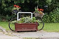 Floral display on Sutton Road, Wawne (geograph 5483062).jpg 1,600 × 1,065; 796 KB
-
 Footpath near Holmpton (geograph 5469295).jpg 640 × 480; 320 KB
-
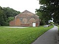
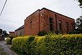 Former Chapel on Chapel Lane, Wawne (geograph 5483445).jpg 1,600 × 1,065; 664 KB
-
 Former railway near Wetwang (geograph 5830350).jpg 1,024 × 683; 851 KB
-
 Former railway station, Stamford Bridge (geograph 5531127).jpg 1,024 × 768; 720 KB
-
 Glebe Farm, Withernwick (geograph 5453880).jpg 640 × 480; 412 KB
-
 Grazing land near Skeffling (geograph 5471113).jpg 640 × 480; 387 KB
-
 Home Farm, Wawne (geograph 5483031).jpg 1,600 × 1,065; 529 KB
-
 Houses on Ferry Road, Wawne (geograph 5483465).jpg 1,600 × 1,065; 489 KB
-
 Humber Flood embankment near Weeton (geograph 5470295).jpg 640 × 480; 396 KB
-
 Humber Lane, Welwick (geograph 5468339).jpg 640 × 640; 528 KB
-
 Lambwath Meadows near Withernwick (geograph 5455275).jpg 640 × 480; 519 KB
-
 Land drain near Patrington (geograph 5467728).jpg 640 × 480; 372 KB
-
 Main Street, Wawne (geograph 5483065).jpg 1,600 × 1,065; 580 KB
-
 Main Street, Welwick (geograph 5468307).jpg 640 × 480; 474 KB
-
 Marshes near Weeton Clough (geograph 5471111).jpg 640 × 480; 422 KB
-
 Meltonby Grange Farm (geograph 5532699).jpg 800 × 600; 119 KB
-
 North End, Withernwick (geograph 5453088).jpg 640 × 480; 408 KB
-
 North of Weeton Bank (geograph 5470261).jpg 468 × 640; 429 KB
-
 Oak Square, Wawne (geograph 5483079).jpg 1,600 × 1,065; 333 KB
-
 Old Spurn Point Low Light.jpg 3,120 × 4,160; 1.25 MB
-
 Old Wife Lane, near Cowden (geograph 5452225).jpg 480 × 640; 483 KB
-
 On the Meridian, near Patrington (geograph 5471137).jpg 480 × 640; 477 KB
-
 Park Lane at Weel Carr (geograph 5484014).jpg 1,600 × 1,065; 717 KB
-
 Path alongside Drewery's Sock Dike (geograph 5472197).jpg 1,024 × 768; 229 KB
-
 Path at Stone Carr (geograph 5484008).jpg 1,600 × 1,065; 620 KB
-
 Path near Fairholme Farm (geograph 5483020).jpg 1,600 × 1,065; 914 KB
-
 River Derwent at Stamford Bridge - geograph.org.uk - 5531113.jpg 800 × 600; 125 KB
-
 Road through the wheat fields (geograph 5472112).jpg 1,024 × 768; 212 KB
-
 Rysome Road, Weeton (geograph 5469261).jpg 640 × 480; 504 KB
-
 Saltmarsh by Weeton Bank (geograph 5470244).jpg 480 × 640; 329 KB
-
 Sheep on Weeton Bank (geograph 5470576).jpg 640 × 480; 533 KB
-
 Soak Dike and East Level Bank (geograph 5449576).jpg 1,024 × 768; 234 KB
-
 South of Wakefield Lane, near Hollym (geograph 5469307).jpg 640 × 480; 411 KB
-
 St Martins church, Yapham (geograph 5531177).jpg 800 × 600; 155 KB
-
 St Martins church, Yapham - the blue pews (geograph 5531178).jpg 800 × 600; 129 KB
-
 St Martins church, Yapham - the font (geograph 5531180).jpg 800 × 600; 120 KB
-
 Stamford Bridge railway viaduct - geograph.org.uk - 5531106.jpg 800 × 600; 108 KB
-
 Swinridge Cottage, Givendale (geograph 5532704).jpg 800 × 600; 122 KB
-
 T-junction at the bottom of Grimthorpe Hill (geograph 5532703).jpg 800 × 600; 135 KB
-
 The remains of Oak Cottage Plantation (geograph 5472104).jpg 1,024 × 768; 209 KB
-
 Towards Patrington on Welwick Road (geograph 5471128).jpg 640 × 553; 453 KB
-
 Track to Woodhouse Lane (geograph 5472124).jpg 1,024 × 768; 167 KB
-
 Trees alongside Burnbutts Lane (geograph 5537708).jpg 1,024 × 768; 684 KB
-
 Turbine access track near Weeton (geograph 5468791).jpg 494 × 640; 327 KB
-
 Weeton Bank (geograph 5470231).jpg 640 × 480; 312 KB
-
 Weeton North Lane (geograph 5468762).jpg 640 × 480; 358 KB
-
 Welwick Road (geograph 5471120).jpg 640 × 480; 299 KB
-
 Welwick Saltmarsh (geograph 5470220).jpg 640 × 480; 367 KB
-
 Wheat field near Kid Hill (geograph 5472199).jpg 1,024 × 768; 205 KB
-
 Wheat near Patrington (geograph 5468375).jpg 640 × 514; 327 KB
-
 Wheatfield near Meltonby Grange (geograph 5532694).jpg 1,024 × 768; 785 KB
-
 Windham Crescent, Wawne (geograph 5483071).jpg 1,600 × 1,065; 482 KB
-
 Withernsea High School.jpg 2,912 × 1,064; 831 KB
-
 Withernwick wind farm (geograph 5453891).jpg 480 × 640; 254 KB
-
 Yapham Holds Farm, Feoffee Lane near Pocklington (geograph 5460242).jpg 800 × 600; 114 KB
-
 Yews alongside the churchyard path, Yapham (geograph 5531164).jpg 800 × 600; 227 KB
.jpg)
.jpg)

.jpg)

.jpg)
.jpg)
.jpg)
.jpg)
.jpg)
.jpg)
.jpg)
.jpg)
.jpg)
.jpg)

.jpg)
.jpg)
.jpg)
.jpg)
.jpg)
.jpg)

.jpg)
.jpg)

.jpg)
.jpg)
.jpg)
.jpg)
.jpg)
.jpg)
.jpg)
.jpg)
.jpg)
.jpg)
.jpg)
.jpg)
.jpg)
.jpg)
.jpg)
.jpg)
.jpg)
.jpg)
.jpg)
.jpg)
.jpg)
.jpg)
.jpg)
.jpg)
.jpg)

.jpg)
.jpg)
.jpg)
.jpg)
.jpg)
.jpg)

.jpg)
.jpg)
.jpg)
.jpg)
.jpg)
.jpg)
.jpg)
.jpg)
.jpg)

.jpg)
.jpg)
.jpg)
.jpg)
.jpg)
.jpg)
.jpg)
.jpg)
.jpg)
.jpg)
.jpg)
.jpg)
.jpg)
.jpg)
.jpg)
.jpg)
.jpg)
.jpg)