Category:Kings Langley
village and civil parish in Hertfordshire, England  | |||||
| Upload media | |||||
| Instance of | |||||
|---|---|---|---|---|---|
| Location | Dacorum, Hertfordshire, East of England, England | ||||
| Population |
| ||||
 | |||||
English: Kings Langley is a historic English village northwest of central London on the southern edge of the Chiltern Hills and now part of the London commuter belt. The major western portion lies in the borough of Dacorum and the east is in the Three Rivers district, both in the county of Hertfordshire, England. It was once the location of Kings Langley Palace, a Royal palace of the Plantagenet kings of England. The twelfth century parish church of All Saints houses the tomb of the first Duke of York.
Français : Kings Langley est un village d’Angleterre à 34 km au nord-ouest du centre de Londres, sur le flanc sud des Chiltern Hills, qui fait maintenant partie de l’agglomération londonienne. Ce fut autefois le lieu où se trouvait le palais royal des Plantagenet, rois d’Angleterre. L’église du XII siècle abrite la tombe d’Edmond de Langley, duc d’York.
Italiano: Kings Langley è un paese di 5.072 abitanti della contea dell' Hertfordshire, in Inghilterra.
Nederlands: Kings Langley is een plaats in het bestuurlijke gebied Dacorum, in het Engelse graafschap Hertfordshire. De plaats telt 5072 inwoners.
Subcategories
This category has the following 9 subcategories, out of 9 total.
A
- All Saints Church, Kings Langley (46 F)
H
- Home Park Lock (8 F)
K
- Kings Langley railway station (19 F)
- Kings Langley War Memorial (8 F)
L
- Longspring Wood (5 F)
O
- Ovaltine Factory, Kings Langley (15 F)
R
S
Media in category "Kings Langley"
The following 200 files are in this category, out of 302 total.
(previous page) (next page)-
 "Old Palace" public house and restaurant, King's Langley - geograph.org.uk - 5707271.jpg 1,600 × 1,305; 559 KB
-
 (Part of) High Street, WD4 - geograph.org.uk - 3061250.jpg 640 × 480; 69 KB
-
 1, 3, and 5 High Street, Kings Langley, April 2022.jpg 4,032 × 3,024; 4.39 MB
-
 15, 17 and 19 High Street, Kings Langley, April 2022.jpg 4,032 × 3,024; 3.64 MB
-
 33 and 35 High Street, King’s Langley, April 2022.jpg 4,032 × 3,024; 5.04 MB
-
 49 High Street, Kings Langley, April 2022.jpg 4,032 × 3,024; 4.22 MB
-
 51 and 53 High Street, Kings Langley, April 2022.jpg 4,032 × 3,024; 4.07 MB
-
 57, 59 and 61 High Street, Kings Langley, April 2022.jpg 4,032 × 3,024; 2.88 MB
-
 63, 65 and 67, High Street, Kings Langley, April 2022.jpg 4,032 × 3,024; 4.17 MB
-

-
 A Virgin express heads through Apsley station - geograph.org.uk - 2368265.jpg 1,280 × 960; 619 KB
-
 A41 at Rucklers Lane - geograph.org.uk - 3008711.jpg 640 × 480; 59 KB
-
 A41 at the M25 junction roundabout - geograph.org.uk - 3008680.jpg 640 × 480; 69 KB
-
 A41 climbing towards Hemel Hempstead - geograph.org.uk - 3008718.jpg 640 × 480; 55 KB
-
 A41 crossing Barnes Lane - geograph.org.uk - 3008707.jpg 640 × 480; 53 KB
-
 A41 en route to Hemel Hempstead - geograph.org.uk - 3008710.jpg 640 × 480; 52 KB
-
 A41 near Middle Farm - geograph.org.uk - 3008692.jpg 640 × 480; 52 KB
-
 A41 north of Chipperfield Road - geograph.org.uk - 3008703.jpg 640 × 480; 53 KB
-
 A41 west of the M25 roundabout - geograph.org.uk - 3008683.jpg 640 × 480; 49 KB
-
 Activity Tower in Scout Camp - geograph.org.uk - 2676185.jpg 2,916 × 1,996; 3.27 MB
-
 Apsley railway station - geograph.org.uk - 3379537.jpg 1,024 × 768; 234 KB
-
 Apsley Station - geograph.org.uk - 1909309.jpg 3,072 × 2,304; 1.92 MB
-
 Apsley Station - geograph.org.uk - 3889925.jpg 1,066 × 800; 176 KB
-
 Apsley Station - geograph.org.uk - 4769138.jpg 640 × 426; 108 KB
-
 Apsley Station - geograph.org.uk - 4769144.jpg 640 × 426; 102 KB
-
 Avenue Approach, WD4 - geograph.org.uk - 3059467.jpg 640 × 480; 99 KB
-
 Barnes Farm - geograph.org.uk - 134907.jpg 640 × 480; 57 KB
-
 Barnes Farm - geograph.org.uk - 135000.jpg 640 × 480; 60 KB
-
 Barnes Lane, Kings Langley - geograph.org.uk - 4431945.jpg 1,280 × 960; 572 KB
-
 Barnes Lane, Kings Langley - geograph.org.uk - 4432110.jpg 1,280 × 960; 721 KB
-
 Barnes Lane, Kings Langley - geograph.org.uk - 4432218.jpg 1,280 × 960; 791 KB
-
 Barnes Lane, Kings Langley - geograph.org.uk - 4432228.jpg 1,280 × 960; 806 KB
-
 Barnes Rise - geograph.org.uk - 4334896.jpg 640 × 480; 50 KB
-
 Barnes Rise - geograph.org.uk - 4334902.jpg 640 × 480; 46 KB
-
 Borough of Dacorum , The M25 Motorway - geograph.org.uk - 5733183.jpg 6,000 × 4,000; 6.09 MB
-
 Bridge 154, Grand Junction Canal - geograph.org.uk - 2962427.jpg 4,000 × 3,000; 4.67 MB
-
 Bridge 155, Grand Junction Canal - geograph.org.uk - 2962380.jpg 4,000 × 3,000; 4.89 MB
-
 Bridge 156, Grand Junction Canal - geograph.org.uk - 2962345.jpg 4,000 × 3,000; 4.44 MB
-
 Bridge 157, Grand Junction Canal - geograph.org.uk - 2962273.jpg 4,000 × 3,000; 4.68 MB
-
 Bridge 158 at Kings Langley - geograph.org.uk - 5329348.jpg 1,600 × 1,200; 980 KB
-
 Bridge 158, Grand Junction Canal - geograph.org.uk - 2962263.jpg 4,000 × 3,000; 4.78 MB
-
 Bridge 158A, Grand Junction Canal - geograph.org.uk - 2962192.jpg 4,000 × 3,000; 5.14 MB
-
 Bridge 158B, Grand Junction Canal - geograph.org.uk - 2962154.jpg 4,000 × 3,000; 5.27 MB
-
 Bridge 159, Grand Junction Canal - geograph.org.uk - 2962148.jpg 4,000 × 3,000; 4.83 MB
-
 Bridge 160, Grand Junction Canal - M25 - geograph.org.uk - 2962119.jpg 4,000 × 3,000; 4.6 MB
-
 Bridge No 157 at Kings Langley - geograph.org.uk - 5266593.jpg 800 × 542; 156 KB
-

-
 Bungalow on Chipperfield Road, Kings Langley - geograph.org.uk - 5079866.jpg 2,304 × 1,728; 841 KB
-
 By Wayside Farm - geograph.org.uk - 1511700.jpg 640 × 480; 119 KB
-
 Canal boats and motorway - geograph.org.uk - 998.jpg 640 × 480; 43 KB
-
 Canal lock, Kings Langley - geograph.org.uk - 997.jpg 480 × 640; 46 KB
-
 Canalbank, Kings Langley - geograph.org.uk - 1511571.jpg 640 × 480; 107 KB
-
 Chemist, Kings Langley WD4.jpg 2,304 × 3,072; 1.35 MB
-
 Chipperfield Road - geograph.org.uk - 98410.jpg 640 × 480; 68 KB
-
 Chipperfield Road bridge, A41 - geograph.org.uk - 3008701.jpg 640 × 480; 58 KB
-
 Chipperfield Road, Kings Langley - geograph.org.uk - 4679377.jpg 640 × 480; 81 KB
-
 Chipperfield Road, Kings Langley - geograph.org.uk - 4679406.jpg 640 × 480; 82 KB
-
 Chipperfield Road, Kings Langley - geograph.org.uk - 5079852.jpg 2,304 × 1,728; 794 KB
-
 Christ Church Baptist, Kings Langley - geograph.org.uk - 2309999.jpg 2,048 × 1,536; 546 KB
-
 Church Cottage, Church Lane, Kings Langley, April 2022.jpg 4,032 × 3,024; 4.93 MB
-
 Church House, Church Lane, WD4 - geograph.org.uk - 3061238.jpg 640 × 480; 96 KB
-
 Church House, Kings Langley, April 2022 01.jpg 4,032 × 3,024; 4.56 MB
-
 Common Lane at the junction of Barnes Lane - geograph.org.uk - 4432232.jpg 1,280 × 960; 680 KB
-
 Common Lane, Kings Langley - geograph.org.uk - 98404.jpg 640 × 480; 95 KB
-
 Construction at Nash Mills Wharf - geograph.org.uk - 5266097.jpg 800 × 600; 143 KB
-

-

-

-

-
 Don't Look Back^ - geograph.org.uk - 1511668.jpg 640 × 480; 137 KB
-
 Entrance to Church Cottage, Church Lane, Kings Langley, April 2022.jpg 4,032 × 3,024; 5.01 MB
-
 Entrance to Church House, Kings Langley, April 2022.jpg 3,024 × 4,032; 6.3 MB
-
 Field by Barnes Lane - geograph.org.uk - 1513378.jpg 640 × 480; 131 KB
-
 Field with horses by Barnes Lane - geograph.org.uk - 4432107.jpg 1,280 × 960; 583 KB
-
 Flats along the Grand Union Canal, Kings Langley - geograph.org.uk - 3833298.jpg 4,320 × 3,240; 5.48 MB
-
 Flats at Kings Langley - geograph.org.uk - 2160222.jpg 640 × 427; 230 KB
-
 Flats on Mill Lane, Kings Langley - geograph.org.uk - 4432519.jpg 1,280 × 960; 493 KB
-
 Footbridge Apsley Station - geograph.org.uk - 1909317.jpg 3,072 × 2,304; 3.56 MB
-
 Footbridge at Nash Mills Wharf - geograph.org.uk - 5266092.jpg 800 × 606; 139 KB
-
 Footbridge over the A41 - geograph.org.uk - 3008698.jpg 640 × 480; 60 KB
-
 Footbridge over the Grand Union Canal - geograph.org.uk - 2052459.jpg 3,648 × 2,736; 4.79 MB
-

-
 Footpath by Rucklers Lane - geograph.org.uk - 1513389.jpg 640 × 480; 147 KB
-
 Footpath near Kings Langley - geograph.org.uk - 1511721.jpg 640 × 480; 133 KB
-
 Footpath to Blackwell Road, WD4 - geograph.org.uk - 3061259.jpg 640 × 480; 136 KB
-
 Footpath to Rockliffe Avenue, WD4 - geograph.org.uk - 3059464.jpg 640 × 480; 131 KB
-
 Footpath to Shendish - geograph.org.uk - 2571588.jpg 3,648 × 2,736; 1.8 MB
-
 Footpath to The Nap, WD4 - geograph.org.uk - 3061256.jpg 640 × 480; 126 KB
-
 Gade Valley - geograph.org.uk - 3152056.jpg 640 × 480; 119 KB
-
 Gantry at junction 20 on M25 anti-clockwise - geograph.org.uk - 4084274.jpg 1,600 × 959; 864 KB
-
 Gate and footpath at Kings Langley - geograph.org.uk - 4679398.jpg 640 × 480; 99 KB
-
 Gate by Barnes Lane, Kings Langley - geograph.org.uk - 4431942.jpg 1,280 × 960; 765 KB
-
 Georgian House, Kings Langley - geograph.org.uk - 1511589.jpg 640 × 480; 82 KB
-

-
 Grand Union Canal - geograph.org.uk - 4769260.jpg 640 × 426; 50 KB
-
 Grand Union Canal and River Gade - geograph.org.uk - 2962338.jpg 4,000 × 3,000; 5.07 MB
-

-
 Grand Union Canal at Kings Langley - geograph.org.uk - 4680728.jpg 640 × 480; 99 KB
-
 Grand Union Canal in Kings Langley - geograph.org.uk - 5267628.jpg 800 × 561; 140 KB
-
 Grand Union Canal in the Snow - geograph.org.uk - 1651313.jpg 640 × 480; 62 KB
-
 Grand Union canal looking south towards M25 bridge - geograph.org.uk - 5432279.jpg 5,202 × 3,465; 3.12 MB
-
 Grand Union canal near Kings Langley - geograph.org.uk - 5432305.jpg 5,202 × 3,465; 4.56 MB
-
 Grand Union Canal south of Kings Langley - geograph.org.uk - 5965038.jpg 1,280 × 851; 369 KB
-
 Grand Union Canal Walk - geograph.org.uk - 5630182.jpg 640 × 480; 99 KB
-
 Grand Union Canal Walk - geograph.org.uk - 5630202.jpg 640 × 480; 98 KB
-
 Grand Union Canal Walk - geograph.org.uk - 5630210.jpg 640 × 480; 79 KB
-
 Grand Union canal, bridge no 157 - geograph.org.uk - 5432344.jpg 5,202 × 3,465; 4.32 MB
-
 Grand Union Canal, Kings Langley - geograph.org.uk - 1511556.jpg 640 × 480; 153 KB
-
 Grand Union Canal, Kings Langley - geograph.org.uk - 5962592.jpg 1,280 × 851; 495 KB
-
 Grand Union Canal, Kings Langley - geograph.org.uk - 5962593.jpg 1,280 × 851; 668 KB
-
 Grand Union Canal, Kings Langley - geograph.org.uk - 5962594.jpg 1,280 × 851; 487 KB
-
 Grand Union Canal, Kings Langley - geograph.org.uk - 5965657.jpg 851 × 1,280; 473 KB
-
 Grand Union Canal, Kings Langley - geograph.org.uk - 5965978.jpg 1,280 × 851; 567 KB
-

-

-

-
-
 Grazing Beside the Hertfordshire Way - geograph.org.uk - 1511779.jpg 640 × 480; 79 KB
-
 Hempstead Road, Kings Langley - geograph.org.uk - 3948720.jpg 2,472 × 1,798; 1.08 MB
-
 Hempstead Road, Kings Langley - geograph.org.uk - 3948721.jpg 2,560 × 1,920; 1.99 MB
-
 Hempstead Road, Kings Langley - geograph.org.uk - 4680723.jpg 640 × 480; 110 KB
-
 Hertfordshire Way - geograph.org.uk - 1511770.jpg 640 × 480; 143 KB
-
 Hertfordshire Way, Kings Langley - geograph.org.uk - 1511711.jpg 640 × 480; 141 KB
-

-
 High Street Kings Langley - geograph.org.uk - 3948715.jpg 2,560 × 1,920; 1.98 MB
-
 High Street, Kings Langley - geograph.org.uk - 1511605.jpg 640 × 480; 113 KB
-
 High Street, Kings Langley - geograph.org.uk - 3948719.jpg 2,560 × 1,920; 1.99 MB
-

-

-

-

-
 Home Park Lock - geograph.org.uk - 5432266.jpg 5,202 × 3,465; 3.45 MB
-
 Home Park Lock, Grand Union Canal - geograph.org.uk - 5964851.jpg 1,280 × 851; 502 KB
-

-
 Home Park Mill Link Road, WD4 - geograph.org.uk - 3057761.jpg 640 × 480; 113 KB
-
 Houses on Chipperfield Road, Kings Langley - geograph.org.uk - 5079864.jpg 2,236 × 1,634; 905 KB
-
 Houses on Chipperfield Road, Kings Langley - geograph.org.uk - 5079865.jpg 2,304 × 1,728; 1.03 MB
-
 Houses on Rucklers Lane, Kings Langley - geograph.org.uk - 4433513.jpg 1,280 × 960; 764 KB
-

-
 Hunton Bridge, Farmland - geograph.org.uk - 114051.jpg 640 × 480; 146 KB
-
 King's Langley Priory ruins 1844.png 1,862 × 1,430; 3.69 MB
-
 Kings Langley By-Pass - geograph.org.uk - 1511731.jpg 640 × 480; 112 KB
-
 Kings Langley By-Pass - geograph.org.uk - 1511740.jpg 640 × 480; 104 KB
-
 Kings Langley Common - geograph.org.uk - 4432244.jpg 1,280 × 960; 477 KB
-
 Kings Langley Common - geograph.org.uk - 69834.jpg 640 × 480; 144 KB
-
 Kings Langley Common - geograph.org.uk - 98406.jpg 640 × 480; 103 KB
-
 Kings Langley Common - geograph.org.uk - 98407.jpg 640 × 480; 74 KB
-
 Kings Langley dinosaur - geograph.org.uk - 5432285.jpg 5,202 × 3,465; 5.24 MB
-
 Kings Langley fire station - geograph.org.uk - 584206.jpg 640 × 427; 225 KB
-
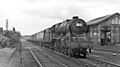 Kings Langley geograph-2741511-by-Ben-Brooksbank.jpg 2,342 × 1,312; 1.16 MB
-
 Kings Langley High Street.jpg 640 × 480; 77 KB
-
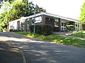 Kings Langley Library - geograph.org.uk - 1336533.jpg 640 × 480; 96 KB
-
 Kings Langley lock - geograph.org.uk - 5432325.jpg 5,202 × 3,465; 3.99 MB
-
 Kings Langley Lock No 69A - geograph.org.uk - 5266603.jpg 800 × 581; 170 KB
-
 Kings Langley Lock, Grand Union Canal - geograph.org.uk - 5962613.jpg 1,280 × 851; 630 KB
-
 Kings Langley Methodist Church - geograph.org.uk - 1334565.jpg 640 × 475; 79 KB
-
 Kings Langley Palace map.png 1,306 × 685; 367 KB
-
 Kings Langley Palace ruins.jpg 657 × 501; 182 KB
-
 Kings Langley railway bridge - geograph.org.uk - 2160181.jpg 640 × 401; 193 KB
-
 Kings Langley railway bridge - geograph.org.uk - 2160185.jpg 640 × 427; 237 KB
-
 Kings Langley Services Club - geograph.org.uk - 1337864.jpg 640 × 480; 70 KB
-
 Kings Langley Telephone Exchange (1) - geograph.org.uk - 4655374.jpg 3,648 × 2,736; 2.5 MB
-
 Kings Langley Telephone Exchange (2) - geograph.org.uk - 4655382.jpg 3,648 × 2,736; 2.3 MB
-
 Kings Langley Telephone Exchange (3) - geograph.org.uk - 4656232.jpg 3,648 × 2,736; 2.39 MB
-
 Kings Langley unknown widget 01.jpg 764 × 878; 217 KB
-
 Kings Langley unknown widget 02.jpg 962 × 944; 301 KB
-
 Kings Langley's Village Garden - geograph.org.uk - 3059480.jpg 640 × 480; 114 KB
-
 Kings Langley, Barnes Farm buttercups - geograph.org.uk - 1339898.jpg 640 × 480; 150 KB
-

-

-
 Kings Langley, Chipperfield Road - geograph.org.uk - 1340136.jpg 640 × 480; 88 KB
-
 Kings Langley, High Street - geograph.org.uk - 1337871.jpg 640 × 480; 71 KB
-
 Kings Langley, Langley Lodge Lane - geograph.org.uk - 114038.jpg 640 × 480; 122 KB
-
 Kings Langley, Old Palace - geograph.org.uk - 1338315.jpg 640 × 480; 82 KB
-

-
 Kings Langley, The Church House - geograph.org.uk - 1334222.jpg 640 × 480; 86 KB
-
 Kings Langley, The Nap - geograph.org.uk - 1336559.jpg 640 × 480; 86 KB
-
 Kings Langley, The Village Garden - geograph.org.uk - 1336097.jpg 640 × 480; 107 KB
-
 Kings Langley, UK - panoramio (1).jpg 3,648 × 2,056; 4.22 MB
-
 Kings Langley, UK - panoramio (2).jpg 3,648 × 2,056; 5.02 MB
-
 Kings Langley, UK - panoramio (3).jpg 3,648 × 2,056; 4.68 MB
-
 Kings Langley, UK - panoramio (4).jpg 3,648 × 2,056; 5.68 MB
-
 Kings Langley, UK - panoramio (5).jpg 3,648 × 2,056; 4.05 MB
-
 Kings Langley, UK - panoramio (6).jpg 3,648 × 2,056; 5.4 MB
-
 Kings Langley, UK - panoramio (7).jpg 3,648 × 2,056; 4.91 MB
-
 Kings Langley, UK - panoramio (8).jpg 3,648 × 2,056; 3.95 MB
-
 Kings Langley, UK - panoramio (9).jpg 3,648 × 2,056; 4.06 MB
-
 Kings Langley, UK - panoramio.jpg 3,648 × 2,056; 3.7 MB
-
 Lake at Kings Langley - geograph.org.uk - 5432361.jpg 5,202 × 3,465; 3.01 MB
-
 Lay-by on A41 - geograph.org.uk - 4248168.jpg 640 × 480; 117 KB
-
 Lay-bys on the A41 - geograph.org.uk - 4248171.jpg 640 × 480; 129 KB
-
 Lay-bys on the A41 near Middle Farm - geograph.org.uk - 3008697.jpg 640 × 480; 55 KB
-
 Layby on Hempstead Road, Kings Langley - geograph.org.uk - 3948722.jpg 2,492 × 1,826; 1.13 MB
-
 Layby on the A41, Kings Langley - geograph.org.uk - 6179669.jpg 1,920 × 1,280; 1.4 MB
-
 Lock 68, Grand Junction Canal - Nash Mills Lock - geograph.org.uk - 2962410.jpg 4,000 × 3,000; 4.69 MB
-
 Lock 69, Grand Junction Canal - Red Lion Lock - geograph.org.uk - 2962395.jpg 4,000 × 3,000; 4.69 MB
-
 Lock 69A, Grand Junction Canal - Kings Langley Lock - geograph.org.uk - 2962267.jpg 4,000 × 3,000; 4.82 MB
-
 Lock 70, Grand Junction Canal - Home Park Lock - geograph.org.uk - 2962159.jpg 4,000 × 3,000; 5.1 MB
-

-
 Lock at Water Lane - geograph.org.uk - 1511648.jpg 640 × 480; 148 KB

_High_Street,_WD4_-_geograph.org.uk_-_3061250.jpg)


_-_geograph.org.uk_-_3418557.jpg)
_-_geograph.org.uk_-_3418558.jpg)
_-_geograph.org.uk_-_3418559.jpg)


_and_lock_(no.70)_on_the_Grand_Union_Canal_-_geograph.org.uk_-_3062568.jpg)
_on_the_Grand_Union_Canal_-_geograph.org.uk_-_3057750.jpg)
_on_the_Grand_Union_Canal_(2)_-_geograph.org.uk_-_3062581.jpg)
_on_the_Grand_Union_Canal_(3)_-_geograph.org.uk_-_3062588.jpg)


_-_geograph.org.uk_-_4655374.jpg)
_-_geograph.org.uk_-_4655382.jpg)
_-_geograph.org.uk_-_4656232.jpg)


.jpg)
.jpg)
.jpg)
.jpg)
.jpg)
.jpg)
.jpg)
.jpg)
.jpg)


