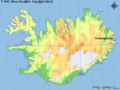
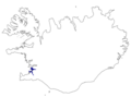
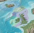
Category:Locator maps of Iceland
Countries of Europe: Albania · Andorra · Armenia‡ · Austria · Azerbaijan‡ · Belarus · Belgium · Bosnia and Herzegovina · Bulgaria · Croatia · Cyprus‡ · Czech Republic · Denmark · Estonia · Finland · France‡ · Georgia‡ · Germany · Greece · Hungary · Iceland · Republic of Ireland · Italy · Kazakhstan‡ · Latvia · Liechtenstein · Lithuania · Luxembourg · Malta · Moldova · Monaco · Montenegro · Netherlands‡ · North Macedonia · Norway · Poland · Portugal‡ · Romania · Russia‡ · San Marino · Serbia · Slovakia · Slovenia · Spain‡ · Sweden · Switzerland · Turkey‡ · Ukraine · United Kingdom · Vatican City
Specific status: Akrotiri and Dhekelia‡ · Faroe Islands · Gibraltar · Bailiwick of Guernsey · Isle of Man · Jersey · Svalbard – Limited recognition: Abkhazia‡ · Gagauzia · Kosovo · South Ossetia‡ · Transnistria
‡: partly located in Europe
Specific status: Akrotiri and Dhekelia‡ · Faroe Islands · Gibraltar · Bailiwick of Guernsey · Isle of Man · Jersey · Svalbard – Limited recognition: Abkhazia‡ · Gagauzia · Kosovo · South Ossetia‡ · Transnistria
‡: partly located in Europe
Subcategories
This category has the following 13 subcategories, out of 13 total.
!
B
- Bilateral maps of Iceland (86 F)
C
F
L
- Locator maps of Vík í Mýrdal (2 F)
M
R
T
- Locator maps of towns in Iceland (11 F)
V
Media in category "Locator maps of Iceland"
The following 140 files are in this category, out of 140 total.
-
 Akranes pos.png 692 × 580; 72 KB
-
 Askja location.png 400 × 311; 42 KB
-
 Barðaströnd.png 600 × 480; 50 KB
-
 Bjargtangar.png 600 × 480; 48 KB
-
 Blönduós.png 640 × 480; 29 KB
-
 Bolungarvík.png 640 × 480; 29 KB
-
 Borgarnes.png 640 × 480; 31 KB
-
 Bíldudalur.png 640 × 480; 29 KB
-
 Dettifoss.png 640 × 480; 29 KB
-
 Djúpivogur.png 640 × 480; 29 KB
-
 Djúpvegur.png 364 × 514; 184 KB
-
 Dynjandifoss.png 640 × 480; 29 KB
-
 Egilsstaðir.PNG 586 × 388; 11 KB
-
 Egilsstaðir.png 640 × 480; 29 KB
-
 Eldey Island.png 630 × 442; 12 KB
-
 Eskifjörður.png 640 × 480; 29 KB
-
 Europe location ISL.png 1,600 × 1,200; 712 KB
-
 Europe map iceland.png 1,231 × 929; 41 KB
-
 Eyrarbakki.png 640 × 480; 29 KB
-
 Fisching-ground-iceland hg.jpg 1,024 × 768; 183 KB
-
 Flagbjarnarholt.png 640 × 480; 38 KB
-
 Flateyjardalur.png 640 × 480; 36 KB
-
 Flateyri.png 640 × 480; 29 KB
-
 Fáskrúðsfjörður.png 640 × 480; 29 KB
-
 Garðabær.png 640 × 480; 29 KB
-
 Geldingaholt.png 640 × 480; 38 KB
-
 Grimsey location.gif 513 × 400; 22 KB
-
 Grindavík.png 640 × 480; 29 KB
-
 Grímsey.PNG 586 × 388; 12 KB
-
 Gullfoss-localisation.png 1,068 × 741; 67 KB
-
 Gullfoss.png 640 × 480; 29 KB
-
 Hafnarfjörður.png 640 × 480; 29 KB
-
 Hella.png 640 × 480; 29 KB
-
 Hrútafjörður.PNG 746 × 553; 61 KB
-
 Hvannadalshnúkur.png 640 × 480; 29 KB
-
 Hvolsvöllur.png 640 × 480; 29 KB
-
 Háifoss.png 640 × 480; 29 KB
-
 Hólmavík.png 640 × 480; 29 KB
-
 Hóp.PNG 746 × 553; 61 KB
-
 Höfn.png 640 × 480; 29 KB
-
 Höfuðborgarsvæðið map.png 501 × 373; 22 KB
-
 Höfuðborgarsvæðið.png 300 × 223; 20 KB
-
 Höfuðborgarsvæðið.svg 1,186 × 841; 284 KB
-
 Húnaflói location.png 200 × 149; 8 KB
-
 Húsavík.png 640 × 480; 29 KB
-
 Iceland - Location Map (2013) - ISL - UNOCHA.svg 250 × 250; 1.21 MB
-
 Iceland Akranes position.png 300 × 223; 20 KB
-
 Iceland Akureyri position.png 300 × 223; 20 KB
-
 Iceland Bolungarvík position.png 300 × 223; 23 KB
-
 Iceland Borgarnes position.png 300 × 223; 21 KB
-
 Iceland Húnafjörður.png 300 × 223; 15 KB
-
 Iceland Húsavík position.png 300 × 223; 20 KB
-
 Iceland Keflavik position.png 300 × 223; 21 KB
-
 Iceland Kópavogur position.png 300 × 223; 20 KB
-
 Iceland location Öskjuvatn.jpg 415 × 698; 19 KB
-
 Iceland position base.png 300 × 223; 20 KB
-
 Iceland position144.png 1,011 × 856; 55 KB
-
 Iceland Sauðárkrókur position.png 300 × 223; 20 KB
-
 Iceland Siglufjörður position.png 300 × 223; 20 KB
-
 Iceland Snaeffels.png 1,280 × 948; 1.57 MB
-
 Iceland Vestmannaeyjar position.png 300 × 223; 21 KB
-
 Iceland Ísafjörður position.PNG 300 × 223; 14 KB
-
 Iceland-globe-map.jpg 969 × 941; 179 KB
-
 Icelandrachelrocket72.jpg 500 × 388; 53 KB
-
 Isafjardardjup-pos.jpg 2,146 × 1,893; 124 KB
-
 Island Tingøyrar.jpg 714 × 538; 53 KB
-
 Island-Surtsey.png 330 × 355; 25 KB
-
 Kardjilov 11334731422520.gif 640 × 480; 37 KB
-
 Kingdom of Iceland (1942).svg 450 × 456; 481 KB
-
 Kirkjubæjarklaustur.png 640 × 480; 29 KB
-
 Kjalvegur.PNG 860 × 633; 54 KB
-
 Kjolur location.png 1,186 × 841; 61 KB
-
 Klaustur islandi.png 300 × 223; 27 KB
-
 Klaustur islandi2.png 300 × 223; 29 KB
-
 Kolbeinsey-pos.jpg 2,146 × 1,893; 124 KB
-
 Kópavogur.png 640 × 480; 29 KB
-
 Lakagígar.png 640 × 480; 29 KB
-
 Laki.png 640 × 480; 29 KB
-
 Langanes.png 300 × 223; 14 KB
-
 Location Iceland Europe.png 2,056 × 1,813; 370 KB
-
 Location Iceland.svg 680 × 520; 511 KB
-
 Location of Iceland.PNG 1,748 × 1,254; 96 KB
-
 Location of Vaglaskógur within Iceland.png 2,000 × 1,515; 227 KB
-
 LocationIceland.png 250 × 115; 6 KB
-
 Loclisation de ingvellir.gif 1,425 × 988; 129 KB
-
 Miðfjörður.PNG 746 × 553; 62 KB
-
 Myrar hnokki.svg 622 × 723; 282 KB
-
 Myrar.svg 622 × 723; 282 KB
-
 Neskaupstaður.png 640 × 480; 29 KB
-
 Nordausturkjordaemi.png 501 × 373; 15 KB
-
 Nordvesturkjordaemi.png 501 × 373; 17 KB
-
 Norðurvegur.png 273 × 273; 101 KB
-
 NUMBERED-ICELAND-REGION-(with labels).png 12,000 × 8,520; 2.8 MB
-
 Ornefnaskra Isl 1081618531960.gif 550 × 410; 22 KB
-
 Patreksfjörður.png 640 × 480; 29 KB
-
 Raufarhöfn.png 640 × 480; 29 KB
-
 Reykjanes-localisation.png 200 × 164; 3 KB
-
 Reykjavik-localisation.png 200 × 164; 3 KB
-
 Reykjavikurkjordaemi.png 501 × 373; 13 KB
-
 Reykjavík.png 640 × 480; 29 KB
-
 Reyðarfjörður.png 640 × 480; 29 KB
-
 Rockall EEZ.jpg 864 × 832; 97 KB
-
 Sandgerði.png 640 × 480; 29 KB
-
 Sauðárkrókur.png 640 × 480; 29 KB
-
 Selfoss.png 640 × 480; 29 KB
-
 Seljalandsfoss.png 640 × 480; 29 KB
-
 Selá (Vopnafjörður).png 640 × 480; 36 KB
-
 Seyðisfjörður - staðsetning.png 640 × 480; 29 KB
-
 Seyðisfjörður.png 640 × 480; 29 KB
-
 Siglufjörður.png 640 × 480; 29 KB
-
 Skagafjörður.png 300 × 223; 22 KB
-
 Skjálfandi location.png 200 × 149; 8 KB
-
 Skógafoss.png 640 × 480; 29 KB
-
 Snæfellsnes.PNG 300 × 223; 20 KB
-
 Sprengisandur-location.png 1,186 × 841; 61 KB
-
 Steingrimsfjordur-pos.jpg 2,146 × 1,893; 124 KB
-
 Stokkseyri.png 640 × 480; 29 KB
-
 Stykkishólmur.png 640 × 480; 29 KB
-
 Stöðvarfjörður.png 640 × 480; 29 KB
-
 Sudurkjordaemi.png 501 × 373; 19 KB
-
 Sudvesturkjordaemi.png 501 × 373; 13 KB
-
 Suðureyri.png 640 × 480; 29 KB
-
 Suðurnes map.png 501 × 373; 22 KB
-
 Suðurnes.png 300 × 223; 20 KB
-
 Suðurnes.svg 1,186 × 841; 281 KB
-
 Thingvellir location.gif 513 × 399; 22 KB
-
 Vaglaskógur map.png 407 × 561; 61 KB
-
 Vesturland map.png 501 × 373; 22 KB
-
 Vik location.gif 513 × 400; 22 KB
-
 Vopnafjörður.png 640 × 480; 29 KB
-
 Ísafjarðardjúp location.png 200 × 149; 8 KB
-
 Ísafjörður.png 640 × 480; 29 KB
-
 Ólafsfjörður.png 640 × 480; 29 KB
-
 Ólafsvík pos.png 200 × 149; 14 KB
-
 Ólafsvík.png 640 × 480; 29 KB
-
 Öxarfjörður location.png 200 × 149; 8 KB
-
 Þingeyri.png 640 × 480; 29 KB
-
 Þjórsárdalur.png 640 × 480; 38 KB
-
 Þorlákshöfn.png 640 × 480; 29 KB
-
 Þórshöfn.png 640 × 480; 29 KB


_-_ISL_-_UNOCHA.svg)


.svg)


.png)


.png)


