Category:Locator maps of the United Kingdom
Countries of Europe: Albania · Andorra · Armenia‡ · Austria · Azerbaijan‡ · Belarus · Belgium · Bosnia and Herzegovina · Bulgaria · Croatia · Cyprus‡ · Czech Republic · Denmark · Estonia · Finland · France‡ · Georgia‡ · Germany · Greece · Hungary · Iceland · Republic of Ireland · Italy · Kazakhstan‡ · Latvia · Liechtenstein · Lithuania · Luxembourg · Malta · Moldova · Monaco · Montenegro · Netherlands‡ · North Macedonia · Norway · Poland · Portugal‡ · Romania · Russia‡ · San Marino · Serbia · Slovakia · Slovenia · Spain‡ · Sweden · Switzerland · Turkey‡ · Ukraine · United Kingdom · Vatican City
Specific status: Akrotiri and Dhekelia‡ · Faroe Islands · Gibraltar · Bailiwick of Guernsey · Isle of Man · Jersey · Svalbard – Limited recognition: Abkhazia‡ · Gagauzia · Kosovo · South Ossetia‡ · Transnistria
‡: partly located in Europe
Specific status: Akrotiri and Dhekelia‡ · Faroe Islands · Gibraltar · Bailiwick of Guernsey · Isle of Man · Jersey · Svalbard – Limited recognition: Abkhazia‡ · Gagauzia · Kosovo · South Ossetia‡ · Transnistria
‡: partly located in Europe
- Many locator maps are located in maps by country subdivisions of the United Kingdom
- Those should be gradually sorted and recategorized into locator maps of Ireland, England, Scotland and Wales.
Subcategories
This category has the following 14 subcategories, out of 14 total.
!
+
B
C
R
S
W
Media in category "Locator maps of the United Kingdom"
The following 29 files are in this category, out of 29 total.
-
 Newlakesidemap.png 1,117 × 460; 201 KB
-
 Birleşik krallık cb.png 294 × 276; 8 KB
-
 Canada United Kingdom Locator.png 2,000 × 883; 224 KB
-
 Creones.gif 140 × 225; 4 KB
-
 Dominionofnewfoundlandlocation.PNG 1,280 × 1,280; 522 KB
-
 Doncaster, UK.png 534 × 540; 82 KB
-
 East Anglia UK Locator Map.svg 1,108 × 1,345; 303 KB
-
 Europe location UK.png 1,600 × 1,200; 712 KB
-
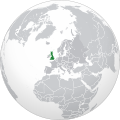 Europe-UK (orthographic projection).svg 2,000 × 2,000; 5.8 MB
-
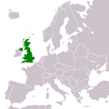
 Europe-UK.svg 2,045 × 1,720; 4.6 MB
-
 Europe-United Kingdom.svg 2,045 × 1,720; 2.22 MB
-
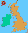
 Ireland and Western Scotland Locator.jpg 383 × 477; 56 KB
-
 Lady's Mile UK Map.jpg 4,167 × 4,167; 1.32 MB
-
 Location-UnitedKingdom.PNG 250 × 115; 6 KB
-
 LocationUK.png 1,245 × 1,245; 78 KB
-
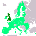 LocationUKinEU.png 1,245 × 1,245; 48 KB
-
 LocationUKinEUinEEA.png 1,245 × 1,245; 649 KB
-
 LocationUnitedKingdom.png 250 × 115; 4 KB
-
 LocationUnitedKingdom.svg 1,000 × 500; 2.76 MB
-
 LocationUnitedKingdomInEurope.png 415 × 422; 5 KB
-
 Production A380 United Kingdom.svg 440 × 495; 32 KB
-
 RAF Menwith Hill map.png 249 × 332; 32 KB
-
 South east Darlington location map.tif 2,551 × 2,000; 2.89 MB
-
 The Wash.gif 801 × 956; 56 KB
-
 Tolleshunt D'Arcy map (Bamber).JPG 240 × 198; 17 KB
-
 United Kingdom (orthographic projection).svg 553 × 553; 2.87 MB
-
 United Kingdom - Location Map (2013) - GBR - UNOCHA.svg 254 × 254; 1.01 MB
-
 United Kingdom AV Referendum 2011 Regional Results.svg 886 × 1,369; 959 KB
-
 Unitedkingdomrachelrocket72.jpg 500 × 388; 54 KB


.svg)


.JPG)
.svg)
_-_GBR_-_UNOCHA.svg)

