Category:Loire River in Indre-et-Loire
Departments of Metropolitan France: Allier [03] · Ardèche [07] · Cher [18] · Indre [36] · Indre-et-Loire [37] · Loir-et-Cher [41] · Loire [42] · Haute-Loire [43] · Loire-Atlantique [44] · Loiret [45] · Maine-et-Loire [49] · Nièvre [58] · Saône-et-Loire [71]
Subcategories
This category has the following 8 subcategories, out of 8 total.
.
- Loire River in Avoine (1 F)
- Loire River in Berthenay (1 F)
- Loire River in Brehémont (19 F)
C
L
M
Media in category "Loire River in Indre-et-Loire"
The following 124 files are in this category, out of 124 total.
-
 07 CVL - Indre-et-Loire - Candes-Saint-Martin (2015-09-03 11-02-13).jpg 3,991 × 2,245; 1.09 MB
-
 07 CVL - Indre-et-Loire - Candes-Saint-Martin (2015-09-03 12-01-40).jpg 4,000 × 2,250; 968 KB
-
 37042-Candes-Saint-Martin-argile.png 3,057 × 2,480; 2.35 MB
-
 37042-Candes-Saint-Martin-Cours eau.jpg 3,507 × 2,480; 433 KB
-
 37042-Candes-Saint-Martin-Sols.png 3,270 × 2,598; 1.53 MB
-
 37074-Chouzé-sur-Loire-argile.png 3,057 × 2,480; 3.01 MB
-
 37074-Chouzé-sur-Loire-Cours eau.jpg 3,507 × 2,480; 587 KB
-
 37074-Chouzé-sur-Loire-Sols.png 3,270 × 2,598; 2.65 MB
-
 37163-Nazelles-Négron-argile.png 3,057 × 2,480; 3.41 MB
-
 37163-Nazelles-Négron-Cours eau.jpg 3,507 × 2,480; 666 KB
-
 37163-Nazelles-Négron-Sols.png 3,270 × 2,598; 3.07 MB
-
 37233-Saint-Pierre-des-Corps-argile.png 3,057 × 2,480; 4.7 MB
-
 37233-Saint-Pierre-des-Corps-Cours eau.jpg 3,507 × 2,480; 693 KB
-
 37233-Saint-Pierre-des-Corps-Sols.png 3,270 × 2,598; 5.21 MB
-
 37233-Saint-Pierre-des-Corps-Zone inondable.jpg 3,507 × 2,480; 640 KB
-
 37273-La Ville-aux-Dames-argile.png 3,057 × 2,480; 3.22 MB
-
 37273-La Ville-aux-Dames-Cours eau.jpg 3,507 × 2,480; 642 KB
-
 37273-La Ville-aux-Dames-Sols.png 3,270 × 2,598; 3.28 MB
-
 ASAMairie confluent et Girouet.jpg 3,008 × 2,000; 1.56 MB
-
 ASAMairie Confluent20.jpg 3,008 × 2,000; 1.51 MB
-
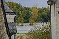
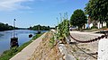
 Berges de la Loire en automne près de Tours.jpg 800 × 503; 194 KB
-
 Bords de Loire (La Riche).jpg 1,536 × 2,048; 1.36 MB
-
 Effet de brouillard sur les bords de la Loire à Candes.jpeg 2,048 × 1,696; 906 KB
-
 Effet de soleil Condes 1999 NYR 09222 0266 000(121731).jpg 400 × 332; 99 KB
-
 Effet de soleil sur les bords de la Loire à Candes.png 1,124 × 930; 2.36 MB
-
 Candes Rouargue.jpg 546 × 372; 69 KB
-
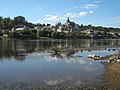
 Candes Saint Martin ( Indre et Loire ).jpg 2,592 × 1,944; 2.09 MB
-
 Candes Saint-Martin-110-Loire-2008-gje.jpg 3,030 × 1,906; 1.63 MB
-
 Candes Saint-Martin-112-Loire-2008-gje.jpg 3,072 × 2,048; 2.09 MB
-
 Candes Saint-Martin-136-Blick zur Loire-2008-gje.jpg 3,072 × 2,048; 1.95 MB
-
 Candes-Saint-Martin (1).jpg 3,264 × 2,448; 1.55 MB
-
 Candes-Saint-Martin (2).jpg 3,264 × 2,448; 1.52 MB
-
 Candes-Saint-Martin antique.svg 627 × 527; 42 KB
-
 Candes-Saint-Martin Cassini.jpg 496 × 375; 59 KB
-
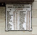 Candes-Saint-Martin Distances Navigation R01.jpg 3,558 × 3,348; 8.86 MB
-
 Candes-Saint-Martin fr37500 bateaux sur la Vienne banner.jpg 5,000 × 714; 1.24 MB
-
 Candes-Saint-Martin Gaignières.jpg 1,024 × 1,199; 314 KB
-
 Candes-Saint-Martin géologie.svg 630 × 515; 31 KB
-
 Candes-Saint-Martin la Vienne R01.jpg 4,411 × 2,944; 12.78 MB
-
 Candes-Saint-Martin Limite communale.jpg 953 × 578; 160 KB
-
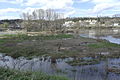
 Candes-Saint-Martin Loire crue.jpg 1,920 × 1,440; 565 KB
-
 Candes-Saint-Martin Loire sécheresse.jpg 3,760 × 2,771; 1.63 MB
-
 Candes-Saint-Martin maison 4 Curés.jpg 1,440 × 1,920; 1.47 MB
-
 Candes-Saint-Martin médiéval.svg 1,112 × 884; 29 KB
-
 Candes-Saint-Martin N2000 habitat.svg 627 × 527; 26 KB
-
 Candes-Saint-Martin N2000 oiseaux.svg 627 × 527; 26 KB
-
 Candes-Saint-Martin N2000 vallée Vienne.svg 627 × 527; 25 KB
-
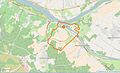
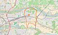
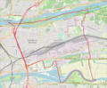
 Candes-Saint-Martin OSM 01.png 617 × 546; 164 KB
-
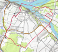 Candes-Saint-Martin OSM 02.png 617 × 545; 272 KB
-
 Candes-Saint-Martin plan MH.svg 1,234 × 884; 31 KB
-
 Candes-Saint-Martin pont antique 2.jpg 3,648 × 2,736; 2.58 MB
-
 Candes-Saint-Martin pont.jpg 1,920 × 1,440; 1.92 MB
-
 Candes-Saint-Martin tourisme.jpg 1,920 × 1,440; 1.42 MB
-
 Candes-Saint-Martin ZNIEFF bocage Véron.svg 627 × 527; 25 KB
-
 Candes-Saint-Martin ZNIEFF Boiret.svg 627 × 527; 25 KB
-
 Candes-Saint-Martin ZNIEFF Loire tourangelle.svg 627 × 527; 26 KB
-
 Candes-Saint-Martin, Fischerboote auf der Vienne.jpg 5,000 × 3,658; 9.92 MB
-
 Candes09.jpg 2,200 × 1,650; 1.5 MB
-
 Cathedrale barque 6485.jpg 4,608 × 3,456; 3.79 MB
-
 Chinon nuclear power plant-3.JPG 2,932 × 1,954; 3.58 MB
-
 Chinon nuclear power plant.JPG 2,610 × 1,758; 1.43 MB
-
 Chouze quai.jpg 5,312 × 2,988; 7.09 MB
-
 Chouzévueloire1.jpg 4,608 × 3,456; 4.61 MB
-
 Chouzévueloire2.jpg 4,608 × 3,456; 4.65 MB
-
 Chouzévueloire3.jpg 4,608 × 3,456; 4.63 MB
-
 Château de Chenonceau add.jpg 4,629 × 3,086; 6.51 MB
-
 Château de Chenonceau, Loire Valley, France.jpg 4,000 × 2,018; 3.88 MB
-
 Cinq-Mars-la-Pile (Indre-et-Loire) (6250166718).jpg 3,648 × 2,736; 4.69 MB
-
 Confluence de la Loire et de la Vienne 2.JPG 2,576 × 1,932; 1.33 MB
-
 Confluence de la Loire et de la Vienne.JPG 2,576 × 1,932; 911 KB
-
 Confluence Vienne-Loire.JPG 3,264 × 2,448; 3.76 MB
-
 Confluent de la Vienne et de la Loire.jpg 7,837 × 3,309; 6.33 MB
-
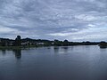
 Confluent vienne loire.jpg 1,984 × 1,488; 598 KB
-
 Confluent Vienne-Loire.jpg 2,048 × 1,536; 814 KB
-
 Kayak sur la Loire, de Chaumont à Saumur. (8560933175).jpg 3,648 × 2,736; 4.78 MB
-
 Kayak sur la Loire, de Chaumont à Saumur. (8560933839).jpg 3,648 × 2,736; 2.5 MB
-
 Kayak sur la Loire, de Chaumont à Saumur. (8562004446).jpg 3,648 × 2,736; 2.56 MB
-
 La Ville-aux-Dames Limite communale.jpg 957 × 576; 221 KB
-
 La Ville-aux-Dames voies antiques.svg 925 × 1,325; 339 KB
-
 Langeais-110-Bruecke-2008-gje.jpg 2,922 × 1,624; 1.4 MB
-
 Langeais-FR-37-carte postale-04.jpg 1,647 × 1,037; 1.02 MB
-
 Les bords de Loire vus depuis l'île de la Métairie.JPG 5,472 × 3,648; 4.42 MB
-
 Limeray crue 1856.JPG 960 × 1,280; 526 KB
-
 Loire - Rochecorbon.jpg 3,872 × 2,592; 3.19 MB
-
 Loire entre Fondettes et La Riche pont Saint-Cosme.jpg 3,648 × 2,736; 2.62 MB
-
 Loire Fondettes La Riche Pont St Cosme 1.jpg 694 × 589; 60 KB
-
 Loire Fondettes La Riche Pont St Cosme 2.jpg 712 × 448; 64 KB
-
 Loire Fondettes La Riche Pont St Cosme 3.jpg 715 × 557; 75 KB
-
 Loire Fondettes.jpg 3,648 × 2,736; 2.04 MB
-
 Loire Langeais.JPG 3,264 × 2,448; 3.84 MB
-
 Loire Touraine01.jpg 3,888 × 2,592; 4.63 MB
-
 Loire à Bréhémont.JPG 2,288 × 1,712; 772 KB
-
 Loire à Bréhémont2.JPG 2,288 × 1,712; 762 KB
-
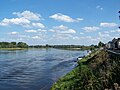
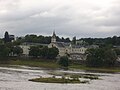
 Loire à Candes Saint Martin.jpg 1,417 × 941; 598 KB
-
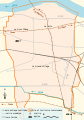
 Map commune FR insee code 37042.png 756 × 605; 46 KB
-
 Map commune FR insee code 37074.png 756 × 605; 69 KB
-
 Map commune FR insee code 37163.png 756 × 605; 74 KB
-
 Map commune FR insee code 37233.png 756 × 605; 70 KB
-
 Map commune FR insee code 37273.png 756 × 605; 66 KB
-
 Montlouis-sur-Loire (Indre-et-Loire) La Loire à vélo.JPG 3,648 × 2,736; 4.17 MB
-
 Piautre.jpg 840 × 640; 94 KB
-
 Pont Charles de Gaulle (Tours).JPG 2,000 × 1,731; 955 KB
-
 Pont Charles de Gaulle (Tours, 37).JPG 1,854 × 1,710; 752 KB
-
 Pont de l'A10 à Tours - panoramio.jpg 4,352 × 2,448; 6.15 MB
-
 Pont de Langeais - Loire - 2.jpg 4,544 × 3,408; 3.92 MB
-
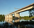
 Pont ferroviaire de Montlouis-sur-Loire.JPG 3,648 × 2,736; 5.73 MB
-
 Pont TGV Vouvray - Montlouis-sur-Loire.JPG 3,098 × 2,574; 2.32 MB
-
 Port Chouze Toues 27apr15 4172.jpg 4,608 × 3,456; 7.41 MB
-
 Port de Loire à Bréhémont.jpg 4,800 × 1,004; 1.56 MB
-
 Région de La Ville-aux-Dames (Cassini).png 999 × 1,004; 1.46 MB
-
 Saint-Pierre-des-Corps OSM 01.png 927 × 763; 557 KB
-
 Saint-Pierre-des-Corps OSM 02.png 927 × 763; 843 KB
-
 Savonnières.jpg 2,592 × 1,944; 2.14 MB
-
 Sunset on Loire river.jpg 4,616 × 3,462; 2.39 MB
-
 The Loire near Langeais.jpg 2,304 × 1,728; 2.23 MB
-
 Toue on Loire.JPG 3,264 × 2,448; 3.82 MB
-
 Toue on the Loire river1.JPG 3,264 × 2,448; 3.55 MB
-
 Tours - Grande Bretèche.jpg 3,264 × 2,448; 3.19 MB
-
 Trouillebert Paul Desire - Bank of the Loire Near Chouze.tif 3,491 × 2,946; 24.07 MB
-
 Trouillebert, Paul Desire - Bank of the Loire Near Chouze.jpg 3,485 × 2,977; 8.5 MB
-
 Viaduc de Vouvray.JPG 3,349 × 3,002; 2.14 MB
-
 Vue montlouis @ville montlouis.jpg 3,456 × 2,304; 3.33 MB
-
 Île Boiret.jpg 1,920 × 1,440; 678 KB
-
 Île des Buteaux.jpg 1,920 × 1,080; 462 KB
.jpg)
.jpg)


.jpg)

.jpg)


.jpg)


.jpg)
.jpg)


_(6250166718).jpg)


.jpg)
.jpg)
.jpg)


_La_Loire_%C3%A0_v%C3%A9lo.JPG)

.JPG)
.JPG)


.png)


