Category:Maps of census statistical areas in Arkansas
States of the United States: Alabama · Alaska · Arizona · Arkansas · California · Colorado · Connecticut · Delaware · Florida · Georgia · Idaho · Illinois · Indiana · Iowa · Kansas · Kentucky · Louisiana · Maine · Maryland · Massachusetts · Michigan · Minnesota · Mississippi · Missouri · Montana · Nebraska · Nevada · New Hampshire · New Jersey · New Mexico · New York · North Carolina · North Dakota · Ohio · Oklahoma · Oregon · Pennsylvania · Rhode Island · South Carolina · South Dakota · Tennessee · Texas · Utah · Vermont · Virginia · Washington · West Virginia · Wisconsin
Puerto Rico
Puerto Rico
Media in category "Maps of census statistical areas in Arkansas"
The following 12 files are in this category, out of 12 total.
-
 Arkansas CBSAs 01.png 5,808 × 3,555; 1.29 MB
-
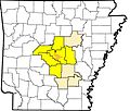
 Arkansas CSAs.png 522 × 432; 7 KB
-
 Camden Micropolitan Area.png 545 × 475; 33 KB
-
 Harrison Micropolitan Area.png 545 × 475; 33 KB
-
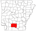
 Hope Micropolitan Area.png 545 × 475; 33 KB
-
 LittleRockCBA.jpg 703 × 600; 93 KB
-
 LR-NLR MSA.png 522 × 432; 7 KB
-
 LR-NLR-PB CSA 2.png 522 × 432; 7 KB
-
 LR-NLR-PB CSA.png 522 × 432; 7 KB
-
 Memphis, TN-MS-AR Metropolitan Statistical Area.svg 17,583 × 10,974; 810 KB
-
 Northwest Arkansas Metropolitan Area.svg 4,474 × 3,895; 200 KB
-
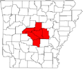
 Russellville Micropolitan Area.png 545 × 475; 33 KB


