Category:Maps of communes in Ariège
Departments of Metropolitan France: Ain [01] · Aisne [02] · Allier [03] · Alpes-de-Haute-Provence [04] · Hautes-Alpes [05] · Alpes-Maritimes [06] · Ardèche [07] · Ardennes [08] · Ariège [09] · Aube [10] · Aude [11] · Aveyron [12] · Bouches-du-Rhône [13] · Calvados [14] · Cantal [15] · Charente [16] · Charente-Maritime [17] · Cher [18] · Corrèze [19] · Corse-du-Sud [2A]† · Haute-Corse [2B]† · Côte-d’Or [21] · Côtes-d'Armor [22] · Creuse [23] · Dordogne [24] · Doubs [25] · Drôme [26] · Eure [27] · Eure-et-Loir [28] · Finistère [29] · Gard [30] · Haute-Garonne [31] · Gers [32] · Gironde [33] · Hérault [34] · Ille-et-Vilaine [35] · Indre [36] · Indre-et-Loire [37] · Isère [38] · Jura [39] · Landes [40] · Loir-et-Cher [41] · Loire [42] · Haute-Loire [43] · Loire-Atlantique [44] · Loiret [45] · Lot [46] · Lot-et-Garonne [47] · Lozère [48] · Maine-et-Loire [49] · Manche [50] · Marne [51] · Haute-Marne [52] · Mayenne [53] · Meurthe-et-Moselle [54] · Meuse [55] · Morbihan [56] · Moselle [57] · Nièvre [58] · Nord [59] · Oise [60] · Orne [61] · Pas-de-Calais [62] · Puy-de-Dôme [63] · Pyrénées-Atlantiques [64] · Hautes-Pyrénées [65] · Pyrénées-Orientales [66] · Bas-Rhin [67] · Haut-Rhin [68] · departmental district of the Rhône [69] · Rhône [69D]‡ · Metropolis of Lyon [69M]‡ · Haute-Saône [70] · Saône-et-Loire [71] · Sarthe [72] · Savoie [73] · Haute-Savoie [74] · Paris [75] · Seine-Maritime [76] · Seine-et-Marne [77] · Yvelines [78] · Deux-Sèvres [79] · Somme [80] · Tarn [81] · Tarn-et-Garonne [82] · Var [83] · Vaucluse [84] · Vendée [85] · Vienne [86] · Haute-Vienne [87] · Vosges [88] · Yonne [89] · Territoire de Belfort [90] · Essonne [91] · Hauts-de-Seine [92] · Seine-Saint-Denis [93] · Val-de-Marne [94] · Val-d'Oise [95]
Overseas departments and regions: Guadeloupe [971] · Martinique [972] · French Guiana [973] · Réunion [974] · Mayotte [976]
Sui generis territories: New Caledonia [988]
Overseas departments and regions: Guadeloupe [971] · Martinique [972] · French Guiana [973] · Réunion [974] · Mayotte [976]
Sui generis territories: New Caledonia [988]

Subcategories
This category has the following 200 subcategories, out of 349 total.
(previous page) (next page)*
2
A
- Maps of Albiès (6 F)
- Maps of Aleu (6 F)
- Maps of Alliat (6 F)
- Maps of Allières (6 F)
- Maps of Alos (Ariège) (10 F)
- Maps of Alzen (6 F)
- Maps of Antras (Ariège) (10 F)
- Maps of Appy (6 F)
- Maps of Argein (10 F)
- Maps of Arignac (6 F)
- Maps of Arnave (6 F)
- Maps of Arrien-en-Bethmale (10 F)
- Maps of Arrout (6 F)
- Maps of Artigat (6 F)
- Maps of Artigues (Ariège) (10 F)
- Maps of Artix (Ariège) (10 F)
- Maps of Arvigna (10 F)
- Maps of Ascou (10 F)
- Maps of Aston (Ariège) (10 F)
- Maps of Aucazein (10 F)
- Maps of Audressein (10 F)
- Maps of Augirein (10 F)
- Maps of Aulos-Sinsat (6 F)
- Maps of Aulus-les-Bains (10 F)
- Maps of Auzat (6 F)
- Maps of Ax-les-Thermes (6 F)
- Maps of Axiat (10 F)
B
- Maps of Bagert (9 F)
- Maps of Balacet (10 F)
- Maps of Balaguères (10 F)
- Maps of Barjac (Ariège) (11 F)
- Maps of Baulou (10 F)
- Maps of Belloc (6 F)
- Maps of Benagues (6 F)
- Maps of Besset (6 F)
- Maps of Bestiac (6 F)
- Maps of Betchat (10 F)
- Maps of Bethmale (1 F)
- Maps of Bethmale (Ariège) (10 F)
- Maps of Biert (10 F)
- Maps of Bompas (Ariège) (10 F)
- Maps of Bonac-Irazein (10 F)
- Maps of Bonnac (Ariège) (10 F)
- Maps of Bordes-Uchentein (9 F)
- Maps of Bouan (1 F)
- Maps of Bouan (Ariège) (11 F)
- Maps of Brassac (Ariège) (10 F)
- Maps of Brie (Ariège) (10 F)
- Maps of Burret (10 F)
- Maps of Buzan (10 F)
- Maps of Bédeilhac-et-Aynat (6 F)
- Maps of Bédeille (Ariège) (10 F)
- Maps of Bélesta (Ariège) (10 F)
- Maps of Bénac (Ariège) (10 F)
- Maps of Bénaix (6 F)
C
- Maps of Cadarcet (6 F)
- Maps of Calzan (6 F)
- Maps of Camarade (Ariège) (11 F)
- Maps of Camon (Ariège) (10 F)
- Maps of Campagne-sur-Arize (6 F)
- Maps of Canté (6 F)
- Maps of Capoulet-et-Junac (6 F)
- Maps of Carcanières (6 F)
- Maps of Carla-Bayle (6 F)
- Maps of Carla-de-Roquefort (6 F)
- Maps of Castelnau-Durban (10 F)
- Maps of Castex (Ariège) (10 F)
- Maps of Castillon-en-Couserans (10 F)
- Maps of Castéras (6 F)
- Maps of Caumont (Ariège) (10 F)
- Maps of Caussou (6 F)
- Maps of Caychax (6 F)
- Maps of Cazals-des-Baylès (6 F)
- Maps of Cazaux (Ariège) (10 F)
- Maps of Cazavet (10 F)
- Maps of Celles (Ariège) (10 F)
- Maps of Cescau (Ariège) (10 F)
- Maps of Château-Verdun (1 F)
- Maps of Château-Verdun (Ariège) (10 F)
- Maps of Clermont (Ariège) (10 F)
- Maps of Contrazy (10 F)
- Maps of Cos (Ariège) (10 F)
- Maps of Couflens (6 F)
- Maps of Coussa (6 F)
- Maps of Coutens (6 F)
- Maps of Crampagna (6 F)
- Maps of Cérizols (10 F)
D
- Maps of Dalou (1 F)
- Maps of Dalou (Ariège) (10 F)
- Maps of Daumazan-sur-Arize (6 F)
- Maps of Dreuilhe (6 F)
- Maps of Dun (Ariège) (9 F)
- Maps of Durban-sur-Arize (10 F)
- Maps of Durfort (Ariège) (10 F)
E
- Maps of Encourtiech (10 F)
- Maps of Engomer (10 F)
- Maps of Erp (12 F)
- Maps of Erp (Ariège) (1 F)
- Maps of Esclagne (6 F)
- Maps of Escosse (6 F)
- Maps of Esplas (6 F)
- Maps of Esplas-de-Sérou (6 F)
- Maps of Eycheil (10 F)
F
- Maps of Fabas (Ariège) (10 F)
- Maps of Ferrières-sur-Ariège (10 F)
- Maps of Fornex (7 F)
- Maps of Fougax-et-Barrineuf (10 F)
- Maps of Freychenet (6 F)
G
- Maps of Gabre (6 F)
- Maps of Gajan (Ariège) (10 F)
- Maps of Galey (6 F)
- Maps of Ganac (7 F)
- Maps of Garanou (6 F)
- Maps of Gaudiès (6 F)
- Maps of Gestiès (10 F)
- Maps of Gourbit (10 F)
- Maps of Gudas (6 F)
I
- Maps of Ignaux (6 F)
- Maps of Ilhat (6 F)
- Maps of Illartein (10 F)
- Maps of Illier-et-Laramade (6 F)
J
- Maps of Justiniac (10 F)
L
- Maps of L'Aiguillon (11 F)
- Maps of L'Herm (10 F)
- Maps of La Bastide-de-Besplas (10 F)
- Maps of La Bastide-de-Lordat (6 F)
- Maps of La Bastide-de-Sérou (10 F)
- Maps of La Bastide-du-Salat (10 F)
- Maps of La Tour-du-Crieu (8 F)
- Maps of Labatut (Ariège) (10 F)
- Maps of Lacave (Ariège) (10 F)
- Maps of Lacourt (10 F)
- Maps of Lacourt (Ariège) (1 F)
- Maps of Lagarde (Ariège) (10 F)
- Maps of Lanoux (10 F)
- Maps of Lapenne (10 F)
- Maps of Lapège (10 F)
- Maps of Larbont (6 F)
- Maps of Larcat (6 F)
- Maps of Larnat (10 F)
- Maps of Laroque-d'Olmes (7 F)
- Maps of Lasserre (Ariège) (11 F)
- Maps of Lassur (10 F)
- Maps of Lavelanet (6 F)
- Maps of Le Bosc (Ariège) (10 F)
- Maps of Le Carlaret (6 F)
- Maps of Le Fossat (6 F)
- Maps of Le Mas-d'Azil (6 F)
- Maps of Le Peyrat (6 F)
- Maps of Le Pla (6 F)
- Maps of Le Port (Ariège) (6 F)
- Maps of Le Puch (6 F)
- Maps of Le Vernet (Ariège) (6 F)
- Maps of Lercoul (6 F)
- Maps of Les Bordes-sur-Arize (10 F)
- Maps of Les Cabannes (Ariège) (11 F)
- Maps of Les Issards (6 F)
- Maps of Les Pujols (7 F)
- Maps of Lescousse (6 F)
- Maps of Lescure (Ariège) (10 F)
- Maps of Lesparrou (10 F)
- Maps of Leychert (6 F)
- Maps of Lieurac (6 F)
- Maps of Limbrassac (6 F)
- Maps of Lordat (10 F)
- Maps of Lorp-Sentaraille (10 F)
- Maps of Loubaut (10 F)
- Maps of Loubens (Ariège) (10 F)
- Maps of Loubières (10 F)
- Maps of Ludiès (6 F)
- Maps of Luzenac (6 F)
- Maps of Léran (10 F)
- Maps of Lézat-sur-Lèze (6 F)
M
- Maps of Madière (6 F)
- Maps of Malegoude (6 F)
Media in category "Maps of communes in Ariège"
This category contains only the following file.
-
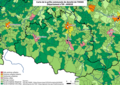 09 ARIEGE carte grille communale densite INSEE.png 3,507 × 2,480; 2.75 MB
