Category:Maps of communes in Ille-et-Vilaine
Departments of Metropolitan France: Ain [01] · Aisne [02] · Allier [03] · Alpes-de-Haute-Provence [04] · Hautes-Alpes [05] · Alpes-Maritimes [06] · Ardèche [07] · Ardennes [08] · Ariège [09] · Aube [10] · Aude [11] · Aveyron [12] · Bouches-du-Rhône [13] · Calvados [14] · Cantal [15] · Charente [16] · Charente-Maritime [17] · Cher [18] · Corrèze [19] · Corse-du-Sud [2A]† · Haute-Corse [2B]† · Côte-d’Or [21] · Côtes-d'Armor [22] · Creuse [23] · Dordogne [24] · Doubs [25] · Drôme [26] · Eure [27] · Eure-et-Loir [28] · Finistère [29] · Gard [30] · Haute-Garonne [31] · Gers [32] · Gironde [33] · Hérault [34] · Ille-et-Vilaine [35] · Indre [36] · Indre-et-Loire [37] · Isère [38] · Jura [39] · Landes [40] · Loir-et-Cher [41] · Loire [42] · Haute-Loire [43] · Loire-Atlantique [44] · Loiret [45] · Lot [46] · Lot-et-Garonne [47] · Lozère [48] · Maine-et-Loire [49] · Manche [50] · Marne [51] · Haute-Marne [52] · Mayenne [53] · Meurthe-et-Moselle [54] · Meuse [55] · Morbihan [56] · Moselle [57] · Nièvre [58] · Nord [59] · Oise [60] · Orne [61] · Pas-de-Calais [62] · Puy-de-Dôme [63] · Pyrénées-Atlantiques [64] · Hautes-Pyrénées [65] · Pyrénées-Orientales [66] · Bas-Rhin [67] · Haut-Rhin [68] · departmental district of the Rhône [69] · Rhône [69D]‡ · Metropolis of Lyon [69M]‡ · Haute-Saône [70] · Saône-et-Loire [71] · Sarthe [72] · Savoie [73] · Haute-Savoie [74] · Paris [75] · Seine-Maritime [76] · Seine-et-Marne [77] · Yvelines [78] · Deux-Sèvres [79] · Somme [80] · Tarn [81] · Tarn-et-Garonne [82] · Var [83] · Vaucluse [84] · Vendée [85] · Vienne [86] · Haute-Vienne [87] · Vosges [88] · Yonne [89] · Territoire de Belfort [90] · Essonne [91] · Hauts-de-Seine [92] · Seine-Saint-Denis [93] · Val-de-Marne [94] · Val-d'Oise [95]
Overseas departments and regions: Guadeloupe [971] · Martinique [972] · French Guiana [973] · Réunion [974] · Mayotte [976]
Sui generis territories: New Caledonia [988]
Overseas departments and regions: Guadeloupe [971] · Martinique [972] · French Guiana [973] · Réunion [974] · Mayotte [976]
Sui generis territories: New Caledonia [988]

Subcategories
This category has the following 200 subcategories, out of 345 total.
(previous page) (next page)*
2
A
- Maps of Acigné (3 F)
- Maps of Amanlis (3 F)
- Maps of Andouillé-Neuville (3 F)
- Maps of Arbrissel (3 F)
- Maps of Argentré-du-Plessis (3 F)
- Maps of Availles-sur-Seiche (3 F)
B
- Maps of Baguer-Morvan (3 F)
- Maps of Baguer-Pican (3 F)
- Maps of Bain-de-Bretagne (3 F)
- Maps of Bains-sur-Oust (3 F)
- Maps of Balazé (3 F)
- Maps of Baulon (3 F)
- Maps of La Baussaine (3 F)
- Maps of La Bazouge-du-Désert (3 F)
- Maps of Bazouges-la-Pérouse (3 F)
- Maps of Beaucé (3 F)
- Maps of Bécherel (3 F)
- Maps of Bédée (3 F)
- Maps of Billé (3 F)
- Maps of Bléruais (3 F)
- Maps of Boisgervilly (3 F)
- Maps of Boistrudan (3 F)
- Maps of Bonnemain (3 F)
- Maps of La Bosse-de-Bretagne (3 F)
- Maps of La Bouëxière (3 F)
- Maps of Bourg-des-Comptes (3 F)
- Maps of Bourgbarré (3 F)
- Maps of La Boussac (3 F)
- Maps of Bovel (3 F)
- Maps of Bréal-sous-Montfort (3 F)
- Maps of Bréal-sous-Vitré (3 F)
- Maps of Brécé (3 F)
- Maps of Breteil (3 F)
- Maps of Brielles (3 F)
- Maps of Broualan (3 F)
- Maps of Bruc-sur-Aff (3 F)
- Maps of Les Brulais (3 F)
- Maps of Bruz (10 F)
C
- Maps of Cancale (3 F)
- Maps of Cardroc (3 F)
- Maps of Cesson-Sévigné (3 F)
- Maps of Chantepie (3 F)
- Maps of La Chapelle-Bouëxic (3 F)
- Maps of La Chapelle-Chaussée (3 F)
- Maps of La Chapelle-de-Brain (3 F)
- Maps of La Chapelle-Erbrée (3 F)
- Maps of Chartres-de-Bretagne (4 F)
- Maps of Chasné-sur-Illet (3 F)
- Maps of Châteaugiron (3 F)
- Maps of Chauvigné (3 F)
- Maps of Chavagne (4 F)
- Maps of Chelun (3 F)
- Maps of Cherrueix (3 F)
- Maps of Chevaigné (3 F)
- Maps of Cintré (3 F)
- Maps of Clayes (3 F)
- Maps of Coësmes (3 F)
- Maps of Comblessac (3 F)
- Maps of Combourg (3 F)
- Maps of Combourtillé (3 F)
- Maps of Cornillé (3 F)
- Maps of Corps-Nuds (3 F)
- Maps of La Couyère (3 F)
- Maps of Crevin (3 F)
- Maps of Le Crouais (3 F)
- Maps of Cuguen (3 F)
D
- Maps of Dinard (6 F)
- Maps of Dingé (3 F)
- Maps of Dol-de-Bretagne (4 F)
- Maps of Domagné (3 F)
- Maps of Domalain (3 F)
- Maps of La Dominelais (3 F)
- Maps of Domloup (3 F)
- Maps of Dourdain (3 F)
- Maps of Drouges (3 F)
E
- Maps of Eancé (3 F)
- Maps of Epiniac (3 F)
- Maps of Erbrée (3 F)
- Maps of Ercé-en-Lamée (3 F)
- Maps of Ercé-près-Liffré (3 F)
- Maps of Essé (3 F)
- Maps of Étrelles (3 F)
F
- Maps of Feins (3 F)
- Maps of Le Ferré (3 F)
- Maps of Forges-la-Forêt (3 F)
- Maps of La Fresnais (3 F)
G
- Maps of Gahard (3 F)
- Maps of Gennes-sur-Seiche (3 F)
- Maps of Gévezé (3 F)
- Maps of Gosné (3 F)
- Maps of La Gouesnière (3 F)
- Maps of Goven (3 F)
- Maps of Grand-Fougeray (3 F)
- Maps of Guichen (3 F)
- Maps of Guignen (3 F)
- Maps of Guipel (3 F)
- Maps of Guipry-Messac (2 F)
H
- Maps of Hédé-Bazouges (3 F)
- Maps of L'Hermitage (3 F)
- Maps of Hirel (3 F)
I
- Maps of Iffendic (3 F)
- Maps of Les Iffs (3 F)
- Maps of Irodouër (3 F)
J
- Maps of Janzé (3 F)
- Maps of Javené (3 F)
L
- Maps of Laignelet (3 F)
- Maps of Laillé (3 F)
- Maps of Lalleu (3 F)
- Maps of Landavran (3 F)
- Maps of Landéan (3 F)
- Maps of Landujan (3 F)
- Maps of Langan (3 F)
- Maps of Langouet (3 F)
- Maps of Lanrigan (3 F)
- Maps of Lécousse (3 F)
- Maps of Lieuron (3 F)
- Maps of Liffré (3 F)
- Maps of Lillemer (3 F)
- Maps of Livré-sur-Changeon (3 F)
- Maps of Lohéac (3 F)
- Maps of Longaulnay (3 F)
- Maps of Le Loroux (3 F)
- Maps of Lourmais (3 F)
- Maps of Loutehel (3 F)
- Maps of Louvigné-de-Bais (3 F)
- Maps of Louvigné-du-Désert (3 F)
- Maps of Luitré-Dompierre (2 F)
M
- Maps of Maen Roch (1 F)
- Maps of Marcillé-Raoul (3 F)
- Maps of Marcillé-Robert (3 F)
- Maps of Marpiré (3 F)
- Maps of Martigné-Ferchaud (3 F)
- Maps of Maxent (3 F)
- Maps of Mecé (3 F)
- Maps of Médréac (3 F)
- Maps of Meillac (3 F)
- Maps of Melesse (3 F)
- Maps of Mellé (3 F)
- Maps of Mernel (3 F)
- Maps of Mesnil-Roc'h (2 F)
- Maps of La Mézière (3 F)
- Maps of Miniac-Morvan (3 F)
- Maps of Miniac-sous-Bécherel (3 F)
- Maps of Le Minihic-sur-Rance (3 F)
- Maps of Mondevert (5 F)
- Maps of Mont-Dol (3 F)
- Maps of Montautour (3 F)
- Maps of Monterfil (3 F)
- Maps of Montfort-sur-Meu (3 F)
- Maps of Montgermont (3 F)
- Maps of Monthault (3 F)
- Maps of Montreuil-des-Landes (3 F)
- Maps of Montreuil-le-Gast (3 F)
- Maps of Montreuil-sur-Ille (3 F)
- Maps of Mordelles (3 F)
- Maps of Mouazé (3 F)
- Maps of Moussé (3 F)
N
- Maps of La Noë-Blanche (3 F)
- Maps of La Nouaye (3 F)
- Maps of Nouvoitou (3 F)
- Maps of Noyal-sous-Bazouges (3 F)
Media in category "Maps of communes in Ille-et-Vilaine"
The following 4 files are in this category, out of 4 total.
-
 35 ILLE-ET-VILAINE carte grille communale densite INSEE.png 3,507 × 2,480; 3.31 MB
-
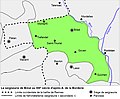 Carte seigneurie de Bréal.jpg 845 × 699; 118 KB
-
 Ille et Vilaine carte des communes.jpg 5,197 × 6,850; 3.97 MB
-
 Plélan Plan commune - Calque villages 1823 & Calque Métier 1727.svg 2,980 × 4,213; 277 KB


