Category:Maps of protected areas in Alaska
States of the United States: Alabama · Alaska · Arizona · Arkansas · California · Colorado · Florida · Georgia · Hawaii · Idaho · Illinois · Indiana · Iowa · Kansas · Kentucky · Louisiana · Maine · Maryland · Massachusetts · Michigan · Minnesota · Mississippi · Missouri · Montana · Nebraska · Nevada · New Hampshire · New Jersey · New Mexico · New York · North Carolina · Ohio · Oklahoma · Oregon · Pennsylvania · South Carolina · South Dakota · Tennessee · Texas · Utah · Vermont · Virginia · Washington · West Virginia · Wisconsin · Wyoming – Washington, D.C.
American Samoa · Puerto Rico · United States Virgin Islands
American Samoa · Puerto Rico · United States Virgin Islands
Subcategories
This category has the following 5 subcategories, out of 5 total.
C
T
Media in category "Maps of protected areas in Alaska"
The following 11 files are in this category, out of 11 total.
-
 National Conservation Areas in ANILCA December 1980.png 1,100 × 816; 356 KB
-
 Adis map.jpg 523 × 528; 68 KB
-
 Bering Land Bridge National Preserve.png 791 × 509; 104 KB
-
 Bering Land Bridge Preserve 95.jpg 2,464 × 1,950; 835 KB
-
 Decision Point State Marine Park Map.png 781 × 1,009; 1.5 MB
-
 Haines State Forest.png 783 × 791; 1.78 MB
-
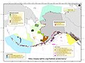 Protected areas of Alaska map (NOAA) 01.jpg 2,000 × 1,500; 520 KB
-
 Protected areas of Alaska map (NOAA) 02.jpg 2,000 × 1,500; 619 KB
-
 Protected areas of Alaska map (NOAA) 03.jpg 2,000 × 1,500; 487 KB
-
 Tanana Valley State Forest.png 775 × 636; 1.41 MB
-
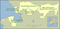 Western Arctic National Parks Alaska NPS1.png 542 × 262; 87 KB


_01.jpg)
_02.jpg)
_03.jpg)

