Category:Maps of protected areas in Wyoming
States of the United States: Alabama · Alaska · Arizona · Arkansas · California · Colorado · Florida · Georgia · Hawaii · Idaho · Illinois · Indiana · Iowa · Kansas · Kentucky · Louisiana · Maine · Maryland · Massachusetts · Michigan · Minnesota · Mississippi · Missouri · Montana · Nebraska · Nevada · New Hampshire · New Jersey · New Mexico · New York · North Carolina · Ohio · Oklahoma · Oregon · Pennsylvania · South Carolina · South Dakota · Tennessee · Texas · Utah · Vermont · Virginia · Washington · West Virginia · Wisconsin · Wyoming – Washington, D.C.
American Samoa · Puerto Rico · United States Virgin Islands
American Samoa · Puerto Rico · United States Virgin Islands
Subcategories
This category has the following 4 subcategories, out of 4 total.
G
M
Y
Media in category "Maps of protected areas in Wyoming"
The following 6 files are in this category, out of 6 total.
-
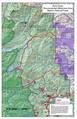
 Map of Shoshone National Forest.jpg 336 × 622; 61 KB
-
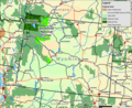
 Map Wyoming NPS sites USA.gif 500 × 429; 15 KB
-
 Moran creek.jpg 617 × 382; 86 KB
-
 Rockcreeklgmap.pdf 1,650 × 2,550; 566 KB
-
 Shoshone wy map.jpg 2,500 × 2,036; 1.48 MB
-
 Shoshone wy map.png 2,500 × 2,036; 4.09 MB


