Category:Maps of the Mayas
English: Maps of the Maya.
- The indigenous Maya peoples, and their pre-Colombian Maya civilization.
- Within the ancient, historical, and present day Mesoamerica region, located in Central America and southern Mexico.
Subcategories
This category has the following 3 subcategories, out of 3 total.
C
- Maps of Chichén Itzá (20 F)
M
- Maps of Tikal (13 F)
- Maps of Uxmal (9 F)
Media in category "Maps of the Mayas"
The following 192 files are in this category, out of 192 total.
-
 Maya civilization (orthographic projection).svg 550 × 550; 161 KB
-
 Distribution-myn.png 800 × 454; 12 KB
-
 Maya civilization location map-blank.svg 1,800 × 1,500; 1.49 MB
-
 Mayamap.png 1,074 × 789; 1,010 KB
-
 Mayas.png 1,031 × 757; 1.03 MB
-
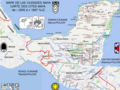
 Mayaruins maps1.JPG 966 × 711; 107 KB
-
 17th century Spanish routes to Petén flat-ar.gif 1,216 × 1,482; 747 KB
-
 17th century Spanish routes to Petén flat.gif 1,152 × 1,404; 516 KB
-
 17th century Spanish routes to Petén.xcf 1,152 × 1,404; 3.02 MB
-
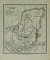
 A glimpse of Guatemala - Plan of the Ruins at Quirigua.png 3,016 × 1,389; 391 KB
-
 Ah Canul.jpg 400 × 300; 30 KB
-
 Altun Ha Übersicht EL.png 698 × 905; 78 KB
-
 America.jpeg 257 × 196; 8 KB
-
 Amerykaprzedkolumbijska.PNG 1,114 × 1,227; 46 KB
-
 Archaeological Palenque by ovedc 012.jpg 3,552 × 2,000; 2.75 MB
-
 Area Cerámica Copador.svg 1,465 × 1,197; 383 KB
-
 BaakulIm2.jpg 959 × 1,098; 161 KB
-
 Balancán Plano de Moral Reforma.JPG 432 × 640; 59 KB
-
 Becan Map.jpg 444 × 292; 43 KB
-
 Cacicazgos mayas - es.svg 600 × 600; 377 KB
-
 Cacicazgos mayas.jpg 1,755 × 1,275; 216 KB
-
 Calakmul archaeologische stätte.png 1,041 × 565; 129 KB
-
 Calakmul Gran Plaza.png 1,064 × 754; 126 KB
-
 Carte Cités Maya MAJ BIS.tif 960 × 720; 940 KB
-
 Carte Commerce Maya.pdf 1,500 × 1,125; 805 KB
-
 Carte des cités Mayas Haute Définition Maj.jpg 3,072 × 2,287; 1,018 KB
-
 Carte du commerce Maya Hte définition mise à jour.jpg 3,072 × 2,287; 843 KB
-
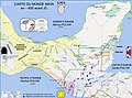
 Carte Empire Itza 1519 FR.tif 960 × 720; 945 KB
-
 Carte Empire Itza 1519.tif 960 × 720; 943 KB
-
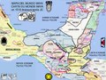
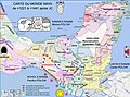 Carte monde Maya +1221+1441 HD.jpg 3,072 × 2,287; 917 KB
-
 Carte monde Maya +1441+1519 HD Maj.jpg 3,072 × 2,287; 985 KB
-
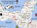
 Carte monde Maya +1519+1695 HD.jpg 3,072 × 2,287; 950 KB
-
 Carte monde Maya +300 HD.jpg 3,072 × 2,287; 852 KB
-
 Carte monde Maya +378 HD.jpg 3,072 × 2,287; 864 KB
-
 Carte monde Maya +535 HD.jpg 3,072 × 2,287; 888 KB
-
 Carte monde Maya -600 HD.jpg 3,072 × 2,287; 726 KB
-
 Carte monde Maya 1519 MAJ BIS.tif 960 × 720; 1.1 MB
-
 Carte Mundo Maya 1519 Bis.tif 960 × 720; 896 KB
-
 Carte Royaumes Maya en 1519.pdf 1,500 × 1,125; 622 KB
-
 Carte2 tous sites Maya.pdf 1,500 × 1,125; 536 KB
-
 Carte3 tous sites Maya.pdf 1,500 × 1,125; 536 KB
-
 Cartes ciudades maya.tif 960 × 720; 845 KB
-
 Cartes commerce Maya.tif 960 × 720; 961 KB
-
 Cartes monde Maya 1519.tif 960 × 720; 928 KB
-
 Catherwood - Santa Cruz del Quiche - Qumarkaj map.jpg 497 × 360; 143 KB
-
 Cerros.png 1,031 × 735; 128 KB
-
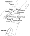 Chan Santa Cruz Maya.gif 1,957 × 2,333; 114 KB
-
 Chan Santa Cruz Maya.svg 524 × 671; 93 KB
-
 Chenes.png 1,267 × 1,015; 2.13 MB
-
 Chenesunam.png 1,317 × 824; 946 KB
-
 Chiapas Preclásico Sitios.png 1,094 × 600; 907 KB
-
 Chiapas-Maya.gif 475 × 416; 25 KB
-
 Chichen Itza.png 715 × 904; 144 KB
-
 Classic Maya Dialects.png 467 × 532; 342 KB
-
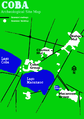 Cobamap.png 600 × 851; 137 KB
-
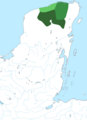
 Comalcalco location.png 1,800 × 1,500; 1.75 MB
-
 Comalcalco.Mapa de zona arqueológica.jpg 4,662 × 2,603; 1.05 MB
-
 Contact Period lowland Guatemala.gif 828 × 631; 224 KB
-
 Dzibilnocac Campeche 1986 Sketch Map.jpg 643 × 988; 227 KB
-
 Edzna.png 1,428 × 1,826; 376 KB
-
 Ekbalam map2 numbered.jpg 669 × 540; 37 KB
-
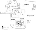 El Chal map of site core.jpg 2,000 × 1,671; 371 KB
-
 El lago Petén Itzá en el tiempo de la conquista 1697.gif 1,122 × 527; 31 KB
-
 El lago Petén Itzá en el tiempo de la conquista 1697.svg 1,052 × 494; 361 KB
-
 El Tintal Mano De León Complex Lidar Map PAET.jpg 3,600 × 3,600; 6.13 MB
-
 El Tintal Plateau Lidar Map PAET.jpg 3,594 × 3,594; 8.53 MB
-
 Esferas ceramicas Providencia-Miraflores y Uapala.png 4,291 × 3,374; 878 KB
-
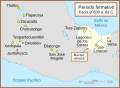
 Formative Era sites ka.svg 629 × 459; 279 KB
-
 Formative Era sites ru.svg 584 × 427; 17 KB
-
 Formative Era sites uk.svg 584 × 427; 18 KB
-
 Formative Era sites.svg 629 × 459; 100 KB
-
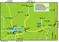 Guatemala-Peten-around-Flores.png 708 × 506; 40 KB
-
 Hochob Plan.jpg 3,984 × 3,545; 647 KB
-
 Hochob Plan.svg 695 × 619; 18 KB
-
 HUASTECA.png 1,096 × 600; 582 KB
-
 Incidents of travel in Central America, Chiapas, and Yucatan (1858) (14783739073).jpg 2,136 × 1,472; 192 KB
-
 Itza Kingdom.jpg 1,260 × 1,536; 86 KB
-
 Itza Kingdom.svg 1,800 × 1,500; 496 KB
-
 Itzá Confederacy at its height.png 1,271 × 1,751; 472 KB
-
 Iximche map.jpg 900 × 626; 229 KB
-
 Jones Columbian Muzul map.png 1,440 × 772; 448 KB
-
 K'atepan plan.png 639 × 451; 30 KB
-
 Labná plan.png 2,400 × 3,400; 1.05 MB
-
 Lake Peten Itza at conquest 1697-ar.gif 1,110 × 522; 132 KB
-
 Lake Peten Itza at conquest 1697.gif 1,122 × 527; 30 KB
-
 Larger Southern Maya area v3-es.svg 1,552 × 1,048; 384 KB
-
 Larger Southern Maya area v3.svg 1,552 × 1,048; 225 KB
-
 Late Postclassic Peten.gif 979 × 858; 27 KB
-
 Los 12 partidos de la intendencia de Chiapas en 1821.jpg 679 × 1,137; 392 KB
-
 Maaya t-aan.jpg 210 × 230; 15 KB
-
 Maler p58 Fig 10 Topoxté Sketch Plan of the Ruins.png 2,351 × 928; 1.09 MB
-
 Maler Researches in the Central Portion of the Usumatsintla Valley Plate XXXIII.png 1,855 × 2,260; 5.97 MB
-
 Manche Chol 16th map.png 2,560 × 1,487; 2.95 MB
-
 Map Kaan & Mutal.jpg 1,332 × 1,395; 196 KB
-
 Map of central Seibal.jpg 1,027 × 728; 86 KB
-
 Map of San Bartolo.jpg 3,504 × 2,480; 328 KB
-
 Map of Seibal GroupA.jpg 1,445 × 2,235; 234 KB
-
 Map of Seibal GroupD.jpg 1,162 × 1,604; 221 KB
-
 Map of the Kabah Maya archeological zone - cleaned.jpg 3,217 × 2,597; 3 MB
-
 Map of the Kabah Maya archeological zone.jpg 3,231 × 2,611; 2.44 MB
-
 Map of the Manche Ch'ol 16th-17th centuries.gif 689 × 467; 152 KB
-
 Map of the Maya area of Mesoamerica.tif 3,078 × 2,642; 7.96 MB
-
 Mapa de complejo de pirámides gemelas.png 731 × 651; 10 KB
-
 Mapa de Iximché.jpg 900 × 626; 229 KB
-
 Mapa Topográfico de Izapa.jpg 535 × 777; 165 KB
-
 Mapa topográfico de Izapa.png 557 × 771; 288 KB
-
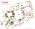 Cahal Pech Site Map.png 3,057 × 2,533; 1.48 MB
-
 Maudslay's 1887 Map of Ixkun, enhanced.png 2,198 × 1,607; 106 KB
-
 Maudslays' Map of Ixkun 1899.jpg 4,334 × 2,970; 2.54 MB
-
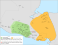
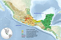
 Maya civilization in Mesoamerica map.svg 1,999 × 1,497; 3.98 MB
-
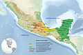
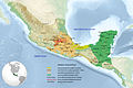
 Maya civilization location map - geography(1).svg 1,800 × 1,500; 1.52 MB
-
 Maya civilization location map - geography.svg 1,800 × 1,500; 1.52 MB
-
 Maya civilization location map - zh-cn.svg 1,800 × 1,500; 1.52 MB
-
 Maya civilization location map - zh-tw.svg 1,800 × 1,500; 1.52 MB
-
 Maya civilization location map-fa.svg 1,800 × 1,500; 1.53 MB
-
 Maya Country.png 1,024 × 736; 760 KB
-
 Maya IV.png 790 × 986; 103 KB
-
 Maya kuchkabals in Yucatan.tif 3,252 × 4,186; 12.99 MB
-
 Maya Languages.png 500 × 568; 357 KB
-
 Maya map.jpg 555 × 555; 198 KB
-
 Maya region w english names.png 1,076 × 828; 312 KB
-
 Maya region w german names.png 1,076 × 828; 320 KB
-
 Maya site northern Yucatan 800 AD-es.svg 1,788 × 1,273; 67 KB
-
 Maya site northern Yucatan 800 AD.svg 1,788 × 1,273; 88 KB
-
 Mayamap1.gif 790 × 1,020; 23 KB
-
 Mayamigrationssketch.png 359 × 283; 149 KB
-
 Mayan Language Map mk.svg 646 × 806; 78 KB
-
 Mayan Region blank map.svg 1,052 × 744; 446 KB
-
 Mayan trade routes map - RU.svg 1,213 × 776; 2.65 MB
-
 Mayanlanguageslocations.png 484 × 676; 41 KB
-
 Mayapan 1200.jpg 1,184 × 933; 84 KB
-
 Mayapan 1200.svg 1,800 × 1,500; 496 KB
-
 Mayisk språkkart.png 1,508 × 1,880; 298 KB
-
 Mayisk språkmigrasjonskart.png 1,463 × 1,079; 216 KB
-
 Means 1917 Plate IV.png 3,759 × 2,549; 162 KB
-
 Means 1917 Plate V.png 2,977 × 2,182; 336 KB
-
 Means 1917 Plate VI.djvu 2,437 × 2,936; 85 KB
-
 Means 1917 Plate VI.png 594 × 648; 416 KB
-
 Means' Map of Lake Petén Itzá.gif 2,872 × 3,713; 140 KB
-
 Mesoamerica - Esquèma generau.png 2,410 × 1,556; 732 KB
-
 Mesoameryca-States-and-Tribes-1280.jpg 1,280 × 853; 201 KB
-
 Mesoameryca-States-and-Tribes-1920.jpg 1,920 × 1,280; 382 KB
-
 Mesoameryca-States-and-Tribes.jpg 3,072 × 2,048; 792 KB
-
 Mopan Territory map.png 2,065 × 1,488; 1.83 MB
-
 Mutul Controled Territory.jpg 1,260 × 1,536; 90 KB
-
 Mutul Controled Territory.svg 1,800 × 1,500; 496 KB
-
 Native-amerika.Mayaruiner.JPG 966 × 711; 107 KB
-
 Nimlipunit.png 1,057 × 794; 113 KB
-
 NorteDeGuatemalaSiglosXVI-XVII-ar.svg 1,386 × 1,064; 14.38 MB
-
 NorteDeGuatemalaSiglosXVI-XVII.svg 1,386 × 1,064; 14.38 MB
-
 Palenque Map.png 753 × 844; 116 KB
-
 Peten Map v3 May archaeological sites.gif 979 × 858; 47 KB
-
 Plan de Ayutla Location.png 3,600 × 3,000; 4.44 MB
-
 Plan of the Ruins of Ake Yucatan by Charnay.jpg 996 × 1,032; 544 KB
-
 Plate I. Map of northern Yucatan. A naturalist in Mexico, 1895.jpg 2,288 × 1,462; 312 KB
-
 Province of Chetumal map.tif 1,644 × 2,238; 3.51 MB
-
 Puuc Area C.800.jpg 800 × 570; 82 KB
-
 Puuc Map.jpg 1,260 × 1,536; 87 KB
-
 Puuc Map.svg 1,800 × 1,500; 496 KB
-
 Puuc Region.png 3,760 × 2,946; 16.94 MB
-
 Puuc4.jpg 2,643 × 2,670; 2.34 MB
-
 Region of mayan.png 960 × 720; 865 KB
-
 ReliefMapMayanSites.JPG 1,600 × 1,200; 521 KB
-
 Roys Provinces.png 2,049 × 2,080; 1.43 MB
-
 Ruins of Xkichmook, Yucatan BHL14059333.jpg 2,688 × 2,947; 783 KB
-
 San Clemente plan by Karl Sapper 1897.png 2,302 × 4,203; 433 KB
-
 SE Mesoamerican Formative Period sites PT.svg 1,226 × 919; 102 KB
-
 Siedlungsraum der Mayas.png 776 × 856; 90 KB
-
 Sites Mayas.png 1,074 × 789; 1.25 MB
-
 Sitios del Formativo.svg 629 × 459; 291 KB
-
 Sketch map, Maya ruins in central Acanceh Yucatan, 1977.jpg 12,430 × 8,876; 14.84 MB
-
 Yucatan Conquest.jpg 2,594 × 2,710; 1.1 MB
-
 Sta Rosa Xtampak Plan.png 3,000 × 2,018; 787 KB
-
 Telchaquillo Yucatan - sketch map 1977.png 1,280 × 1,104; 1.26 MB
-
 Territorio Maya Chontal.tif 960 × 720; 882 KB
-

-

-
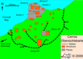
 Tikal Übersichtskarte.png 2,750 × 1,947; 579 KB
-
 Tulum Übersichtskarte.png 745 × 851; 147 KB
-
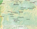
 Postclassicguatemalahighlands.png 600 × 405; 138 KB
-
 Xkichmook Lage1.jpg 1,982 × 2,002; 365 KB
-
 Yaxchilan map - RU.svg 1,323 × 1,079; 1.26 MB
-
 Yucatan- maya.jpg 1,551 × 1,914; 582 KB
-
 Mixco Viejo (Jilotepeque Viejo) map.png 1,446 × 1,289; 55 KB
-
 Río Bec.jpg 4,282 × 2,974; 527 KB
-
 Sayil Palacio Plan EN.png 2,250 × 1,700; 459 KB
-
 Sayil Palacio Plan.png 3,000 × 2,200; 526 KB
-
 Sayil Sur plan.jpg 1,151 × 1,015; 63 KB
-
 Sta Rosa Xtampak Pal Plan.jpg 6,487 × 4,457; 1.15 MB
-
 Sta Rosa Xtampak Plan.jpg 5,235 × 3,522; 885 KB
-
 Twin pyramid complex plan.png 731 × 651; 10 KB
-
 Xkichmook Maler Map.jpg 3,005 × 4,357; 3.6 MB
.svg)


_(14783739073).jpg)


.svg)


_(19564178389).jpg)
_(19750782205).jpg)


_map.png)


